Fraud Blocker Skip to main content

Home > Europe > Belgium > Maps

Maps Collection (page 3)

Belgium is a small country located in the heart of Europe and has been an important crossroads for centuries

722 items

Background imageMaps Collection: Plan of the Battle of Waterloo, June 16-18, 1815. From Historical Atlas, published 1923

Plan of the Battle of Waterloo, June 16-18, 1815. From Historical Atlas, published 1923
2603479 Plan of the Battle of Waterloo, June 16-18, 1815. From Historical Atlas, published 1923

Background imageMaps Collection: Belgian officers, 1917. Creator: Bain News Service

Belgian officers, 1917. Creator: Bain News Service
Belgian officers, 1917. Belgian generals studying a map during the visit of Albert I, King of the Belgians, to the Western Front, May 15, 1917 during World War I

Background imageMaps Collection: Map of the Republic of the Seven United Netherlands, 1677-1679. Creator: Nicolaes Visscher

Map of the Republic of the Seven United Netherlands, 1677-1679. Creator: Nicolaes Visscher
Map of the Republic of the Seven United Netherlands, 1677-1679. At the bottom right, the Maas from Maastricht to Wessem. At the top left the title in a cartouche surrounded by putti

Background imageMaps Collection: Map of North Flanders, c.1695. Creator: Nicolaes Visscher

Map of North Flanders, c.1695. Creator: Nicolaes Visscher
Map of North Flanders, c.1695. Showing part of Zeeland. Top right the scale in German and French miles

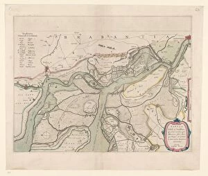
Background imageMaps Collection: Map of the surroundings of Zandvliet, 1642. Creator: Willem Blaeu

Map of the surroundings of Zandvliet, 1642. Creator: Willem Blaeu
Map of the surroundings of Zandvliet, 1642. The north on the left, the borders coloured, cities, buildings and flags indicated. At the top left Explanation of the symbols on the map

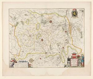
Background imageMaps Collection: Map of Brabant, 1635. Creator: Michael van Langren

Map of Brabant, 1635. Creator: Michael van Langren
Map of Brabant, 1635. Prima pars Brabantiae cuius caput Lovanivm'. Top right: a coat of arms; bottom right: title in a cartouche with King David playing the harp

Background imageMaps Collection: Map of the southern (Austrian) Netherlands, 1719. Creator: Joachim Ottens

Map of the southern (Austrian) Netherlands, 1719. Creator: Joachim Ottens
Map of the southern (Austrian) Netherlands, 1719. Novissima et accuratissima decem Austriacarum in Belgio provinciarum tabula, ut sunt ducatus Brabantiae, Luxembergensis, Limburgensis, et Geldriae

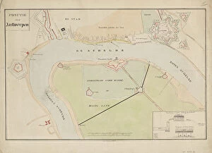
Background imageMaps Collection: Map of Antwerp during the siege by the French, 1832, (1832-1833)

Map of Antwerp during the siege by the French, 1832, (1832-1833). Creators: Anon, Johannes Paulus Houtman
Plan showing Schelde and Antwerp with the location of the forts in Dutch hands, during the siege of the Citadel by the French, 1832, (1832-1833). Dutch gunboats on the Scheldt

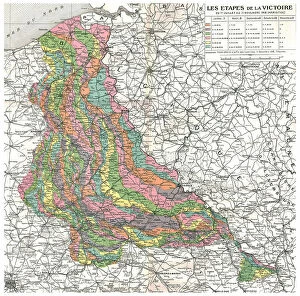
Background imageMaps Collection: Les Etapes de la Victoire. Du 1er juillet au 11 novembre 1918 (Armistice). Reduction de la

Les Etapes de la Victoire. Du 1er juillet au 11 novembre 1918 (Armistice). Reduction de la... 1918 Creator: Unknown
Les Etapes de la Victoire. Du 1er juillet au 11 novembre 1918 (Armistice). Reduction de la carte d'Etat-major placee dans le cabinet de travail du marechal Foch, a son quartier general de Senlis

Background imageMaps Collection: Voies de communication du bassin du Congo; L'Ouest Africain, 1914. Creator: Unknown

Voies de communication du bassin du Congo; L'Ouest Africain, 1914. Creator: Unknown
Voies de communication du bassin du Congo; L'Ouest Africain, 1914. From "Grande Geographie Bong Illustree", 1914

Background imageMaps Collection: Bas-Congo; L'Ouest Africain, 1914. Creator: Unknown

Bas-Congo; L'Ouest Africain, 1914. Creator: Unknown
Bas-Congo; L'Ouest Africain, 1914. From "Grande Geographie Bong Illustree", 1914

Background imageMaps Collection: Map, Afrique Equatoriale; L'Ouest Africain, 1914. Creator: Unknown

Map, Afrique Equatoriale; L'Ouest Africain, 1914. Creator: Unknown
Map, Afrique Equatoriale; L'Ouest Africain, 1914. From "Grande Geographie Bong Illustree", 1914

Background imageMaps Collection: Map of Afrique showing Possessions et protectorats d'Europe, 1914. Creator: Unknown

Map of Afrique showing Possessions et protectorats d'Europe, 1914. Creator: Unknown
Map of Afrique showing Possessions et protectorats d'Europe, 1914. From "Grande Geographie Bong Illustree", 1914

Background imageMaps Collection: La Course a la Mer; Les positions successives des armes alliees, du septembre au 17 october

La Course a la Mer; Les positions successives des armes alliees, du septembre au 17 october, 1914 Creator: Unknown
La Course a la Mer; Les positions successives des armes alliees, du septembre au 17 october, 1914. From "L'Album de la Guerre 1914-1919: Volume I". [L'Illustration, Paris, 1926]

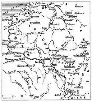
Background imageMaps Collection: Du front a Essen. -- Les noms soulignes sont ceux de points bombardes par nos escadrilles, 1916

Du front a Essen. -- Les noms soulignes sont ceux de points bombardes par nos escadrilles, 1916. Creator: Unknown
Du front a Essen. -- Les noms soulignes sont ceux de points bombardes par nos escadrilles. 1916. From "Collection de la Guerre IV. L'Illustration Tome CXLVII

Background imageMaps Collection: 1 Maps 2 26

1 Maps 2 26
Emiliano Deificus

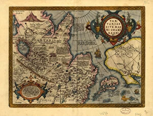
Background imageMaps Collection: Tartariae sive Magni Chami Regni ty¨pus, 1603. Creators: Abraham Ortelius, Jan Baptist Vrients

Tartariae sive Magni Chami Regni ty¨pus, 1603. Creators: Abraham Ortelius, Jan Baptist Vrients
Tartariae sive Magni Chami Regni ty¨pus, 1603. Covers northern Asia. Relief shown pictorially. From Abraham Ortelius's atlas: Theatrvm Orbis Terrarvm, 1603 ed. Hand col

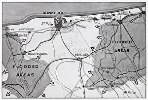
Background imageMaps Collection: Map of Dunkirk area during the evacuation, WW2

Map of Dunkirk area during the evacuation, WW2
Map of the Dunkirk area in northern France during the evacuation, showing two flooded areas of low-lying meadow land which assisted in the Allied retreat. Date: 1940

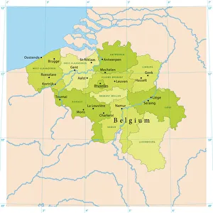
Background imageMaps Collection: Belgium Vector Map

Belgium Vector Map
Highly detailed vector map of Belgium. File was created on July 14, 2011. The colors in the.eps-file are ready for print (CMYK). Included files: EPS (v8) and Hi-Res JPG

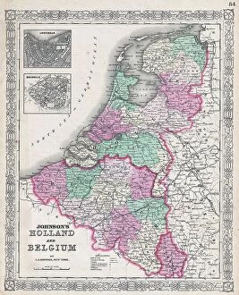
Background imageMaps Collection: 1866 Johnson Map Of Holland And Belgium Topography

1866 Johnson Map Of Holland And Belgium Topography
1866, Johnson Map of Holland and Belgium

Background imageMaps Collection: 1855 Colton Map Of Holland And Belgium Topography

1855 Colton Map Of Holland And Belgium Topography
1855, Colton Map of Holland and Belgium

Background imageMaps Collection: 1850 Mitchell Map Of Holland And Belgium Topography

1850 Mitchell Map Of Holland And Belgium Topography
1850, Mitchell Map of Holland and Belgium

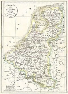
Background imageMaps Collection: 1832 Delamarche Map Of Holland And Belgium Topography

1832 Delamarche Map Of Holland And Belgium Topography
1832, Delamarche Map of Holland and Belgium

Background imageMaps Collection: 1835 Malte-Brun Map Of Belgium And Holland Or The Netherlands

1835 Malte-Brun Map Of Belgium And Holland Or The Netherlands
1835, Malte-Brun Map of Belgium and Holland or the Netherlands

Background imageMaps Collection: 1827 Finley Map Of Belgium And Luxembourg Anthony Finley Mapmaker Of The United States In The 19th

1827 Finley Map Of Belgium And Luxembourg Anthony Finley Mapmaker Of The United States In The 19th Century
1827, Finley Map of Belgium and Luxembourg, Anthony Finley mapmaker of the United States in the 19th century

Background imageMaps Collection: 1804 Cary Map Of Belgium And Luxembourg John Cary

1804 Cary Map Of Belgium And Luxembourg John Cary
1804, Cary Map of Belgium and Luxembourg, John Cary, 1754 - 1835, English cartographer

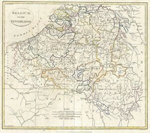
Background imageMaps Collection: 1799 Clement Cruttwell Map Of Belgium Or The Netherlands

1799 Clement Cruttwell Map Of Belgium Or The Netherlands
1799, Clement Cruttwell Map of Belgium or the Netherlands

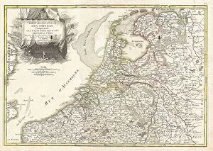
Background imageMaps Collection: 1780 Raynal And Bonne Map Of Holland And Belgium

1780 Raynal And Bonne Map Of Holland And Belgium
1780, Raynal and Bonne Map of Holland and Belgium, Rigobert Bonne 1727 - 1794, one of the most important cartographers of the late 18th century

Background imageMaps Collection: 1775 Janvier Map Of Holland And Belgium Topography

1775 Janvier Map Of Holland And Belgium Topography
1775, Janvier Map of Holland and Belgium

Background imageMaps Collection: 1771 Janvier Map Of Belgium And Luxembourg Topography

1771 Janvier Map Of Belgium And Luxembourg Topography
1771, Janvier Map of Belgium and Luxembourg

Background imageMaps Collection: 1747 Homann Heirs Map Of Belgium And The Netherlands

1747 Homann Heirs Map Of Belgium And The Netherlands
1747, Homann Heirs Map of Belgium and the Netherlands

Background imageMaps Collection: 1730 Homann Heirs Map Of Belgium And Luxembourg

1730 Homann Heirs Map Of Belgium And Luxembourg
1730, Homann Heirs Map of Belgium and Luxembourg

Background imageMaps Collection: 1870 Johnson Map Of Holland Belgium And Switzerland

1870 Johnson Map Of Holland Belgium And Switzerland
1870, Johnson Map of Holland, Belgium, and Switzerland

Background imageMaps Collection: 1864 Mitchell Map Of Russia Scandinavia Denmark

1864 Mitchell Map Of Russia Scandinavia Denmark
1864, Mitchell Map of Russia, Scandinavia, Denmark, Holland and Belgium

Background imageMaps Collection: 1862 Stieler Map Of Holland Belgium And Western Germany

1862 Stieler Map Of Holland Belgium And Western Germany
1862, Stieler Map of Holland, Belgium and Western Germany

Background imageMaps Collection: 1862 Johnson Map Of France Holland And Belgium

1862 Johnson Map Of France Holland And Belgium
1862, Johnson Map of France, Holland and Belgium

Background imageMaps Collection: 1747 La Feuille Map Of Flanders Holland And Belgium

1747 La Feuille Map Of Flanders Holland And Belgium
1747, La Feuille Map of Flanders, Holland and Belgium

Background imageMaps Collection: 1747 La Feuille Map Of Liege Belgium Leodiensis

1747 La Feuille Map Of Liege Belgium Leodiensis
1747, La Feuille Map of Liege, Belgium, Leodiensis

Background imageMaps Collection: 1747 La Feuille Map Of Brabant Vicinity Of Brussels

1747 La Feuille Map Of Brabant Vicinity Of Brussels
1747, La Feuille Map of Brabant, vicinity of Brussels, Belgium

Background imageMaps Collection: 1710 De La Feuille Map Of The Netherlands Belgium And Luxembourg

1710 De La Feuille Map Of The Netherlands Belgium And Luxembourg
1710, De La Feuille Map of the Netherlands, Belgium and Luxembourg

Background imageMaps Collection: Map Showing Allied Advance Eastwards France Belgium

Map Showing Allied Advance Eastwards France Belgium
Map showing the Allied advance eastwards across France, Belgium and Holland to the Rhine from 3 September 1945 during WWII. From The War in Pictures, Sixth Year

Background imageMaps Collection: Map Extent Germans Attack Americans Ardennes

Map Extent Germans Attack Americans Ardennes
Map showing the extent of the German's attack against the Americans in the Ardennes and their drive into Belgium, 1944, during WWII. From The War in Pictures, Sixth Year

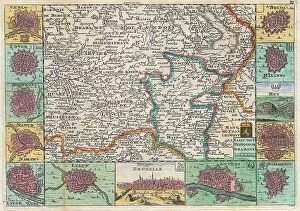
Background imageMaps Collection: Old engraved illustration of France and Belgium border map

Old engraved illustration of France and Belgium border map
Antique Illustration, Copyright has expired on this artwork. From my own archives, digitally restored

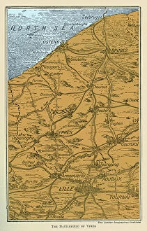
Background imageMaps Collection: WWI Battlefield of Ypres

WWI Battlefield of Ypres
3789212 WWI Battlefield of Ypres; (add.info.: WWI - Map of Battlefield of Ypres The History of the Great European War vol III); Lebrecht History

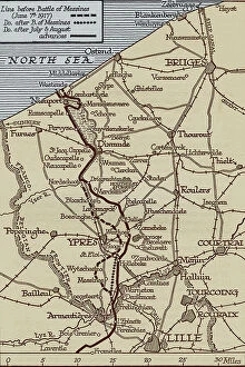
Background imageMaps Collection: Map of the Flanders Front, World War 1

Map of the Flanders Front, World War 1
3788101 Map of the Flanders Front, World War 1; (add.info.: Map of the front lines in Flanders, Belgium, during World War 1, July and August 1917. The Year 1917 Illustrated)

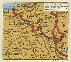
Background imageMaps Collection: WWI Map of the position of the Armies August 22 1914

WWI Map of the position of the Armies August 22 1914
3789214 WWI Map of the position of the Armies August 22 1914; (add.info.: WWI - Map of the position of the Armies August 22 1914 in Belgium and France shwoing German army divisions and British)

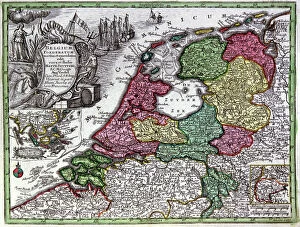
Background imageMaps Collection: Map of Holland, 1720-1744 (engraving)

Map of Holland, 1720-1744 (engraving)
1953912 Map of Holland, 1720-1744 (engraving) by Seutter, Georg Matthaus (1678-1757); (add.info.: Map of Holland (Belgium Foederatum) from "Atlas Minor" by Matthaeus Seutter, Augsbourg

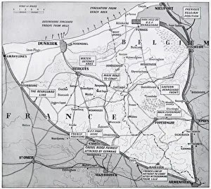
Background imageMaps Collection: Map of France and Belgium, evacuation from Dunkirk, WW2

Map of France and Belgium, evacuation from Dunkirk, WW2
Map of the northern French and Belgian coast, showing the evacuation from Dunkirk and other points, and the evacuation triangle through which the Allied army retreated


All Professionally Made to Order for Quick Shipping


-

Maps Collection

Belgium is a small country located in the heart of Europe and has been an important crossroads for centuries, and its location has made it a popular destination for travelers. Maps of Belgium Europe are essential to navigating this diverse nation. The maps show the country's main cities, rivers, mountains, and other features. They also provide information on transportation networks such as highways and railroads. Additionally, they can help visitors plan their trips by showing them points of interest such as museums, parks, monuments, and other attractions. With its rich history and vibrant culture, Belgium is an exciting place to explore - but make sure you have a good map before you go.
+

Our beautiful Wall Art and Photo Gifts include Framed Prints, Photo Prints, Poster Prints, Canvas Prints, Jigsaw Puzzles, Metal Prints and so much more

Media Storehouse offers a collection of Maps of Belgium Europe wall art and framed prints. Our collection features vintage maps that showcase the geographical details, cities, towns, rivers, and borders of Belgium in different eras. These maps are printed on high-quality paper using state-of-the-art printing technology to ensure clarity and durability. They come in various sizes and framing options to suit individual preferences. The Maps of Belgium Europe collection is perfect for history enthusiasts, geography lovers or anyone who wants to add a touch of sophistication to their home or office decor. These maps can also serve as educational tools for schools or museums. Media Storehouse guarantees the authenticity and quality of its products by sourcing them from reputable archives worldwide. Customers can browse through the extensive collection online and make secure purchases with ease. Our Maps of Belgium Europe collection offers an excellent opportunity for individuals or institutions to own unique pieces that capture the rich history and beauty of this European country.
+

What are Maps of Belgium Europe art prints?

Maps of Belgium Europe art prints are high-quality reproductions of antique and modern maps depicting the geography, topography, and political boundaries of Belgium. These prints showcase the intricate details and artistic styles used in creating these historical documents. They are perfect for collectors, history enthusiasts, or anyone who appreciates fine art. These maps offer a unique perspective on the evolution of Belgium's landscape over time. From early depictions that show its development as a nation to more recent maps that highlight its cities and landmarks, these prints provide an insight into how this country has changed throughout history. Maps of Belgium Europe art prints come in various sizes and formats to suit different preferences. Whether you want a large canvas print or a smaller framed version to display on your wall, there is something for everyone. These prints make great gifts for friends or family members who have an interest in cartography or Belgian culture.
+

What Maps of Belgium Europe art prints can I buy from Media Storehouse?

We offer a wide range of Maps of Belgium Europe art prints that you can choose from. These include vintage maps, antique maps, modern maps, and topographical maps. You can also find city plans and street maps of various Belgian cities such as Brussels, Antwerp, Ghent, Bruges and many more. The Maps of Belgium Europe art prints available at Media Storehouse are printed on high-quality paper using the latest printing technology to ensure that they are vibrant and long-lasting. They come in different sizes to suit your needs and preferences. Whether you're looking for a map to decorate your home or office or as a gift for someone who loves geography or history, we have got you covered. With their vast collection of Maps of Belgium Europe art prints, you'll surely find something that will catch your eye. If you want to buy beautiful and accurate Maps of Belgium Europe art prints with excellent quality from an online store with great customer service then Media Storehouse is definitely worth checking out.
+

How do I buy Maps of Belgium Europe art prints?

To buy Maps of Belgium Europe art prints from Media Storehouse, you can browse our extensive collection online. Simply search for "Maps of Belgium Europe" in the search bar on our website and select the print that catches your eye. Once you have found a print that you like, click on it to view more details about the product. From there, add the item to your cart and proceed to checkout. You will be prompted to enter your shipping and payment information before completing your purchase. We offer a variety of sizes for their art prints, so make sure to choose one that fits your needs. We also offer framing options if you want a ready-to-hang piece of artwork. Buying Maps of Belgium Europe art prints from Media Storehouse is easy and convenient. With just a few clicks, you can have beautiful artwork delivered right to your doorstep.
+

How much do Maps of Belgium Europe art prints cost?

We offer a wide range of Maps of Belgium Europe art prints at varying prices. Our collection includes vintage maps, modern maps, and artistic interpretations of the country's geography. The cost of each print depends on several factors such as size, material quality, and printing technique used. We have options for every budget and preference. Our high-quality paper prints are affordable yet durable while our premium canvas prints provide a more luxurious finish. Additionally, we offer framed versions that come ready to hang in your home or office space. Whether you're looking for a detailed map to help plan your travels or an artistic piece to decorate your walls with Belgian charm, we have something for everyone. We take pride in offering exceptional customer service and ensuring that our customers receive their orders promptly without any hassle. Browse through our extensive collection today to find the perfect Maps of Belgium Europe art print that suits your style and budget.
+

How will my Maps of Belgium Europe art prints be delivered to me?

We take great care in ensuring that your Maps of Belgium Europe art prints are delivered to you safely and securely. We use high-quality packaging materials to protect your artwork during transit, including sturdy cardboard tubes for rolled prints and flat-pack boxes for framed prints. Once your order has been processed, our team will carefully package your artwork and arrange for it to be shipped directly to you. We work with trusted courier partners who offer reliable delivery services across the UK and internationally. When your Maps of Belgium Europe art print arrives, simply unpack it from its protective packaging and enjoy. Whether you choose a classic framed print or a contemporary canvas option, our high-quality printing techniques ensure that every detail is captured perfectly. We pride ourselves on delivering exceptional customer service at every stage of the process. If you have any questions about delivery or shipping options, please don't hesitate to get in touch with our friendly team today.