
Maps Collection
Maps of Albania Europe are a great resource for anyone looking to explore the country
Choose a picture from our Maps Collection for your Wall Art and Photo Gifts
34 items


All Professionally Made to Order for Quick Shipping
-
Maps Collection
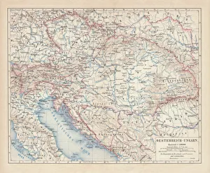
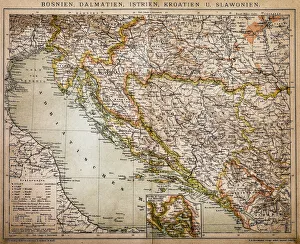
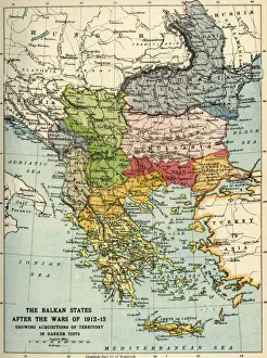
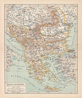
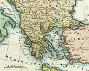
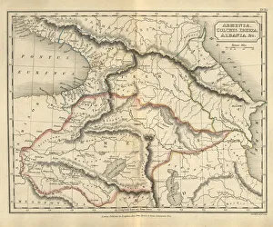
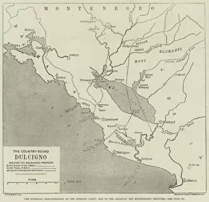
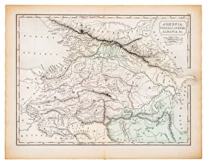
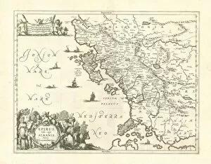
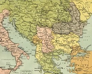
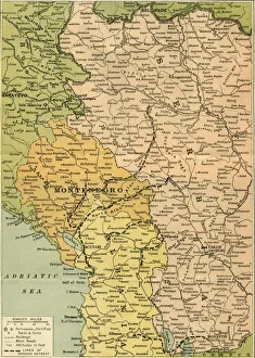
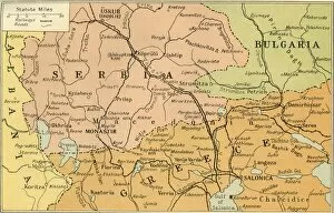
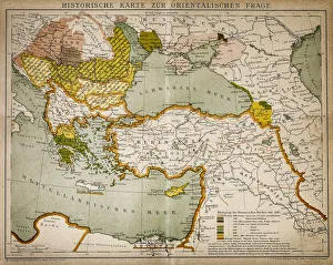
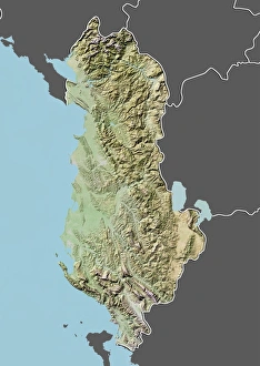
Maps of Albania Europe are a great resource for anyone looking to explore the country. Albania is a small but beautiful country located in the western part of the Balkan Peninsula, bordered by Montenegro, Kosovo, Macedonia and Greece. The maps provide detailed information on cities, roads and other points of interest throughout the region. They also feature topographical features such as mountains and rivers. They are be used for planning trips or simply exploring the area from home, and are available in both digital and paper formats, making them accessible to everyone who wants to learn more about this fascinating part of Europe.
+
Our beautiful Wall Art and Photo Gifts include Framed Prints, Photo Prints, Poster Prints, Canvas Prints, Jigsaw Puzzles, Metal Prints and so much more
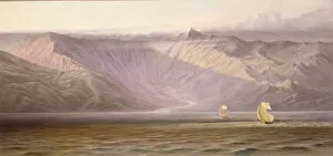
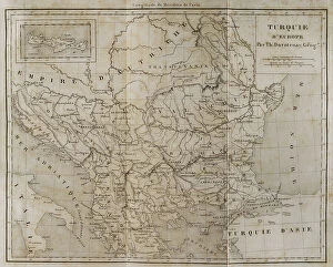
The Maps of Albania Europe collection from Media Storehouse is a stunning assortment of wall art and framed prints that showcase the beauty and diversity of Albania. Our collection features an extensive range of maps, including antique maps dating back to the 16th century, as well as modern-day maps that highlight the country's topography, cities, and landmarks. Each print in our collection has been carefully curated to offer a unique perspective on Albania's geography and history. From detailed street maps to panoramic views of mountain ranges and coastlines, these prints are perfect for anyone who loves travel or wants to learn more about this fascinating country. Whether you're looking for a striking piece of artwork for your home or office or want to give a thoughtful gift to someone special, the Maps of Albania Europe collection from Media Storehouse is sure to impress. With its high-quality printing and framing options available at affordable prices, it's easy to find something that suits your style and budget.
+
What are Maps of Albania Europe art prints?
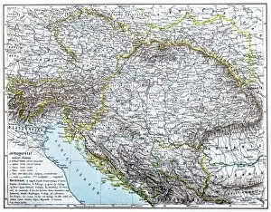
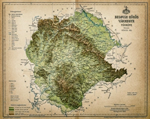
Maps of Albania Europe art prints are high-quality reproductions of maps that depict the geography and topography of Albania, a country located in southeastern Europe. These art prints showcase the intricate details and features of Albania's landscape, including its mountains, rivers, lakes, cities, and borders. These maps can be used for educational purposes or as decorative pieces to add character to any living space. They are perfect for those who have an interest in geography or history or simply want to display their love for this beautiful country. We offer a wide selection of Maps of Albania Europe art prints that come in various sizes and formats such as canvas prints or framed posters. With their exceptional quality printing techniques and attention to detail, these art prints are sure to impress anyone who sees them.
+
What Maps of Albania Europe art prints can I buy from Media Storehouse?
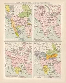
We offer a wide range of Albania Europe art prints that you can purchase. These maps showcase the beautiful landscapes, cities, and towns of Albania in intricate detail. You can choose from different styles such as vintage, modern or contemporary to suit your taste. One popular option is the detailed topographic map which shows the mountainous terrain of Albania with rivers and lakes marked out clearly. Another option is a political map which highlights all major cities and borders within the country. Media Storehouse also has panoramic views of Albanian coastlines and beaches for those who want to capture the beauty of this Mediterranean country. Additionally, there are street maps available for specific regions or cities like Tirana or Durres. Whether you're looking for a decorative piece for your home or office, or an educational tool for students studying geography or history, we have something suitable for everyone interested in Albania's geography and culture.
+
How do I buy Maps of Albania Europe art prints?
To buy Maps of Albania Europe art prints from Media Storehouse, you can browse through our extensive collection of high-quality and unique artworks. Simply search for the specific map or artwork that you are interested in and select the size and format that suits your needs. You can choose from a range of print formats including canvas, framed prints, posters, metal prints, and more. Once you have selected your preferred format and size, simply add it to your cart and proceed to checkout. You will be prompted to enter your shipping details and payment information before completing the purchase. We offer a wide selection of Maps of Albania Europe art prints created by talented artists from around the world. Our easy-to-use website makes it simple to find exactly what you're looking for while their secure online ordering system ensures that your transaction is safe and hassle-free. Whether you're looking for a beautiful piece of wall art or a unique gift for someone special, we have something to suit every taste and budget.
+
How much do Maps of Albania Europe art prints cost?
We offer a wide range of Albania Europe art prints, including maps. The cost of these prints can vary depending on the size and type of print selected. However, you can rest assured that they will receive high-quality artwork at an affordable price. Media Storehouse is known for its extensive collection of art prints from around the world, including Albania in Europe. These maps are perfect for those who want to decorate their homes or offices with unique and interesting pieces that showcase their love for geography. The prices for these maps may differ based on various factors such as the size and printing material used. You can browse through our website to find the perfect map print that fits their budget and style preferences. We provide excellent value for money when it comes to purchasing Albania Europe art prints, including maps. With a vast selection available at reasonable prices, customers are sure to find something they love without breaking the bank.
+
How will my Maps of Albania Europe art prints be delivered to me?
We take great care in delivering your Maps of Albania Europe art prints to you. We use high-quality packaging materials to ensure that your prints arrive in perfect condition. Your order will be carefully packed and shipped using a trusted courier service. Once your order is placed, our team will process it promptly and prepare it for shipping. You can expect to receive regular updates on the status of your delivery, including tracking information so you can follow its progress. We understand how important it is for you to receive your artwork quickly and safely, which is why we work hard to ensure that all orders are dispatched as soon as possible. Our goal is to provide you with an exceptional shopping experience from start to finish, so if there are any issues or concerns with your order, please don't hesitate to get in touch with us.