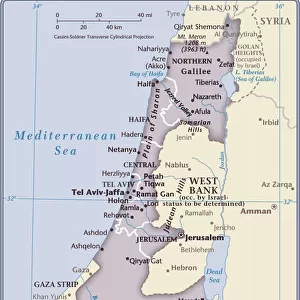
Home > Africa > Egypt > Maps
Map showing the Suez Canal, a man-made sea-level waterway in Egypt, which connects the Mediterranean Sea to the Red Sea through the Isthmus of Suez. From The Business Encyclopaedia and Legal Adviser, published 1907

![]()
Wall Art and Photo Gifts from Design Pics
Map showing the Suez Canal, a man-made sea-level waterway in Egypt, which connects the Mediterranean Sea to the Red Sea through the Isthmus of Suez. From The Business Encyclopaedia and Legal Adviser, published 1907
Design Pics offers Distinctively Different Imagery representing over 1,500 contributors
Media ID 24906357
© Ken Welsh
20th Century Canals Connecting Connection Egypt Man Made Mediterranean Sea Red Sea Waterway Waterways Sea Level Suez Canal
FEATURES IN THESE COLLECTIONS
> Africa
> Egypt
> Related Images
> Maps and Charts
> Early Maps
> Maps and Charts
> Related Images
EDITORS COMMENTS
This print showcases a historical map from 1907, revealing the remarkable Suez Canal in Egypt. A man-made sea-level waterway, this engineering marvel connects the Mediterranean Sea to the Red Sea through the Isthmus of Suez. The intricate details depicted on this archival illustration provide a glimpse into the first decade of the 20th century and highlight one of humanity's greatest achievements. The Suez Canal has long been hailed as an essential connection between two major bodies of water, enabling efficient trade routes and maritime transportation. This image not only captures its geographical significance but also serves as a testament to human ingenuity and determination. As we delve into history through this old print, it becomes evident that canals like these played a crucial role in inter-oceanic travel during that era. The meticulously crafted map offers insights into how nations sought to overcome geographic barriers by creating artificial waterways. Preserved for over a century, this print allows us to appreciate both its artistic value and historical importance. It stands as a reminder of our ability to reshape nature for our benefit while honoring those who paved the way for modern advancements in navigation and global connectivity. Ken Welsh's expert eye has beautifully captured this piece from "The Business Encyclopaedia and Legal Adviser" providing us with an opportunity to reflect on past achievements while contemplating future possibilities in marine infrastructure development.
MADE IN THE USA
Safe Shipping with 30 Day Money Back Guarantee
FREE PERSONALISATION*
We are proud to offer a range of customisation features including Personalised Captions, Color Filters and Picture Zoom Tools
SECURE PAYMENTS
We happily accept a wide range of payment options so you can pay for the things you need in the way that is most convenient for you
* Options may vary by product and licensing agreement. Zoomed Pictures can be adjusted in the Cart.