Canvas Print > Universal Images Group (UIG) > Illustrations > Illustrations 2
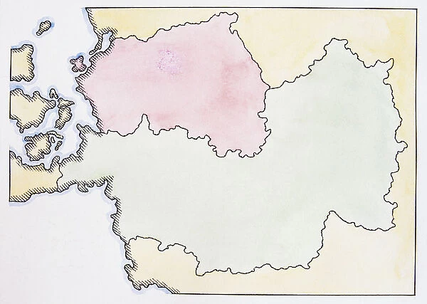
Canvas Print : Map of Germany post World War II
![]()

Canvas Prints From Universal Images Group (UIG)
Map of Germany post World War II
Universal Images Group (UIG) manages distribution for many leading specialist agencies worldwide
Media ID 9541249
© Dorling Kindersley/UIG
Berlin Wall Communism Conquered German History Nation Iron Curtain Spoils
20"x16" (51x41cm) Canvas Print
Discover history in vibrant detail with our Media Storehouse Canvas Prints. This captivating piece features a Map of Germany post World War II, as seen in the Universal Images Group (UIG) archive. Each print is meticulously crafted on high-quality canvas, ensuring a stunning and long-lasting display. Bring history into your home or office with this thought-provoking and conversation-starting addition to your decor.
Delivered stretched and ready to hang our premium quality canvas prints are made from a polyester/cotton blend canvas and stretched over a 1.25" (32mm) kiln dried knot free wood stretcher bar. Packaged in a plastic bag and secured to a cardboard insert for safe transit.
Canvas Prints add colour, depth and texture to any space. Professionally Stretched Canvas over a hidden Wooden Box Frame and Ready to Hang
Estimated Product Size is 50.8cm x 40.6cm (20" x 16")
These are individually made so all sizes are approximate
Artwork printed orientated as per the preview above, with landscape (horizontal) orientation to match the source image.
EDITORS COMMENTS
This print showcases a historically significant "Map of Germany post World War II" from the renowned Universal Images Group (UIG). The image vividly depicts the aftermath of one of humanity's most devastating conflicts, offering an intriguing glimpse into German history. The map itself serves as a visual testament to the profound impact that World War II had on the nation. It highlights not only geographical boundaries but also political and ideological divisions that emerged in its wake. The conquered territories, marked with precision, reflect the spoils claimed by various nations involved in the war. One cannot overlook the symbolic representation of communism through this map. The Iron Curtain is prominently displayed, representing the ideological divide between Eastern and Western Europe during those tumultuous years. Moreover, it reminds us of how Berlin became a microcosm for this division with its infamous Berlin Wall standing tall. As we delve deeper into this historical artifact, it becomes evident that behind these lines lies a story of resilience and rebuilding. This map encapsulates both tragedy and hope - reminding us of Germany's journey towards reunification after decades under separate governments. Through this powerful illustration, UIG invites us to explore not just geography but also human narratives embedded within maps. It encourages reflection on our collective past while serving as a reminder that history shapes our present reality in profound ways.
MADE IN THE USA
Safe Shipping with 30 Day Money Back Guarantee
FREE PERSONALISATION*
We are proud to offer a range of customisation features including Personalised Captions, Color Filters and Picture Zoom Tools
SECURE PAYMENTS
We happily accept a wide range of payment options so you can pay for the things you need in the way that is most convenient for you
* Options may vary by product and licensing agreement. Zoomed Pictures can be adjusted in the Basket.


