Canvas Print > Europe > United Kingdom > England > Yorkshire > Sheffield
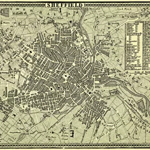
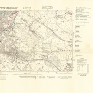
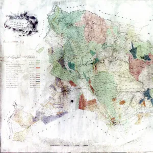
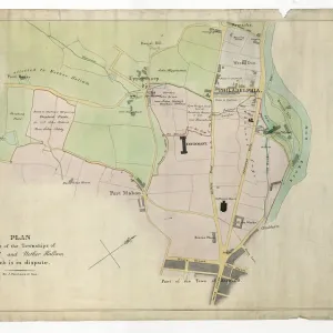
Canvas Print : Plan of Sheffield, Yorkshire, c. 1870 - 1905


![]()
Canvas Prints from Sheffield City Archives
Plan of Sheffield, Yorkshire, c. 1870 - 1905
Undated but shows the Midland Station as it was built in 1870, therefore between 1870 and 1905 when the station was enlarged.
Original at Sheffield Local Studies Library: y11773
Sheffield City Archives and Local Studies Library has an unrivalled collection of images of Sheffield, England
Media ID 14086408
© Sheffield City Council
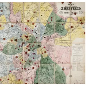
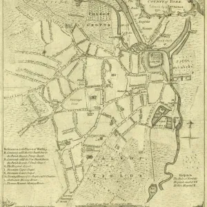
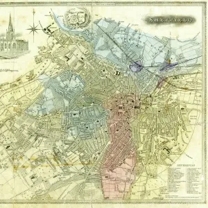
Maps Plans Sheffield Yorkshire
30"x20" (76x51cm) Canvas Print
Discover the rich history of Sheffield with our exquisite Canvas Prints from Media Storehouse. This captivating piece showcases an antique Plan of Sheffield, dating back to the late 19th century. The meticulously detailed map, sourced from Sheffield City Archives, highlights the city's layout around 1870, featuring the stunning Midland Station as it was originally built in 1870. Add a touch of history and character to your home or office with this beautifully preserved piece of Sheffield's past.
Delivered stretched and ready to hang our premium quality canvas prints are made from a polyester/cotton blend canvas and stretched over a 1.25" (32mm) kiln dried knot free wood stretcher bar. Packaged in a plastic bag and secured to a cardboard insert for safe transit.
Canvas Prints add colour, depth and texture to any space. Professionally Stretched Canvas over a hidden Wooden Box Frame and Ready to Hang
Estimated Product Size is 76.2cm x 50.8cm (30" x 20")
These are individually made so all sizes are approximate
Artwork printed orientated as per the preview above, with landscape (horizontal) orientation to match the source image.
FEATURES IN THESE COLLECTIONS
> Europe
> United Kingdom
> England
> Yorkshire
> Related Images
> Europe
> United Kingdom
> England
> Yorkshire
> Sheffield
> Maps and Charts
> Related Images
> Sheffield City Archives
> Maps and Plans
> Maps of Sheffield
EDITORS COMMENTS
This print showcases the intricate "Plan of Sheffield, Yorkshire" during a period between 1870 and 1905. Undated but featuring the iconic Midland Station as it was built in 1870, this image transports us back to an era where bustling railway networks were at the heart of industrial progress. The city's evolution is beautifully captured within this historic map, which offers a glimpse into Sheffield's growth and transformation. With its detailed streets, landmarks, and buildings meticulously illustrated, this plan serves as a testament to the rich history that shaped Sheffield. It allows us to explore the urban landscape of yesteryears and appreciate how much has changed over time. From residential areas to commercial districts, every corner of this vibrant city is laid out before our eyes. Preserved at the esteemed Sheffield Local Studies Library under reference number y11773, this original print holds immense value for historians and enthusiasts alike. Its presence in the archives ensures that future generations can delve into Sheffield's past and gain insights into its architectural heritage. As we study this remarkable piece of history, let us marvel at how far Sheffield has come since those early days when steam trains chugged through its stations. This photograph invites us on a journey through time – an opportunity to reflect upon our roots while embracing the ever-changing face of progress in one of Yorkshire's most beloved cities.
MADE IN THE USA
Safe Shipping with 30 Day Money Back Guarantee
FREE PERSONALISATION*
We are proud to offer a range of customisation features including Personalised Captions, Color Filters and Picture Zoom Tools
SECURE PAYMENTS
We happily accept a wide range of payment options so you can pay for the things you need in the way that is most convenient for you
* Options may vary by product and licensing agreement. Zoomed Pictures can be adjusted in the Cart.