Canvas Print > Europe > United Kingdom > England > Birmingham > Area > Castle Vale
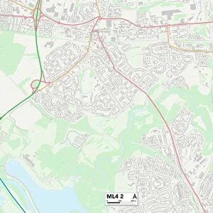
Canvas Print : Birmingham B35 7 Map


![]()
Canvas Prints From Map Marketing
Birmingham B35 7 Map
Postcode Sector Map of Birmingham B35 7
Media ID 19964972
Beale Close Birmingham Blenheim Way Davenport Drive Dixon Close Farnborough Road High Street Hurricane Way Kestrel Close Lancaster Drive Langley Drive Lysander Way Merlin Close Pioneer Way School Close Spitfire Way Viscount Close Viscount Drive Wellington Way Castle Bromwich
20"x16" (51x41cm) Canvas Print
Delivered stretched and ready to hang our premium quality canvas prints are made from a polyester/cotton blend canvas and stretched over a 1.25" (32mm) kiln dried knot free wood stretcher bar. Packaged in a plastic bag and secured to a cardboard insert for safe transit.
Canvas Prints add colour, depth and texture to any space. Professionally Stretched Canvas over a hidden Wooden Box Frame and Ready to Hang
Estimated Product Size is 50.8cm x 40.6cm (20" x 16")
These are individually made so all sizes are approximate
Artwork printed orientated as per the preview above, with landscape (horizontal) orientation to match the source image.
FEATURES IN THESE COLLECTIONS
> Europe
> United Kingdom
> England
> Birmingham
> Area
> Castle Vale
> Europe
> United Kingdom
> Northern Ireland
> County Down
> Newcastle
> Maps and Charts
> Related Images
> Transportation
> Aeroplanes
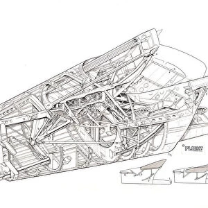
> Concorde
> Transportation
> Aeroplanes
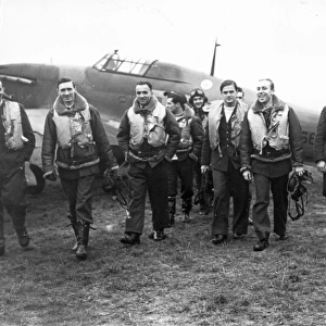
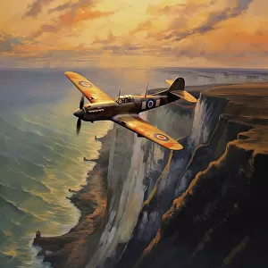
> Hawker Hurricane
MADE IN THE USA
Safe Shipping with 30 Day Money Back Guarantee
FREE PERSONALISATION*
We are proud to offer a range of customisation features including Personalised Captions, Color Filters and Picture Zoom Tools
SECURE PAYMENTS
We happily accept a wide range of payment options so you can pay for the things you need in the way that is most convenient for you
* Options may vary by product and licensing agreement. Zoomed Pictures can be adjusted in the Basket.