Canvas Print > Arts > Artists > W > Frederick de Wit
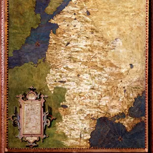
Canvas Print : Map Magni ducatus LithuaniAŠ tabula divisa tam


![]()
Canvas Prints from Liszt Collection
Map Magni ducatus LithuaniAŠ tabula divisa tam
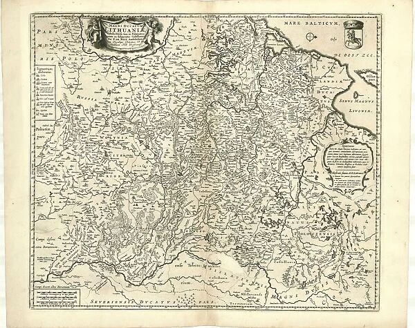
Map, Magni ducatus Lithuaniae tabula divisa tam in Palatinatus, quam in subjacentes Castellamas per F. de Witt Amstelodami, Frederick de Wit (1630-1706), Copperplate print
Liszt Collection of nineteenth-century engravings and images to browse and enjoy
Media ID 19585035
© Artokoloro
1630 1706 Copperplate Print Frederick De Wit Quam
20"x16" (51x41cm) Canvas Print
Bring history to life with our exquisite Canvas Prints from the Media Storehouse collection. This captivating piece features the intricately detailed Map Magni ducatus Lithuaniae tabula divisa tam, showcasing the territories of Lithuania and its adjacent castellans. Originally a copperplate print from the renowned Liszt Collection, this masterpiece by Frederick de Wit (1630-1706) is now transformed into a stunning work of art for your home or office. Experience the rich history and intricate details of this antique map in a whole new way with our high-quality Canvas Prints.
Delivered stretched and ready to hang our premium quality canvas prints are made from a polyester/cotton blend canvas and stretched over a 1.25" (32mm) kiln dried knot free wood stretcher bar. Packaged in a plastic bag and secured to a cardboard insert for safe transit.
Canvas Prints add colour, depth and texture to any space. Professionally Stretched Canvas over a hidden Wooden Box Frame and Ready to Hang
Estimated Product Size is 50.8cm x 40.6cm (20" x 16")
These are individually made so all sizes are approximate
Artwork printed orientated as per the preview above, with landscape (horizontal) orientation to match the source image.
FEATURES IN THESE COLLECTIONS
> Arts
> Artists
> W
> Frederick de Wit
> Europe
> Lithuania
> Posters
> Europe
> Lithuania
> Related Images
> Maps and Charts
> Related Images
EDITORS COMMENTS
This print showcases a remarkable piece of cartographic art titled "Map, Magni ducatus Lithuaniae tabula divisa tam in Palatinatus, quam in subjacentes Castellamas per F. de Witt Amstelodami" by Frederick de Wit. Crafted using copperplate printing technique, this map is a true testament to the skill and precision of its creator. The intricate details and vibrant colors bring to life the vast territories of the Grand Duchy of Lithuania, divided into palatinates and castles. With every glance at this print, one can't help but be transported back in time to an era when maps were not just navigational tools but works of art. Frederick de Wit's mastery shines through as he intricately depicts each region with meticulous accuracy. The careful placement of cities, rivers, forests, and mountains creates a visual feast for the eyes. It is evident that De Wit poured his heart and soul into creating this masterpiece. As we admire this stunning copperplate print from Liszt Collection, let us appreciate not only its aesthetic beauty but also its historical significance. This map serves as a window into the past - a reminder of how our world has evolved over centuries. Whether you are an avid collector or simply someone who appreciates fine craftsmanship and history, this print is sure to captivate your imagination and spark curiosity about the rich heritage it represents.
MADE IN THE USA
Safe Shipping with 30 Day Money Back Guarantee
FREE PERSONALISATION*
We are proud to offer a range of customisation features including Personalised Captions, Color Filters and Picture Zoom Tools
SECURE PAYMENTS
We happily accept a wide range of payment options so you can pay for the things you need in the way that is most convenient for you
* Options may vary by product and licensing agreement. Zoomed Pictures can be adjusted in the Cart.