Canvas Print > Europe > Germany > Maps
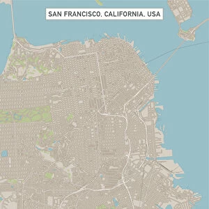
Canvas Print : Map of Berlin and surrounding area 1898


![]()
Canvas Prints from Fine Art Storehouse
Map of Berlin and surrounding area 1898
Historic city map of Berlin, Germany. Lithograph, published in 1898
Unleash your creativity and transform your space into a visual masterpiece!
Nastasic
Media ID 19860019
© Nikola Nastasic
20"x16" (51x41cm) Canvas Print
Step back in time with our stunning Canvas Print of the Historic Map of Berlin and Surrounding Areas by Nastasic, from our Media Storehouse Fine Art Collection. This exquisite lithograph, published in 1898, offers a captivating glimpse into the past, showcasing the layout of Berlin and its surroundings during an era of significant historical importance. The intricate details and vibrant colors are brought to life on high-quality canvas, adding a touch of timeless charm to any space. Perfect for history enthusiasts, travelers, or anyone seeking to add a unique and thought-provoking piece to their décor. Experience the rich history of Berlin like never before with our Canvas Print of the Nastasic Map.
Delivered stretched and ready to hang our premium quality canvas prints are made from a polyester/cotton blend canvas and stretched over a 1.25" (32mm) kiln dried knot free wood stretcher bar. Packaged in a plastic bag and secured to a cardboard insert for safe transit.
Canvas Prints add colour, depth and texture to any space. Professionally Stretched Canvas over a hidden Wooden Box Frame and Ready to Hang
Estimated Product Size is 50.8cm x 40.6cm (20" x 16")
These are individually made so all sizes are approximate
Artwork printed orientated as per the preview above, with landscape (horizontal) orientation to match the source image.
FEATURES IN THESE COLLECTIONS
> Maps and Charts
> Related Images
> Fine Art Storehouse
> Map
> Historical Maps
EDITORS COMMENTS
This lithograph takes us on a journey back in time to the bustling streets of Berlin in 1898. The intricate details and exquisite craftsmanship of this historic city map transport us to an era long gone, offering a glimpse into the past that is both fascinating and nostalgic. The Map of Berlin and surrounding area showcases the capital city's layout during its Prussian days, capturing its grandeur and architectural marvels. Every street, square, and landmark is meticulously engraved onto the print, revealing a labyrinthine network that once defined this vibrant metropolis. As our eyes wander across the image, we can almost hear the echoes of horse-drawn carriages trotting along cobblestone roads while elegantly dressed pedestrians go about their daily lives. This antique masterpiece not only serves as a visual delight but also holds historical significance. It reminds us of Berlin's rich heritage and how it has evolved over time. While some areas may have transformed beyond recognition or become obsolete altogether, this lithograph immortalizes them forever. Nastasic's skillful execution breathes life into every stroke, making this piece more than just a cartographic representation; it becomes an artistic treasure that captivates collectors and history enthusiasts alike. Whether displayed in homes or offices, this print sparks conversations about urban development, cultural heritage preservation, and the passage of time. As we admire this beautifully preserved relic from 1898 Germany, let us appreciate how art can transcend generations by preserving memories through ink on paper.
MADE IN THE USA
Safe Shipping with 30 Day Money Back Guarantee
FREE PERSONALISATION*
We are proud to offer a range of customisation features including Personalised Captions, Color Filters and Picture Zoom Tools
SECURE PAYMENTS
We happily accept a wide range of payment options so you can pay for the things you need in the way that is most convenient for you
* Options may vary by product and licensing agreement. Zoomed Pictures can be adjusted in the Cart.