Canvas Print > Europe > France > Maps
Canvas Print : France. Map of the evacuation of the German army and the ceded parts of the country


![]()
Canvas Prints from Fine Art Storehouse
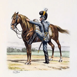
France. Map of the evacuation of the German army and the ceded parts of the country
Illustration of a France. Map of the evacuation of the German army and the ceded parts of the country
Unleash your creativity and transform your space into a visual masterpiece!
Nastasic
Media ID 19681609
20"x16" (51x41cm) Canvas Print
Bring the rich history of France into your home with our stunning Canvas Prints from Media Storehouse. This exquisite piece features a captivating illustration of France, including a detailed map of the historic evacuation of the German army and the ceded parts of the country as depicted by the renowned artist Nastasic. Each Canvas Print is meticulously crafted using premium materials, ensuring vibrant colors and sharp details that truly bring the art to life. Add this beautiful and educational piece to your collection and relive the history of France in your very own space.
Delivered stretched and ready to hang our premium quality canvas prints are made from a polyester/cotton blend canvas and stretched over a 1.25" (32mm) kiln dried knot free wood stretcher bar. Packaged in a plastic bag and secured to a cardboard insert for safe transit.
Canvas Prints add colour, depth and texture to any space. Professionally Stretched Canvas over a hidden Wooden Box Frame and Ready to Hang
Estimated Product Size is 50.8cm x 40.6cm (20" x 16")
These are individually made so all sizes are approximate
Artwork printed orientated as per the preview above, with landscape (horizontal) orientation to match the source image.
FEATURES IN THESE COLLECTIONS
> Europe
> Germany
> Related Images
> Maps and Charts
> Related Images
> Fine Art Storehouse
> Map
> Historical Maps
EDITORS COMMENTS
This print titled "France. Map of the evacuation of the German army and the ceded parts of the country" takes us back in time to a significant moment in history. The illustration, skillfully crafted by Nastasic, depicts a map that tells a tale of both triumph and loss. As we gaze upon this artwork, our eyes are drawn to the intricate details that showcase the strategic movements during World War II. The map reveals how the German army was forced to evacuate certain areas while other parts were ceded to opposing forces. It serves as a visual testament to France's resilience and determination during those tumultuous times. The artist's meticulous attention to detail allows us to immerse ourselves in this historical event. We can almost feel the tension within each stroke, capturing not only geographical boundaries but also emotions felt by those affected by war. This print is more than just an artistic representation; it serves as a reminder of human strength amidst adversity. It prompts us to reflect on past sacrifices made for freedom and encourages us never to forget those who fought for peace. "Nastasic" has masterfully captured this pivotal moment in French history through their artistry, ensuring that future generations will have access to this important piece of historical documentation.
MADE IN THE USA
Safe Shipping with 30 Day Money Back Guarantee
FREE PERSONALISATION*
We are proud to offer a range of customisation features including Personalised Captions, Color Filters and Picture Zoom Tools
SECURE PAYMENTS
We happily accept a wide range of payment options so you can pay for the things you need in the way that is most convenient for you
* Options may vary by product and licensing agreement. Zoomed Pictures can be adjusted in the Cart.