Canvas Print > Asia > China > Maps
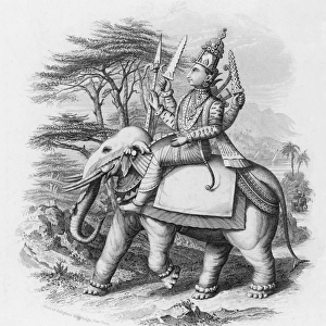
Canvas Print : Mitchell Map of India, Tibet, China and Southeast Asia, 1864


![]()
Canvas Prints From Fine Art Finder
Mitchell Map of India, Tibet, China and Southeast Asia, 1864
1578196 Mitchell Map of India, Tibet, China and Southeast Asia, 1864; (add.info.: Mitchell Map of India, Tibet, China and Southeast Asia. Dated 1864.); Universal History Archive/UIG
Media ID 38102008
© Universal History Archive/UIG / Bridgeman Images
1860s Chineze Southeast Asia Tibet Asiae Chineses
20"x16" (51x41cm) Canvas Print
Explore our collection of stunning Canvas Prints featuring historical maps like the "Mitchell Map of India, Tibet, China and Southeast Asia, 1864" by Bridgeman Images. Perfect for adding a touch of vintage charm to any space.
Delivered stretched and ready to hang our premium quality canvas prints are made from a polyester/cotton blend canvas and stretched over a 1.25" (32mm) kiln dried knot free wood stretcher bar. Packaged in a plastic bag and secured to a cardboard insert for safe transit.
Canvas Prints add colour, depth and texture to any space. Professionally Stretched Canvas over a hidden Wooden Box Frame and Ready to Hang
Estimated Product Size is 50.8cm x 40.6cm (20" x 16")
These are individually made so all sizes are approximate
Artwork printed orientated as per the preview above, with landscape (horizontal) orientation to match the source image.
FEATURES IN THESE COLLECTIONS
> Asia
> India
> Related Images
> Maps and Charts
> India
> Maps and Charts
> Related Images
> Fine Art Finder
> Temp Classification
EDITORS COMMENTS
This stunning print showcases the intricate details of the Mitchell Map of India, Tibet, China, and Southeast Asia from 1864. The map is a true work of art, with its carefully drawn borders and labels that provide a glimpse into the geography of these regions during the 19th century.
The Mitchell Map is not just a cartographic representation but also a historical document that reflects the political boundaries and cultural diversity of India, Tibet, China, and Southeast Asia at that time. It serves as a reminder of the rich history and interconnectedness of these regions.
As you study this map closely, you can see how each country's unique features are highlighted - from the majestic Himalayas in Tibet to the sprawling rivers in India and China. The attention to detail in this map is truly remarkable and speaks to the skill and precision of its creator.
Whether you have an interest in cartography or simply appreciate beautiful works of art, this Mitchell Map print is sure to captivate your imagination. It offers a window into another era while reminding us of the enduring importance of geography in shaping our world.
MADE IN THE USA
Safe Shipping with 30 Day Money Back Guarantee
FREE PERSONALISATION*
We are proud to offer a range of customisation features including Personalised Captions, Color Filters and Picture Zoom Tools
SECURE PAYMENTS
We happily accept a wide range of payment options so you can pay for the things you need in the way that is most convenient for you
* Options may vary by product and licensing agreement. Zoomed Pictures can be adjusted in the Basket.