Canvas Print > Fine Art Finder > Schools > German School
Canvas Print : Map of Europe, 1841 (colour litho)
")
")

![]()
Canvas Prints from Fine Art Finder
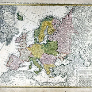
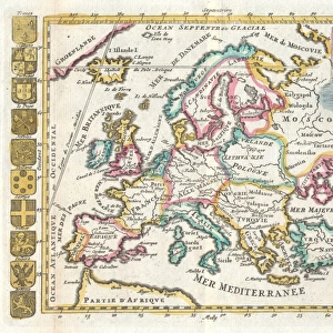
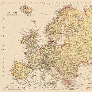
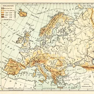
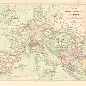
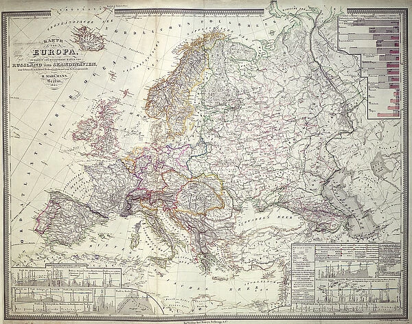
Map of Europe, 1841 (colour litho)
XCF306031 Map of Europe, 1841 (colour litho) by German School, (19th century); Private Collection; German, out of copyright
Media ID 12840976
© www.bridgemanart.com
20"x16" (51x41cm) Canvas Print
Bring historical charm into your home with Media Storehouse's Canvas Prints featuring the intricately detailed Map of Europe from 1841. This stunning, color lithograph by the German School of the 19th century, now out of copyright, offers a captivating glimpse into the past. Transport yourself back in time as you explore the borders and territories of Europe as they once were. Each Canvas Print is meticulously crafted with premium materials and vibrant colors to ensure a beautiful, long-lasting addition to your decor. Order yours today from Media Storehouse and create a unique, educational, and timeless piece for your living space.
Delivered stretched and ready to hang our premium quality canvas prints are made from a polyester/cotton blend canvas and stretched over a 1.25" (32mm) kiln dried knot free wood stretcher bar. Packaged in a plastic bag and secured to a cardboard insert for safe transit.
Canvas Prints add colour, depth and texture to any space. Professionally Stretched Canvas over a hidden Wooden Box Frame and Ready to Hang
Estimated Product Size is 50.8cm x 40.6cm (20" x 16")
These are individually made so all sizes are approximate
Artwork printed orientated as per the preview above, with landscape (horizontal) orientation to match the source image.
FEATURES IN THESE COLLECTIONS
> Fine Art Finder
> Maps (celestial & Terrestrial)
> Fine Art Finder
> Schools
> German School
EDITORS COMMENTS
This print showcases a stunning "Map of Europe, 1841" in vibrant colors and intricate detail. Created by the German School in the 19th century, this piece is now part of a private collection. The map offers an intriguing glimpse into the past, allowing us to explore the continent as it was over 180 years ago. With its emphasis on mapping, cartography, geography, topography, and statistics, this artwork serves as both an aesthetic delight and an educational tool. Every line and contour has been meticulously crafted to accurately represent each country's borders and geographical features. From Russia's vast expanse to Scandinavia's rugged coastline, every region is depicted with precision. The historical significance of this map cannot be overstated. It provides valuable insights into how Europe appeared during a pivotal era marked by political upheaval and social change. As we study its intricacies, we can trace the evolution of nations and witness their interactions across borders. Whether you are a history enthusiast or simply appreciate fine artistry, this remarkable print from Fine Art Finder will transport you back in time while simultaneously enriching your understanding of European geography. Its timeless beauty combined with its informative nature makes it a perfect addition to any home or office space.
MADE IN THE USA
Safe Shipping with 30 Day Money Back Guarantee
FREE PERSONALISATION*
We are proud to offer a range of customisation features including Personalised Captions, Color Filters and Picture Zoom Tools
SECURE PAYMENTS
We happily accept a wide range of payment options so you can pay for the things you need in the way that is most convenient for you
* Options may vary by product and licensing agreement. Zoomed Pictures can be adjusted in the Cart.