Fraud Blocker Skip to main content

Home > Asia > Japan > Maps

Maps Collection (page 7)

Maps of Japan Asia are detailed maps that show the various physical features, cities, and other points of interest in Japan and surrounding countries

391 items

Background imageMaps Collection: Which way is North? Huguette Borrelly (France), Mrs

Which way is North? Huguette Borrelly (France), Mrs. Yenawaki (Japan), Safia Hamly (Egypt), Raji Sundram (Malayan Indian)

Background imageMaps Collection: Ancient Map of Japan 1606 Date: 1606

Ancient Map of Japan 1606 Date: 1606

Background imageMaps Collection: 20063474

20063474
JAPAN Honshu Tokyo Ueno train station with women buying train tickets from vending machines with the train route map above

Background imageMaps Collection: 20072195

20072195
JAPAN Honshu Tokyo Tokyo station commuters at a row of ticket machines with route map above

Background imageMaps Collection: Manchester M8 9 Map

Manchester M8 9 Map
Postcode Sector Map of Manchester M8 9

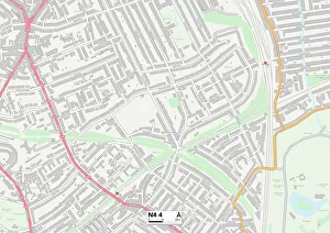
Background imageMaps Collection: Haringey N4 4 Map

Haringey N4 4 Map
Postcode Sector Map of Haringey N4 4

Background imageMaps Collection: West Lindsey DN21 2 Map

West Lindsey DN21 2 Map
Postcode Sector Map of West Lindsey DN21 2

Background imageMaps Collection: Fuji in Clear Weather (from the series Thirty-six Views of Mt. Fuji), early 1830s

Fuji in Clear Weather (from the series Thirty-six Views of Mt. Fuji), early 1830s. Mt. Fuji, Japans highest mountain, appeared in most 18th-century travel literature. Maps sometimes situated Mt

Background imageMaps Collection: Chinese and Japanese Empires

Chinese and Japanese Empires
Antique Maps, TR002315

Background imageMaps Collection: Map of China and Japan 1896

Map of China and Japan 1896
Andres Allgemeiner Handatlas - Bielefeld und Leipzig 1896

Background imageMaps Collection: Map of Japan 1894

Map of Japan 1894
Johnsons Universal Cyclopedia - Volume IV New York - A. J. Johnson Company 1894

Background imageMaps Collection: Antique map of Chinese Empire, Japan, 1897, late 19th Century

Antique map of Chinese Empire, Japan, 1897, late 19th Century
Vintage engraving of a Antique map of Chinese Empire, Japan, 1897, late 19th Century

Background imageMaps Collection: Map of China and Japan, 1902. Creator: Unknown

Map of China and Japan, 1902. Creator: Unknown
Map of China and Japan, 1902. Showing Mongolia, Eastern Turkestan and Tibet, with insets of Hong Kong and Tokyo Bay. From The Century Atlas of the World. [John Walker & Co, Ltd. London, 1902]

Background imageMaps Collection: Map of Asia, 1902. Creator: Unknown

Map of Asia, 1902. Creator: Unknown
Map of Asia, 1902. Showing Arabia, Persia, the Indian Subcontinent, Indochina and the Chinese Empire. From The Century Atlas of the World. [John Walker & Co, Ltd. London, 1902]

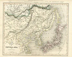
Background imageMaps Collection: Central Asia including Japan antique map 19th century 1843

Central Asia including Japan antique map 19th century 1843
This is an original steel engraving with original colour, an antique map of Central Asia (including Japan, northern China, Mongolia and Korea)

Background imageMaps Collection: Japan and Korea 1898

Japan and Korea 1898
Antique map of Japan and Korea from 1898

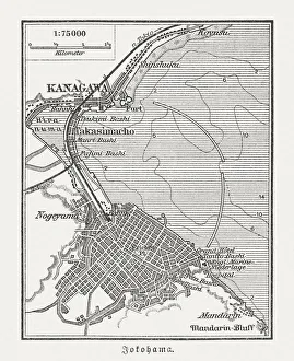
Background imageMaps Collection: Old map of Yokohama, Japan, wood engraving, published in 1897

Old map of Yokohama, Japan, wood engraving, published in 1897
Old map of Yokohama, Japan. Wood engraving, published in 1897

Background imageMaps Collection: Japanese Soldiers

Japanese Soldiers
Japanese military officers studying a map. (Photo by Felice Beato/Henry Guttmann/Getty Images)

Background imageMaps Collection: Japanese Army

Japanese Army
circa 1860: Japanese soldiers with topknots and curved swords consult a map. (Photo by Felice Beato/Henry Guttmann/Getty Images)

Background imageMaps Collection: Map of Nagasaki, c1801

Map of Nagasaki, c1801
(Map of Nagasaki, c 1801 (colour woodcut)

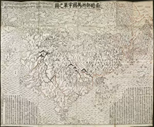
Background imageMaps Collection: Buddhist map of the world, Early 18th cen Artist: Anonymous master

Buddhist map of the world, Early 18th cen Artist: Anonymous master
Buddhist map of the world, Early 18th cen.. Found in the collection of the Art Gallery of South Australia

Background imageMaps Collection: The Buddhist world map, 1710. Artist: Rokashi Hotan, Zuda (1654-1738)

The Buddhist world map, 1710. Artist: Rokashi Hotan, Zuda (1654-1738)
The Buddhist world map, 1710. Private Collection

Background imageMaps Collection: China and Japan, c1903, (1904)

China and Japan, c1903, (1904). From The Worlds History, Volume II, by Dr. H. F. Helmolt [William Heinemann, London, 1904]

Background imageMaps Collection: The Burial-Place and Temple Groves of Nikko in Japan, c1860, (1904)

The Burial-Place and Temple Groves of Nikko in Japan, c1860, (1904). From The Worlds History, Volume II, by Dr. H. F. Helmolt [William Heinemann, London, 1904]

Background imageMaps Collection: Scene of operations south of Port Adams, Manchuria, Russo-Japanese War, 1905

Scene of operations south of Port Adams, Manchuria, Russo-Japanese War, 1905. The Russo-Japanese War arose due to the two countries conflicting territorial ambitions in East Asia

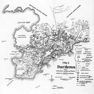
Background imageMaps Collection: Port Arthur, Manchuria, showing Japanese and Russian fortifications, Russo-Japanese War, 1905

Port Arthur, Manchuria, showing Japanese and Russian fortifications, Russo-Japanese War, 1905. The city of Port Arthur, leased from the Chinese by Russia

Background imageMaps Collection: The pillory in Japan before the revolution, 1895. Artist: Hildibrand

The pillory in Japan before the revolution, 1895. Artist: Hildibrand
The pillory in Japan before the revolution, 1895. From The Universal Geography with Illustrations and Maps, division XIV, written by Elisee Reclus and published by Virtue & Co. Limited (London, 1895)

Background imageMaps Collection: A rickshaw, Japan, 1895

A rickshaw, Japan, 1895. From The Universal Geography with Illustrations and Maps, division XIV, written by Elisee Reclus and published by Virtue & Co. Limited (London, 1895)

Background imageMaps Collection: A bell from the Shiba quarter, Tokyo, Japan, 1895. Artist: Armand Kohl

A bell from the Shiba quarter, Tokyo, Japan, 1895. Artist: Armand Kohl
A bell from the Shiba quarter, Tokyo, Japan, 1895

Background imageMaps Collection: Buddhist temple, Nikko, Japan, 1895. Artist: Hildibrand

Buddhist temple, Nikko, Japan, 1895. Artist: Hildibrand
Buddhist temple, Nikko, Japan, 1895. From The Universal Geography with Illustrations and Maps, division XIV, written by Elisee Reclus and published by Virtue & Co. Limited (London, 1895)

Background imageMaps Collection: Japanese man with a tattooed back, 1895. Artist: Charles Barbant

Japanese man with a tattooed back, 1895. Artist: Charles Barbant
Japanese man with a tattooed back, 1895. From The Universal Geography with Illustrations and Maps, division XIV, written by Elisee Reclus and published by Virtue & Co. Limited (London, 1895)

Background imageMaps Collection: Japanese musicians and a dealer, 1895

Japanese musicians and a dealer, 1895. From The Universal Geography with Illustrations and Maps, division XIV, written by Elisee Reclus and published by Virtue & Co. Limited (London, 1895)

Background imageMaps Collection: Portico of the Temple of the Four Dragons (Nikko Toshogu), Nikko, Japan, 1895. Artist: Armand Kohl

Portico of the Temple of the Four Dragons (Nikko Toshogu), Nikko, Japan, 1895. Artist: Armand Kohl
Portico of the Temple of the Four Dragons (Nikko Toshogu), Nikko, Japan, 1895. From The Universal Geography with Illustrations and Maps, division XIV

Background imageMaps Collection: Ainu people, Japan, 1895

Ainu people, Japan, 1895. From The Universal Geography with Illustrations and Maps, division XIV, written by Elisee Reclus and published by Virtue & Co. Limited (London, 1895)

Background imageMaps Collection: Tali lake, Japan, 1895. Artist: Armand Kohl

Tali lake, Japan, 1895. Artist: Armand Kohl
Tali lake, Japan, 1895. From The Universal Geography with Illustrations and Maps, division XIV, written by Elisee Reclus and published by Virtue & Co. Limited (London, 1895)

Background imageMaps Collection: Mount Fuji, Japan, 1895. Artist: Charles Barbant

Mount Fuji, Japan, 1895. Artist: Charles Barbant
Mount Fuji, Japan, 1895. As seen from the south-west. From The Universal Geography with Illustrations and Maps, division XIV, written by Elisee Reclus and published by Virtue & Co

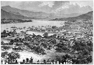
Background imageMaps Collection: Nagasaki, Japan, 1895. Artist: Armand Kohl

Nagasaki, Japan, 1895. Artist: Armand Kohl
Nagasaki, Japan, 1895. From The Universal Geography with Illustrations and Maps, division XIV, written by Elisee Reclus and published by Virtue & Co. Limited (London, 1895)

Background imageMaps Collection: Japanese people and costumes, 1895. Artist: Armand Kohl

Japanese people and costumes, 1895. Artist: Armand Kohl
Japanese people and costumes, 1895. From The Universal Geography with Illustrations and Maps, division XIV, written by Elisee Reclus and published by Virtue & Co. Limited (London, 1895)

Background imageMaps Collection: Odovara, Japan, 1895

Odovara, Japan, 1895. As seen from Tokaido. From The Universal Geography with Illustrations and Maps, division XIV, written by Elisee Reclus and published by Virtue & Co. Limited (London, 1895)

Background imageMaps Collection: Citizens of Tokyo, Japan, 1895

Citizens of Tokyo, Japan, 1895. From The Universal Geography with Illustrations and Maps, division XIV, written by Elisee Reclus and published by Virtue & Co. Limited (London, 1895)

Background imageMaps Collection: Cape Horner, Japan, 1895. Artist: Armand Kohl

Cape Horner, Japan, 1895. Artist: Armand Kohl
Cape Horner, Japan, 1895. As seen from the entrance to Kagosima Bay. From The Universal Geography with Illustrations and Maps, division XIV, written by Elisee Reclus and published by Virtue & Co

Background imageMaps Collection: Japanese peasants, 1895. Artist: Armand Kohl

Japanese peasants, 1895. Artist: Armand Kohl
Japanese peasants, 1895. From The Universal Geography with Illustrations and Maps, division XIV, written by Elisee Reclus and published by Virtue & Co. Limited (London, 1895)

Background imageMaps Collection: An Ainu girl, Japan, 1895. Artist: E Ronjat

An Ainu girl, Japan, 1895. Artist: E Ronjat
An Ainu girl, Japan, 1895. From The Universal Geography with Illustrations and Maps, division XII, written by Elisee Reclus and published by Virtue & Co. Limited (London, 1895)

Background imageMaps Collection: Lake Hakone, c1890

Lake Hakone, c1890. Landscape in Japan, possibly of Lake Ashi. Illustration from The Universal Geography with Illustrations and Maps, Division XIII, (Virtue & Co Limited, London, c1890)

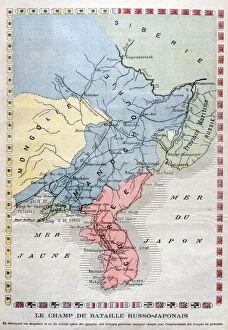
Background imageMaps Collection: Map of the theatre of the Russo-Japanese War, 1904. Artist: A Meunier

Map of the theatre of the Russo-Japanese War, 1904. Artist: A Meunier
Map of the theatre of the Russo-Japanese War, 1904. The Russo-Japanese War arose due to the two countries conflicting territorial ambitions in East Asia

Background imageMaps Collection: Map of the Russo-Japanese War, 1904

Map of the Russo-Japanese War, 1904. The Russo-Japanese War arose due to the two countries conflicting territorial ambitions in East Asia

Background imageMaps Collection: Map of Asia 1895

Map of Asia 1895
The Rand-McNally Grammar School Geography 1895 - Chicago & New York

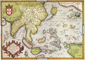
Background imageMaps Collection: South East Asia 1570

South East Asia 1570
Southeast Asia 1570, Ortelius


All Professionally Made to Order for Quick Shipping


-

Maps Collection

Maps of Japan Asia are detailed maps that show the various physical features, cities, and other points of interest in Japan and surrounding countries. They provide an overview of the region's geography, as well as a look at its cultural and historical sites, and are be used to plan trips or to gain a better understanding of the area. They often include information on transportation networks, airports, major roads, national parks and other attractions. It also provide information on population density and climate conditions for each region. With such detailed maps available for Japan Asia, travelers can easily find their way around this fascinating part of the world.
+

Our beautiful Wall Art and Photo Gifts include Framed Prints, Photo Prints, Poster Prints, Canvas Prints, Jigsaw Puzzles, Metal Prints and so much more

The Maps of Japan Asia collection from Media Storehouse is a stunning compilation of vintage maps that showcase the rich history and geography of Japan and its neighboring countries in Asia. Our collection features beautifully detailed maps dating back to the 18th century, depicting various regions such as Hokkaido, Tokyo, Kyoto, Osaka, China, Korea, Taiwan and more. Each map has been carefully restored to retain its original charm while ensuring clarity and accuracy. The Maps of Japan Asia collection offers a wide range of options for wall art and framed prints that are perfect for home or office decor. These high-quality prints come in different sizes to suit any space. Whether you're an avid collector or simply appreciate the beauty of historical cartography, our collection is sure to impress. With its intricate details and vibrant colors, it's easy to see why these antique maps continue to captivate audiences today.
+

What are Maps of Japan Asia art prints?

Maps of Japan Asia art prints are high-quality reproductions of vintage and contemporary maps depicting the geography, topography, and landmarks of Japan and other Asian countries. These art prints showcase intricate details such as mountain ranges, rivers, cities, towns, temples, shrines, and cultural icons that represent the rich history and diversity of these regions. These maps are not only functional but also aesthetically pleasing pieces that can add a touch of sophistication to any room or office space. They come in various sizes and styles to suit different preferences and interior design themes. Whether you're a history buff or simply appreciate beautiful artwork with a cultural twist, Maps of Japan Asia art prints offer something for everyone. With their vivid colors and fine details captured through high-resolution printing technology on premium quality paper stock or canvas material - they make perfect gifts for anyone who loves travel or has an interest in Japanese culture.
+

What Maps of Japan Asia art prints can I buy from Media Storehouse?

We offer a wide range of Maps of Japan Asia art prints that are perfect for those who love to explore the beauty and culture of this region. These art prints showcase different maps of Japan, including antique maps from the 18th century, modern-day roadmaps, and detailed topographical maps. You can also find artistic renditions of famous landmarks in Japan such as Mount Fuji or Tokyo Tower. In addition to Japanese maps, Media Storehouse also has a collection of Asian map prints that include countries like China, India, Thailand and more. These artworks feature intricate details about each country's geography and history. All these Maps of Japan Asia art prints are available in various sizes and formats to suit your preferences. Whether you want a small print for your home office or a large canvas print for your living room wall, we have got you covered with their extensive selection.
+

How do I buy Maps of Japan Asia art prints?

To buy Maps of Japan Asia art prints from Media Storehouse, you can browse our extensive collection online. Simply search for "Maps of Japan Asia" in the search bar on our website and select the print that catches your eye. You can choose from a variety of sizes and framing options to suit your preferences. Once you have selected your desired print, add it to your cart and proceed to checkout. At this point, you will be prompted to enter your shipping and payment information. We offer secure payment options such as credit card or PayPal so that you can shop with peace of mind. Once your order is confirmed, they will process it promptly and ship it out to you as soon as possible. Buying Maps of Japan Asia art prints from Media Storehouse is a simple process that allows you to enjoy beautiful artwork in the comfort of your own home.
+

How much do Maps of Japan Asia art prints cost?

We offer a wide range of Maps of Japan Asia art prints at varying prices depending on the size and type of print. Our collection includes vintage maps, modern interpretations, and artistic renditions of the region. We pride ourselves on offering high-quality prints that are perfect for home or office decor. Our Maps of Japan Asia art prints come in various sizes ranging from small to large, allowing you to choose the best fit for your space. We also offer different types of paper finishes such as matte, gloss or satin which can affect pricing. We believe that everyone should have access to affordable art prints without compromising quality. Therefore, our prices are competitive and reflect our commitment to providing exceptional value for money. If you're looking for beautiful Maps of Japan Asia art prints that won't break the bank but still look stunning in any setting then Media Storehouse is the place to go.
+

How will my Maps of Japan Asia art prints be delivered to me?

We take great care in delivering your Maps of Japan Asia art prints to you. We use high-quality packaging materials to ensure that your artwork arrives safely and securely at your doorstep. Our standard delivery method is through a trusted courier service, which allows us to track the progress of your shipment and provide you with updates on its status. Once your order has been processed and shipped, you will receive an email notification containing a tracking number that you can use to monitor the progress of your delivery. Depending on where you are located, it may take several days for your package to arrive. We understand how important it is for our customers to receive their orders promptly and in good condition. That's why we work hard to ensure that every aspect of our shipping process meets the highest standards of quality and reliability.