Fraud Blocker Skip to main content

Home > Asia > Cyprus > Maps

Maps Collection (#4)

Maps of Cyprus Asia are a collection that show the geography and political boundaries of the island nation

472 Items

Background imageMaps Collection: 0050 City

0050 City
Emiliano Deificus

Background imageMaps Collection: 0010 City

0010 City
Emiliano Deificus

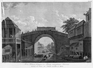
Background imageMaps Collection: View of the Canal, Leading to Gonamu Opposite Canton, 1813.. Creator: Ivan Vasil'evich Chesky

View of the Canal, Leading to Gonamu Opposite Canton, 1813.. Creator: Ivan Vasil'evich Chesky
View of the Canal, Leading to Gonamu Opposite Canton, 1813. In 1803-06, Captain I. F. Kruzenshtern became the first Russian to circumnavigate the globe

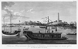
Background imageMaps Collection: Goppo, or the Custom Office Director in Canton, Sailing on His Vessel, 1813

Goppo, or the Custom Office Director in Canton, Sailing on His Vessel, 1813. Creator: Ivan Vasil'evich Chesky
Goppo, or the Custom Office Director in Canton, Sailing on His Vessel, 1813. In 1803-06, Captain I. F. Kruzenshtern became the first Russian to circumnavigate the globe

Background imageMaps Collection: Map of the Far East of the USSR, Northern China (Manchuria) and Mongolia, 1930. Creator: Unknown

Map of the Far East of the USSR, Northern China (Manchuria) and Mongolia, 1930. Creator: Unknown
Map of the Far East of the USSR, Northern China (Manchuria) and Mongolia, 1930. This Soviet-era map is intended to serve a propaganda purpose

Background imageMaps Collection: Old Map of China 1852 by Henry George Collins

Old Map of China 1852 by Henry George Collins
This is a finely detailed map of China remastered from a rare Atlas of the World published in 1852 by Henry George Collins

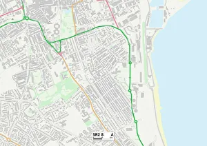
Background imageMaps Collection: Sunderland SR2 8 Map

Sunderland SR2 8 Map
Postcode Sector Map of Sunderland SR2 8

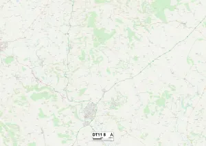
Background imageMaps Collection: North Dorset DT11 8 Map

North Dorset DT11 8 Map
Postcode Sector Map of North Dorset DT11 8

Background imageMaps Collection: Darlington DL1 2 Map

Darlington DL1 2 Map
Postcode Sector Map of Darlington DL1 2

Background imageMaps Collection: Kunyu Wanguo Quantu (Map of the Myriad Countries of the World), 1602. Creator: Ricci

Kunyu Wanguo Quantu (Map of the Myriad Countries of the World), 1602. Creator: Ricci
Kunyu Wanguo Quantu (Map of the Myriad Countries of the World), 1602. Found in the Collection of Nanjing Museum

Background imageMaps Collection: Map of China and Japan 1889

Map of China and Japan 1889
Comprehensive Geography by James Monteith - American Book Company 1882, 1889

Background imageMaps Collection: Map of China and Japan 1900

Map of China and Japan 1900
Meyers hand-Atlas Leipzig und Wien Verlag des Bibliographischen Instituts 1900

Background imageMaps Collection: Map of the Indian Ocean

Map of the Indian Ocean. Map showing the Indian subcontinent, East Africa, the Arabian peninsula, Indo-China and Western Australia. Plate 54 from The Times Atlas

Background imageMaps Collection: Political map of China

Political map of China. Map showing China, Mongolia, East Turkestan, Tibet and the Korean peninsula. Plate 62 from The Times Atlas

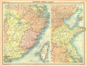
Background imageMaps Collection: Political map of Eastern China

Political map of Eastern China, showing Taiwan, Tianjin and the Bohai Sea. Plate 64 from The Times Atlas

Background imageMaps Collection: Map of Macau, 19th Century

Map of Macau, 19th Century
Vintage engraving of a Map of Macau, 19th Century

Background imageMaps Collection: The New Imperialism. American cartoon, 1951, by D. R. Fitzpatrick on the growing empire of Joseph

The New Imperialism. American cartoon, 1951, by D. R. Fitzpatrick on the growing empire of Joseph Stalins Soviet Union
RUSSIA: IMPERIALISM, 1951. The New Imperialism. American cartoon, 1951, by D.R. Fitzpatrick on the growing empire of Joseph Stalins Soviet Union

Background imageMaps Collection: Chinese Empire with the islands of Japan, engraving by G. Zuliani taken from Tome IV of

Chinese Empire with the islands of Japan, engraving by G. Zuliani taken from Tome IV of the "Newest Atlas" published in Venice in 1784 by Antonio Zatta

Background imageMaps Collection: Beijing

Beijing
StudioSix

Background imageMaps Collection: Hong Kong

Hong Kong
StudioSix

Background imageMaps Collection: Shanghai

Shanghai
StudioSix

Background imageMaps Collection: SHANGHAI

SHANGHAI
StudioSix

Background imageMaps Collection: HONG KONG

HONG KONG
StudioSix

Background imageMaps Collection: China

China

Background imageMaps Collection: 13849201

13849201

Background imageMaps Collection: 13825172

13825172

Background imageMaps Collection: 13825076

13825076

Background imageMaps Collection: Big Game hunting Antquie map of Asia, showing locations of animals, Victorian 1860s, 19th Century

Big Game hunting Antquie map of Asia, showing locations of animals, Victorian 1860s, 19th Century
Vintage illustration of Big Game hunting Antquie map of Asia, showing locations of animals, Victorian 1860s, 19th Century

Background imageMaps Collection: Map of China 1883

Map of China 1883

Background imageMaps Collection: Old Antique map of China, detail of Pekin and Nanjing, Shanghai, 1890s

Old Antique map of China, detail of Pekin and Nanjing, Shanghai, 1890s, Victorian 19th Century history, 1890s

Background imageMaps Collection: Old chromolithograph map of China and Japan Islands

Old chromolithograph map of China and Japan Islands
Copyright has expired on this artwork. From my own archives, digitally restored

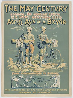
Background imageMaps Collection: The May Century: Across Asia on a Bicycle, 1894 (lithograph)

The May Century: Across Asia on a Bicycle, 1894 (lithograph)
7317735 The May Century: Across Asia on a Bicycle, 1894 (lithograph) by Lincoln, A.W.B. (active 1890s); 45.6 -- 33 cm; (add.info.: From Constantinople to Peking)

Background imageMaps Collection: Antique map of Central Asia, Afghanistan, Kashmir, Persia, Turkestan, 19th Century, 1890s

Antique map of Central Asia, Afghanistan, Kashmir, Persia, Turkestan, 19th Century, 1890s
Vintage illustration, Antique map of Central Asia, Afghanistan, Kashmir, Persia, Turkestan, 19th Century, 1890s

Background imageMaps Collection: Antique map of Asia, with cross section of terrain, Mountains, 19th Century

Antique map of Asia, with cross section of terrain, Mountains, 19th Century
Vintage illustration, Antique map of Asia, with cross section of terrain, Mountains, 19th Century

Background imageMaps Collection: Old Antique map of Chinese Empire, China, Hong Kong, Canton, 1890s, Victorian 19th Century history

Old Antique map of Chinese Empire, China, Hong Kong, Canton, 1890s, Victorian 19th Century history
Antique map of Chinese Empire, China, Hong Kong, Canton, 1890s, Victorian 19th Century history

Background imageMaps Collection: Map of the compasssole from a 16th century atlas, based on the original preserved in the library

Map of the compasssole from a 16th century atlas, based on the original preserved in the library of the Museo Civico in
LSE4102206 Map of the compasssole from a 16th century atlas, based on the original preserved in the library of the Museo Civico in Venice by Italian School

Background imageMaps Collection: Old engraved map of Beijing city, worlds most populous national capital city, China

Old engraved map of Beijing city, worlds most populous national capital city, China
Copyright has expired on this artwork. From my own archives, digitally restored

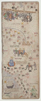
Background imageMaps Collection: Catalan Atlas, Sheet 10, 1375 (pen with coloured inks on parchment)

Catalan Atlas, Sheet 10, 1375 (pen with coloured inks on parchment)
5054670 Catalan Atlas, Sheet 10, 1375 (pen with coloured inks on parchment) by Cresques, Abraham (1325-87); Bibliotheque Nationale, Paris, France; (add.info.: World map made in Majorca)

Background imageMaps Collection: Map of China, Chinese Empire just before the start of the Boxer Rebellion, 1898

Map of China, Chinese Empire just before the start of the Boxer Rebellion, 1898
Vintage illustration, Map of China, Chinese Empire just before the start of the Boxer Rebellion, 1898

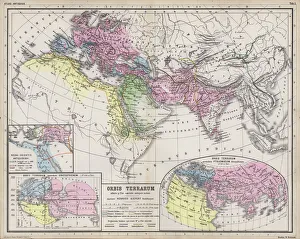
Background imageMaps Collection: Maps showing the extent of realms of the known World in ancient times (coloured engraving)

Maps showing the extent of realms of the known World in ancient times (coloured engraving)
7148245 Maps showing the extent of realms of the known World in ancient times (coloured engraving) by Kiepert, Heinrich (1818-99); Private Collection; (add.info)

Background imageMaps Collection: L Assiette au Beurre, number 183, Satirical in Colors, 1904_10_8

L Assiette au Beurre, number 183, Satirical in Colors, 1904_10_8
ICA4892969 L Assiette au Beurre, number 183, Satirical in Colors, 1904_10_8 by Camara, Leal de (1877-1948); (add.info.: Europe, China, Geographic Maps)

Background imageMaps Collection: Map of China (Cathay), with descriptions of small scenes, delimitation of the kingdoms with its

Map of China (Cathay), with descriptions of small scenes, delimitation of the kingdoms with its sovereign represented
AIS5350367 Map of China (Cathay), with descriptions of small scenes, delimitation of the kingdoms with its sovereign represented each time, 1375 (manuscript) by Cresques

Background imageMaps Collection: Awkward Ada (colour litho)

Awkward Ada (colour litho)
7157023 Awkward Ada (colour litho) by Hassall, John (1868-1948) (after); Private Collection; (add.info.: Awkward Ada. Illustration from Six and Twenty Boys and Girls (Blackie & Son Limited, London)

Background imageMaps Collection: Map of China with inset portraits of Matteo Ricci and two Chinese costumed figures, c

Map of China with inset portraits of Matteo Ricci and two Chinese costumed figures, c. 1625-26 (coloured engraving)
BON111186 Map of China with inset portraits of Matteo Ricci and two Chinese costumed figures, c.1625-26 (coloured engraving) by Purchas

Background imageMaps Collection: View of China (Cambaluc, now Beijing) Detail of the world map (mappamundi) of brother Maurus (Mauro)

View of China (Cambaluc, now Beijing) Detail of the world map (mappamundi) of brother Maurus (Mauro)
LRI4648478 View of China (Cambaluc, now Beijing) Detail of the world map (mappamundi) of brother Maurus (Mauro) Camaldolese 1459 (map) by Fra Mauro (1385-1460); Biblioteca Nazionale Marciana, Venice

Background imageMaps Collection: Plan of the city of Beijing, China (coloured engraving)

Plan of the city of Beijing, China (coloured engraving)
7148372 Plan of the city of Beijing, China (coloured engraving) by European School, (19th century); Private Collection; (add.info.: Plan of the city of Beijing, China)

Background imageMaps Collection: Germany and China (engraving)

Germany and China (engraving)
7157242 Germany and China (engraving) by Radiguet, Maurice (1866-1941); Private Collection; (add.info.: Germany and China. French cartoon from Le Rire, 1900)

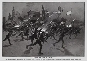
Background imageMaps Collection: Re-enactment of the Boxer Rebellion, Earls Court, London (litho)

Re-enactment of the Boxer Rebellion, Earls Court, London (litho)
7201860 Re-enactment of the Boxer Rebellion, Earls Court, London (litho) by Goble, Warwick (1862-1943) (after); Private Collection; (add.info)


All Professionally Made to Order for Quick Shipping


-

Maps Collection

Maps of Cyprus Asia are a collection that show the geography and political boundaries of the island nation. The maps include physical features such as mountains, rivers, lakes, and coastlines. They also show major cities and towns, roads, airports, ports, archaeological sites and other points of interest. They are be used for planning trips or just to get an overview of the country's geography, and are available in both digital and paper formats for easy access. Maps of Cyprus Asia provide an invaluable resource for anyone interested in learning more about this beautiful Mediterranean island nation.
+

Our beautiful Wall Art and Photo Gifts include Framed Prints, Photo Prints, Poster Prints, Canvas Prints, Jigsaw Puzzles, Metal Prints and so much more

The Maps of Cyprus Asia collection offered by Media Storehouse is a unique and fascinating assortment of vintage maps that showcase the historical significance of the island nation. Our collection features an array of beautifully crafted maps dating back to the 16th century, highlighting various aspects such as topography, political boundaries, and cultural landmarks. These maps provide insight into how Cyprus has evolved over time and offer a glimpse into its rich history. They also serve as decorative pieces for those interested in adding some character to their living spaces or offices. The Maps of Cyprus Asia collection includes prints from renowned cartographers such as Abraham Ortelius, Gerard Mercator, and Jodocus Hondius. These high-quality reproductions are available in different sizes and formats including framed prints and canvas art. Our collection is perfect for anyone who appreciates history or wants to add a touch of elegance to their home or office decor.
+

What are Maps of Cyprus Asia art prints?

Maps of Cyprus Asia art prints are high-quality reproductions of vintage maps that depict the island nation of Cyprus and its surrounding regions in Asia. These prints showcase intricate details such as topography, landmarks, and borders, providing a unique glimpse into the historical geography of this area. These art prints are perfect for those who appreciate history or have an interest in cartography. They can be used to decorate homes, offices, or classrooms and make great gifts for anyone with a passion for travel or culture. We offer a wide selection of Maps of Cyprus Asia art prints to choose from. Each print is carefully crafted using state-of-the-art printing technology to ensure vibrant colors and sharp detail. The prints come in various sizes and can be framed to match any decor style. Maps of Cyprus Asia art prints offer a beautiful way to explore the rich history and geography of this fascinating region.
+

What Maps of Cyprus Asia art prints can I buy from Media Storehouse?

We offer a wide range of Maps of Cyprus Asia art prints that are perfect for those who love to explore the world through art. These maps showcase the beautiful island nation of Cyprus, located in the eastern Mediterranean Sea and its surrounding regions in Asia. You can choose from vintage or modern style maps, each with their own unique features and designs. Some maps may include detailed topography, landmarks, cities and towns while others may focus on political boundaries or historical events. Our collection also includes different sizes and formats such as canvas prints, framed prints or posters so you can find the perfect piece to suit your home decor needs. Whether you're looking for a stunning addition to your living room wall or an educational tool for your classroom, we have got you covered with their diverse selection of Maps of Cyprus Asia art prints.
+

How do I buy Maps of Cyprus Asia art prints?

To purchase Maps of Cyprus Asia art prints from Media Storehouse, you can browse our extensive collection online. Simply search for "Maps of Cyprus Asia" in the search bar on our website and select the print that catches your eye. Once you have found a print you like, click on it to view more details about the artwork. From there, add the print to your cart and proceed to checkout. You will be prompted to enter your shipping information and payment details. We accept various forms of payment including credit cards and PayPal. Once your order is processed, Media Storehouse will begin preparing your Maps of Cyprus Asia art print for shipment. Your order will then be shipped directly to you without any hassle or fuss. Buying Maps of Cyprus Asia art prints from Media Storehouse is an easy process that allows you to enjoy beautiful artwork in no time.
+

How much do Maps of Cyprus Asia art prints cost?

We offer a wide range of Maps of Cyprus Asia art prints for purchase. The cost of these prints varies depending on the size and type of print that you choose. We have options ranging from small to large sizes, as well as different finishes such as canvas or framed prints. Our prices are competitive and affordable, ensuring that you can find the perfect piece to fit your budget. Our Maps of Cyprus Asia art prints are high-quality reproductions that capture every detail and nuance of the original artwork. They make excellent additions to any home or office decor, adding a touch of sophistication and elegance to any space. Whether you're looking for a unique gift for someone special or simply want to treat yourself to some beautiful artwork, our selection of Maps of Cyprus Asia art prints is sure to impress. Browse our collection today and discover the perfect piece for your needs.
+

How will my Maps of Cyprus Asia art prints be delivered to me?

We take great care in ensuring that your Maps of Cyprus Asia art prints are delivered to you safely and securely. We use high-quality packaging materials to protect your artwork during transit and ensure that it arrives at your doorstep in pristine condition. Your art print will be carefully rolled and placed inside a sturdy cardboard tube for shipping. The tube is then sealed with tape to prevent any damage or moisture from entering the package. We work with trusted courier services who offer reliable delivery options worldwide. Once your order has been dispatched, you will receive an email confirmation containing tracking information so that you can keep track of its progress. We understand the importance of delivering your artwork promptly and efficiently. That's why we strive to provide fast and reliable delivery services without compromising on quality or safety.