Fraud Blocker Skip to main content

Home > Arts > Artists > B > Willem Blaeu

Willem Blaeu Collection (page 3)

Willem Blaeu (1571-1638) was a Dutch cartographer, publisher, and globe maker

206 items

Background imageWillem Blaeu Collection: The silver mines of Potosi (Bolivia) after William Blaeus 'Atlas', 1630

The silver mines of Potosi (Bolivia) after William Blaeus "Atlas", 1630
GIA4729960 The silver mines of PotosAi (Bolivia) after William Blaeus " Atlas", 1630. by Blaeu, Willem (1571-1638); Private Collection; (add.info)

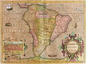
Background imageWillem Blaeu Collection: Map of South America (engraving, 1635)

Map of South America (engraving, 1635)
LRI4706249 Map of South America (engraving, 1635) by Blaeu, Willem (1571-1638); Museo Navale di Pegli, Genoa, Italy; (add.info.: Map of South America - Plate from " Theatrum orbis Terrarum)

Background imageWillem Blaeu Collection: The Earth, one of the four elements represented in the Atlas of W

The Earth, one of the four elements represented in the Atlas of W
GIA4762998 The Earth, one of the four elements represented in the Atlas of W. Blaeu printed in Amsterdam in 1655. by Blaeu, Willem (1571-1638); Private Collection; (add.info.: The Earth)

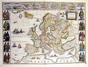
Background imageWillem Blaeu Collection: Map of Europe. Atlas by William Blaeu (1571 - 1638). Amsterdam 1635

Map of Europe. Atlas by William Blaeu (1571 - 1638). Amsterdam 1635
GIA4751129 Map of Europe. Atlas by William Blaeu (1571 - 1638). Amsterdam 1635. by Blaeu, Willem (1571-1638); Private Collection; (add.info.: Map of Europe. Atlas by William Blaeu (1571 - 1638)

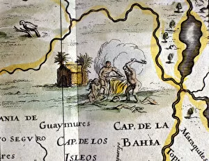
Background imageWillem Blaeu Collection: Brazil. Cannibals representing a man with an axe. Detail of a map of the Atlas of W

Brazil. Cannibals representing a man with an axe. Detail of a map of the Atlas of W
GIA4775566 Brazil. Cannibals representing a man with an axe. Detail of a map of the Atlas of W. Blaeu, 1650 - 1655. by Blaeu, Willem (1571-1638); Private Collection; (add.info.: Brazil)

Background imageWillem Blaeu Collection: Brazil, view of Pernambuc (Recife), Atlas by W. G. Blaeu, Amsterdam 1600

Brazil, view of Pernambuc (Recife), Atlas by W. G. Blaeu, Amsterdam 1600
GIA4775705 Brazil, view of Pernambuc (Recife), Atlas by W. G. Blaeu, Amsterdam 1600. by Blaeu, Willem (1571-1638); Private Collection; (add.info.: Brazil, view of Pernambuc (Recife), Atlas by W. G

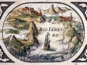
Background imageWillem Blaeu Collection: View of Rio de Janeiro, Brazil, 1600 (coloured engraving)

View of Rio de Janeiro, Brazil, 1600 (coloured engraving)
GIA3051063 View of Rio de Janeiro, Brazil, 1600 (coloured engraving) by Blaeu, Willem (1571-1638); Biblioteca Angelica, Rome, Italy; eGiancarlo Costa; Dutch, out of copyright

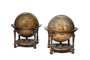
Background imageWillem Blaeu Collection: Large pair of library globes, the terrestrial 1645 / 48, the celestial after c

Large pair of library globes, the terrestrial 1645 / 48, the celestial after c
3482878 Large pair of library globes, the terrestrial 1645/48, the celestial after c.1630 (plaster, wood & engraved paper) by Blaeu

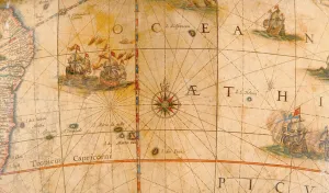
Background imageWillem Blaeu Collection: Detail of fighting ships in the Atlantic Ocean from a terrestrial globe 1645 / 48 (plaster

Detail of fighting ships in the Atlantic Ocean from a terrestrial globe 1645 / 48 (plaster
3482881 Detail of fighting ships in the Atlantic Ocean from a terrestrial globe 1645/48 (plaster, wood & engraved paper) by Blaeu

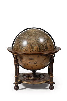
Background imageWillem Blaeu Collection: Terrestrial globe, 1645-48 (wood, paper, gypsum and copper)

Terrestrial globe, 1645-48 (wood, paper, gypsum and copper)
4071431 Terrestrial globe, 1645-48 (wood, paper, gypsum and copper) by Blaeu, Willem (1571-1638) and Joan (1596-1673); Rijksmuseum, Amsterdam

Background imageWillem Blaeu Collection: Title Page for The Light of Navigation by William Iohnson

Title Page for The Light of Navigation by William Iohnson
498325 Title Page for The Light of Navigation by William Iohnson, published 1612 (letterpress and engraving) by English School

Background imageWillem Blaeu Collection: Map of Cambridgeshire, published Amsterdam c. 1647-48 (hand-coloured engraving)

Map of Cambridgeshire, published Amsterdam c. 1647-48 (hand-coloured engraving)
STC222030 Map of Cambridgeshire, published Amsterdam c.1647-48 (hand-coloured engraving) by Blaeu, Willem (1571-1638) and Joan (1596-1673); Private Collection; (add.info)

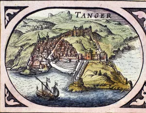
Background imageWillem Blaeu Collection: View of the fortified city of Tangier and the coast, Morocco

View of the fortified city of Tangier and the coast, Morocco
GIA4801766 View of the fortified city of Tangier and the coast, Morocco. Map from the Dutch Atlas by W. G. Blaeu, Amsterdam, 1600

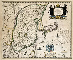
Background imageWillem Blaeu Collection: Map of China, Japan and Korea. (engraving, 1638)

Map of China, Japan and Korea. (engraving, 1638)
LRI4678176 Map of China, Japan and Korea. (engraving, 1638) by Blaeu, Willem (1571-1638); Private Collection; (add.info.: Map of China, Japan and Korea)

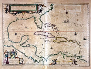
Background imageWillem Blaeu Collection: The Caribbean Sea: Gulf of Mexico and Caribbean Sea from the Atlas of Wilhelm Blaeu, 1650

The Caribbean Sea: Gulf of Mexico and Caribbean Sea from the Atlas of Wilhelm Blaeu, 1650
GIA4730820 The Caribbean Sea: Gulf of Mexico and Caribbean Sea from the Atlas of Wilhelm Blaeu, 1650. by Blaeu, Willem (1571-1638); Private Collection; (add.info.: The Caribbean Sea)

Background imageWillem Blaeu Collection: Atlas Willem Janszoon Blaeu (1571 - 1638), 1617

Atlas Willem Janszoon Blaeu (1571 - 1638), 1617
GIA4699171 Atlas Willem Janszoon Blaeu (1571 - 1638), 1617. by Blaeu, Willem (1571-1638); Private Collection; (add.info.: Atlas Willem Janszoon Blaeu (1571 - 1638), 1617.); eGiancarlo Costa; Dutch

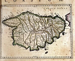
Background imageWillem Blaeu Collection: Corsica from the Atlas of Wilhelm Blaeu. Amsterdam 17th century

Corsica from the Atlas of Wilhelm Blaeu. Amsterdam 17th century
GIA4741621 Corsica from the Atlas of Wilhelm Blaeu. Amsterdam 17th century. by Blaeu, Willem (1571-1638); Private Collection; (add.info.: Corsica from the Atlas of Wilhelm Blaeu)

Background imageWillem Blaeu Collection: Rose des vents (detail of 10831), 'Le theatre du monde ou Nouvel atlas'

Rose des vents (detail of 10831), "Le theatre du monde ou Nouvel atlas"
LSE4090486 Rose des vents (detail of 10831), " Le theatre du monde ou Nouvel atlas" by Guillaume et Jean Blaeu, 1645 by Blaeu

Background imageWillem Blaeu Collection: Detail of Africa from a terrestrial globe 1645 / 48 (plaster, wood & engraved paper)

Detail of Africa from a terrestrial globe 1645 / 48 (plaster, wood & engraved paper)
3482883 Detail of Africa from a terrestrial globe 1645/48 (plaster, wood & engraved paper) by Blaeu, Willem (1571-1638); height: 99 cm; Private Collection; (add.info)

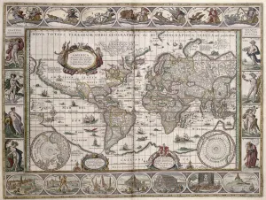
Background imageWillem Blaeu Collection: World Map, from Le Theatre du Monde or Nouvel Atlas

World Map, from Le Theatre du Monde or Nouvel Atlas
CHT172438 World Map, from Le Theatre du Monde or Nouvel Atlas, 1645 (coloured engraving) by Blaeu, Willem (1571-1638); Bibliotheque des Arts Decoratifs, Paris

Background imageWillem Blaeu Collection: Pair of 12-inch celestial and territorial globes (mixed media)

Pair of 12-inch celestial and territorial globes (mixed media)
MFR348320 Pair of 12-inch celestial and territorial globes (mixed media) by Blaeu, Willem (1571-1638); 30.48 cm; Private Collection; Dutch, out of copyright

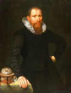
Background imageWillem Blaeu Collection: Portrait of a Gentleman, early 17th century (oil on panel)

Portrait of a Gentleman, early 17th century (oil on panel)
MFR313904 Portrait of a Gentleman, early 17th century (oil on panel) by Dutch School, (17th century); 99x75 cm; Private Collection; (add.info.: A lightly drawn inscription reads Aetatis 38 (aged 38)

Background imageWillem Blaeu Collection: The Light of Navigation, 1608 (engraving)

The Light of Navigation, 1608 (engraving)
498324 The Light of Navigation, 1608 (engraving) by Dutch School, (17th century); Private Collection; (add.info.: The Light of Navigation by Willem Janszoon Blaeu (1571-1638)

Background imageWillem Blaeu Collection: Representation de Macao, detail in Le Theatre du monde, 1645

Representation de Macao, detail in Le Theatre du monde, 1645
AIS5386901 Representation de Macao, detail in Le Theatre du monde, 1645, de Willem Janszoon Blaeu (1571-1638) et Jan Blaeu (1596-1673). Eau forte en couleurs

Background imageWillem Blaeu Collection: 'Representation of the City of London '

"Representation of the City of London "
AIS5357390 " Representation of the City of London " Detail of a world map in " The Theatre of the World " by Willem Janszoon Blaeu (1571-1638), 1645

Background imageWillem Blaeu Collection: Map of Europe. (engraving, 1638)

Map of Europe. (engraving, 1638)
LRI4678144 Map of Europe. (engraving, 1638) by Blaeu, Willem (1571-1638); Private Collection; (add.info.: Map of Europe. Plate from an Atlas by Willem Janszoon Blaeu (Guilielmus Jansonius Blavius)

Background imageWillem Blaeu Collection: Tycho Brahes system - in 'Le theatre du monde ou Nouvel atlas'

Tycho Brahes system - in "Le theatre du monde ou Nouvel atlas"
GIA4816940 Tycho BrahA©s system - in " Le theatre du monde ou Nouvel atlas" by Guillaume et Jean Blaeu, 1645. Arts Deco, Paris

Background imageWillem Blaeu Collection: Air, one of the four elements represented in W. Blaeu

Air, one of the four elements represented in W. Blaeu
GIA4762987 Air, one of the four elements represented in W. Blaeus Atlas printed in Amsterdam in 1655. by Blaeu, Willem (1571-1638); Private Collection; (add.info.: Air)

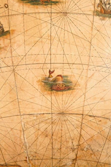
Background imageWillem Blaeu Collection: Detail of a sea monster from a terrestrial globe, 1645 / 48 (plaster

Detail of a sea monster from a terrestrial globe, 1645 / 48 (plaster
3482879 Detail of a sea monster from a terrestrial globe, 1645/48 (plaster, wood & engraved paper) by Blaeu, Willem (1571-1638); height: 99 cm; Private Collection; (add.info)

Background imageWillem Blaeu Collection: Map of Normandy after an illustration from Theatrum Orbis Terrarum sive Atlas Novus by

Map of Normandy after an illustration from Theatrum Orbis Terrarum sive Atlas Novus by
3518953 Map of Normandy after an illustration from Theatrum Orbis Terrarum sive Atlas Novus by Willem and Joan Blaeu, plate representing Normandia Ducatus (Normandy: Calvados, Manche, Orne, Eure)

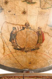
Background imageWillem Blaeu Collection: Large pair of library globes, the terrestrial 1645 / 48, the celestial after c

Large pair of library globes, the terrestrial 1645 / 48, the celestial after c
3482890 Large pair of library globes, the terrestrial 1645/48, the celestial after c.1630 (plaster, wood & engraved paper) by Blaeu

Background imageWillem Blaeu Collection: Large pair of library globes, the terrestrial 1645 / 48, the celestial after c

Large pair of library globes, the terrestrial 1645 / 48, the celestial after c
3482884 Large pair of library globes, the terrestrial 1645/48, the celestial after c.1630 (plaster, wood & engraved paper) by Blaeu

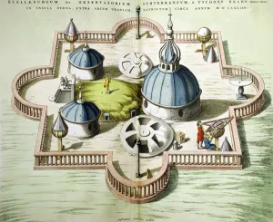
Background imageWillem Blaeu Collection: General View of the Observatory of Uraniborg, constructed c

General View of the Observatory of Uraniborg, constructed c
XCF221637 General View of the Observatory of Uraniborg, constructed c.1584 by Tycho Brahe (1546-1601) on the island of Hven, Denmark from Le Theatre du Monde or Nouvel Atlas, published in Amsterdam

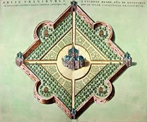
Background imageWillem Blaeu Collection: Plan of the Castle and Observatory of Uraniborg, constructed c

Plan of the Castle and Observatory of Uraniborg, constructed c
XCF221636 Plan of the Castle and Observatory of Uraniborg, constructed c.1584 by Tycho Brahe (1546-1601) on the island of Hven, Denmark from Le Theatre du Monde or Nouvel Atlas

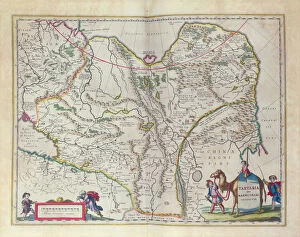
Background imageWillem Blaeu Collection: Map of Siberia and China from Le Theatre du Monde or Nouvel Atlas

Map of Siberia and China from Le Theatre du Monde or Nouvel Atlas
CHT290033 Map of Siberia and China from Le Theatre du Monde or Nouvel Atlas, 1645 (coloured engraving) by Blaeu, Willem (1571-1638) and Joan (1596-1673); Bibliotheque des Arts Decoratifs, Paris

Background imageWillem Blaeu Collection: Map of Germany, c. 1644-1645 (hand-coloured engraving)

Map of Germany, c. 1644-1645 (hand-coloured engraving)
985772 Map of Germany, c.1644-1645 (hand-coloured engraving) by Blaeu, Willem (1571-1638) and Joan (1596-1673) (after); 50.6x33.4 (folio size) cm; Private Collection; (add.info.: Map of Germany)

Background imageWillem Blaeu Collection: Ischia, 1642 (coloured engraving)

Ischia, 1642 (coloured engraving)
985753 Ischia, 1642 (coloured engraving) by Blaeu, Willem (1571-1638) and Joan (1596-1673); 49.2x65.4 cm; Private Collection; (add.info.: Ischia. From Theatrum orbis terrarum)

Background imageWillem Blaeu Collection: The Chief of the Powhattan Tribe, detail from the Nova Virginiae Tabula

The Chief of the Powhattan Tribe, detail from the Nova Virginiae Tabula
CHT170174 The Chief of the Powhattan Tribe, detail from the Nova Virginiae Tabula, engraved by Jodocus Hondius (1563-1612) and Dirck Gryp, 1647 (coloured engraving) by Blaeu

Background imageWillem Blaeu Collection: Representation of the God Jupiter fighting black eagles in his chariot (engraving

Representation of the God Jupiter fighting black eagles in his chariot (engraving
AIS5356076 Representation of the God Jupiter fighting black eagles in his chariot (engraving) in " Le Theatre du Monde", 1645 (engraving) by Blaeu

Background imageWillem Blaeu Collection: Carte de la region de la Venetie, Italie. Atlas de William Blaeu (1571 - 1638), 1670

Carte de la region de la Venetie, Italie. Atlas de William Blaeu (1571 - 1638), 1670
AGF5502048 Carte de la region de la Venetie, Italie. Atlas de William Blaeu (1571 - 1638), 1670. by Blaeu, Willem (1571-1638); Private Collection; eGiancarlo Costa; Dutch, out of copyright

Background imageWillem Blaeu Collection: Cartagena in Colombia from the Atlas of W. Blaeu, 17th century

Cartagena in Colombia from the Atlas of W. Blaeu, 17th century
GIA4730348 Cartagena in Colombia from the Atlas of W. Blaeu, 17th century. by Blaeu, Willem (1571-1638); Private Collection; (add.info.: Cartagena in Colombia from the Atlas of W)

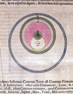
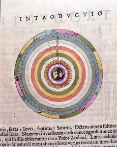
Background imageWillem Blaeu Collection: The Ptolemaic System - The Theatre of the World or New Atlas by Guillaume and Jean Blaeu

The Ptolemaic System - The Theatre of the World or New Atlas by Guillaume and Jean Blaeu
GIA4816975 The Ptolemaic System - The Theatre of the World or New Atlas by Guillaume and Jean Blaeu, 1645. by Blaeu, Willem (1571-1638) and Joan (1596-1673); Private Collection; (add.info)

Background imageWillem Blaeu Collection: Water, one of the four elements, represented in the Atlas of W

Water, one of the four elements, represented in the Atlas of W
GIA4762986 Water, one of the four elements, represented in the Atlas of W. Blaeu printed in Amsterdam in 1655. by Blaeu, Willem (1571-1638); Private Collection; (add.info.: Water)

Background imageWillem Blaeu Collection: The Caribbean Sea: you can see the Bermuda triangle between the Bermuda Archipelago

The Caribbean Sea: you can see the Bermuda triangle between the Bermuda Archipelago
GIA4764548 The Caribbean Sea: you can see the Bermuda triangle between the Bermuda Archipelago, Miami and Puerto Rico. According to Wilhelm Blaeus Atlas, 1650

Background imageWillem Blaeu Collection: Dolphins, Roquaille-style frontispiece. Detail of Atlas di W. Blaeu, Amsterdam 1650

Dolphins, Roquaille-style frontispiece. Detail of Atlas di W. Blaeu, Amsterdam 1650
GIA4734401 Dolphins, Roquaille-style frontispiece. Detail of Atlas di W. Blaeu, Amsterdam 1650. by Blaeu, Willem (1571-1638); Private Collection; (add.info.: Dolphins, Roquaille-style frontispiece)

Background imageWillem Blaeu Collection: View of Cartagena in Colombia (South America). Detail of a map of the Atlas '

View of Cartagena in Colombia (South America). Detail of a map of the Atlas "
GIA4805226 View of Cartagena in Colombia (South America). Detail of a map of the Atlas " Le Theatre du Monde" by Willem Janszoon Blaeu (1571-1638), 1645

Background imageWillem Blaeu Collection: Breton fishermen hunt the whale with the hand harpoon. Detail from William Blaeu

Breton fishermen hunt the whale with the hand harpoon. Detail from William Blaeu
GIA4754403 Breton fishermen hunt the whale with the hand harpoon. Detail from William Blaeus Atlas, printed in Amsterdam in 1665 by Blaeu

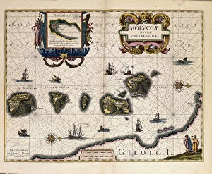
Background imageWillem Blaeu Collection: Map of the Molucca Islands east of Indonesia. (engraving, 1638)

Map of the Molucca Islands east of Indonesia. (engraving, 1638)
LRI4678184 Map of the Molucca Islands east of Indonesia. (engraving, 1638) by Blaeu, Willem (1571-1638); Private Collection; (add.info.: Map of the Molucca Islands east of Indonesia)


All Professionally Made to Order for Quick Shipping


-

Willem Blaeu Collection

Willem Blaeu (1571-1638) was a Dutch cartographer, publisher, and globe maker. He was born in Alkmaar and studied law at the University of Franeker. In 1594 he moved to Amsterdam where he established a printing press and began producing maps. His work was highly sought after due to its accuracy and beauty; his maps were known for their vibrant colors, intricate details, and ornate borders. Blaeu's most famous works include the Atlas Maior (the largest atlas ever published), the Novus Atlas (a collection of world maps), and his globes which were considered some of the finest ever made. He also wrote several books on astronomy, navigation, geography, history, philosophy, mathematics and botany. Willem Blaeu is remembered as one of the greatest cartographers in history whose work has had an enduring influence on modern mapmaking.
+

Our beautiful Wall Art and Photo Gifts include Framed Prints, Photo Prints, Poster Prints, Canvas Prints, Jigsaw Puzzles, Metal Prints and so much more

The Willem Blaeu collection at Media Storehouse is a stunning array of wall art, framed prints, photo prints, canvas prints, jigsaw puzzles and greeting cards featuring the works of the famous Dutch cartographer and artist. Our collection showcases some of Blaeu's most iconic maps and illustrations from his 17th century atlas "Atlas Maior", which was considered one of the greatest achievements in cartography during that time. The pieces are meticulously reproduced with high-quality printing techniques to ensure that each detail is captured perfectly. From intricate depictions of celestial bodies to beautifully rendered landscapes and seascapes, our collection offers something for everyone who appreciates fine art or has an interest in history or geography. Whether you're looking for a unique gift or want to add some sophistication to your home decor, the Willem Blaeu collection is sure to impress with its timeless beauty and historical significance.
+

What are Willem Blaeu (Artists Arts) art prints?

Willem Blaeu was a Dutch cartographer, astronomer and publisher who lived in the 16th century. He is known for his stunning maps of the world, which were highly accurate and beautifully designed. His work has been reproduced as art prints by Artists Arts and are available on Media Storehouse. These art prints showcase Blaeu's intricate designs, featuring detailed depictions of continents, oceans and countries. The colors used in these prints are vibrant and eye-catching, making them perfect for adding a touch of elegance to any room. Whether you're a history buff or simply appreciate beautiful artwork, Willem Blaeu's map prints are sure to impress. They make great gifts for anyone who loves geography or wants to add some unique decor to their home or office space. Willem Blaeu's art prints offer a fascinating glimpse into the past while also providing stunning visuals that will enhance any interior design scheme.
+

What Willem Blaeu (Artists Arts) art prints can I buy from Media Storehouse?

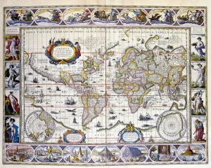
We offer a wide range of Willem Blaeu art prints for purchase. Blaeu was a Dutch cartographer and publisher who produced some of the most beautiful maps and atlases in history during the 17th century. His works are highly sought after by collectors, historians, and enthusiasts alike. Some of the Willem Blaeu art prints available from Media Storehouse include his famous world map, Nova et Accurata Totius Terrarum Orbis Tabula, as well as various regional maps such as those depicting Europe or Asia. Additionally, there are also reproductions of his celestial charts which were used to navigate the stars. These high-quality art prints are perfect for anyone looking to add a touch of historical elegance to their home or office decor. Whether you're interested in geography or astronomy, there is sure to be a Willem Blaeu print that will catch your eye at Media Storehouse.
+

How do I buy Willem Blaeu (Artists Arts) art prints?

To purchase Willem Blaeu art prints from Media Storehouse, you can browse our extensive collection of artwork online. Once you have found the piece that you would like to purchase, simply add it to your cart and proceed to checkout. During the checkout process, you will be prompted to enter your payment and shipping information. We offer a variety of sizes for their art prints, so be sure to select the size that best fits your needs. We also offer framing options for an additional fee if desired. When purchasing Willem Blaeu art prints from Media Storehouse, rest assured that you are receiving high-quality reproductions of his original works. These prints make great additions to any home or office decor and are perfect for art enthusiasts looking for beautiful pieces at an affordable price point.
+

How much do Willem Blaeu (Artists Arts) art prints cost?

We offer a wide range of Willem Blaeu art prints for sale. The cost of these prints varies depending on the size and type of print you choose. We have a selection of high-quality paper prints that are affordable for those on a budget, as well as more expensive canvas and framed options for those looking to make a statement with their artwork. Our Willem Blaeu art prints are available in various sizes, from small 8x10 inch prints to large 24x36 inch pieces. Each print is made using the highest quality materials to ensure that it looks great and lasts for years to come. Whether you're looking for something classic or contemporary, our collection of Willem Blaeu art prints has something to suit every taste and style. So why not browse our selection today and find the perfect piece of artwork for your home or office?
+

How will my Willem Blaeu (Artists Arts) art prints be delivered to me?

We take great care in delivering your Willem Blaeu art prints to you. Once you have placed your order, our team will carefully package and ship your print using high-quality materials to ensure it arrives safely and undamaged. We use trusted shipping partners who are experienced in handling delicate items such as artwork. Your print will be rolled up and securely packaged in a sturdy tube to protect it during transit. When it arrives at your doorstep, simply unroll the print and display it as desired. Our team is dedicated to providing excellent customer service, so if you have any questions or concerns about the delivery of your Willem Blaeu art prints, please don't hesitate to get in touch with us. We hope that receiving your beautiful artwork brings joy and inspiration into your home or office space.