Photo Mug > Granger Art on Demand > Maps
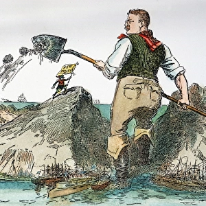
Photo Mug : MAP: JAMAICA, 1756. British map of the harbors of Port Royal and Kingston, Jamaica


![]()
Home Decor from Granger
MAP: JAMAICA, 1756. British map of the harbors of Port Royal and Kingston, Jamaica
MAP: JAMAICA, 1756.
British map of the harbors of Port Royal and Kingston, Jamaica from surveys by Richard Jones, 1756
Granger holds millions of images spanning more than 25,000 years of world history, from before the Stone Age to the dawn of the Space Age
Media ID 12321398
1756 British Harbor Island Jamaica Jones Kingston Port Royal Richard Shoal Survey
Large Photo Mug (15 oz)
Add a touch of history to your morning routine with our Media Storehouse Photo Mug featuring the intriguing map of Jamaica from 1756. This beautifully detailed British map, taken from surveys by Richard Jones, showcases the harbors of Port Royal and Kingston. The vibrant and clear image of MAP: JAMAICA, 1756, sourced from The Granger Collection, adds an element of intrigue and adventure to your daily cup of coffee or tea. Embrace the rich history of Jamaica every time you take a sip from this high-quality, sturdy mug. Perfect for history enthusiasts, travelers, or anyone who appreciates the beauty of vintage maps.
Elevate your coffee or tea experience with our premium white ceramic mug. Its wide, comfortable handle makes drinking easy, and you can rely on it to be both microwave and dishwasher safe. Sold in single units, preview may show both sides of the same mug so you can see how the picture wraps around.
Elevate your coffee or tea experience with our premium white ceramic mug. Its wide, comfortable handle makes drinking easy, and you can rely on it to be both microwave and dishwasher safe. Sold in single units, preview may show both sides of the same mug so you can see how the picture wraps around.
These are individually made so all sizes are approximate
EDITORS COMMENTS
This print showcases a historical treasure - the British map of the harbors of Port Royal and Kingston, Jamaica from 1756. Created by Richard Jones, this meticulously engraved map offers a fascinating glimpse into the island's past. The map depicts the intricate details of both Port Royal and Kingston harbors, highlighting their strategic importance during that era. Every shoal, every contour is intricately captured on this piece of art. It serves as a testament to the skill and dedication of Richard Jones in conducting surveys to create an accurate representation. Jamaica itself is beautifully portrayed in this print, with its lush greenery and stunning coastline stretching out towards crystal-clear waters. The island's rich history as a hub for trade and commerce comes alive through this visual masterpiece. As we gaze upon this remarkable artifact from centuries ago, we are transported back in time to witness how these bustling ports must have looked like during the British colonial period. This image invites us to explore not only the physical landscape but also delve into stories of exploration, conquests, and cultural exchange that shaped Jamaica's history. Granger Art on Demand has preserved this invaluable piece for us to appreciate today. Through their careful curation and preservation efforts, they allow us to connect with our past while celebrating the beauty found within historical maps like these.
MADE IN THE USA
Safe Shipping with 30 Day Money Back Guarantee
FREE PERSONALISATION*
We are proud to offer a range of customisation features including Personalised Captions, Color Filters and Picture Zoom Tools
SECURE PAYMENTS
We happily accept a wide range of payment options so you can pay for the things you need in the way that is most convenient for you
* Options may vary by product and licensing agreement. Zoomed Pictures can be adjusted in the Cart.