
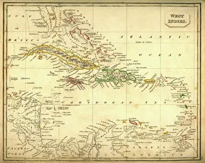
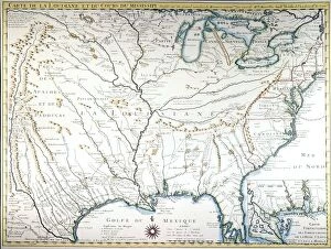
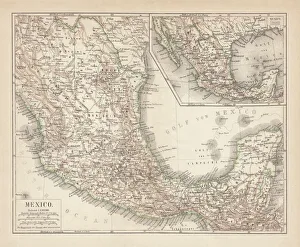
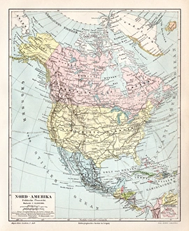
Maps Collection
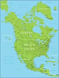
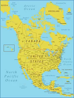
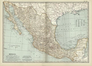
Maps of Mexico North America are a type of map that shows the geographical features and boundaries of Mexico, as well as its neighbouring countries
Choose a picture from our Maps Collection for your Wall Art and Photo Gifts
331 items


All Professionally Made to Order for Quick Shipping
-
Maps Collection
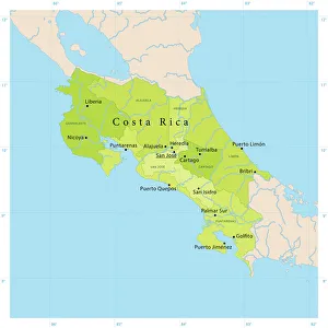
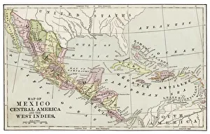
Maps of Mexico North America are a type of map that shows the geographical features and boundaries of Mexico, as well as its neighbouring countries. These they can typically used for navigation, planning trips, and understanding the political divisions within the region. They are be printed or digital versions, depending on the user’s preference. They often include major cities and towns in Mexico along with their population numbers, roads and highways, rivers and lakes, mountains and other physical features. Additionally they may show national parks or protected areas in Mexico as well as international borders between countries. Maps of Mexico North America can be found online or purchased from map stores around the world.
+
Our beautiful pictures are available as Framed Prints, Photos, Wall Art and Photo Gifts
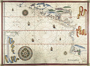
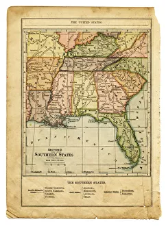
The Maps of Mexico North America collection from Media Storehouse offers a wide range of wall art and framed prints that showcase the rich history and geography of Mexico. Our collection features an extensive selection of maps, including antique maps dating back to the 16th century, as well as modern-day topographical maps. These high-quality prints are perfect for anyone interested in Mexican culture or history. They make great additions to any home space, adding a touch of sophistication and elegance to any room. Whether you're looking for a vintage map of Mexico City or a detailed topographical map of the Yucatan Peninsula, our collection has something for everyone. Each print is carefully crafted using only the highest quality materials, ensuring that they will last for years to come. If you're looking for beautiful and informative wall art that celebrates the beauty and diversity of Mexico's landscape and history, then look no further than our Maps of Mexico North America collection.
+
What are Maps of Mexico North America art prints?
Maps of Mexico North America art prints are high-quality reproductions of maps that depict the geography and topography of Mexico and North America. These prints showcase detailed illustrations, accurate cartography, and vibrant colors that make them perfect for display in homes, offices, or educational institutions. These art prints come in a variety of sizes to suit different needs and preferences. They can be framed or mounted on walls as standalone pieces or combined with other artworks to create a stunning gallery wall. Maps of Mexico North America art prints are also great gifts for history buffs, travelers, students, or anyone interested in exploring the world through art. Whether you're looking for vintage maps from centuries ago or contemporary depictions of modern-day cities and landmarks, we offer an extensive collection of Maps of Mexico North America art prints to choose from. Each print is made using premium materials and printing techniques to ensure long-lasting quality and durability.
+
What Maps of Mexico North America art prints can I buy from Media Storehouse?
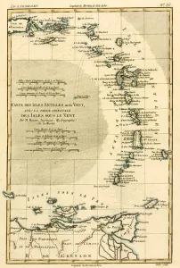
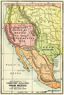
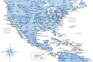
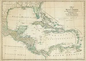
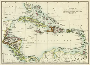
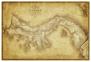
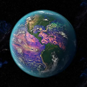
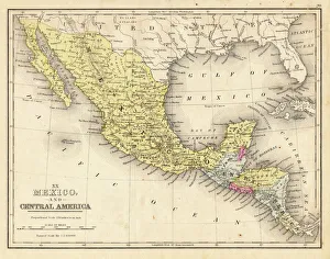
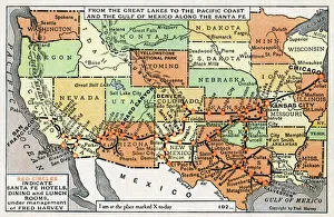
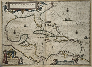
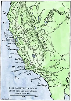
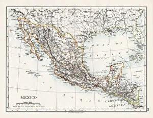
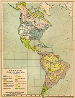
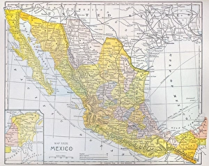
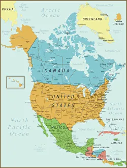
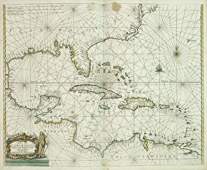
We offer a wide range of Maps of Mexico North America art prints that are perfect for home or office decor. You can choose from vintage, antique, and modern maps that showcase the geography, topography, and political boundaries of Mexico and North America. These maps come in various sizes and styles to suit your preferences. Some popular options include the 1847 Mapa de los Estados Unidos Mexicanos by John Disturnell, which features detailed illustrations of cities, rivers, mountains, and landmarks; the 1922 Mapa Fisico y Politico de la Republica Mexicana by Antonio Garcia Cubas that shows the physical features and administrative divisions of Mexico; and the colorful Satellite Image Map of North America that displays satellite imagery with borders marked. Whether you're a history buff or simply appreciate beautiful cartography artwork, we have something for everyone. Browse our collection today to find your perfect Maps of Mexico North America art print.
+
How do I buy Maps of Mexico North America art prints?
To purchase Maps of Mexico North America art prints from Media Storehouse, you can browse our collection online and select the print that catches your eye. Once you have found the desired artwork, click on it to view its details and choose the size and framing options if available. Then add it to your cart and proceed to checkout by filling in your shipping information and payment details. We offer a variety of payment methods including credit cards, PayPal, Apple Pay, Google Pay, among others. They also provide secure transactions for all purchases made through their website. If you encounter any issues during the buying process or have questions about their products or services, we have a customer support team ready to assist you via email or phone. Purchasing Maps of Mexico North America art prints from Media Storehouse is an easy process that involves browsing their selection online, selecting your preferred print with optional framing choices before proceeding to checkout using one of several secure payment methods.
+
How much do Maps of Mexico North America art prints cost?
Maps of Mexico North America art prints are available in a variety of sizes and styles, so the cost can vary depending on your preferences. Generally speaking, smaller prints will be less expensive than larger ones. Additionally, some prints may be more detailed or feature higher-quality materials, which can also affect the price. It's important to note that Maps of Mexico North America art prints are not just functional tools for navigation - they're also beautiful pieces of artwork that can add color and interest to any room in your home or office. Whether you're looking for a vintage-style map with muted colors or a modern print with bold graphics, there's sure to be an option that suits your taste and budget. The cost of Maps of Mexico North America art prints is reasonable given their quality and versatility as both decorative items and useful references.
+
How will my Maps of Mexico North America art prints be delivered to me?
Your Maps of Mexico North America art prints will be delivered to you securely and safely. The prints are carefully packaged to ensure that they arrive in perfect condition. They are usually shipped rolled up in a sturdy cardboard tube, which protects them from any damage during transit. The delivery process is handled by reliable shipping companies who have experience in handling delicate items such as art prints. You can expect your package to be tracked so that you can monitor its progress until it arrives at your doorstep. Once the package has been delivered, simply unroll the print and display it as desired. Whether you choose to frame it or hang it on its own, your Maps of Mexico North America art print is sure to add a touch of sophistication and style to any room. Media Storehouse takes great care in ensuring that your order is fulfilled promptly and efficiently while maintaining the highest standards of quality throughout the entire process.