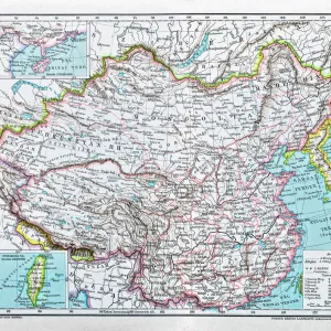
Metal Print : Map / Asia / China 1871


![]()
Metal Prints from Mary Evans Picture Library
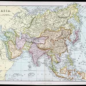
Map / Asia / China 1871
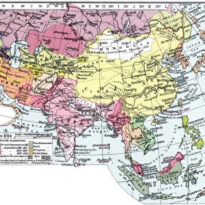
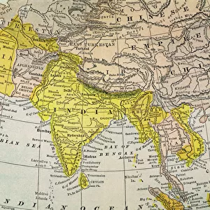
The CHINESE EMPIRE with Korea and Japan. The Treaty Ports are underlined, Hong Kong is underlined in red Date: 1871
Mary Evans Picture Library makes available wonderful images created for people to enjoy over the centuries
Media ID 7110965
© Mary Evans Picture Library 2015 - https://copyrighthub.org/s0/hub1/creation/maryevans/MaryEvansPictureID/10004466
1871 Hong Kong Korea Maps Ports Treaty Underlined
16"x20" (51x41cm) Metal Print
Discover the rich history of Asia with our stunning Metal Prints from Media Storehouse, featuring the captivating map "Chinese Empire with Korea and Japan, 1871" from Mary Evans Prints Online. This exquisite vintage map showcases the Chinese Empire during a pivotal period in history, with treaty ports and key locations, including Hong Kong, highlighted in bold. Bring history to life in your home or office with the vibrant colors and sleek design of our Metal Prints. Each print is meticulously crafted using high-quality materials and state-of-the-art printing techniques, ensuring a long-lasting and eye-catching addition to your space. Order now and step back in time with this beautiful and intriguing piece of cartographic history.
Made with durable metal and luxurious printing techniques, our metal photo prints go beyond traditional canvases, adding a cool, modern touch to your space. Wall mount on back. Eco-friendly 100% post-consumer recycled ChromaLuxe aluminum surface. The thickness of the print is 0.045". Featuring a Scratch-resistant surface and Rounded corners. Backing hangers are attached to the back of the print and float the print 1/2-inch off the wall when hung, the choice of hanger may vary depending on size and International orders will come with Float Mount hangers only. Finished with a brilliant white high gloss surface for unsurpassed detail and vibrance. Printed using Dye-Sublimation and for best care we recommend a non-ammonia glass cleaner, water, or isopropyl (rubbing) alcohol to prevent harming the print surface. We recommend using a clean, lint-free cloth to wipe off the print. The ultra-hard surface is scratch-resistant, waterproof and weatherproof. Avoid direct sunlight exposure.
Made with durable metal and luxurious printing techniques, metal prints bring images to life and add a modern touch to any space
Estimated Image Size (if not cropped) is 50.8cm x 40.6cm (20" x 16")
Estimated Product Size is 51.4cm x 41.2cm (20.2" x 16.2")
These are individually made so all sizes are approximate
Artwork printed orientated as per the preview above, with landscape (horizontal) orientation to match the source image.
EDITORS COMMENTS
This map print, dated 1871, offers a fascinating glimpse into the political landscape of Asia during the Chinese Empire's era of treaty ports. The map meticulously outlines the borders of China, Korea, and Japan, with key treaty ports underlined for emphasis. The Chinese Empire, once a powerful and unified political entity, was being gradually influenced by external forces, leading to the establishment of treaty ports as points of interaction between China and the Western world. The map's vibrant colors and intricate detailing bring to life the geographical features and political divisions of the region. The underlined treaty ports, including Hong Kong, indicate the growing presence of foreign powers in China's territories. Hong Kong, marked in bold red, was a British colony since 1841, and its strategic location made it a crucial trading hub between China and the West. Japan and Korea, situated to the east of China, are also depicted on the map. Japan had already begun its modernization process, while Korea remained largely isolated from the outside world. The map serves as a testament to the complex political dynamics of Asia during the late 19th century, a time of significant change and transformation. This map print, with its historical significance and captivating visual appeal, is an essential addition to any collection focused on Asian history, cartography, or geography. Its intricate detailing and underlined treaty ports offer valuable insights into the political landscape of Asia during the Chinese Empire's era of treaty ports, making it an invaluable resource for scholars, historians, and enthusiasts alike.
MADE IN THE USA
Safe Shipping with 30 Day Money Back Guarantee
FREE PERSONALISATION*
We are proud to offer a range of customisation features including Personalised Captions, Color Filters and Picture Zoom Tools
SECURE PAYMENTS
We happily accept a wide range of payment options so you can pay for the things you need in the way that is most convenient for you
* Options may vary by product and licensing agreement. Zoomed Pictures can be adjusted in the Cart.