Fine Art Print > Maps and Charts > British Empire Maps
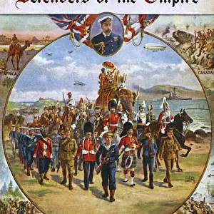
Fine Art Print : British Empire Map 1902


![]()
Fine Art Prints from Mary Evans Picture Library
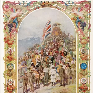
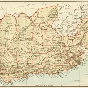
British Empire Map 1902
Map showing the extent of the British Empire in 1902 - the Empire on which the sun never sets
Mary Evans Picture Library makes available wonderful images created for people to enjoy over the centuries
Media ID 4322812
© Mary Evans Picture Library 2015 - https://copyrighthub.org/s0/hub1/creation/maryevans/MaryEvansPictureID/10025389
20"x16" (+3" Border) Fine Art Print
Step into the past with our exquisite Fine Art Print of the British Empire Map 1902 from Media Storehouse. This captivating piece, sourced from Mary Evans Prints Online, offers a glimpse into history with its intricate detailing of the vast expanse of the British Empire at the turn of the 20th century. The sun never sets on this impressive territory, making it a true testament to the reach and power of the British Empire. Add this stunning print to your collection and bring a piece of history into your home or office.
20x16 image printed on 26x22 Fine Art Rag Paper with 3" (76mm) white border. Our Fine Art Prints are printed on 300gsm 100% acid free, PH neutral paper with archival properties. This printing method is used by museums and art collections to exhibit photographs and art reproductions.
Our fine art prints are high-quality prints made using a paper called Photo Rag. This 100% cotton rag fibre paper is known for its exceptional image sharpness, rich colors, and high level of detail, making it a popular choice for professional photographers and artists. Photo rag paper is our clear recommendation for a fine art paper print. If you can afford to spend more on a higher quality paper, then Photo Rag is our clear recommendation for a fine art paper print.
Estimated Image Size (if not cropped) is 36.1cm x 50.8cm (14.2" x 20")
Estimated Product Size is 55.9cm x 66cm (22" x 26")
These are individually made so all sizes are approximate
Artwork printed orientated as per the preview above, with portrait (vertical) orientation to match the source image.
FEATURES IN THESE COLLECTIONS
> Maps and Charts
> British Empire Maps
> Maps and Charts
> Early Maps
> Maps and Charts
> Related Images
EDITORS COMMENTS
This striking print of the British Empire Map from 1902 showcases the vast extent of one of history's most powerful empires. The map illustrates the reach of British imperialism at its peak, with territories spanning across continents and oceans. Known as the empire on which the sun never sets, this map is a visual representation of Britain's dominance and influence during this time.
The intricate details on the map provide a glimpse into the historical significance and political power that characterized the British Empire in 1902. From India to Africa to Australia, each region under British rule is clearly demarcated, highlighting the sheer magnitude of their global presence.
As we reflect on this piece of history, it serves as a reminder of both the achievements and controversies associated with imperialism. The legacy left behind by the British Empire continues to shape geopolitics and international relations to this day.
Whether you are a history enthusiast or simply appreciate fine art, this print offers a unique perspective on a pivotal moment in world history. Displaying it in your home or office will not only add an element of sophistication but also spark conversations about colonialism, power dynamics, and cultural exchange.
MADE IN THE USA
Safe Shipping with 30 Day Money Back Guarantee
FREE PERSONALISATION*
We are proud to offer a range of customisation features including Personalised Captions, Color Filters and Picture Zoom Tools
SECURE PAYMENTS
We happily accept a wide range of payment options so you can pay for the things you need in the way that is most convenient for you
* Options may vary by product and licensing agreement. Zoomed Pictures can be adjusted in the Cart.