Fine Art Print > Europe > France > Canton > Saint Denis
Fine Art Print : 14th century World Map


![]()
Fine Art Prints from Mary Evans Picture Library
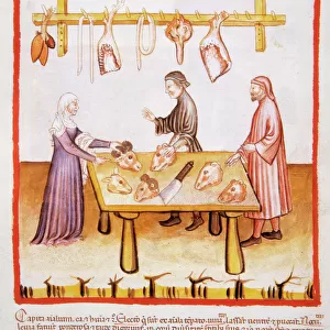
14th century World Map
14th century World Map according to the Grandes Chroniques de Saint-Denis
Mary Evans Picture Library makes available wonderful images created for people to enjoy over the centuries
Media ID 570611
© Mary Evans Picture Library 2015 - https://copyrighthub.org/s0/hub1/creation/maryevans/MaryEvansPictureID/10001213
Chroniques Denis Grandes Maps 14th
20"x20" (+3" Border) Fine Art Print
Discover the rich history and intrigue of the 14th century with our exquisite selection of Fine Art Prints from Mary Evans Picture Library. This captivating print showcases a rare and detailed 14th century World Map, as depicted in the Grandes Chroniques de Saint-Denis. Transport yourself back in time as you explore the fascinating cartography of the medieval world, adorned with vivid colors and intricate details. Each print is meticulously crafted to bring the beauty and history of this bygone era into your home or office. A perfect addition to any collection or decor, these Fine Art Prints are sure to inspire wonder and curiosity for generations to come.
20x20 image printed on 26x26 Fine Art Rag Paper with 3" (76mm) white border. Our Fine Art Prints are printed on 300gsm 100% acid free, PH neutral paper with archival properties. This printing method is used by museums and art collections to exhibit photographs and art reproductions.
Our fine art prints are high-quality prints made using a paper called Photo Rag. This 100% cotton rag fibre paper is known for its exceptional image sharpness, rich colors, and high level of detail, making it a popular choice for professional photographers and artists. Photo rag paper is our clear recommendation for a fine art paper print. If you can afford to spend more on a higher quality paper, then Photo Rag is our clear recommendation for a fine art paper print.
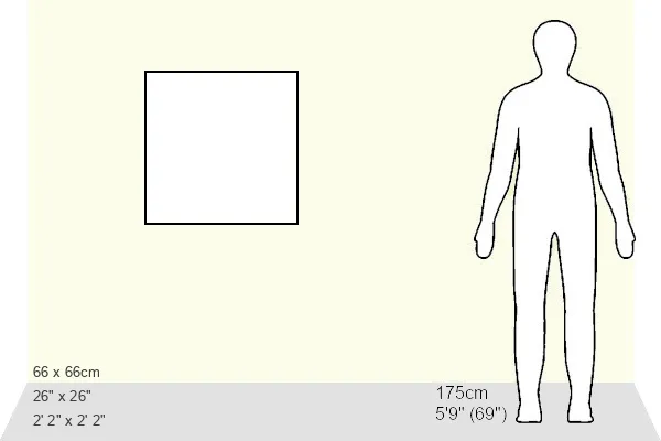
Estimated Image Size (if not cropped) is 50.8cm x 50.8cm (20" x 20")
Estimated Product Size is 66cm x 66cm (26" x 26")
These are individually made so all sizes are approximate
Artwork printed orientated as per the preview above, with landscape (horizontal) or portrait (vertical) orientation to match the source image.
FEATURES IN THESE COLLECTIONS
> Europe
> France
> Canton
> Saint Denis
> Maps and Charts
> Early Maps
> Maps and Charts
> Related Images
> Maps and Charts
> World
EDITORS COMMENTS
1. Title: 14th Century World Map from the Grandes Chroniques de Saint-Denis The Grandes Chroniques de Saint-Denis, or the "Great Chronicles of Saint Denis," is a 14th-century illuminated manuscript produced in France. This historical text, commissioned by King Charles V, chronicles the history of the Kingdom of France from its legendary founding to the author's present day. The manuscript is renowned for its magnificent illustrations, including this intriguing map depicting the known world during the late Middle Ages. The map, which is believed to have been created around 1330, is a testament to the geographical knowledge and cartographic skills of the time. It showcases a rounded representation of Europe, Africa, and Asia, with the easternmost extent of the known world extending to the Indian subcontinent. The map also includes the Mediterranean Sea, the Black Sea, and the Red Sea, highlighting the maritime connections and trade routes that were crucial during the Middle Ages. The Grandes Chroniques de Saint-Denis map is noteworthy for its inclusion of the New World, which was unknown to Europeans at the time. Instead, the map features a large, mythical island, known as Insula Magna or the "Great Island," located in the Atlantic Ocean. This island was believed to be the source of various exotic goods, such as gold, spices, and precious stones, and it fueled the European imagination for centuries. The map's intricate detailing and vibrant colors reflect the artistic achievements of the period, making it an essential piece of historical cartography. The Grandes Chroniques de Saint-Denis map offers a fascinating glimpse into the geographical knowledge and perceptions of the 14th century, providing valuable insights into the worldview of the Middle Ages.
MADE IN THE USA
Safe Shipping with 30 Day Money Back Guarantee
FREE PERSONALISATION*
We are proud to offer a range of customisation features including Personalised Captions, Color Filters and Picture Zoom Tools
SECURE PAYMENTS
We happily accept a wide range of payment options so you can pay for the things you need in the way that is most convenient for you
* Options may vary by product and licensing agreement. Zoomed Pictures can be adjusted in the Cart.