Canvas Print > Europe > Germany > Maps
Canvas Print : Map / Europe / Germany 1827


![]()
Canvas Prints from Mary Evans Picture Library
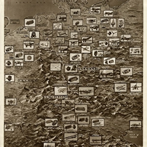
Map / Europe / Germany 1827
Map of Germany (Prussia) showing the various nation states
Mary Evans Picture Library makes available wonderful images created for people to enjoy over the centuries
Media ID 575402
© Mary Evans Picture Library 2015 - https://copyrighthub.org/s0/hub1/creation/maryevans/MaryEvansPictureID/10012756
20"x16" (51x41cm) Canvas Print
Introducing the captivating "Map / Europe / Germany 1827" print from the Media Storehouse collection, brought to you by Mary Evans Picture Library via Mary Evans Prints Online. This exquisite canvas print showcases an intricately detailed map of Germany in 1827, featuring the various nation states at a pivotal moment in European history. Each line and border is meticulously rendered, making this an essential addition to any history or geography enthusiast's collection. The high-quality canvas material adds an artistic touch, transforming this historical document into a stunning piece of wall art. Experience the past like never before with the Media Storehouse range of canvas prints.
Delivered stretched and ready to hang our premium quality canvas prints are made from a polyester/cotton blend canvas and stretched over a 1.25" (32mm) kiln dried knot free wood stretcher bar. Packaged in a plastic bag and secured to a cardboard insert for safe transit.
Canvas Prints add colour, depth and texture to any space. Professionally Stretched Canvas over a hidden Wooden Box Frame and Ready to Hang
Estimated Product Size is 50.8cm x 40.6cm (20" x 16")
These are individually made so all sizes are approximate
Artwork printed orientated as per the preview above, with landscape (horizontal) orientation to match the source image.
FEATURES IN THESE COLLECTIONS
> Europe
> Germany
> Related Images
> Europe
> Related Images
> Maps and Charts
> Early Maps
> Maps and Charts
> Related Images
> Mary Evans Prints Online
> Maps
EDITORS COMMENTS
This stunning print captures a piece of history with its detailed map of Germany from 1827. The map showcases the various nation states within Prussia, providing a glimpse into the political landscape of Europe during this time period. Each state is clearly delineated, allowing viewers to see how borders were defined and territories were divided.
The intricate details on the map offer a fascinating insight into the historical context of Germany in the early 19th century. From major cities to smaller towns, every corner of this region is meticulously depicted, giving us a sense of what life was like for people living in these different states.
As we study this map, we can imagine the political alliances and rivalries that shaped the destiny of these nation states. It serves as a reminder of how boundaries have shifted over time and how countries have evolved throughout history.
This print from Mary Evans Picture Library is not just a visual representation of geography; it is also a window into the past, allowing us to connect with our ancestors and gain a deeper understanding of our shared heritage. Whether you are a history buff or simply appreciate fine art, this map of Germany from 1827 is sure to captivate your imagination and spark your curiosity about days gone by.
MADE IN THE USA
Safe Shipping with 30 Day Money Back Guarantee
FREE PERSONALISATION*
We are proud to offer a range of customisation features including Personalised Captions, Color Filters and Picture Zoom Tools
SECURE PAYMENTS
We happily accept a wide range of payment options so you can pay for the things you need in the way that is most convenient for you
* Options may vary by product and licensing agreement. Zoomed Pictures can be adjusted in the Cart.