Home > Africa > Uganda > Lakes > Lake Victoria
Photo Mug : Uganda, Relief Map with Border and Mask


![]()
Home Decor from Universal Images Group (UIG)
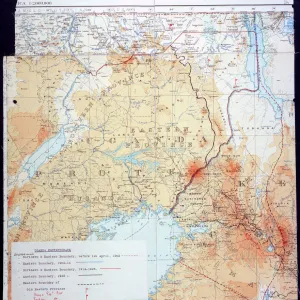
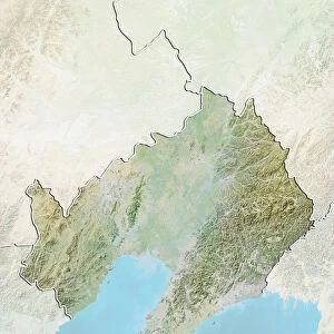
Uganda, Relief Map with Border and Mask
Relief map of Uganda (with border and mask). This image was compiled from data acquired by landsat 5 & 7 satellites combined with elevation data
Universal Images Group (UIG) manages distribution for many leading specialist agencies worldwide
Media ID 9619123
© Planet Observer/UIG
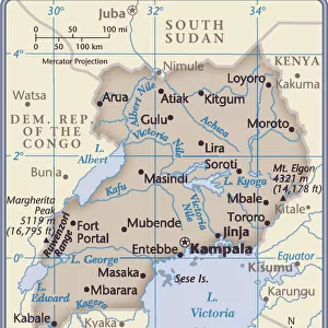
Africa Great Lakes Lake Victoria Relief Map Uganda Kampala Satellite View
Photo Mug (11 oz)
Add a touch of African culture to your daily routine with our Media Storehouse Photo Mug featuring a stunning relief map of Uganda. This unique mug showcases intricate details of the country's borders, topography, and a traditional Ugandan mask. Compiled from satellite data acquired by Landsat 5 & 7, this mug is not only a beautiful addition to your collection but also an educational piece, making every sip an adventure. Embrace the beauty of Uganda with our Photo Mug.
A personalized photo mug blends sentimentality with functionality, making an ideal gift for cherished loved ones, close friends, or valued colleagues. Preview may show both sides of the same mug.
Elevate your coffee or tea experience with our premium white ceramic mug. Its wide, comfortable handle makes drinking easy, and you can rely on it to be both microwave and dishwasher safe. Sold in single units, preview may show both sides of the same mug so you can see how the picture wraps around.
Mug Size is 9.5cm high x 8cm diameter (3.7" x 3.1")
These are individually made so all sizes are approximate
FEATURES IN THESE COLLECTIONS
> Africa
> Uganda
> Lakes
> Lake Victoria
> Africa
> Uganda
> Lakes
> Related Images
> Africa
> Uganda
> Related Images
> Universal Images Group (UIG)
> Universal Images Group
> Satellite and Aerial
> Planet Observer 4
EDITORS COMMENTS
This stunning print showcases the intricate beauty of Uganda's relief map, adorned with a border and mask. Compiled from data acquired by Landsat 5 & 7 satellites, combined with elevation data, this image offers a unique perspective on the physical geography of Uganda. The horizontal composition allows for an immersive viewing experience, transporting you to the heart of Africa. The vibrant colors bring out the diverse topography of this East African nation. From the majestic Great Lakes region to the bustling cityscape of Kampala, every detail is captured in this photograph. Lake Victoria takes center stage as it glistens under the golden sunlight, reflecting its significance as one of Africa's largest freshwater bodies. With no people in sight, this image invites you to explore Uganda's natural wonders at your own pace. The relief map provides valuable insights into the country's terrain and geographical features while highlighting its rich cultural heritage. Whether you are a cartography enthusiast or simply appreciate breathtaking landscapes, this print is sure to captivate your imagination. It serves as a reminder that our world is filled with hidden treasures waiting to be discovered and appreciated
MADE IN THE USA
Safe Shipping with 30 Day Money Back Guarantee
FREE PERSONALISATION*
We are proud to offer a range of customisation features including Personalised Captions, Color Filters and Picture Zoom Tools
SECURE PAYMENTS
We happily accept a wide range of payment options so you can pay for the things you need in the way that is most convenient for you
* Options may vary by product and licensing agreement. Zoomed Pictures can be adjusted in the Cart.