Home > Europe > France > Canton > Bas Rhin
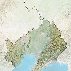
Region of Nord-Pas de Calais, France, Relief Map

![]()
Wall Art and Photo Gifts from Universal Images Group (UIG)
Region of Nord-Pas de Calais, France, Relief Map
Relief map of the departement of Pas-de-Calais in Nord-Pas-de-Calais, France. Relief map It borders the Strait of Dover in northern France. This image was compiled from data acquired by LANDSAT 5 & 7 satellites combined with elevation data
Universal Images Group (UIG) manages distribution for many leading specialist agencies worldwide
Media ID 9615653
© Planet Observer
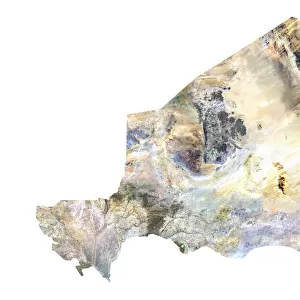
Alsace Bas Rhin Geographical Border Relief Map Satellite View
FEATURES IN THESE COLLECTIONS
> Europe
> France
> Canton
> Bas Rhin
> Europe
> France
> Canton
> Nord
> Europe
> France
> Canton
> Pas de Calais
> Europe
> France
> Canton
> Rhin
> Universal Images Group (UIG)
> Universal Images Group
> Satellite and Aerial
> Planet Observer 4
> Universal Images Group (UIG)
> Universal Images Group
> Satellite and Aerial
> Planet Observer 6
EDITORS COMMENTS
This print showcases the stunning region of Nord-Pas de Calais in France, specifically highlighting the relief map of Pas-de-Calais departement. The intricate details and topography depicted in this image were compiled from data acquired by LANDSAT 5 & 7 satellites, combined with elevation data. Situated along the picturesque Strait of Dover in northern France, this region boasts a diverse landscape that is beautifully captured here. From rolling hills to expansive plains, every contour and geographical border is vividly portrayed on this relief map. The colors used in this photograph add depth and vibrancy to the overall composition, making it visually appealing for any admirer of physical geography or cartography. With no people present in the frame, one can truly immerse themselves into the natural beauty and grandeur of this area. As an aerial view taken from a satellite perspective, it offers a unique vantage point that allows viewers to appreciate both the vastness and intricacy of Nord-Pas de Calais' terrain. This print serves as an excellent educational tool for those interested in studying or understanding regional topography
MADE IN THE USA
Safe Shipping with 30 Day Money Back Guarantee
FREE PERSONALISATION*
We are proud to offer a range of customisation features including Personalised Captions, Color Filters and Picture Zoom Tools
SECURE PAYMENTS
We happily accept a wide range of payment options so you can pay for the things you need in the way that is most convenient for you
* Options may vary by product and licensing agreement. Zoomed Pictures can be adjusted in the Cart.