Home > Europe > Related Images
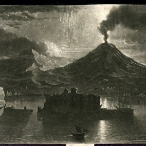
MAP OF SOUTH AND WEST EUROPE AFTER 843 A. D

![]()
Wall Art and Photo Gifts from Universal Images Group (UIG)
MAP OF SOUTH AND WEST EUROPE AFTER 843 A. D
MAP OF SOUTH AND WEST EUROPE AFTER 843 A.D
Universal Images Group (UIG) manages distribution for many leading specialist agencies worldwide
Media ID 20165245
© Universal Images Group
1872 Engraving Heir Nineteenth Century Map South Wandering West
FEATURES IN THESE COLLECTIONS
> Europe
> Related Images
> Universal Images Group (UIG)
> History
> Historical Maps
EDITORS COMMENTS
This 19th-century engraving, titled "Map of South and West Europe after 843 A. D" takes us on a journey back in time to explore the intricate political landscape of Europe during the ninth century. Created with meticulous attention to detail and an illustrative technique reminiscent of the Victorian era, this vintage print showcases the rich history and cultural heritage of this region. The map depicts the territorial divisions that emerged after the Treaty of Verdun in 843 A. D. , which marked a significant turning point in European history. It offers a glimpse into how power was distributed among various kingdoms and empires during that period, showcasing boundaries that have long since evolved or disappeared entirely. With its retro-styled aesthetic, this engraved image transports us to an era when cartography was both an art form and a scientific endeavor. The delicate lines and intricate patterns invite us to wander through each corner of South and West Europe as it existed centuries ago. As we study this historic artwork, we become heirs to a wealth of knowledge about our past. It serves as a reminder that understanding our roots is essential for comprehending our present reality. This remarkable piece from Universal History Archive allows us to appreciate not only the beauty but also the significance embedded within historical maps – they are windows into worlds long gone yet forever imprinted on our collective memory.
MADE IN THE USA
Safe Shipping with 30 Day Money Back Guarantee
FREE PERSONALISATION*
We are proud to offer a range of customisation features including Personalised Captions, Color Filters and Picture Zoom Tools
SECURE PAYMENTS
We happily accept a wide range of payment options so you can pay for the things you need in the way that is most convenient for you
* Options may vary by product and licensing agreement. Zoomed Pictures can be adjusted in the Cart.