
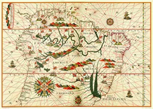
Maps Collection
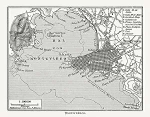
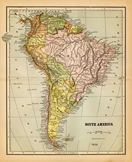
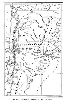
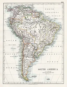
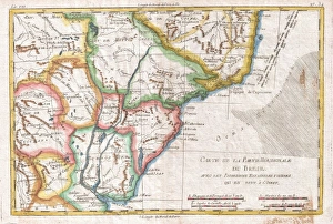
Uruguay is a small country located in South America
Choose a picture from our Maps Collection for your Wall Art and Photo Gifts
59 items


All Professionally Made to Order for Quick Shipping
-
Maps Collection
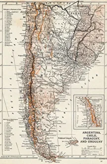
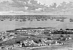
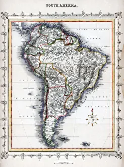
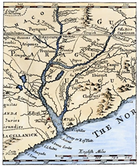
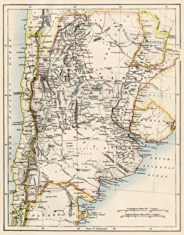
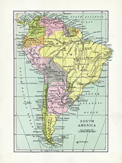
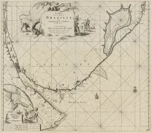
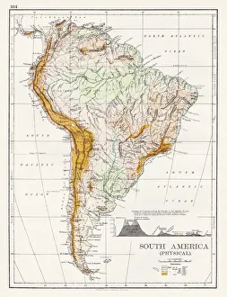
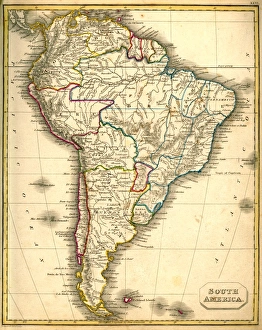
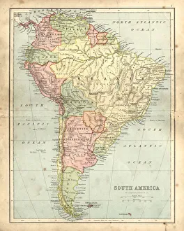
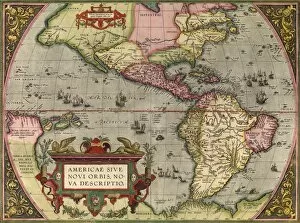
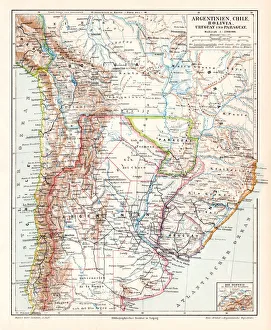
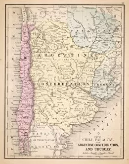
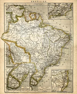
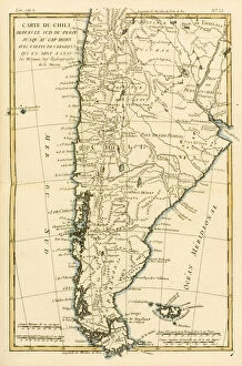
Uruguay is a small country located in South America, bordered by Brazil to the north and Argentina to the west and has a population of around 3.5 million people and its capital city is Montevideo. Uruguay has a varied landscape, ranging from rolling hills and plains in the interior to coastal beaches on its eastern shoreline. The country is known for its rich cultural heritage, with many festivals and celebrations taking place throughout the year. Maps of Uruguay are available online, showing cities, towns, roads, rivers and other geographical features of this beautiful country. These they are help travelers plan their trips or simply explore more about this fascinating nation's geography.
+
Our beautiful pictures are available as Framed Prints, Photos, Wall Art and Photo Gifts
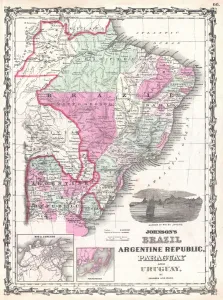
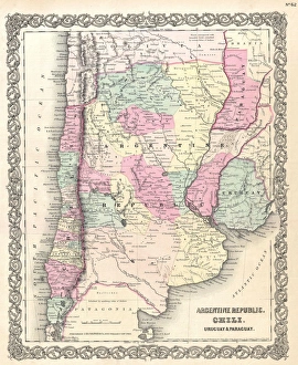
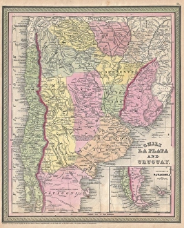
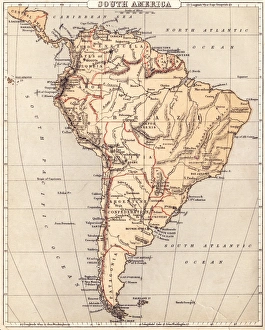
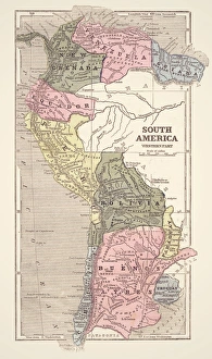
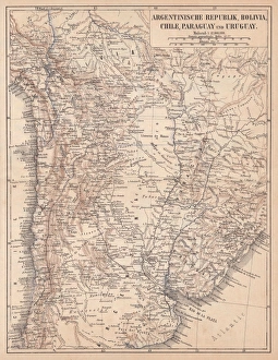
The Maps of Uruguay South America collection from Media Storehouse is a stunning array of wall art and framed prints that showcase the beauty and diversity of this fascinating country. Featuring a range of different maps, including topographical, political, and historical versions, these pieces are perfect for anyone with an interest in geography or travel. Each print is expertly crafted using high-quality materials to ensure maximum durability and longevity. Whether you're looking for a large statement piece to hang in your living room or something smaller to add some character to your office space, there's sure to be something in our collection that catches your eye. From the rugged coastline along the Atlantic Ocean to the rolling hills of the interior, Uruguay has plenty to offer visitors who want to explore its natural wonders. With these beautiful maps on display in your home or office, you'll be able to appreciate all that this amazing country has to offer without ever leaving your doorstep.
+
What are Maps of Uruguay South America art prints?
Maps of Uruguay South America art prints are high-quality reproductions of vintage and contemporary maps depicting the geography, topography, and political boundaries of Uruguay. These prints showcase the intricate details and artistic elements that make these maps not only informative but also visually appealing. These art prints are perfect for those who have an interest in cartography or history, as well as for those who want to add a unique touch to their home decor. They come in various sizes and can be framed or mounted according to personal preference. Whether you're looking to decorate your living room, office space, or study area with a piece that is both educational and aesthetically pleasing, Maps of Uruguay South America art prints from Media Storehouse offer a wide selection to choose from. With their high-quality printing technology and attention to detail, these prints will surely impress anyone who sees them.
+
What Maps of Uruguay South America art prints can I buy from Media Storehouse?
We offer a wide range of Maps of Uruguay South America art prints that you can choose from. These maps are perfect for those who love geography or want to decorate their homes with unique and interesting pieces. You can find vintage maps, modern maps, political maps, physical maps, and more. The vintage Maps of Uruguay South America art prints showcase the country's history and how it has evolved over time. The modern ones show the current state of the country and its various regions. Political maps highlight the different administrative divisions within Uruguay while physical ones depict its natural features such as mountains, rivers, lakes, etc. All these Maps of Uruguay South America art prints come in different sizes so you can choose one that fits your space perfectly. They are printed on high-quality paper using advanced printing techniques to ensure they look great for years to come. Whether you're looking for something educational or decorative, we have got you covered.
+
How do I buy Maps of Uruguay South America art prints?
To buy Maps of Uruguay South America art prints from Media Storehouse, you can browse our extensive collection of maps and select the one that catches your eye. Once you have found the map print you want to purchase, simply add it to your cart and proceed to checkout. During checkout, you will be prompted to enter your shipping and payment information. We offer a variety of sizes for their map prints, so be sure to choose the size that best fits your needs. We also offer different finishes such as matte or glossy paper. If you are looking for a specific type of map or need help finding what you're looking for, we have a customer service team available to assist with any questions or concerns. Buying Maps of Uruguay South America art prints from Media Storehouse is an easy process that allows you to bring beautiful and unique artwork into your home or office.
+
How much do Maps of Uruguay South America art prints cost?
We offer a wide range of Maps of Uruguay South America art prints at varying prices. Our collection includes high-quality prints that are perfect for adding a touch of elegance to any room or office space. The cost of our Maps of Uruguay South America art prints depends on the size and type of print you choose. We have options ranging from small to large sizes, as well as different materials such as canvas or framed paper. Our selection is carefully curated to ensure that we provide only the best quality products for our customers. Whether you're looking for a vintage map or a modern interpretation, we have something for everyone's taste and budget. You can browse through our extensive collection online and find the perfect piece that suits your style and needs. Our Maps of Uruguay South America art prints are competitively priced without compromising on quality, making them an excellent investment for anyone who appreciates fine art.
+
How will my Maps of Uruguay South America art prints be delivered to me?
We take great care in delivering your Maps of Uruguay South America art prints to you. We use high-quality packaging materials to ensure that your artwork arrives in perfect condition. Your print will be carefully rolled and placed into a sturdy tube for protection during transit. We work with trusted shipping partners who offer reliable delivery services worldwide. Once your order has been dispatched, you will receive an email notification with tracking information so that you can keep track of the progress of your delivery. Our team is dedicated to providing excellent customer service and ensuring that our customers are satisfied with their purchases. If you have any questions or concerns about the delivery of your Maps of Uruguay South America art prints, please do not hesitate to contact us and we will be happy to assist you.