Fraud Blocker Skip to main content

Map of Europe, 1600

Map of Europe, 1600
Sold 12
In Stock
We accept all major payment options so you can pay for the things you need in the way that is most convenient for you

Science Photo Library Photo Prints and Wall Art

Map of Europe, 1600

16th century map of Europe. Published in Sienna in 1600, this Italian map shows the latest knowledge of the geography of Europe. The writing is in Italian, and a dedication is given at upper left in a cartouche, along with the name of the cartographer, Arnoldo di Arnoldi (died 1602). Notes are given at far right, with the title at lower right. A scale bar is at lower left. Science Photo Library features Science and Medical images including photos and illustrations. © LIBRARY OF CONGRESS, GEOGRAPHY AND MAP DIVISION/SCIENCE PHOTO LIBRARY

Media ID 1699833

1500s 1600 1600s 16th Century 17th Century Cartography Exploration Italian Medieval Middle Ages

SECURE PAYMENTS
We accept all major payment options so you can pay for the things you need in the way that is most convenient for you

Made in USA
Safe Shipping, Easy Returns

FREE PERSONALISATION
We are proud to offer a range of customisation including Cropping, Captions, and Filters. Zoom Cropping can be adjusted in the basket


EDITORS COMMENTS

This print showcases a remarkable piece of history - a Map of Europe from the 16th century. Published in Sienna, Italy in the year 1600, this Italian map represents the most up-to-date knowledge of European geography at that time. The intricate details and exquisite craftsmanship make it an invaluable artifact for both cartography enthusiasts and history buffs. The writing on the map is elegantly scripted in Italian, providing a glimpse into the language used during that era. At the upper left corner, a beautifully designed cartouche contains a dedication along with the name of its creator, Arnoldo di Arnoldi (died 1602), who meticulously crafted this masterpiece. On the far right side, informative notes further enhance our understanding of Europe's geographical features. As we explore this ancient map further, we discover its title elegantly placed at lower right. Additionally, a scale bar positioned at lower left allows us to comprehend distances between various regions accurately. Transporting us back to an age when exploration was still unfolding across uncharted territories, this photograph captures not only historical significance but also serves as a testament to human curiosity and ingenuity. It reminds us how maps have played an essential role throughout centuries in shaping our understanding of the world around us. With its rich historical context and visual appeal, this print from Science Photo Library provides viewers with an opportunity to appreciate both artistry and knowledge encapsulated within one extraordinary piece.


Framed Prints of Map of Europe, 1600

Discover the rich history of Europe with our exquisite Framed Prints from Media Storehouse. This captivating piece features a 1600 map of Europe, published in Sienna, Italy. Dated back to the 16th century, this vintage map showcases the latest geographical knowledge of Europe during that time. Add an element of historical charm to your space with this intricately detailed and beautifully preserved map, brought to you by Science Photo Library. Each Framed Print is meticulously crafted to preserve the authenticity and vibrancy of the image, making it a stunning addition to any room. Travel back in time and embellish your home or office with this timeless treasure.


Photo Prints of Map of Europe, 1600

Discover the rich history of Europe through the captivating lens of the past with our Media Storehouse range of Photographic Prints. This exquisite piece features a 16th-century map of Europe, published in Sienna in 1600. Witness the latest geographical knowledge of the time, as depicted in this intricately detailed and beautifully preserved map from the Science Photo Library. Transport yourself back to an era of exploration and discovery, and add a touch of historical charm to your space with this stunning photographic print.


Poster Prints of Map of Europe, 1600

Introducing the captivating "Map of Europe, 1600" from our Media Storehouse Poster Prints collection, brought to you by Science Photo Library. Travel back in time with this exquisite representation of Europe as it appeared in the 16th century. Meticulously published in Sienna in 1600, this Italian map showcases the most up-to-date knowledge of European geography during that era. Adorn your walls with a piece of history, and let this captivating print ignite your imagination as you explore the rich tapestry of European history.


Jigsaw Puzzles of Map of Europe, 1600

Discover the rich history of Europe with our captivating "Map of Europe, 1600" jigsaw puzzle from Media Storehouse. This intriguing puzzle, featuring an authentic reproduction of the Science Photo Library's map published in Sienna in 1600, invites you on a journey back in time. Delve into the 16th century and piece together the latest geographical knowledge of Europe as it existed over 400 years ago. The intricate details of this Italian map will challenge and delight puzzle enthusiasts of all ages. Immerse yourself in a historical adventure, assembling this beautiful puzzle to reveal a fascinating snapshot of Europe's past.

diamond
Made With High Grade Materials
thumb_up
Professional Quality Finish
package_2
Carefully Packed To Aid Safe Arrival

You May Also Like


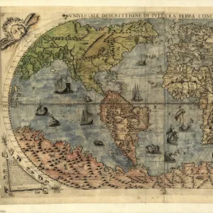
17th century world map17th century world map
Add to Basket
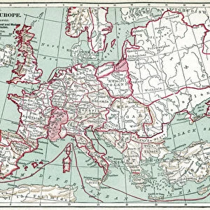
Medieval Europe at the start of the CrusadesMedieval Europe at the start of the Crusades
Add to Basket
16th century world map16th century world map
Add to Basket
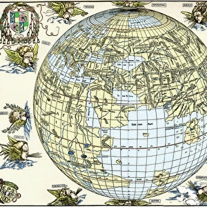
Durers world map, 1515Durers world map, 1515
Add to Basket
MAP OF EUROPE, 12th CENTURY. A 19th century map of Europe as it was politically constituted in theMAP OF EUROPE, 12th CENTURY. A 19th century map of Europe as it was politically constituted in the
Add to Basket
Antique Map of Europe, 1785Antique Map of Europe, 1785
Add to Basket
Historical World Events map 1970 US versionHistorical World Events map 1970 US version
Add to Basket
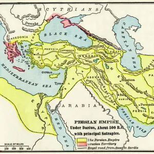
Persian Empire about 500 BCPersian Empire about 500 BC
Add to Basket
Angevin kings holdings in France and BritainAngevin kings holdings in France and Britain
Add to Basket
Scotland map, 1870sScotland map, 1870s
Add to Basket
Map of England in 1066Map of England in 1066
Add to Basket
Map of Europe 1721Map of Europe 1721
Add to Basket

Gallery Wall Inspiration

Skull anatomy by Leonardo da Vinci
Title pages of Pacciolis Summa de Arithmetica
Krakatoa sunsets, 1883 artworks
Continental drift after 250 million years
Map of Europe, 1600
Red kite, historical artwork
Marconi radio apparatus
1838 Darwins Christ College Cambridge
Roman memento mori mosaic
Heart
1862 British prehistoric marine reptiles
St. Bartholomews Hospital, 18th Century
Set of glass eyeballs
Map of Palestine, 1588
Portrait of Charles Darwin, British naturalist
Yuri Gagarin, Soviet cosmonaut
Trepanation, 14th century artwork
Continental drift, 100 million years ago
Cygnus and Lyra constellations
Trilobite fossil
Full Moon
Persian pharmacy, 13th century artwork
Perseus constellation
Pyramids at Giza
Map of Europe, 1700
Map of Western Europe, 1590
Second Byrd Antarctic Expedition, 1933-35


© Copyright Media Storehouse, All Rights Reserved 2003 - 2024
Facebook     Pinterest     100% Payment Secure     Reviews IO