Home > Europe > United Kingdom > England > Cornwall > New Polzeath
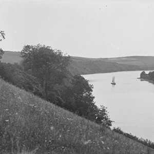
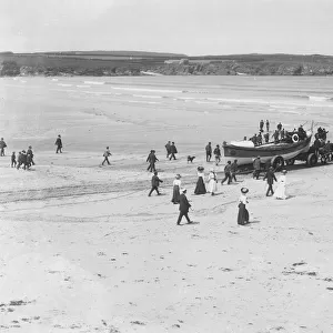
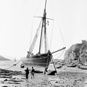
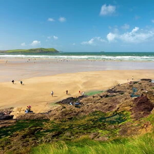
East side of Polzeath beach, St Minver, Cornwall. 1907

![]()
Wall Art and Photo Gifts from Royal Cornwall Museum
East side of Polzeath beach, St Minver, Cornwall. 1907
Pentire Point from the area of Polzeath beach marked on the 1908 Ordnance Survey maps as Crockett Haven. The steps to the right of the picture lead up to an area then known as Pentireglaze, but now known as New Polzeath. The name change to New Polzeath was probably to reflect the housing development that has taken place over the decades since this photograph was taken. Two men are walking up the steps and a number of people are on the rocks above the beach. Photographer: Herbert Hughes
Royal Cornwall Museum is the UK's Greatest Museum For Cornish Life & Culture
TRURI : MIVph.2
Media ID 19005274
© From the collection of the RIC
Coast Coastal Coastline Cove Head Headland Rocks Sand Seaside Seaweed
FEATURES IN THESE COLLECTIONS
> Europe
> United Kingdom
> England
> Cornwall
> New Polzeath
> Europe
> United Kingdom
> England
> Cornwall
> Pentire
> Europe
> United Kingdom
> England
> Cornwall
> Polzeath
> Europe
> United Kingdom
> England
> Cornwall
> Rock
> Europe
> United Kingdom
> England
> Cornwall
> St Minver
> Maps and Charts
> Related Images
> Royal Cornwall Museum
> Places
> St Minver
EDITORS COMMENTS
This print transports us back to the year 1907, capturing the serene beauty of the east side of Polzeath beach in St Minver, Cornwall. The image showcases Pentire Point as seen from an area known as Crockett Haven on the 1908 Ordnance Survey maps. Intriguingly, we can observe a group of people gathered on the rocks above the sandy shoreline, enjoying a leisurely day by the sea. Two men are making their way up a set of steps that lead to an area once called Pentireglaze but now known as New Polzeath. This name change likely reflects the housing development that has taken place over several decades since this photograph was captured. The photographer behind this remarkable snapshot is Herbert Hughes, who skillfully immortalized this picturesque coastal scene for future generations to appreciate. The rugged headland and rocky cove provide a dramatic backdrop against which nature's elements collide harmoniously – sand meeting sea, seaweed clinging to rocks. This historical gem from Royal Cornwall Museum offers us a glimpse into simpler times when seaside retreats were cherished and embraced by those seeking solace amidst nature's wonders. Let this image transport you back in time and evoke feelings of tranquility and nostalgia for Cornwall's breathtaking coastline.
MADE IN THE USA
Safe Shipping with 30 Day Money Back Guarantee
FREE PERSONALISATION*
We are proud to offer a range of customisation features including Personalised Captions, Color Filters and Picture Zoom Tools
FREE COLORIZATION SERVICE
You can choose advanced AI Colorization for this picture at no extra charge!
SECURE PAYMENTS
We happily accept a wide range of payment options so you can pay for the things you need in the way that is most convenient for you
* Options may vary by product and licensing agreement. Zoomed Pictures can be adjusted in the Cart.