Home > North America > Panama > Colon
Canvas Print : Panama Canal Map 1890


![]()
Canvas Prints from Mary Evans Picture Library
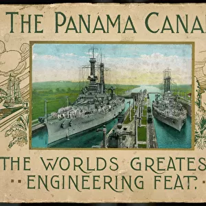
Panama Canal Map 1890
Map of the Canal : note that the Atlantic is on the left, the Pacific on the right, because the canal actually runs from NW to SE - Panama is east of Colon
Mary Evans Picture Library makes available wonderful images created for people to enjoy over the centuries
Media ID 4364695
© Mary Evans Picture Library 2015 - https://copyrighthub.org/s0/hub1/creation/maryevans/MaryEvansPictureID/10119484
Atlantic Canal Canals Colon Note Pacific Panama Runs
12"x9" (30x23cm) Canvas Print
"Step back in time with our stunning Panama Canal Map 1890 Canvas Print from Media Storehouse. This exquisite piece, sourced from Mary Evans Prints Online, offers a captivating glimpse into history with intricate detail. The map, illustrating the Panama Canal in its early stages, beautifully depicts the connection between the Atlantic and Pacific Oceans. With the Atlantic on the left and the Pacific on the right, this vintage map is a testament to engineering marvels and historical significance. Elevate your home or office decor with this unique and thought-provoking addition."
Delivered stretched and ready to hang our premium quality canvas prints are made from a polyester/cotton blend canvas and stretched over a 1.25" (32mm) kiln dried knot free wood stretcher bar. Packaged in a plastic bag and secured to a cardboard insert for safe transit.
Canvas Prints add colour, depth and texture to any space. Professionally Stretched Canvas over a hidden Wooden Box Frame and Ready to Hang
Estimated Product Size is 30.5cm x 22.9cm (12" x 9")
These are individually made so all sizes are approximate
Artwork printed orientated as per the preview above, with landscape (horizontal) orientation to match the source image.
FEATURES IN THESE COLLECTIONS
> Maps and Charts
> Early Maps
> North America
> Panama
> Colon
> North America
> Panama
> Maps
> North America
> Panama
> Related Images
EDITORS COMMENTS
This map print, dated 1890, showcases an intricate layout of the proposed Panama Canal route. The historic document, sourced from Mary Evans Prints Online, offers a fascinating glimpse into the planning stages of one of the most significant engineering projects in history. The map, titled "Map of the Canal," is a testament to the ambition and vision of the canal's architects. With the Atlantic Ocean on the left and the Pacific Ocean on the right, the map illustrates the intended canal route running from the Northwest to the Southeast, traversing the Isthmus of Panama. Panama, located to the east of Colon, is depicted as a narrow strip of land connecting the two vast bodies of water. The map is rich in detail, highlighting various features such as the proposed locks, waterways, and the mountain ranges that the canal would need to navigate. The meticulous planning and engineering required to construct the canal are evident in the map's precise depiction of the topography and geography of the region. This map holds immense historical significance, as it represents a crucial step in the development of the Panama Canal project. The canal, which opened in 1914, revolutionized global transportation by allowing ships to travel between the Atlantic and Pacific Oceans without having to navigate the lengthy and treacherous Cape Horn route. The map serves as a reminder of the ingenuity and determination of the human spirit, as well as the profound impact that a single project can have on the world. Its intricate details and historical significance make it a valuable addition to any collection of maps or historical documents.
MADE IN THE USA
Safe Shipping with 30 Day Money Back Guarantee
FREE PERSONALISATION*
We are proud to offer a range of customisation features including Personalised Captions, Color Filters and Picture Zoom Tools
SECURE PAYMENTS
We happily accept a wide range of payment options so you can pay for the things you need in the way that is most convenient for you
* Options may vary by product and licensing agreement. Zoomed Pictures can be adjusted in the Cart.