Fraud Blocker Skip to main content

Home > Oceania > New Zealand > Maps

Maps Collection (#4)

Maps of New Zealand Oceania are a type of map that provide detailed information about the geography and culture of the region

241 Items

Background imageMaps Collection: Bishop Stubbs (b / w photo)

Bishop Stubbs (b / w photo)
7155385 Bishop Stubbs (b/w photo) by English Photographer, (19th century); Private Collection; (add.info.: Bishop Stubbs, from a photo by Gilman and Co Ltd, Oxford)

Background imageMaps Collection: James Andrew Ramsay, 1st Marquis Dalhousie (litho)

James Andrew Ramsay, 1st Marquis Dalhousie (litho)
7155382 James Andrew Ramsay, 1st Marquis Dalhousie (litho) by English School, (19th century); Private Collection; (add.info.: James Andrew Ramsay, 1st Marquis Dalhousie)

Background imageMaps Collection: Dean Gaisford (litho)

Dean Gaisford (litho)
7155371 Dean Gaisford (litho) by English School, (19th century); Private Collection; (add.info.: Dean Gaisford, from the Painting in the Hall of Christ Church, Oxford)

Background imageMaps Collection: The Right Honourable George Canning, MP (litho)

The Right Honourable George Canning, MP (litho)
7155369 The Right Honourable George Canning, MP (litho) by English School, (19th century); Private Collection; (add.info.: The Right Honourable George Canning, MP, from the Painting at Christ Church)

Background imageMaps Collection: Francis Alterbury, DD, Bishop of Rochester (litho)

Francis Alterbury, DD, Bishop of Rochester (litho)
7155362 Francis Alterbury, DD, Bishop of Rochester (litho) by English School, (19th century); Private Collection; (add.info.: Francis Alterbury, DD, Bishop of Rochester)

Background imageMaps Collection: Richard Burton (litho)

Richard Burton (litho)
7155354 Richard Burton (litho) by English School, (19th century); Private Collection; (add.info.: Richard Burton, from the painting at Brasenose College, Oxford)

Background imageMaps Collection: John Ruskin, DCL (litho)

John Ruskin, DCL (litho)
7155386 John Ruskin, DCL (litho) by English School, (19th century); Private Collection; (add.info.: John Ruskin, DCL, from an etching by C Laurie)

Background imageMaps Collection: The Right Honourable Earl Canning (litho)

The Right Honourable Earl Canning (litho)
7155383 The Right Honourable Earl Canning (litho) by English School, (19th century); Private Collection; (add.info.: The Right Honourable Earl Canning)

Background imageMaps Collection: The Right Honourable W E Gladstone, DCL (litho)

The Right Honourable W E Gladstone, DCL (litho)
7155378 The Right Honourable W E Gladstone, DCL (litho) by English School, (19th century); Private Collection; (add.info.: The Right Honourable W E Gladstone, DCL, from the painting at Christ Church)

Background imageMaps Collection: The Right Honourable Sir George Cornewall Lewis, Baronet, Secretary of State for the Home

The Right Honourable Sir George Cornewall Lewis, Baronet, Secretary of State for the Home Department (litho)
7155377 The Right Honourable Sir George Cornewall Lewis, Baronet, Secretary of State for the Home Department (litho) by English School

Background imageMaps Collection: John Locke (litho)

John Locke (litho)
7155359 John Locke (litho) by English School, (19th century); Private Collection; (add.info.: John Locke, after the original picture by Sir G Kneller, in the Hall of Christ Church, Oxford)

Background imageMaps Collection: Christ Church, Oxford: Library (b / w photo)

Christ Church, Oxford: Library (b / w photo)
7155339 Christ Church, Oxford: Library (b/w photo) by English Photographer, (19th century); Private Collection; (add.info.: Library)

Background imageMaps Collection: Christ Church, Oxford: The Great Quadrangle (b / w photo)

Christ Church, Oxford: The Great Quadrangle (b / w photo)
7155337 Christ Church, Oxford: The Great Quadrangle (b/w photo) by English Photographer, (19th century); Private Collection; (add.info.: The Great Quadrangle)

Background imageMaps Collection: George Augustus Selwyn, English-born Bishop of New Zealand (engraving)

George Augustus Selwyn, English-born Bishop of New Zealand (engraving)
7200964 George Augustus Selwyn, English-born Bishop of New Zealand (engraving) by English School, (19th century); Private Collection; (add.info.: George Augustus Selwyn (1809-1878)

Background imageMaps Collection: Sir Robert Phillimore, Baronet, DCL (b / w photo)

Sir Robert Phillimore, Baronet, DCL (b / w photo)
7155380 Sir Robert Phillimore, Baronet, DCL (b/w photo) by English Photographer, (19th century); Private Collection; (add.info.: Sir Robert Phillimore, Baronet, DCL)

Background imageMaps Collection: Dean Liddell (litho)

Dean Liddell (litho)
7155379 Dean Liddell (litho) by English School, (19th century); Private Collection; (add.info.: Dean Liddell, from the painting in the Hall of Christ Church)

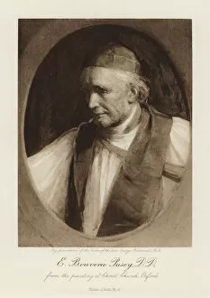
Background imageMaps Collection: E Bouverie Pusey, DD (litho)

E Bouverie Pusey, DD (litho)
7155375 E Bouverie Pusey, DD (litho) by English School, (19th century); Private Collection; (add.info.: E Bouverie Pusey, DD, from the painting at Christ Church, Oxford)

Background imageMaps Collection: Richard, Marquess Wellesley, KG, etc (litho)

Richard, Marquess Wellesley, KG, etc (litho)
7155368 Richard, Marquess Wellesley, KG, etc (litho) by English School, (19th century); Private Collection; (add.info.: Richard, Marquess Wellesley, KG, etc, after a painting by Sir J Lawrence, PRA)

Background imageMaps Collection: Henry VIII (litho)

Henry VIII (litho)
7155350 Henry VIII (litho) by English School, (19th century); Private Collection; (add.info.: Henry VIII, after an original by H Holbein)

Background imageMaps Collection: Christ Church, Oxford: Broad Walk (b / w photo)

Christ Church, Oxford: Broad Walk (b / w photo)
7155347 Christ Church, Oxford: Broad Walk (b/w photo) by English Photographer, (19th century); Private Collection; (add.info.: Broad Walk)

Background imageMaps Collection: Christ Church, Oxford: Hall (b / w photo)

Christ Church, Oxford: Hall (b / w photo)
7155343 Christ Church, Oxford: Hall (b/w photo) by English Photographer, (19th century); Private Collection; (add.info.: Hall)

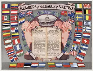
Background imageMaps Collection: Members of the League of Nations (colour litho)

Members of the League of Nations (colour litho)
7163177 Members of the League of Nations (colour litho) by English School, (20th century); Private Collection; (add.info.: Members of the League of Nations)

Background imageMaps Collection: Old engraved map of Invercargill and Bluff Harbour, New Zealand

Old engraved map of Invercargill and Bluff Harbour, New Zealand
Copyright has expired on this artwork. From my own archives, digitally restored

Background imageMaps Collection: Great waterfalls (b / w photo)

Great waterfalls (b / w photo)
6013427 Great waterfalls (b/w photo) by English Photographer, (20th century); Private Collection; (add.info.: Great waterfalls)

Background imageMaps Collection: iv. A View of the Watering Place Tegadoo Bay, New Zealand, 23 Oct 1769

iv. A View of the Watering Place Tegadoo Bay, New Zealand, 23 Oct 1769
5670249 iv. A View of the Watering Place Tegadoo Bay, New Zealand, 23 Oct 1769 by Cook, James (1728-79); Mitchell Library, State Library of New South Wales; (add.info.: Possibly draw by Isaac Smith)

Background imageMaps Collection: Total Eclipse of the Sun in New Zealand, Map of Parts of the North and Middle Islands (engraving)

Total Eclipse of the Sun in New Zealand, Map of Parts of the North and Middle Islands (engraving)
1614371 Total Eclipse of the Sun in New Zealand, Map of Parts of the North and Middle Islands (engraving) by English School

Background imageMaps Collection: Page 32b New Zealand Portrait of a Maori, 1768-75 (red chalk)

Page 32b New Zealand Portrait of a Maori, 1768-75 (red chalk)
5670297 Page 32b New Zealand Portrait of a Maori, 1768-75 (red chalk) by Hodges, William (1744-97); Mitchell Library, State Library of New South Wales; (add.info.: Original Sketches, Drawings)

Background imageMaps Collection: Page 32a View, possibly of Dusky Bay, New Zealand, 1768-75 (w / c)

Page 32a View, possibly of Dusky Bay, New Zealand, 1768-75 (w / c)
5670296 Page 32a View, possibly of Dusky Bay, New Zealand, 1768-75 (w/c) by Hodges, William (1744-97); Mitchell Library, State Library of New South Wales; (add.info.: Original Sketches, Drawings)

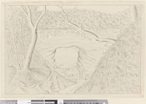
Background imageMaps Collection: v Great Natural Arch, 75 long, 27 broad, 45 high, Tegadoo Bay, New Zealand

v Great Natural Arch, 75 long, 27 broad, 45 high, Tegadoo Bay, New Zealand
5670250 v Great Natural Arch, 75 long, 27 broad, 45 high, Tegadoo Bay, New Zealand, 1769 by Cook, James (1728-79); Mitchell Library

Background imageMaps Collection: Two maps of Taranaki, New Zealand showing Middlesex Regiment operations during the Maori

Two maps of Taranaki, New Zealand showing Middlesex Regiment operations during the Maori
2973892 Two maps of Taranaki, New Zealand showing Middlesex Regiment operations during the Maori War, 1860-72 (colour litho) by English School, (19th century); National Army Museum

Background imageMaps Collection: Map of the coast of New Zealand, illustration from

Map of the coast of New Zealand, illustration from
3610747 Map of the coast of New Zealand, illustration from A journal of a voyage to the South Seas : in His Majestys ship, the Endeavour, 1794 (hand-coloured engraving) by Parkinson

Background imageMaps Collection: Map of the eastern hemisphere, illustration from A journal of a voyage to the South

Map of the eastern hemisphere, illustration from A journal of a voyage to the South
3610754 Map of the eastern hemisphere, illustration from A journal of a voyage to the South Seas : in His Majestys ship, the Endeavour, 1794 (hand-coloured engraving) by Parkinson

Background imageMaps Collection: Map of the western hemisphere, illustration from A journal of a voyage to the South

Map of the western hemisphere, illustration from A journal of a voyage to the South
3610752 Map of the western hemisphere, illustration from A journal of a voyage to the South Seas : in His Majestys ship, the Endeavour, 1794 (hand-coloured engraving) by Parkinson

Background imageMaps Collection: Map of the Country between Auckland and the River Waikato, New Zealand

Map of the Country between Auckland and the River Waikato, New Zealand, illustrating the War with the Natives
1102862 Map of the Country between Auckland and the River Waikato, New Zealand, illustrating the War with the Natives (engraving) by Dower

Background imageMaps Collection: Plan of the Rangariri District, New Zealand (engraving)

Plan of the Rangariri District, New Zealand (engraving)
1103131 Plan of the Rangariri District, New Zealand (engraving) by English School, (19th century); Private Collection; (add.info.: Plan of the Rangariri District, New Zealand)

Background imageMaps Collection: Scene of the Late Conflict in New Zealand (engraving)

Scene of the Late Conflict in New Zealand (engraving)
1101350 Scene of the Late Conflict in New Zealand (engraving) by English School, (19th century); Private Collection; (add.info.: Scene of the Late Conflict in New Zealand)

Background imageMaps Collection: New Zealand, Australia and the Pacific (colour litho)

New Zealand, Australia and the Pacific (colour litho)
5996923 New Zealand, Australia and the Pacific (colour litho) by English School, (20th century); Private Collection; (add.info.: New Zealand, Australia and the Pacific)

Background imageMaps Collection: Page 31 In Dusky Bay, New Zealand, 1768-75 (w / c)

Page 31 In Dusky Bay, New Zealand, 1768-75 (w / c)
5670294 Page 31 In Dusky Bay, New Zealand, 1768-75 (w/c) by Hodges, William (1744-97); Mitchell Library, State Library of New South Wales; (add.info.: Original Sketches, Drawings)

Background imageMaps Collection: John Pinkertons map of Australia and the South West Pacific, 1818 (colour engraving)

John Pinkertons map of Australia and the South West Pacific, 1818 (colour engraving)
696806 John Pinkertons map of Australia and the South West Pacific, 1818 (colour engraving) by Pinkerton, E. J. (fl.1844); Private Collection; (add.info)

Background imageMaps Collection: Illustrations of Australia and Polynesia, from a geography book (colour litho)

Illustrations of Australia and Polynesia, from a geography book (colour litho)
CHT197186 Illustrations of Australia and Polynesia, from a geography book (colour litho) by English School, (19th century); Private Collection; (add.info)

Background imageMaps Collection: Page 32 Dusky Bay, New Zealand, 1768-75 (w / c)

Page 32 Dusky Bay, New Zealand, 1768-75 (w / c)
5670295 Page 32 Dusky Bay, New Zealand, 1768-75 (w/c) by Hodges, William (1744-97); Mitchell Library, State Library of New South Wales; (add.info.: Original Sketches, Drawings)

Background imageMaps Collection: Explorers Sir Edmund Hillary of New Zealand (left) and Vivian Fuchs of Great Britain look

Explorers Sir Edmund Hillary of New Zealand (left) and Vivian Fuchs of Great Britain look at a map of the South Pole. Circa 1950
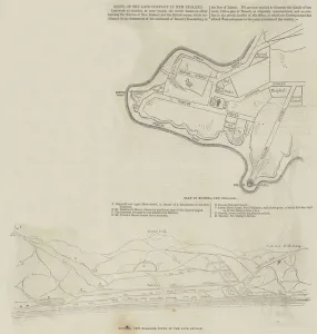
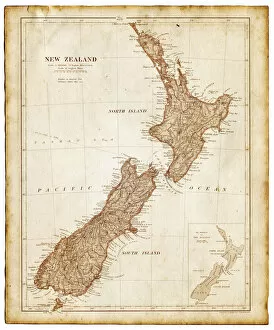
Background imageMaps Collection: Map of New Zealand 1897

Map of New Zealand 1897
Map of the city of Vienna

Background imageMaps Collection: map of australia, malaysia and polynesia

map of australia, malaysia and polynesia
old map of australia, malaysia and polynesia - 1883

Background imageMaps Collection: Old map of New Zealand and Tasmania 1899

Old map of New Zealand and Tasmania 1899 - combined with textures overlay

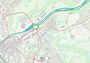
Background imageMaps Collection: Stockport SK1 2 Map

Stockport SK1 2 Map
Postcode Sector Map of Stockport SK1 2

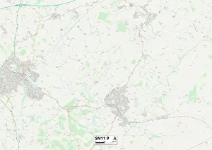
Background imageMaps Collection: Wiltshire SN11 9 Map

Wiltshire SN11 9 Map
Postcode Sector Map of Wiltshire SN11 9

Background imageMaps Collection: Havering RM13 8 Map

Havering RM13 8 Map
Postcode Sector Map of Havering RM13 8


All Professionally Made to Order for Quick Shipping


-

Maps Collection

Maps of New Zealand Oceania are a type of map that provide detailed information about the geography and culture of the region. These they are be used for a variety of purposes, including navigation, research, and education. They typically include physical features such as rivers, mountains, lakes, and coastlines; political boundaries; cities and towns; points of interest; roads and highways; airports; national parks; protected areas; cultural sites such as museums or monuments; and other features. Maps of New Zealand Oceania also often include information about local flora and fauna, climate zones, population density data, historical events or landmarks related to the region's history. With these maps in hand it is possible to explore this unique part of the world with greater understanding.
+

Our beautiful Wall Art and Photo Gifts include Framed Prints, Photo Prints, Poster Prints, Canvas Prints, Jigsaw Puzzles, Metal Prints and so much more

The Maps of New Zealand Oceania collection from Media Storehouse is a stunning assortment of wall art and framed prints that showcase the beauty and diversity of New Zealand's geography. Our collection features an array of maps, including topographical maps, vintage maps, and satellite images that capture the country's rugged coastlines, majestic mountains, lush forests, and sparkling lakes. Each print in our collection is expertly crafted using high-quality materials to ensure long-lasting durability and vibrant colors. Whether you're looking for a unique piece to add to your home decor or a thoughtful gift for someone special, these prints are sure to impress. From the iconic landmarks like Mount Cook National Park to lesser-known gems like Fiordland National Park, our collection offers something for everyone who loves exploring the natural wonders of New Zealand. With its breathtaking landscapes and rich cultural heritage, it's no wonder why so many people are drawn to this beautiful part of the world.
+

What are Maps of New Zealand Oceania art prints?

Maps of New Zealand Oceania art prints are high-quality reproductions of maps that depict the geography, topography, and landmarks of New Zealand and its surrounding islands in the Pacific Ocean. These prints are designed to be both informative and visually appealing, making them a popular choice for home decor or office spaces. The maps featured in these prints showcase the unique features of New Zealand's landscape, including its mountains, rivers, lakes, forests, and coastlines. They also highlight key cities and towns throughout the country as well as neighboring islands such as Fiji and Samoa. Whether you're a history buff looking to explore New Zealand's past or simply seeking an eye-catching piece of wall art for your home or office space, Maps of New Zealand Oceania art prints offer something for everyone. With their stunning detail and vibrant colors, they make a great addition to any collection.
+

What Maps of New Zealand Oceania art prints can I buy from Media Storehouse?

We offer a wide range of Maps of New Zealand Oceania art prints that are perfect for anyone who loves geography or wants to add some cultural flair to their home decor. These maps showcase the stunning landscapes, coastlines, and cities of New Zealand and its surrounding islands in intricate detail. You can choose from vintage-style maps that evoke a sense of nostalgia or modern designs with bold colors and typography. Some popular options include antique maps from the 19th century, topographical maps that highlight the country's natural features, and political maps that show borders and territories. Media Storehouse also offers customizable map prints where you can add your own text or markers to make it unique to your preferences. Whether you're looking for a gift for someone who loves travel or want to decorate your own space with beautiful artwork, we have plenty of Maps of New Zealand Oceania art prints to choose from.
+

How do I buy Maps of New Zealand Oceania art prints?

To buy Maps of New Zealand Oceania art prints from Media Storehouse, you can browse our extensive collection online. Simply search for the specific print or category that interests you and add it to your cart. Once you have selected all the items you wish to purchase, proceed to checkout where you will be prompted to enter your payment and shipping information. We offer a variety of payment options including credit card and PayPal. If you prefer not to shop online, Media Storehouse also has a customer service team available by phone who can assist with placing an order over the phone. Once your order is processed, Media Storehouse will carefully package your artwork and ship it directly to your chosen address. You can expect high-quality prints that are true-to-life representations of the original artwork. Whether as a gift or for personal use, Maps of New Zealand Oceania art prints from Media Storehouse are sure to impress any art lover or enthusiast.
+

How much do Maps of New Zealand Oceania art prints cost?

We offer a wide range of Maps of New Zealand Oceania art prints at various price points to suit different budgets. Our collection includes high-quality reproductions of antique maps as well as contemporary designs that showcase the beauty and diversity of this region. Each print is carefully crafted using premium materials and printing techniques to ensure maximum clarity, detail, and durability. We understand that our customers have different needs and preferences when it comes to art prints, which is why we offer a variety of sizes and framing options for our Maps of New Zealand Oceania collection. Whether you're looking for a small print to add some color to your home office or a large statement piece for your living room wall, we've got you covered. Our Maps of New Zealand Oceania art prints are an affordable way to bring some unique style and personality into your space while celebrating the rich history and culture of this fascinating part of the world.
+

How will my Maps of New Zealand Oceania art prints be delivered to me?

We take great care in delivering your Maps of New Zealand Oceania art prints to you. We use high-quality packaging materials that ensure the safety and protection of your artwork during transit. Your art prints will be carefully rolled and placed into a sturdy tube for delivery. We work with trusted courier services to deliver your order directly to your doorstep. Once dispatched, you will receive an email notification containing tracking information so that you can monitor the progress of your delivery. Our team is committed to providing exceptional customer service, and we are always available to answer any questions or concerns you may have about your order. If for any reason there are issues with the delivery of your Maps of New Zealand Oceania art prints, please do not hesitate to contact us so that we can resolve it as quickly as possible.