Fraud Blocker Skip to main content

Home > Oceania > Australia > Maps

Maps Collection (page 8)

Maps of Australia Oceania are a collection of detailed maps that provide an overview of the geographical features and terrain of the region

760 items

Background imageMaps Collection: Golt, Tucker, Bull, Aikens, Bragg and Paris, c. 1916 (b / w photo)

Golt, Tucker, Bull, Aikens, Bragg and Paris, c. 1916 (b / w photo)
1768690 Golt, Tucker, Bull, Aikens, Bragg and Paris, c.1916 (b/w photo) by English Photographer, (20th century); The Royal Institution, London, UK; (add.info.: Sound ranging team)

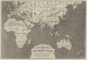
Background imageMaps Collection: Telegraph Map of the Eastern World (engraving)

Telegraph Map of the Eastern World (engraving)
1610430 Telegraph Map of the Eastern World (engraving) by Dower, John (fl.c.1845-55); Private Collection; (add.info.: Telegraph Map of the Eastern World)

Background imageMaps Collection: Map, The Commonwealth of Australia

Map, The Commonwealth of Australia. Date: circa 1900s

Background imageMaps Collection: Louis XVI of France giving his instructions to the Comte de Laperouse, 1785 (engraving)

Louis XVI of France giving his instructions to the Comte de Laperouse, 1785 (engraving)
972700 Louis XVI of France giving his instructions to the Comte de Laperouse, 1785 (engraving) by Monsiau, Nicolas Andre (1754-1837) (after); Private Collection; (add.info)

Background imageMaps Collection: Advert for Queensland, Australia

Advert for Queensland, Australia, a call for more people to live and work there. circa 1890

Background imageMaps Collection: The Direct Route to Australia (engraving)

The Direct Route to Australia (engraving)
1097207 The Direct Route to Australia (engraving) by English School, (19th century); Private Collection; (add.info.: The Direct Route to Australia)

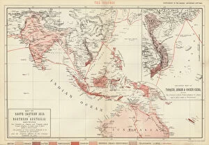
Background imageMaps Collection: Map of South-Eastern Asia and Northern Australia (colour litho)

Map of South-Eastern Asia and Northern Australia (colour litho)
726783 Map of South-Eastern Asia and Northern Australia (colour litho) by English School, (19th century); Private Collection; (add.info.: Map of South-Eastern Asia and Northern Australia)

Background imageMaps Collection: Composite Great Circle Sailing, New and Shorter Route to Australia (engraving)

Composite Great Circle Sailing, New and Shorter Route to Australia (engraving)
1612017 Composite Great Circle Sailing, New and Shorter Route to Australia (engraving) by English School, (19th century); Private Collection; (add.info.: Composite Great Circle Sailing)

Background imageMaps Collection: Map of the coast of New Zealand, illustration from

Map of the coast of New Zealand, illustration from
3610747 Map of the coast of New Zealand, illustration from A journal of a voyage to the South Seas : in His Majestys ship, the Endeavour, 1794 (hand-coloured engraving) by Parkinson

Background imageMaps Collection: Wool (colour litho)

Wool (colour litho)
3648633 Wool (colour litho) by English School, (20th century); Private Collection; (add.info.: Wool. Illustration for Atlas of the Worlds Commerce compiled from the latest official returns at)

Background imageMaps Collection: Part of South Australia, from a Series of World Maps published by John Tallis & Co

Part of South Australia, from a Series of World Maps published by John Tallis & Co
STC190604 Part of South Australia, from a Series of World Maps published by John Tallis & Co, New York & London, 1850s (engraving) by Rapkin

Background imageMaps Collection: Australia, from a Series of World Maps published by John Tallis & Co

Australia, from a Series of World Maps published by John Tallis & Co
STC190600 Australia, from a Series of World Maps published by John Tallis & Co. London & New York, 1850s (engraving) by Rapkin

Background imageMaps Collection: Isobars and Isohyets, Australia and South East Australia (colour litho)

Isobars and Isohyets, Australia and South East Australia (colour litho)
6015866 Isobars and Isohyets, Australia and South East Australia (colour litho) by English School, (19th century); Private Collection; (add.info.: Isobars and Isohyets)

Background imageMaps Collection: Map of the Eastern Hemisphere (coloured engraving)

Map of the Eastern Hemisphere (coloured engraving)
6014056 Map of the Eastern Hemisphere (coloured engraving) by American School, (19th century); Private Collection; (add.info.: Map of the Eastern Hemisphere)

Background imageMaps Collection: Map of the Americas, 1631 (coloured engraving)

Map of the Americas, 1631 (coloured engraving)
STC93603 Map of the Americas, 1631 (coloured engraving) by Hondius, Henricus (1597-1651); Private Collection; The Stapleton Collection; Dutch, out of copyright

Background imageMaps Collection: Portrait of Admiral Sir James Stirling (1791-1865), first Governor of Western Australia

Portrait of Admiral Sir James Stirling (1791-1865), first Governor of Western Australia
NSW71485 Portrait of Admiral Sir James Stirling (1791-1865), first Governor of Western Australia 1829-39, c.1833 by Anonymous; Mitchell Library, State Library of New South Wales; Mitchell Library

Background imageMaps Collection: General map extending from India and Ceylon to northwestern Australia by way of southern

General map extending from India and Ceylon to northwestern Australia by way of southern
BON111064 General map extending from India and Ceylon to northwestern Australia by way of southern Japan, the Philippines

Background imageMaps Collection: Map of the eastern hemisphere, illustration from A journal of a voyage to the South

Map of the eastern hemisphere, illustration from A journal of a voyage to the South
3610754 Map of the eastern hemisphere, illustration from A journal of a voyage to the South Seas : in His Majestys ship, the Endeavour, 1794 (hand-coloured engraving) by Parkinson

Background imageMaps Collection: Map of the western hemisphere, illustration from A journal of a voyage to the South

Map of the western hemisphere, illustration from A journal of a voyage to the South
3610752 Map of the western hemisphere, illustration from A journal of a voyage to the South Seas : in His Majestys ship, the Endeavour, 1794 (hand-coloured engraving) by Parkinson

Background imageMaps Collection: Early English terrestrial globe, c. 1673 (engraving, brass, walnut & oak)

Early English terrestrial globe, c. 1673 (engraving, brass, walnut & oak)
3482897 Early English terrestrial globe, c.1673 (engraving, brass, walnut & oak) by Berry, William (1639-1718) & Morden, Robert (c.1650-1703); height: 53 cm; Private Collection; (add.info)

Background imageMaps Collection: New Zealand, Australia and the Pacific (colour litho)

New Zealand, Australia and the Pacific (colour litho)
5996923 New Zealand, Australia and the Pacific (colour litho) by English School, (20th century); Private Collection; (add.info.: New Zealand, Australia and the Pacific)

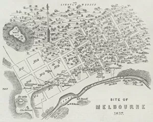
Background imageMaps Collection: Site of Melbourne, 1837 (engraving)

Site of Melbourne, 1837 (engraving)
1608354 Site of Melbourne, 1837 (engraving) by English School, (19th century); Private Collection; (add.info.: Site of Melbourne, 1837. Illustration for The Illustrated London News, 24 November 1855)

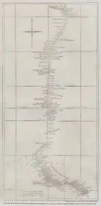
Background imageMaps Collection: The Route of Burke and Wills across the Continent of Australia from Coopers Creek to the Gulf of

The Route of Burke and Wills across the Continent of Australia from Coopers Creek to the Gulf of Carpentaria (engraving)
1620141 The Route of Burke and Wills across the Continent of Australia from Coopers Creek to the Gulf of Carpentaria (engraving) by Dower

Background imageMaps Collection: Gold in Australia, Port Phillip District (engraving)

Gold in Australia, Port Phillip District (engraving)
1607487 Gold in Australia, Port Phillip District (engraving) by English School, (19th century); Private Collection; (add.info.: Gold in Australia, Port Phillip District)

Background imageMaps Collection: A game of maps around a campfire in Queenslaw, Australia

A game of maps around a campfire in Queenslaw, Australia
LSE4085455 A game of maps around a campfire in Queenslaw, Australia. by Unknown Artist, (19th century); Bibliotheque des Arts Decoratifs, Paris

Background imageMaps Collection: A practical demonstration (b / w photo)

A practical demonstration (b / w photo)
3651749 A practical demonstration (b/w photo) by English Photographer, (20th century); Private Collection; (add.info.: A practical demonstration)

Background imageMaps Collection: Map of the southern hemisphere of the world, 1708 (etching, 1717)

Map of the southern hemisphere of the world, 1708 (etching, 1717)
LRI4711137 Map of the southern hemisphere of the world, 1708 (etching, 1717) by Nolin, Jean-Baptiste (c.1657-1708); Private Collection; (add.info.: Map of the southern hemisphere of the world)

Background imageMaps Collection: John Pinkertons map of Australia and the South West Pacific, 1818 (colour engraving)

John Pinkertons map of Australia and the South West Pacific, 1818 (colour engraving)
696806 John Pinkertons map of Australia and the South West Pacific, 1818 (colour engraving) by Pinkerton, E. J. (fl.1844); Private Collection; (add.info)

Background imageMaps Collection: India Quae Orientalis Dicitur, Et Insulae Adiacentes, map showing South-East Asia

India Quae Orientalis Dicitur, Et Insulae Adiacentes, map showing South-East Asia
BON93408 India Quae Orientalis Dicitur, Et Insulae Adiacentes, map showing South-East Asia and The East Indies, published, Amsterdam, c.1635 (hand-coloured engraving) by Blaeu

Background imageMaps Collection: Illustrations of Australia and Polynesia, from a geography book (colour litho)

Illustrations of Australia and Polynesia, from a geography book (colour litho)
CHT197186 Illustrations of Australia and Polynesia, from a geography book (colour litho) by English School, (19th century); Private Collection; (add.info)

Background imageMaps Collection: Plan of Sydney with Pyrmont, New South Wales, the latter the Property of Edward

Plan of Sydney with Pyrmont, New South Wales, the latter the Property of Edward
STC195053 Plan of Sydney with Pyrmont, New South Wales, the latter the Property of Edward Macarthure Esquire Divided into Allotments for Building, 1836, published by James & Luke G

Background imageMaps Collection: Gold, mining countries (colour litho)

Gold, mining countries (colour litho)
3648659 Gold, mining countries (colour litho) by English School, (20th century); Private Collection; (add.info.: Gold, mining countries)

Background imageMaps Collection: Australia (chromolitho)

Australia (chromolitho)
3656913 Australia (chromolitho) by American School, (19th century); Private Collection; (add.info.: Australia. Illustration for trade card)

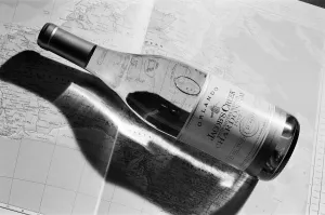
Background imageMaps Collection: Bottle of White Wine, Orlando, Jacobs Creek, South Eastern Australia Chardonnay 1992

Bottle of White Wine, Orlando, Jacobs Creek, South Eastern Australia Chardonnay 1992

Background imageMaps Collection: Scouts tune in for the jamboree. Huddersfield scouts took part in a worldwide

Scouts tune in for the jamboree. Huddersfield scouts took part in a worldwide jamboree ? on the radio. Mr Tony Barr, of Denby Dale Amateur Radio Club

Background imageMaps Collection: Winds - Map of the world 1861

Winds - Map of the world 1861
Map of the world - Winds over the globe - storms and hurricanes

Background imageMaps Collection: the world 1877

the world 1877
antique map of the world - 1877

Background imageMaps Collection: map of the world 1814

map of the world 1814
antique map showing the world with all the latest discovery of 1814

Background imageMaps Collection: old map of australia - australasia

old map of australia - australasia
an old australasia map with the principal islands of malaysa map (1865) - sepia vintage colors

Background imageMaps Collection: Map of Oceania 1884

Map of Oceania 1884

Background imageMaps Collection: map of australia, malaysia and polynesia

map of australia, malaysia and polynesia
old map of australia, malaysia and polynesia - 1883

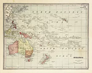
Background imageMaps Collection: Map of Oceania Australia 1899

Map of Oceania Australia 1899
Maurys Geographical Series Manual of Geography - New York 1899

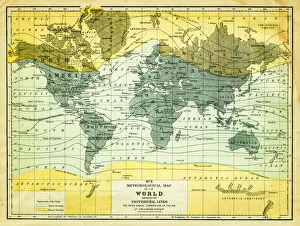
Background imageMaps Collection: map of the world 1867

map of the world 1867
meteorological map of the world 1867 - showing isothermal lines

Background imageMaps Collection: Map of the world 1861

Map of the world 1861
Map of the world - The distribution of Earthquakes and Volcanoes over the globe

Background imageMaps Collection: Animals - Map of the world 1861

Animals - Map of the world 1861
Map of the world - The distributions of animals

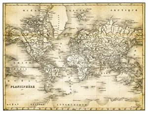
Background imageMaps Collection: map of the world 1873

map of the world 1873
antique map of the world - from a french atlas - 1872

Background imageMaps Collection: Climate map of the world 1861

Climate map of the world 1861
Map of the world - Climatological Chart

Background imageMaps Collection: map of the world 1855

map of the world 1855
map of the world illustrating the principal features of the land and the co-tidal lines - 1855


All Professionally Made to Order for Quick Shipping


-

Maps Collection

Maps of Australia Oceania are a collection of detailed maps that provide an overview of the geographical features and terrain of the region. The maps cover a wide range of topics, including physical features, political boundaries, population density, climate zones, and more. They also include information on major cities and towns as well as roads and transportation networks. They can available in both digital and print formats for easy access to anyone interested in exploring the region. With their comprehensive coverage and detailed information, Maps of Australia Oceania can be used for research or planning trips to the area.
+

Our beautiful pictures are available as Framed Prints, Photos, Wall Art and Photo Gifts

The Maps of Australia Oceania collection from Media Storehouse is a stunning array of wall art and framed prints that showcase the beauty and diversity of this region. Our collection features an extensive range of maps, including vintage maps, topographical maps, political maps, and satellite images. These high-quality prints are available in a variety of sizes to suit any space or decor style. One standout feature of the Maps of Australia Oceania collection is its attention to detail. Each map is carefully selected for its accuracy and visual appeal, making it an ideal choice for both educational purposes and home decor. Whether you're looking to add some color to your living room or want to create a focal point in your office, these prints are sure to impress. The Maps of Australia Oceania collection offers something for everyone with its vast selection and exceptional quality. It's no wonder that these prints have become a popular choice among art lovers and geography enthusiasts alike.
+

What are Maps of Australia Oceania art prints?

Maps of Australia Oceania art prints are a collection of high-quality, visually stunning maps that showcase the geography and topography of the region. These prints are perfect for anyone who wants to add a touch of sophistication and style to their home or office decor. They feature detailed depictions of the landmasses, waterways, cities, towns, and other important landmarks in Australia and Oceania. These art prints come in various sizes and formats such as canvas prints, framed prints, poster prints among others. They are printed on premium quality paper using state-of-the-art printing technology that ensures vibrant colors and sharp details. The Maps of Australia Oceania art print collection is ideal for travel enthusiasts who want to commemorate their travels or anyone looking to decorate their space with unique wall art. These maps offer an excellent way to explore the beauty and diversity of this fascinating part of the world while adding a touch of elegance to your living space.
+

What Maps of Australia Oceania art prints can I buy from Media Storehouse?

We offer a wide range of Maps of Australia Oceania art prints that are perfect for those who love geography and history. You can choose from a variety of maps, including antique maps, topographical maps, political maps, and satellite images. These art prints showcase the beauty and diversity of Australia Oceania's landscapes and provide an insight into its rich cultural heritage. Whether you're looking for a map to decorate your home or office or as a gift for someone special, we have something to suit every taste and budget. The art prints are available in different sizes and formats, such as canvas prints, framed prints, metal prints, or photographic paper. Some popular choices include vintage-style world maps with intricate details of the region's flora and fauna; colorful political maps highlighting each country's borders; detailed topographic maps showing mountain ranges, rivers, lakes; satellite images capturing stunning aerial views of cities like Sydney or Auckland. Overall We provide an extensive collection that will satisfy any cartography enthusiast.
+

How do I buy Maps of Australia Oceania art prints?

To buy Maps of Australia Oceania art prints from Media Storehouse, you can browse our collection online and select the print that catches your eye. Once you have found the perfect piece, simply add it to your cart and proceed to checkout. During the checkout process, you will be prompted to enter your shipping and payment information. After completing these steps, your order will be processed and shipped directly to you. We offer a wide variety of maps of Australia Oceania art prints in different sizes and styles, so there is something for everyone's taste. Whether you are looking for vintage or modern designs, colorful or monochromatic options, they have it all. Their high-quality printing ensures that each map looks stunning on any wall in your home or office. With easy ordering and fast delivery times available worldwide, buying Maps of Australia Oceania art prints from Media Storehouse is a hassle-free experience that will bring joy to any space.
+

How much do Maps of Australia Oceania art prints cost?

We offer a wide range of Maps of Australia Oceania art prints that vary in price depending on the size and type of print. Our collection includes vintage maps, contemporary designs, and artistic interpretations of the region. We strive to provide high-quality prints at affordable prices so that everyone can enjoy beautiful artwork in their homes or offices. Our selection includes various sizes ranging from small to large prints suitable for any space. We also offer different types of paper finishes such as matte, gloss, or satin to suit your preferences. Whether you're looking for a gift or something to enhance your decor, our Maps of Australia Oceania art prints are an excellent choice. Please note that prices may vary depending on the specific print you choose and other factors such as framing options. However, we aim to keep our prices competitive while maintaining quality standards across all products offered through Media Storehouse.
+

How will my Maps of Australia Oceania art prints be delivered to me?

We take great care in delivering your Maps of Australia Oceania art prints to you. We use high-quality packaging materials to ensure that your artwork arrives safely and securely. Your print will be carefully rolled and placed into a sturdy cardboard tube for protection during transit. We work with trusted courier services to deliver your order directly to your doorstep. Once dispatched, you will receive an email notification with tracking information so that you can monitor the progress of your delivery. Our team is dedicated to providing excellent customer service, so if you have any questions or concerns about the delivery of your Maps of Australia Oceania art prints, please do not hesitate to contact us. We are always happy to help and ensure that our customers receive their orders in a timely manner and in perfect condition.