Home > Asia > Malaysia > Maps
GASI2A-00005

![]()
Wall Art and Photo Gifts from North Wind
GASI2A-00005
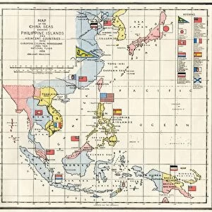
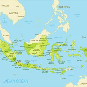
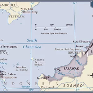
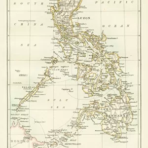
Map of Asia, circa 1870.
Printed color lithograph, 19th century
North Wind Picture Archives brings history to life with stock images and hand-colored illustrations
Media ID 5881455
© North Wind Picture Archives
1870s Asia Asia Minor Asian British Empire China Colonialism Imperialism India Indian Ocean Indonesia Island Japan Java Mid East Middle East Philippines Russia Siberia Southeast Asia Arabian Sea Bay Of Bengal Borneo French Indochina Pacific Islands Philippine Islands South China Sea
FEATURES IN THESE COLLECTIONS
> Asia
> Philippines
> Maps
> Maps and Charts
> British Empire Maps
> Maps and Charts
> India
> North Wind Picture Archives
> India & Asia
EDITORS COMMENTS
This print titled "GASI2A-00005 (Map of Asia, circa 1870)" takes us on a journey back in time to the late 19th century. The image showcases a beautifully detailed map of Asia, highlighting the intricate web of political and geographical boundaries that defined the region during this era. Printed using vibrant colors through lithography, this vintage piece offers a glimpse into an age marked by imperialism and colonialism. It depicts major Asian powers such as China, Russia, and Japan alongside various European empires vying for influence across the continent. The illustration encompasses not only mainland territories but also numerous islands scattered throughout the Indian Ocean and South China Sea. From India to Indonesia, from Siberia to Malaysia, it captures the diverse tapestry of cultures and histories that have shaped Asia over centuries. As we examine this historic artifact closely, we can appreciate its significance in understanding past geopolitical dynamics. It serves as a visual testament to how nations expanded their dominions while also shedding light on trade routes and strategic locations that played crucial roles in shaping world history. With its meticulous attention to detail and evocative artistic style, this artwork transports us back to an era where exploration was rife and global powers sought dominance over vast lands. It stands as both an educational tool for historians and art enthusiasts alike—a tangible reminder of our collective past etched onto paper with utmost precision.
MADE IN THE USA
Safe Shipping with 30 Day Money Back Guarantee
FREE PERSONALISATION*
We are proud to offer a range of customisation features including Personalised Captions, Color Filters and Picture Zoom Tools
SECURE PAYMENTS
We happily accept a wide range of payment options so you can pay for the things you need in the way that is most convenient for you
* Options may vary by product and licensing agreement. Zoomed Pictures can be adjusted in the Cart.