Fraud Blocker Skip to main content

Home > North America > Mexico > Maps

Maps Collection (page 5)

Maps of Mexico North America are a type of map that shows the geographical features and boundaries of Mexico, as well as its neighbouring countries

406 items

Background imageMaps Collection: Mexico, Quintana Roo, Coba

Mexico, Quintana Roo, Coba, The Nohoch Pyramid

Background imageMaps Collection: Cornwall TR27 5 Map

Cornwall TR27 5 Map
Postcode Sector Map of Cornwall TR27 5

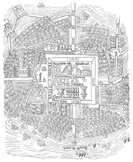
Background imageMaps Collection: City map of Mexico and the Menagerie de Montezuma 1524

City map of Mexico and the Menagerie de Montezuma 1524

Background imageMaps Collection: Map of Mexico and Outlines of Mexico City

Map of Mexico and Outlines of Mexico City
Antique Maps, TR002306

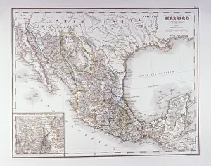
Background imageMaps Collection: Map of Mexico and Central America 1900

Map of Mexico and Central America 1900
Meyers hand-Atlas Leipzig und Wien Verlag des Bibliographischen Instituts 1900

Background imageMaps Collection: Historical map of Mexico, lithograph, published in 1897

Historical map of Mexico, lithograph, published in 1897
Historical map of Mexico. Lithograph, published in 1897

Background imageMaps Collection: Map of Mexico, 1902. Creator: Unknown

Map of Mexico, 1902. Creator: Unknown
Map of Mexico, 1902. Showing Guatemala and British Honduras, with inset of Mexico City. From The Century Atlas of the World. [John Walker & Co, Ltd. London, 1902]

Background imageMaps Collection: Political map of North America

Political map of North America. Map showing Canada, the United States, Mexico, the Caribbean and Central America. Plate 80 from The Times Atlas

Background imageMaps Collection: Map of Mexico and Central America

Map of Mexico and Central America. Map showing Baja California, Mexico and the Yucatan peninsula, Plate 95 from The Times Atlas

Background imageMaps Collection: Geographical map of the West Indies

Geographical map of the West Indies. Map of the Caribbean, showing the Isthmus of Panama, the north coast of South America, the Greater Antilles, and various other islands

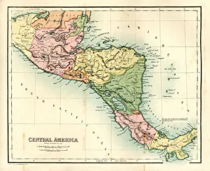
Background imageMaps Collection: Antique map - Central America

Antique map - Central America
Antique map of Central America, 1864

Background imageMaps Collection: Map of Mexico and West Indies 1889

Map of Mexico and West Indies 1889
Comprehensive Geography by James Monteith - American Book Company 1882, 1889

Background imageMaps Collection: 2685219

2685219

Background imageMaps Collection: 2685217

2685217

Background imageMaps Collection: Map of Tenochtitlan, Mexico, 1560, in the work General Islands of the World, by

Map of Tenochtitlan, Mexico, 1560, in the work General Islands of the World, by the chronicler and cosmographer Alonso de Santa Cruz

Background imageMaps Collection: Aztec god Xiuhtecuhtli. The Codex Fejervary-Mayer, 15th century. Artist: Pre-Columbian art
Aztec god Xiuhtecuhtli. The Codex Fejervary-Mayer, 15th century. Artist: Pre-Columbian art
Aztec god Xiuhtecuhtli. The Codex Fejervary-Mayer, 15th century. Found in the collection of World Museum Liverpool

Background imageMaps Collection: Aztec Calendar, Between 1655 and 1660. Artist: Pre-Columbian art

Aztec Calendar, Between 1655 and 1660. Artist: Pre-Columbian art
Aztec Calendar, Between 1655 and 1660. Found in the collection of Museo Nacional de Antropologia, Mexico

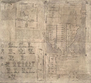
Background imageMaps Collection: Aztec Oztoticpac map, c. 1540. Artist: Pre-Columbian art

Aztec Oztoticpac map, c. 1540. Artist: Pre-Columbian art
Aztec Oztoticpac map, c.1540. Found in the collection of Museo Nacional de Antropologia, Mexico

Background imageMaps Collection: Map of The United States of America, c1910. Artist: Gull Engraving Company

Map of The United States of America, c1910. Artist: Gull Engraving Company
Map of The United States of America, c1910. [Encyclopaedia Britannica Co]

Background imageMaps Collection: Map of Texas, USA, c1910s. Artist: Emery Walker Ltd

Map of Texas, USA, c1910s. Artist: Emery Walker Ltd
Map of Texas, USA, c1910s

Background imageMaps Collection: Mexico

Mexico. Detailed and scaled map of Mexico with geographical features and place names

Background imageMaps Collection: Map of the West Indies, 18th century(?). Artist: Barlow

Map of the West Indies, 18th century(?). Artist: Barlow
Map of the West Indies, 18th century(?)

Background imageMaps Collection: A map of the West Indies, 1808. Artist: C Smith

A map of the West Indies, 1808. Artist: C Smith
A map of the West Indies, 1808

Background imageMaps Collection: A map of St Lucia, the West Indies, 1758. Artist: N Bellun

A map of St Lucia, the West Indies, 1758. Artist: N Bellun
A map of St Lucia, the West Indies, 1758

Background imageMaps Collection: Map of North America

Map of North America. Hand-coloured later

Background imageMaps Collection: City of Veracruz, Mexico, 17th century

City of Veracruz, Mexico, 17th century. Detail from a map of the city which lies on the Caribbean, on the east coast of Mexico

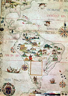
Background imageMaps Collection: French Map of Central and South America, French, 1550

French Map of Central and South America, French, 1550. Map showing Florida, the Gulf of Mexico, the Caribbean islands and Antilles, and South America with the River Plate prominent

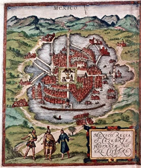
Background imageMaps Collection: Mexico City in the early 16th century

Mexico City in the early 16th century. Depiction probably based on a sketch in the conquistador Hernan Cortes book of 1524. From the British Museum

Background imageMaps Collection: Map of Mexico and West Indies 1877

Map of Mexico and West Indies 1877
Warrens Common School Geography 1877

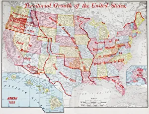
Background imageMaps Collection: Map from 1898 showing the territorial growth of the United States of America

Map from 1898 showing the territorial growth of the United States of America. From The History of Our Country, published 1900

Background imageMaps Collection: MEXICO

MEXICO
Mexico Cartoon map

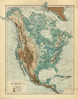
Background imageMaps Collection: North America Physical Map, Engraving, 1892

North America Physical Map, Engraving, 1892
Very rare, beautifully detailed engraving of North America Physical Map, Engraving, Published in 1892. Original edition from my own archives. Copyright has expired on this artwork. Digitally restored

Background imageMaps Collection: United States in 1825

United States in 1825
Map of the United States and Unorganized Public Lands in 1825. Printed color lithograph

Background imageMaps Collection: Map Central America Caribbean Islands Gulf Of Mexico

Map Central America Caribbean Islands Gulf Of Mexico
Map of Central America and the Caribbean islands. Published by Johannes Janssonius, Amsterdam, circa 1650

Background imageMaps Collection: Old chromolithograph map of the United States and Mexico

Old chromolithograph map of the United States and Mexico
Antique Illustration. Copyright has expired on this artwork. From my own archives, digitally restored

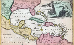
Background imageMaps Collection: 18th century map of Central America and the Gulf of Mexico engraved by Balthasar Ruyter

18th century map of Central America and the Gulf of Mexico engraved by Balthasar Ruyter

Background imageMaps Collection: Mississippi River Delta, Louisiana, Usa, True Colour Satellite Image

Mississippi River Delta, Louisiana, Usa, True Colour Satellite Image. True colour satellite image of the Mississippi River Delta

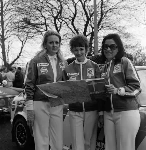
Background imageMaps Collection: 1970 London to Mexico World Cup Rally. The motor rally started at Wembley Stadium in

1970 London to Mexico World Cup Rally. The motor rally started at Wembley Stadium in London on 19 April 1970 and finished in Mexico City on 27 May 1970, covering approximately 16, 000 miles

Background imageMaps Collection: Victorian Map of North America

Victorian Map of North America
Engraved illustrations of the Theory of the Art of Drawing from Iconographic Encyclopedia of Science, Literature and Art, Published in 1851. Copyright has expired on this artwork. Digitally restored

Background imageMaps Collection: Map Kaart van de onderkoningschappen van Mexico en Nieuw Granada

Map Kaart van de onderkoningschappen van Mexico en Nieuw Granada
Map, Kaart van de onderkoningschappen van Mexico en Nieuw Granada in de Spaansche West-Indien, Copperplate print

Background imageMaps Collection: Map De Golf van Mexico de eilanden en het omleggende land

Map De Golf van Mexico de eilanden en het omleggende land
Map, De Golf van Mexico, de eilanden en het omleggende land, Copperplate print

Background imageMaps Collection: Pass card part Gulf Mexico west coast Florida Pass card

Pass card part Gulf Mexico west coast Florida Pass card
Pass card of part of the Gulf of Mexico, with the west coast of Florida Pass card of the Boght of Florida with the Canal between Florida and Cuba

Background imageMaps Collection: Map Mexico City Delle navigationi et viaggi Ramusio

Map Mexico City Delle navigationi et viaggi Ramusio
Map of Mexico City, Delle navigationi et viaggi, Ramusio, Giovanni Battista, 1485-1557, Woodcut, 1606

Background imageMaps Collection: Map Of The West Indies And The Mexican Gulf, Circa. 1760. From 'Atlas De Toutes Les Parties

Map Of The West Indies And The Mexican Gulf, Circa. 1760. From "Atlas De Toutes Les Parties Connues Du Globe
Map Of The West Indies And The Mexican Gulf, Circa.1760. From " Atlas De Toutes Les Parties Connues Du Globe Terrestre " By Cartographer Rigobert Bonne. Published Geneva Circa. 1760

Background imageMaps Collection: Map Of Southern Mexico, Circa. 1760. From 'Atlas De Toutes Les Parties Connues Du Globe Terrestre

Map Of Southern Mexico, Circa. 1760. From "Atlas De Toutes Les Parties Connues Du Globe Terrestre "By
Map Of Southern Mexico, Circa.1760. From " Atlas De Toutes Les Parties Connues Du Globe Terrestre " By Cartographer Rigobert Bonne. Published Geneva Circa. 1760

Background imageMaps Collection: Globe of earth in space centred on North America

Globe of earth in space centred on North America
Globe Of Earth In Space Centered On The North America

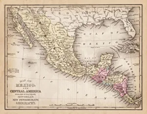
Background imageMaps Collection: Map of Mexico and central america 1881

Map of Mexico and central america 1881
A System of Modern Geography designed for the use of schools and academies by Augustus Mitchell - Published by T. H. Butler / Philadelphia 1881

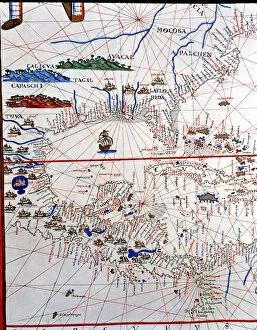
Background imageMaps Collection: Atlas of Joan Martines, Messina, 1582. Portulan chart of Central America, Caribbean

Atlas of Joan Martines, Messina, 1582. Portulan chart of Central America, Caribbean, Florida, Georgia and the Gulf of Mexico


All Professionally Made to Order for Quick Shipping


-

Maps Collection

Maps of Mexico North America are a type of map that shows the geographical features and boundaries of Mexico, as well as its neighbouring countries. These they can typically used for navigation, planning trips, and understanding the political divisions within the region. They are be printed or digital versions, depending on the user’s preference. They often include major cities and towns in Mexico along with their population numbers, roads and highways, rivers and lakes, mountains and other physical features. Additionally they may show national parks or protected areas in Mexico as well as international borders between countries. Maps of Mexico North America can be found online or purchased from map stores around the world.
+

Our beautiful pictures are available as Framed Prints, Photos, Wall Art and Photo Gifts

The Maps of Mexico North America collection from Media Storehouse offers a wide range of wall art and framed prints that showcase the rich history and geography of Mexico. Our collection features an extensive selection of maps, including antique maps dating back to the 16th century, as well as modern-day topographical maps. These high-quality prints are perfect for anyone interested in Mexican culture or history. They make great additions to any home space, adding a touch of sophistication and elegance to any room. Whether you're looking for a vintage map of Mexico City or a detailed topographical map of the Yucatan Peninsula, our collection has something for everyone. Each print is carefully crafted using only the highest quality materials, ensuring that they will last for years to come. If you're looking for beautiful and informative wall art that celebrates the beauty and diversity of Mexico's landscape and history, then look no further than our Maps of Mexico North America collection.
+

What are Maps of Mexico North America art prints?

Maps of Mexico North America art prints are high-quality reproductions of maps that depict the geography and topography of Mexico and North America. These prints showcase detailed illustrations, accurate cartography, and vibrant colors that make them perfect for display in homes, offices, or educational institutions. These art prints come in a variety of sizes to suit different needs and preferences. They can be framed or mounted on walls as standalone pieces or combined with other artworks to create a stunning gallery wall. Maps of Mexico North America art prints are also great gifts for history buffs, travelers, students, or anyone interested in exploring the world through art. Whether you're looking for vintage maps from centuries ago or contemporary depictions of modern-day cities and landmarks, we offer an extensive collection of Maps of Mexico North America art prints to choose from. Each print is made using premium materials and printing techniques to ensure long-lasting quality and durability.
+

What Maps of Mexico North America art prints can I buy from Media Storehouse?

We offer a wide range of Maps of Mexico North America art prints that are perfect for home or office decor. You can choose from vintage, antique, and modern maps that showcase the geography, topography, and political boundaries of Mexico and North America. These maps come in various sizes and styles to suit your preferences. Some popular options include the 1847 Mapa de los Estados Unidos Mexicanos by John Disturnell, which features detailed illustrations of cities, rivers, mountains, and landmarks; the 1922 Mapa Fisico y Politico de la Republica Mexicana by Antonio Garcia Cubas that shows the physical features and administrative divisions of Mexico; and the colorful Satellite Image Map of North America that displays satellite imagery with borders marked. Whether you're a history buff or simply appreciate beautiful cartography artwork, we have something for everyone. Browse our collection today to find your perfect Maps of Mexico North America art print.
+

How do I buy Maps of Mexico North America art prints?

To purchase Maps of Mexico North America art prints from Media Storehouse, you can browse our collection online and select the print that catches your eye. Once you have found the desired artwork, click on it to view its details and choose the size and framing options if available. Then add it to your cart and proceed to checkout by filling in your shipping information and payment details. We offer a variety of payment methods including credit cards, PayPal, Apple Pay, Google Pay, among others. They also provide secure transactions for all purchases made through their website. If you encounter any issues during the buying process or have questions about their products or services, we have a customer support team ready to assist you via email or phone. Purchasing Maps of Mexico North America art prints from Media Storehouse is an easy process that involves browsing their selection online, selecting your preferred print with optional framing choices before proceeding to checkout using one of several secure payment methods.
+

How much do Maps of Mexico North America art prints cost?

Maps of Mexico North America art prints are available in a variety of sizes and styles, so the cost can vary depending on your preferences. Generally speaking, smaller prints will be less expensive than larger ones. Additionally, some prints may be more detailed or feature higher-quality materials, which can also affect the price. It's important to note that Maps of Mexico North America art prints are not just functional tools for navigation - they're also beautiful pieces of artwork that can add color and interest to any room in your home or office. Whether you're looking for a vintage-style map with muted colors or a modern print with bold graphics, there's sure to be an option that suits your taste and budget. The cost of Maps of Mexico North America art prints is reasonable given their quality and versatility as both decorative items and useful references.
+

How will my Maps of Mexico North America art prints be delivered to me?

Your Maps of Mexico North America art prints will be delivered to you securely and safely. The prints are carefully packaged to ensure that they arrive in perfect condition. They are usually shipped rolled up in a sturdy cardboard tube, which protects them from any damage during transit. The delivery process is handled by reliable shipping companies who have experience in handling delicate items such as art prints. You can expect your package to be tracked so that you can monitor its progress until it arrives at your doorstep. Once the package has been delivered, simply unroll the print and display it as desired. Whether you choose to frame it or hang it on its own, your Maps of Mexico North America art print is sure to add a touch of sophistication and style to any room. Media Storehouse takes great care in ensuring that your order is fulfilled promptly and efficiently while maintaining the highest standards of quality throughout the entire process.