Fraud Blocker Skip to main content

Home > Europe > United Kingdom > Wales > Maps

Viking Britain Map

 : Viking Britain Map
Sold 32
In Stock
We accept all major payment options so you can pay for the things you need in the way that is most convenient for you

Choose Your Product


Mary Evans Picture Library Photo Prints and Wall Art

Viking Britain Map

A map of the British Isles (including Ireland) during the time of the Vikings. Mary Evans Picture Library makes available wonderful images created for people to enjoy over the centuries. © Mary Evans Picture Library 2015 - https://copyrighthub.org/s0/hub1/creation/maryevans/MaryEvansPictureID/10168008

Media ID 4323434

10th Centuries Counties Including Isles Maps Scot Land Viking Vikings

FEATURES IN THESE COLLECTIONS

> Europe > Republic of Ireland > Maps

> Europe > United Kingdom > England > Maps

> Europe > United Kingdom > Wales > Maps

> Europe > United Kingdom > Wales > Posters

> Europe > United Kingdom > Wales > Related Images

> Maps and Charts > Early Maps

> Maps and Charts > Ireland

> Maps and Charts > Wales

> Popular Themes > Maps and Charts

SECURE PAYMENTS
We accept all major payment options so you can pay for the things you need in the way that is most convenient for you

Made in USA
Safe Shipping, Easy Returns

FREE PERSONALISATION
We are proud to offer a range of customisation including Cropping, Captions, and Filters. Zoom Cropping can be adjusted in the basket


EDITORS COMMENTS

Step back in time and explore the intriguing world of Viking Britain and Ireland, as depicted in this map from the 9th and 10th centuries. This historical cartographic representation illustrates the extent of Viking influence and settlements across the British Isles during this dynamic period in European history. The map encompasses the entirety of Britain, including England, Wales, Scotland, and Ireland. The intricate detailing reveals the division of territories into various counties, showcasing the political and cultural landscape of the time. The map also highlights the strategic locations of significant Viking settlements, such as Dublin, York, and Lindisfarne, providing a visual representation of the extensive reach of Viking explorers and conquerors. The map's creation during the late Viking Age, around the 10th century, offers a unique insight into the geographical knowledge and cartographic skills of the time. The map's accuracy is a testament to the advanced navigational abilities of the Vikings, who traveled vast distances across the North Sea and Atlantic Ocean, establishing trade networks and settlements. The map serves as a powerful reminder of the profound impact the Vikings had on the British Isles during the late medieval period. Their influence is evident in the language, art, architecture, and genealogy of the region, making this map an essential resource for students of history, archaeology, and cultural studies. This stunning print, brought to you by Mary Evans Prints Online, offers a glimpse into the rich tapestry of history that continues to captivate and inspire us. Let this map transport you to a time of adventure, exploration, and cultural exchange as you delve deeper into the fascinating history of Viking Britain and Ireland.


Framed Prints of Viking Britain Map

Discover the rich history of Viking Britain with our stunning Framed Prints from Media Storehouse. This captivating map, titled "Viking Britain," is brought to you by Rights Managed from Mary Evans Prints Online. It provides a fascinating insight into the British Isles during the Viking era, showcasing the extent of their reach and influence. Each print is meticulously framed with care, enhancing the intricate details of the map and adding a touch of history to your space. Bring the past to life with this beautifully presented Framed Print from Media Storehouse.


Photo Prints of Viking Britain Map

Discover the rich history of Viking Britain with our stunning photographic print from Media Storehouse, in partnership with Mary Evans Prints Online. This captivating image showcases an intricately detailed map of the British Isles and Ireland during the Viking era. Bring history to life in your home or office, and transport yourself back in time as you explore the fascinating world of the Vikings. Our high-quality photographic prints are perfect for history enthusiasts, educators, or anyone looking to add a touch of culture and sophistication to their space. Order yours today and start your journey into the past.


Poster Prints of Viking Britain Map

Discover the rich history of Viking Britain with our stunning poster prints from Media Storehouse. This captivating map, sourced from Mary Evans Prints Online, illustrates the British Isles and Ireland during the Viking era. Bring the past to life in your home or office with this intricately detailed and historically accurate representation of Viking Britain. Our high-quality poster prints are perfect for history enthusiasts, educators, or anyone with a passion for the past. Order now and transport yourself back in time.


Jigsaw Puzzles of Viking Britain Map

Discover the rich history of Viking Britain with our captivating jigsaw puzzle from Media Storehouse. This intricately detailed puzzle features an authentic map of the British Isles and Ireland during the Viking era, sourced from Mary Evans Prints Online. Immerse yourself in the world of the Vikings as you piece together this intricate puzzle, revealing the intricate details of ancient trade routes, settlements, and territories. A perfect addition to any home or classroom, this challenging yet rewarding puzzle is a must-have for history enthusiasts and puzzle lovers alike. Unleash your inner explorer and embark on an exciting journey through time with Media Storehouse's Viking Britain Map puzzle.

diamond
Made With High Grade Materials
thumb_up
Professional Quality Finish
package_2
Carefully Packed To Aid Safe Arrival

You May Also Like


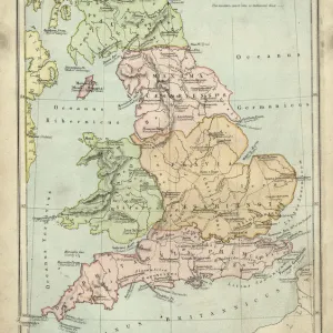
Antique map of Britain under the Ancient RomansAntique map of Britain under the Ancient Romans
Add to Basket
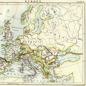
Map of Europe under the Roman EmpireMap of Europe under the Roman Empire
Add to Basket
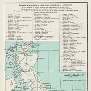
VIKING MAPVIKING MAP
Add to Basket
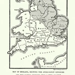
Map of Anglo-Saxon Kingdoms and the Danelaw, 9th CenturyMap of Anglo-Saxon Kingdoms and the Danelaw, 9th Century
Add to Basket
The Hereford Mappa Mundi of 1280 - Jerusalem is at the centerThe Hereford Mappa Mundi of 1280 - Jerusalem is at the center
Add to Basket
Bayeux Tapestry. 1066-1077. Scene of the BattleBayeux Tapestry. 1066-1077. Scene of the Battle
Add to Basket
Flat Earth map of the world showing it to be a planeFlat Earth map of the world showing it to be a plane
Add to Basket
Antique map of Britain under the Anglo SaxonsAntique map of Britain under the Anglo Saxons
Add to Basket
Battle of HastingsBattle of Hastings
Add to Basket
Durham Cathedral OP04503Durham Cathedral OP04503
Add to Basket
Short CalcuttaShort Calcutta
Add to Basket
MAP: BRITISH EMPIRE, 1886. Map, 1886, of the British Empire by Walter CraneMAP: BRITISH EMPIRE, 1886. Map, 1886, of the British Empire by Walter Crane
Add to Basket

Gallery Wall Inspiration

Entrance to Llyfnant Valley (b / w photo)
GWR Network Map, c1920s
William Smith Geological Map
Viking Britain Map
Map of England in 1066
Map of England, 1800s
Geological map of the British Islands
Map of Britain in 597 AD
Pictorial History Map of Wales and Monmouth 1966
Old Map of the Routes and Stations of the Great Western Railway 1927
Old Map of Cambridge 1898 from the Royal Atlas by Bartholomew
Antique colored illustrations: Geological map of England and Wales
Map of the City of Dublin, 1797
Map by M. F. Peck - Anglesey
County Map of Surrey, c. 1777
Pictorial History Railway Map of Britain
16th century map of the British Isles
Map / England & Wales 9C
Pictorial History Map of England and Wales 1963
Old Map of Manchester and Salford 1898 from the Royal Atlas by Bartholomew
Old Map of Brighton 1898 from the Royal Atlas by Bartholomew
WWI Poster, Is your home here? Defend it
Llandudno, BR poster, 1953
Angevin kings holdings in France and Britain
Map / England & Wales 1857
Old Map of Plymouth, Devonport and Stonehouse 1898 from the Royal Atlas by Bartholomew
Old Map of Durham 1898 from the Royal Atlas by Bartholomew

Discover Our Collections


Early MapsEarly Maps
View Collection
Maps and ChartsMaps and Charts
View Collection
Wales Related ImagesWales Related Images
View Collection
MapsMaps
View Collection
IrelandIreland
View Collection
WalesWales
View Collection
MapsMaps
View Collection
MapsMaps
View Collection
PostersPosters
View Collection


© Copyright Media Storehouse, All Rights Reserved 2003 - 2025
Facebook     Pinterest     100% Payment Secure     Reviews IO