Home > Africa > Uganda > Maps
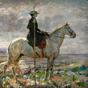
Photo Mug : Map of Kenya and Uganda


![]()
Home Decor from Mary Evans Picture Library
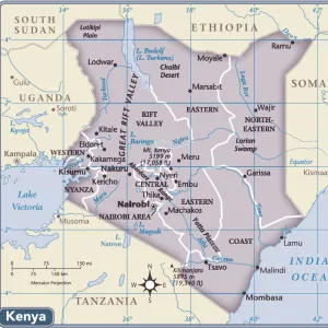
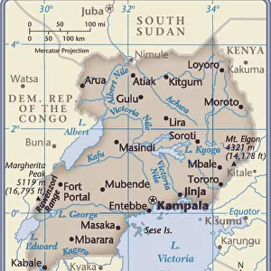
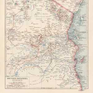
Map of Kenya and Uganda
Map of Kenya Uganda boundary, 1926 Date: 1926
Mary Evans Picture Library makes available wonderful images created for people to enjoy over the centuries
Media ID 7401295
© Mary Evans Picture Library 2015 - https://copyrighthub.org/s0/hub1/creation/maryevans/MaryEvansPictureID/10473848
Photo Mug (11 oz)
Introducing the Media Storehouse Photo Mug featuring a stunning vintage map of Kenya and Uganda from Mary Evans Prints Online. Dating back to 1926, this captivating image showcases the detailed boundary lines between these two beautiful African countries. Bring a piece of history into your daily routine with this high-quality mug. Perfect for tea or coffee, each mug is printed with state-of-the-art technology to ensure vibrant, long-lasting colors. Make it a unique and thoughtful gift for the history or travel enthusiast in your life. Embrace the richness of the past as you enjoy your favorite beverage.
A personalized photo mug blends sentimentality with functionality, making an ideal gift for cherished loved ones, close friends, or valued colleagues. Preview may show both sides of the same mug.
Elevate your coffee or tea experience with our premium white ceramic mug. Its wide, comfortable handle makes drinking easy, and you can rely on it to be both microwave and dishwasher safe. Sold in single units, preview may show both sides of the same mug so you can see how the picture wraps around.
Mug Size is 9.5cm high x 8cm diameter (3.7" x 3.1")
These are individually made so all sizes are approximate
FEATURES IN THESE COLLECTIONS
> Mary Evans Prints Online
> National Archives
> Africa
> Kenya
> Related Images
> Africa
> Uganda
> Related Images
EDITORS COMMENTS
1. Title: "A Fragment of African History: The Map of Kenya and Uganda Border, 1926" This vintage map print showcases the borders of Kenya and Uganda as they appeared in 1926. The intricate details of the topography, rivers, and major cities are rendered with meticulous precision, offering a glimpse into the geographical makeup of East Africa during the 1920s. The map's age, with its worn edges and subtle discoloration, adds a sense of historical depth and authenticity. The map's creation coincides with a pivotal period in African history. In the aftermath of World War I, European powers redrew the continent's borders, often disregarding the traditional territories and ethnic affiliations of the indigenous populations. This map reflects the new political realities, with Kenya and Uganda emerging as distinct entities under British rule. Kenya, located to the south, was a British protectorate since 1895, while Uganda, to the north, was a British protectorate since 1894. The map highlights major cities such as Nairobi, Mombasa, and Kisumu in Kenya, and Kampala, Gulu, and Jinja in Uganda. The Nile River, a vital water source and historic trade route, is depicted flowing through both countries. This map serves as a poignant reminder of the complex history of Africa and the intricate web of political, cultural, and geographical influences that have shaped its modern borders. It invites us to reflect on the past and consider the ongoing implications of colonial legacies in contemporary Africa. The map's intricate details and historical significance make it an essential addition to any collection focused on African history, geography, or cartography. Its aged appearance adds a sense of nostalgia and authenticity, transporting us back to a time when the world was being reshaped through the lens of European imperialism.
MADE IN THE USA
Safe Shipping with 30 Day Money Back Guarantee
FREE PERSONALISATION*
We are proud to offer a range of customisation features including Personalised Captions, Color Filters and Picture Zoom Tools
SECURE PAYMENTS
We happily accept a wide range of payment options so you can pay for the things you need in the way that is most convenient for you
* Options may vary by product and licensing agreement. Zoomed Pictures can be adjusted in the Cart.