Home > Maps and Charts > World
Photographic Print : Maps / World / Currents

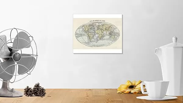

![]()
Photo Prints from Mary Evans Picture Library
Maps / World / Currents
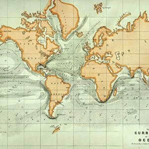
World map of the ocean currents
Mary Evans Picture Library makes available wonderful images created for people to enjoy over the centuries
Media ID 592843
© Mary Evans Picture Library 2015 - https://copyrighthub.org/s0/hub1/creation/maryevans/MaryEvansPictureID/10042276
10"x8" Photo Print
Discover the captivating beauty of the world's ocean currents with our exquisite "Maps / World / Currents" print from Mary Evans Picture Library. This stunning photograph, available through Media Storehouse from Mary Evans Prints Online, offers a unique perspective on the intricate patterns and movements of our planet's waterways. Delve into the mesmerizing depths and explore the intricacies of this living, breathing map, adding an element of wonder and education to any space. The high-quality print, with its vivid colors and exceptional detail, is sure to inspire awe and curiosity in all who behold it. Bring the mysteries of the deep into your home or office with this captivating addition to your decor.
Photo prints are produced on Kodak professional photo paper resulting in timeless and breath-taking prints which are also ideal for framing. The colors produced are rich and vivid, with accurate blacks and pristine whites, resulting in prints that are truly timeless and magnificent. Whether you're looking to display your prints in your home, office, or gallery, our range of photographic prints are sure to impress. Dimensions refers to the size of the paper in inches.
Our Photo Prints are in a large range of sizes and are printed on Archival Quality Paper for excellent colour reproduction and longevity. They are ideal for framing (our Framed Prints use these) at a reasonable cost. Alternatives include cheaper Poster Prints and higher quality Fine Art Paper, the choice of which is largely dependant on your budget.
Estimated Image Size (if not cropped) is 25.4cm x 16.1cm (10" x 6.3")
Estimated Product Size is 25.4cm x 20.3cm (10" x 8")
These are individually made so all sizes are approximate
Artwork printed orientated as per the preview above, with landscape (horizontal) orientation to match the source image.
FEATURES IN THESE COLLECTIONS
> Maps and Charts
> Early Maps
> Maps and Charts
> World
EDITORS COMMENTS
This print from Mary Evans Picture Library showcases a stunning world map of ocean currents, dating back to the late 19th century. The intricate details and historical significance of this map are truly mesmerizing, offering a glimpse into the way our ancestors navigated the vast seas.
As we gaze upon this piece, we are transported back in time to an era where exploration and discovery were at the forefront of human endeavors. The delicate lines and patterns on the map reveal the complex network of currents that crisscrossed the oceans, shaping trade routes and influencing maritime travel.
The beauty of this print lies not only in its visual appeal but also in its educational value. It serves as a reminder of how interconnected our world truly is, with currents acting as invisible highways that connect distant shores and shape ecosystems.
Whether you're a history buff or simply appreciate fine art, this world map of ocean currents is sure to captivate your imagination. It's a testament to human ingenuity and curiosity, reminding us of our enduring quest to understand and conquer the great unknown that lies beyond our shores.
MADE IN THE USA
Safe Shipping with 30 Day Money Back Guarantee
FREE PERSONALISATION*
We are proud to offer a range of customisation features including Personalised Captions, Color Filters and Picture Zoom Tools
SECURE PAYMENTS
We happily accept a wide range of payment options so you can pay for the things you need in the way that is most convenient for you
* Options may vary by product and licensing agreement. Zoomed Pictures can be adjusted in the Cart.