Fraud Blocker Skip to main content

Home > Maps and Charts > Ukraine

Ukraine Collection (#2)

Ukraine is a country located in Eastern Europe, bordered by Russia to the east and northeast, Belarus to the north, Poland, Slovakia and Hungary to the west

175 Items

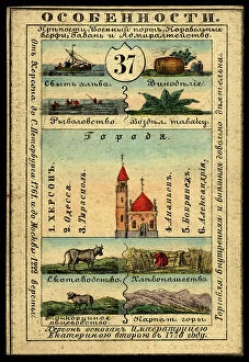
Background imageUkraine Collection: Kherson Province, 1856. Creator: Unknown

Kherson Province, 1856. Creator: Unknown
Kherson Province, 1856. This card is one of a souvenir set of 82 illustrated cards-one for each province of the Russian Empire as it existed in 1856

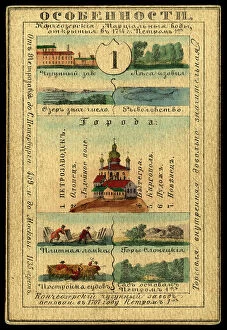
Background imageUkraine Collection: Olonetsk Province, 1856. Creator: Unknown

Olonetsk Province, 1856. Creator: Unknown
Olonetsk Province, 1856. This card is one of a souvenir set of 82 illustrated cards-one for each province of the Russian Empire as it existed in 1856

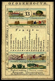
Background imageUkraine Collection: Chernigov Province, 1856. Creator: Unknown

Chernigov Province, 1856. Creator: Unknown
Chernigov Province, 1856. This card is one of a souvenir set of 82 illustrated cards-one for each province of the Russian Empire as it existed in 1856

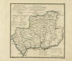
Background imageUkraine Collection: General Map of Kherson Province: Showing Postal and Major Roads, Stations and... 1821

General Map of Kherson Province: Showing Postal and Major Roads, Stations and... 1821
General Map of Kherson Province: Showing Postal and Major Roads, Stations and the Distance in Versts between Them, 1821. This 1821 map of Kherson Provinceis from a larger work

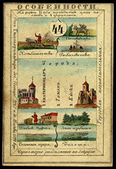
Background imageUkraine Collection: Land of the Black Sea Cossacks, 1856. Creator: Unknown

Land of the Black Sea Cossacks, 1856. Creator: Unknown
Land of the Black Sea Cossacks, 1856. This card is one of a souvenir set of 82 illustrated cards-one for each province of the Russian Empire as it existed in 1856

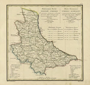
Background imageUkraine Collection: General Map of Kiev Province: Showing Postal and Major Roads, Stations and.. 1821

General Map of Kiev Province: Showing Postal and Major Roads, Stations and.. 1821
General Map of Kiev Province: Showing Postal and Major Roads, Stations and the Distance in Versts between Them, 1821. This 1821 map of Kiev Province is from a larger work

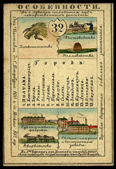
Background imageUkraine Collection: Poltava Province, 1856. Creator: Unknown

Poltava Province, 1856. Creator: Unknown
Poltava Province, 1856. This card is one of a souvenir set of 82 illustrated cards-one for each province of the Russian Empire as it existed in 1856

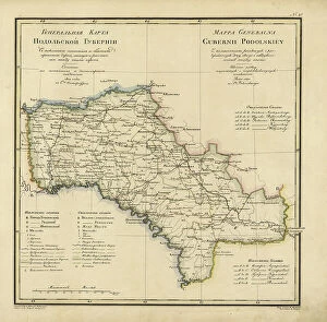
Background imageUkraine Collection: General Map of Podolsk Province: Showing Postal and Major Roads, Stations and the... 1820

General Map of Podolsk Province: Showing Postal and Major Roads, Stations and the... 1820
General Map of Podolsk Province: Showing Postal and Major Roads, Stations and the Distance in Versts between Them, 1820. This 1820 map of Podolsk Provinceis from a larger work

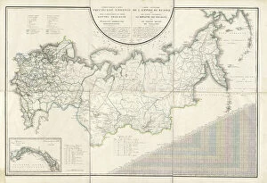
Background imageUkraine Collection: General Map of the Russian Empire and the Neighboring Polish.. 1827

General Map of the Russian Empire and the Neighboring Polish.. 1827. Creators: Vasilii Petrovich Piadyshev, Ieremin
General Map of the Russian Empire and the Neighboring Polish Empire and Grand Duchy of Finland: With the Distance in Versts on Postal Roads between Provincial Cities;

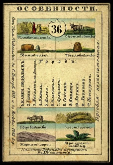
Background imageUkraine Collection: Kamenets-Podolsk Province, 1856. Creator: Unknown

Kamenets-Podolsk Province, 1856. Creator: Unknown
Kamenets-Podolsk Province, 1856. This card is one of a souvenir set of 82 illustrated cards-one for each province of the Russian Empire as it existed in 1856

Background imageUkraine Collection: Land of the Don Cossacks, 1856. Creator: Unknown

Land of the Don Cossacks, 1856. Creator: Unknown
Land of the Don Cossacks, 1856. This card is one of a souvenir set of 82 illustrated cards-one for each province of the Russian Empire as it existed in 1856

Background imageUkraine Collection: Tavrich Province, 1856. Creator: Unknown

Tavrich Province, 1856. Creator: Unknown
Tavrich Province, 1856. This card is one of a souvenir set of 82 illustrated cards-one for each province of the Russian Empire as it existed in 1856

Background imageUkraine Collection: The Partition of Europe under Treaties of Paris, June 1919, (c1920). Creator: Unknown

The Partition of Europe under Treaties of Paris, June 1919, (c1920). Creator: Unknown
The Partition of Europe under Treaties of Paris, June 1919, (c1920). Independent States coloured separately; Names of New States shown in Red capitals; Proposed League of Nations Territory; Projected

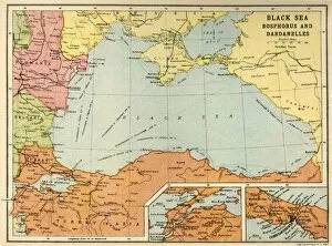
Background imageUkraine Collection: Black Sea: Bosphorus and Dardanelles, c1914, (c1920). Creator: John Bartholomew & Son

Black Sea: Bosphorus and Dardanelles, c1914, (c1920). Creator: John Bartholomew & Son
Black Sea: Bosphorus and Dardanelles, c1914, (c1920). Map of the Black Sea and parts of surrounding countries at the start of the First World War, showing Russia and the Crimea, Romania

Background imageUkraine Collection: Poland and the Partitions of 1772, 1793 & 1795, (c1920). Creator: John Bartholomew & Son

Poland and the Partitions of 1772, 1793 & 1795, (c1920). Creator: John Bartholomew & Son
Poland and the Partitions of 1772, 1793 & 1795, (c1920). Map showing how territory in Europe was divided between the empires of Russia, Prussia and Austria in the 18th century

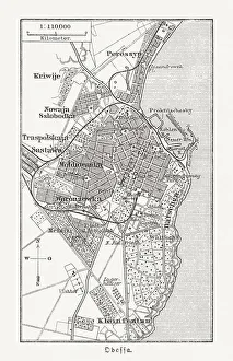
Background imageUkraine Collection: Historical city map of Odessa, Ukraine, wood engraving, published 1897

Historical city map of Odessa, Ukraine, wood engraving, published 1897
Historical city map of Odessa, Ukraine. Wood engraving, published in 1897

Background imageUkraine Collection: Map of Southern Russia

Map of Southern Russia. Map showing the Black Sea, the Caspian Sea, Turkey, Bulgaria, Romania, the Ukraine, Georgia and Azerbaijan. Plate 46 from The Times Atlas

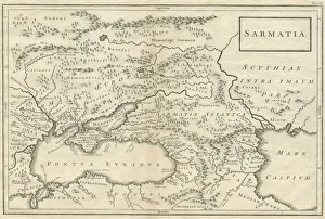
Background imageUkraine Collection: Sarmatia modern Ukraine and Russia 18th century 1740

Sarmatia modern Ukraine and Russia 18th century 1740
This is a map of Sarmatia, an area connected with the Sarmatian peoples who flourished between the 5th century BC and the 4th century AD

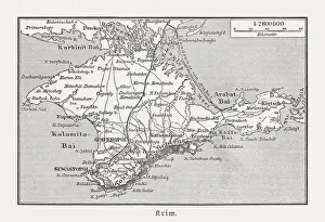
Background imageUkraine Collection: Historical map of Crimea (Ukraine / Russia), wood engraving, published in 1897

Historical map of Crimea (Ukraine / Russia), wood engraving, published in 1897
Historical map of the Peninsula Crimea (Ukraine/Russia). Wood engraving, published in 1897

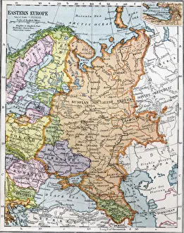
Background imageUkraine Collection: Eastern Europe between the First and Second World Wars. From Bacons Excelsior Atlas of

Eastern Europe between the First and Second World Wars. From Bacons Excelsior Atlas of the World, published circa 1930

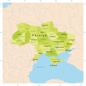
Background imageUkraine Collection: Ukraine Vector Map

Ukraine Vector Map
Highly detailed vector map of Ukraine. File was created on December 16, 2011. The colors in the.eps-file are ready for print (CMYK). Included files: EPS (v8) and Hi-Res JPG

Background imageUkraine Collection: Map of the northern Mexican archipelago and the West Indies, 1688 (engraving)

Map of the northern Mexican archipelago and the West Indies, 1688 (engraving)
VNK284160 Map of the northern Mexican archipelago and the West Indies, 1688 (engraving) by Coronelli, Vincenzo Maria (1650-1718); Vorontsov Palace, Crimea

Background imageUkraine Collection: Gray map of Kiev downtown (pre-war)

Gray map of Kiev downtown (pre-war)
Rosana Laiz Blursbyai

Background imageUkraine Collection: Le port de Yalta (Ukraine) - Peinture de Grigori (Grigoriy, Grigory)

Le port de Yalta (Ukraine) - Peinture de Grigori (Grigoriy, Grigory) Grigoryevich Myasoyedov (Miasoedov) (1834-1911)
FIA5372927 Le port de Yalta (Ukraine) - Peinture de Grigori (Grigoriy, Grigory) Grigoryevich Myasoyedov (Miasoedov) (1834-1911), huile sur toile, 1890 (47, 5x64 cm) - (Yalta Harbour, Oil on canvas)

Background imageUkraine Collection: Le palais du Khan a Bakhchisarai (Ukraine). Peinture de Jacques Christoph Miville (1786-1836)

Le palais du Khan a Bakhchisarai (Ukraine). Peinture de Jacques Christoph Miville (1786-1836), huile sur toile, 1816
FIA5375563 Le palais du Khan a Bakhchisarai (Ukraine). Peinture de Jacques Christoph Miville (1786-1836), huile sur toile, 1816. Art suisse 19e siecle, classicisme. State Museum of A.S

Background imageUkraine Collection: The tea rose. 1905 (Oil on canvas)

The tea rose. 1905 (Oil on canvas)
FIA5345218 The tea rose. 1905 (Oil on canvas) by Cloginsky, Jan Franzevich (1858-1912); 80x67, 5 cm; Kharkov Art Museum, Kharkov, Russia; (add.info.: The rose (The tea rose)

Background imageUkraine Collection: 'La consultation du medecin'(Sick Woman and a Doctor) Le docteur examine une fiole d urine lors de

"La consultation du medecin"(Sick Woman and a Doctor) Le docteur examine une fiole d urine lors de la
FIA5326048 " La consultation du medecin" (Sick Woman and a Doctor) Le docteur examine une fiole d urine lors de la consultation d une dame malade

Background imageUkraine Collection: La cueillette des cerises dans le verger d un proprietaire en Ukraine

La cueillette des cerises dans le verger d un proprietaire en Ukraine. Peinture de Ivan Ivanovich Sokolov (1823-1918)
FIA5380590 La cueillette des cerises dans le verger d un proprietaire en Ukraine. Peinture de Ivan Ivanovich Sokolov (1823-1918), huile sur toile, 1858. Art russe, 19e siecle, romantisme

Background imageUkraine Collection: Vue de la ville de Bakhchisaray (Ukraine) (View of the town Bakhchisaray)

Vue de la ville de Bakhchisaray (Ukraine) (View of the town Bakhchisaray)
FIA5330444 Vue de la ville de Bakhchisaray (Ukraine) (View of the town Bakhchisaray). Peinture de Fyodor Yakovlevich Alexeev (1753-1824). Huile sur toile, 197 x 178, 5 cm, 1798-1800

Background imageUkraine Collection: Vue de la ville de Nikolaev (Nikolayev) en Ukraine (View of the Town of Nikolayev)

Vue de la ville de Nikolaev (Nikolayev) en Ukraine (View of the Town of Nikolayev)
FIA5332013 Vue de la ville de Nikolaev (Nikolayev) en Ukraine (View of the Town of Nikolayev). Peinture de Fyodor Yakovlevich Alexeev (1753-1824), 1798-1800. Huile sur toile

Background imageUkraine Collection: Saint Theodore the Varangian, 19th century (tempera on panel)

Saint Theodore the Varangian, 19th century (tempera on panel)
FAR4227333 Saint Theodore the Varangian, 19th century (tempera on panel) by Chirikov, Osip Semionovich (d.1903); (add.info.: State Museum of Religious History)

Background imageUkraine Collection: La bataille navale du detroit de Kertch (Ukraine) le 19 juillet 1790

La bataille navale du detroit de Kertch (Ukraine) le 19 juillet 1790 (The Naval Battle of Kerch Strait on July 19)
FIA5374908 La bataille navale du detroit de Kertch (Ukraine) le 19 juillet 1790 (The Naval Battle of Kerch Strait on July 19, 1790)

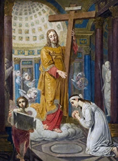
Background imageUkraine Collection: The Appearance of Christ with the Cross to Ekaterina Filippovna Tatarinova (1783-1856)

The Appearance of Christ with the Cross to Ekaterina Filippovna Tatarinova (1783-1856) - par Borovikovsky
FIA5404883 The Appearance of Christ with the Cross to Ekaterina Filippovna Tatarinova (1783-1856) - par Borovikovsky, Vladimir Lukich (1757-1825)

Background imageUkraine Collection: Dans les montagnes de Crimee (In the Crimean Mountain). Peinture de Isaak (Isaac)

Dans les montagnes de Crimee (In the Crimean Mountain). Peinture de Isaak (Isaac) Ilyich Levitan (1860-1900)
FIA5338221 Dans les montagnes de Crimee (In the Crimean Mountain). Peinture de Isaak (Isaac) Ilyich Levitan (1860-1900), huile sur toile, 1886. Art russe, paysage 19e siecle

Background imageUkraine Collection: Art Scythe (Civilisation scythique ou de Scythie) : peigne en or decore de scenes de batailles

Art Scythe (Civilisation scythique ou de Scythie) : peigne en or decore de scenes de batailles avec guerriers scythe
FIA5335525 Art Scythe (Civilisation scythique ou de Scythie) : peigne en or decore de scenes de batailles avec guerriers scythe (Comb with a fighting scene)

Background imageUkraine Collection: Sur le rivage de Livadie (dans le golfe de Crimee, Ukraine) (At the Livadia Shore)

Sur le rivage de Livadie (dans le golfe de Crimee, Ukraine) (At the Livadia Shore)
FIA5333482 Sur le rivage de Livadie (dans le golfe de Crimee, Ukraine) (At the Livadia Shore). Paysage marin, avec un voilier dans le lointain et les vagues de la Mer Noire qui se cassent sur les

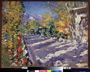
Background imageUkraine Collection: La route de Gourzouf (Crimee, Russie). (Road to Gurzuf). Route ombragee en plein ete qui mene a la

La route de Gourzouf (Crimee, Russie). (Road to Gurzuf). Route ombragee en plein ete qui mene a la montagne pres du
FIA5350705 La route de Gourzouf (Crimee, Russie). (Road to Gurzuf). Route ombragee en plein ete qui mene a la montagne pres du bord de la mer

Background imageUkraine Collection: Le cantique de Noel en Ukraine (The Christmas carol in the Ukraine)

Le cantique de Noel en Ukraine (The Christmas carol in the Ukraine) - Peinture de Konstantin Alexandrovich Trutovsky
FIA5342477 Le cantique de Noel en Ukraine (The Christmas carol in the Ukraine) - Peinture de Konstantin Alexandrovich Trutovsky (Troutovsky) (1826-1893), huile sur toile, 1864 - Art russe

Background imageUkraine Collection: Le siege de Sebastopol en 1854. (The Siege Of Sevastopol In 1854)

Le siege de Sebastopol en 1854. (The Siege Of Sevastopol In 1854). Episode de la guerre de Crimee (1853-1856)
FIA5367437 Le siege de Sebastopol en 1854. (The Siege Of Sevastopol In 1854). Episode de la guerre de Crimee (1853-1856), les troupes alliees organisent le siege penible et meurtrier de la ville

Background imageUkraine Collection: Le bapteme du prince Vladimir I (958-1015). Extrait des Chroniques de Radziwill (ou de Konigsberg)

Le bapteme du prince Vladimir I (958-1015). Extrait des Chroniques de Radziwill (ou de Konigsberg)
FIA5378391 Le bapteme du prince Vladimir I (958-1015). Extrait des Chroniques de Radziwill (ou de Konigsberg). (The Baptism of Prince Vladimir I. From the Radziwill Chronicle)

Background imageUkraine Collection: Nuit calme dans la batterie d artillerie (A quiet night in the batteries)

Nuit calme dans la batterie d artillerie (A quiet night in the batteries)
FIA5368900 Nuit calme dans la batterie d artillerie (A quiet night in the batteries). Vue d un camp militair pendant le siege de Sebastopol durant la guerre de Crimee

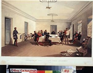
Background imageUkraine Collection: Conseil de guerre au quartier general du baron Raglan (A council of war at Lord Raglans head)

Conseil de guerre au quartier general du baron Raglan (A council of war at Lord Raglans head quarters)
FIA5366792 Conseil de guerre au quartier general du baron Raglan (A council of war at Lord Raglans head quarters). Fitzroy Somerset

Background imageUkraine Collection: Un tertre paien. (Moyen age, Ukraine). Oeuvre de Nicolas (Nicholas) Roerich (1874-1947)

Un tertre paien. (Moyen age, Ukraine). Oeuvre de Nicolas (Nicholas) Roerich (1874-1947), tempera sur carton, 1920-1930
FIA5370226 Un tertre paien. (Moyen age, Ukraine). Oeuvre de Nicolas (Nicholas) Roerich (1874-1947), tempera sur carton, 1920-1930. Art russe, 20e siecle, symbolisme. State Tretyakov Gallery, Moscou

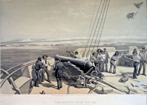
Background imageUkraine Collection: Vue de Sebastopol depuis la mer (View of Sevastopol from the sea)

Vue de Sebastopol depuis la mer (View of Sevastopol from the sea). La flotte franco britannique lors de la bataille de
FIA5368905 Vue de Sebastopol depuis la mer (View of Sevastopol from the sea). La flotte franco britannique lors de la bataille de Sebastopol durant la guerre de Crimee

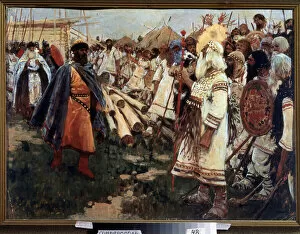
Background imageUkraine Collection: 'Christianisme et paganisme'Christianisation de l Ukraine - Allegorie des deux religions face a face

"Christianisme et paganisme"Christianisation de l Ukraine - Allegorie des deux religions face a face
FIA5368797 " Christianisme et paganisme" Christianisation de l Ukraine - Allegorie des deux religions face a face - Peinture de Sergei Ivanov (1864-1910) 1909 Regional Art Museum

Background imageUkraine Collection: Une scene de la guerre de Crimee (1853-1856). Derriere la ligne des troupes de front

Une scene de la guerre de Crimee (1853-1856). Derriere la ligne des troupes de front, des officiers dont un blesse
FIA5368180 Une scene de la guerre de Crimee (1853-1856). Derriere la ligne des troupes de front, des officiers dont un blesse, observent le champ de bataille

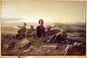
Background imageUkraine Collection: Plastounes a Sebastopol. (Bataille de Malakoff, 1855, des soldats russes surveillent l ennemi)

Plastounes a Sebastopol. (Bataille de Malakoff, 1855, des soldats russes surveillent l ennemi francais)
FIA5380522 Plastounes a Sebastopol. (Bataille de Malakoff, 1855, des soldats russes surveillent l ennemi francais, en mission de reconnaissance)

Background imageUkraine Collection: Le debarquement du general Nikolai Nikolaievitch Raievski, a Subashi (Ukraine)

Le debarquement du general Nikolai Nikolaievitch Raievski, a Subashi (Ukraine)
FIA5368042 Le debarquement du general Nikolai Nikolaievitch Raievski, a Subashi (Ukraine), en juillet 1839 (The landing of the general N.Raevsky at Subashi on July 1839)


All Professionally Made to Order for Quick Shipping


-

Ukraine Collection

Ukraine is a country located in Eastern Europe, bordered by Russia to the east and northeast, Belarus to the north, Poland, Slovakia and Hungary to the west, and Romania and Moldova to the southwest and has an area of 603,628 square kilometers with a population of approximately 42 million people. The capital city is Kyiv (Kiev) which is also its largest city. Ukraine's economy relies heavily on agriculture as it has some of the most fertile soil in Europe. Other major industries include metallurgy, energy production, chemicals and machinery manufacturing. Ukraine has been facing political instability since 2014 due to conflict with Russia over Crimea annexation leading to economic sanctions imposed by Western countries against Russia affecting Ukrainian economy adversely.
+

Our beautiful Wall Art and Photo Gifts include Framed Prints, Photo Prints, Poster Prints, Canvas Prints, Jigsaw Puzzles, Metal Prints and so much more

The Ukraine collection from Media Storehouse is a stunning compilation of historical maps and charts that depict the geography, topography, and political boundaries of Ukraine. Our collection features a wide range of maps dating back to the 16th century, including antique atlases, city plans, military maps, and nautical charts. These beautiful prints are perfect for anyone interested in Ukrainian history or geography. They make great wall art for homes or offices and can be framed to suit any decor style. Our collection includes detailed depictions of major cities like Kiev and Odessa as well as regional maps showing the country's diverse landscapes. Whether you're an avid collector or simply looking for a unique piece of artwork to add to your home or office decor, the Ukraine collection from Media Storehouse is sure to impress. With its rich history and stunning visuals, our collection offers something for everyone who loves Ukrainian culture.
+

What are Ukraine (Maps and Charts) art prints?

Ukraine art prints are high-quality reproductions of maps and charts depicting the geography, topography, and history of Ukraine. These prints showcase the intricate details of Ukraine's landscape, including its rivers, mountains, cities, and borders. They also highlight important historical events such as battles and political changes that have shaped the country over time. These art prints are perfect for anyone interested in Ukrainian culture or history. They can be used to decorate homes or offices with a unique touch that celebrates this fascinating country's past and present. The maps and charts featured in these prints are carefully selected by Media Storehouse to ensure accuracy and quality. Whether you're a collector looking for rare pieces or simply want to add some cultural flair to your decor, Ukraine art prints offer something special for everyone. With their stunning visuals and rich historical context, they make excellent conversation starters that will impress guests while showcasing your love for all things Ukrainian.
+

What Ukraine (Maps and Charts) art prints can I buy from Media Storehouse?

We offer a wide range of Ukraine maps and charts art prints that are perfect for those who love geography, history, or simply want to decorate their homes with unique pieces. You can find vintage maps of Ukraine from different periods in history, including the Soviet era and pre-World War II times. These maps showcase the country's borders, cities, rivers, and other landmarks. In addition to traditional maps, Media Storehouse also has artistic renditions of Ukraine's landscapes and cityscapes. These prints feature stunning views of Kiev's skyline at night or Lviv's charming streets lined with colorful buildings. They capture the essence of Ukrainian culture through vibrant colors and intricate details. Whether you're looking for educational or decorative purposes, we have something for everyone interested in Ukraine's rich history and geography. With high-quality printing techniques on premium paper stock options available too.
+

How do I buy Ukraine (Maps and Charts) art prints?

To purchase Ukraine art prints from Media Storehouse, you can browse our extensive collection of high-quality images online. Once you have found the print that you would like to buy, simply add it to your cart and proceed to checkout. During the checkout process, you will be prompted to enter your shipping and payment information. We offer a variety of sizes and framing options for their prints, so be sure to select the one that best suits your needs. We also offer a range of paper types, including fine art paper for a more traditional look or poster paper for a more affordable option. Once your order is placed, Media Storehouse will carefully package and ship your print directly to you. Whether you are looking for a unique piece of wall art or a thoughtful gift for someone special, buying Ukraine art prints from Media Storehouse is easy and convenient.
+

How much do Ukraine (Maps and Charts) art prints cost?

We offer a wide range of Ukraine maps and charts art prints that are available at varying prices. Our collection includes high-quality prints featuring different regions and cities in Ukraine, as well as historical maps and charts. The cost of our Ukraine maps and charts art prints depends on several factors such as the size of the print, the type of paper used, and whether it is framed or unframed. We offer a variety of sizes ranging from small to large to cater to different preferences. Our art prints are produced using state-of-the-art printing technology which ensures that they have vibrant colors and sharp details. Whether you're looking for a unique piece to add to your home decor or an educational tool for your classroom or office space, our Ukraine maps and charts art prints are sure to impress. We strive to provide affordable yet high-quality products that meet the needs of our customers.
+

How will my Ukraine (Maps and Charts) art prints be delivered to me?

We take great care in ensuring that your Ukraine art prints are delivered to you safely and securely. We use high-quality packaging materials to protect your artwork during transit, so it arrives at your doorstep in pristine condition. Your art prints will be carefully rolled up and placed inside a sturdy cardboard tube for shipping. This ensures that the print remains flat and undamaged during transport. The tube is then sealed with tape to prevent any moisture or dust from entering. Once your order has been dispatched, you will receive an email notification with tracking information so you can monitor its progress until it reaches you. We work with trusted delivery partners who have a proven track record of delivering packages on time and without damage. We understand how important it is for our customers to receive their orders quickly, which is why we strive to dispatch all orders as soon as possible after they are received.