Fraud Blocker Skip to main content

Home > Maps and Charts > Spain

Spain Collection (page 4)

Spain is a country located in southwestern Europe

1,429 items

Background imageSpain Collection: Valleys of Mexico, 1885

Valleys of Mexico, 1885
2902264 Valleys of Mexico, 1885; (add.info.: Historic map of Mexico with Valleys, amphitheaters, industry, groves, waterways, plains. Printed in Spanish.); Buyenlarge Archive/UIG

Background imageSpain Collection: Hydrographic Map of Mexico, 1885

Hydrographic Map of Mexico, 1885
2902259 Hydrographic Map of Mexico, 1885; (add.info.: Historic map of Mexico with Waterfalls, streams, rivers, dams, rapids, and lakes. Printed in Spanish.); Buyenlarge Archive/UIG

Background imageSpain Collection: Defenses

Defenses
2900917 Defenses; (add.info.: Barcelona, Spain, Defenses, 1700.); Buyenlarge Archive/UIG

Background imageSpain Collection: Gibraltar

Gibraltar
2900914 Gibraltar; (add.info.: Gibraltar Plan, 1700.); Buyenlarge Archive/UIG

Background imageSpain Collection: Cartoon against Thomas Jefferson's (Prairie Dog) secret negotiations for US purchase West Florida

Cartoon against Thomas Jefferson's (Prairie Dog) secret negotiations for US purchase West Florida from Spain
528387 Cartoon against Thomas Jefferson's (Prairie Dog) secret negotiations for US purchase West Florida from Spain. Napoleon as a hornet stings Jefferson to reveal the purchase price

Background imageSpain Collection: Spanish War of Independence (1808-1814).Map of the first siege of Zaragoza (June 1808)

Spanish War of Independence (1808-1814).Map of the first siege of Zaragoza (June 1808)
AIS5353202 Spanish War of Independence (1808-1814).Map of the first siege of Zaragoza (June 1808), in "Atlas of the Guerra de Independencia" (1868) (engraving); Biblioteca Nacional, Madrid

Background imageSpain Collection: Map of European odds on the Atlantic Ocean, including Gibraltar, Portugal, Spain, England

Map of European odds on the Atlantic Ocean, including Gibraltar, Portugal, Spain, England, Ireland and Iceland
AIS5350370 Map of European odds on the Atlantic Ocean, including Gibraltar, Portugal, Spain, England, Ireland and Iceland, as well as North Africa

Background imageSpain Collection: Detail of a globe, on Martinus (eastern Spain), 1908 (globe)

Detail of a globe, on Martinus (eastern Spain), 1908 (globe)
MMM5475132 Detail of a globe, on Martinus (eastern Spain), 1908 (globe) by Behaim, Martin (1459-1507); National Maritime Museum, London, UK; (add.info.: Detail of a globe)

Background imageSpain Collection: Map of Madrid late 17th or early 18th century (map)

Map of Madrid late 17th or early 18th century (map)
6117613 Map of Madrid late 17th or early 18th century (map); (add.info.: Anonymous map of Madrid dating from late 17th or early 18th century.); Photo © Ken Welsh. All rights reserved 2024

Background imageSpain Collection: Twelfth Siege of Gibraltar, 1705 (map)

Twelfth Siege of Gibraltar, 1705 (map)
6117247 Twelfth Siege of Gibraltar, 1705 (map); (add.info.: An Exact Plan of the Town Castle Moles and Bay of Gibraltar during the Twelfth Siege of Gibraltar, September 1704 to May 1705)

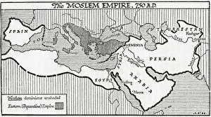
Background imageSpain Collection: Map of the Moslem Empire, 750 AD, 1936

Map of the Moslem Empire, 750 AD, 1936
7125146 Map of the Moslem Empire, 750 AD, 1936; (add.info.: Map of the Moslem Empire, 750 AD. From A Short History of the World, published c.1936); Photo © Ken Welsh. All rights reserved 2024

Background imageSpain Collection: Chart of the Atlantic Ocean, with the British, French & Spanish settlements in North America

Chart of the Atlantic Ocean, with the British, French & Spanish settlements in North America and the West Indies
7295390 Chart of the Atlantic Ocean, with the British, French & Spanish settlements in North America and the West Indies, 1753 (engraving) by Jefferys

Background imageSpain Collection: Falkland's Islands, c.1805 (coloured manuscript)

Falkland's Islands, c.1805 (coloured manuscript)
7295386 Falkland's Islands, c.1805 (coloured manuscript) by Unknown Artist, (19th century); 30x34.5 cm; National Maritime Museum, London, UK; (add.info.: Creator: Anonymous Single sheet)

Background imageSpain Collection: North America, c.1765 (coloured engraving)

North America, c.1765 (coloured engraving)
7295384 North America, c.1765 (coloured engraving) by Unknown artist, (18th century); 56x97 cm; National Maritime Museum, London, UK; (add.info.: Creator: Anonymous Single sheet. Hand col. engr)

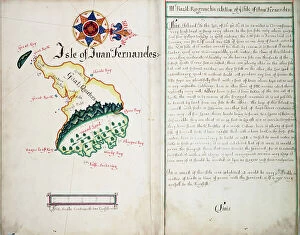
Background imageSpain Collection: Isle of Juan Fernandes, 1685 (bound sheet)

Isle of Juan Fernandes, 1685 (bound sheet)
7295405 Isle of Juan Fernandes, 1685 (bound sheet) by Hack, William (17th Century); 40.5x50 cm; National Maritime Museum, London

Background imageSpain Collection: Map of the neighbourhood of San Juan in Madrid

Map of the neighbourhood of San Juan in Madrid
3329846 Map of the neighbourhood of San Juan in Madrid; (add.info.: Map of the neighbourhood of San Juan in Madrid during the 17th Century.); Universal History Archive/UIG

Background imageSpain Collection: Map of the Iberic Peninsula under the Moors (Arab Muslim domination), 11th century

Map of the Iberic Peninsula under the Moors (Arab Muslim domination), 11th century. 19th century lithography
NWI4871897 Map of the Iberic Peninsula under the Moors (Arab Muslim domination), 11th century. 19th century lithography.; (add.info)

Background imageSpain Collection: Map of Cadiz by Antonio Ponz (1794). Engraving. SPAIN. MADRID (AUTONOMOUS COMMUNITY). Madrid

Map of Cadiz by Antonio Ponz (1794). Engraving. SPAIN. MADRID (AUTONOMOUS COMMUNITY). Madrid. National Library
CUL4869615 Map of Cadiz by Antonio Ponz (1794). Engraving. SPAIN. MADRID (AUTONOMOUS COMMUNITY). Madrid. National Library; Biblioteca Nacional, Madrid

Background imageSpain Collection: Theory of Round Earth: Map of the world drawn up from the discoveries of Christopher Columbus

Theory of Round Earth: Map of the world drawn up from the discoveries of Christopher Columbus (1451-1506)
NWI4848339 Theory of Round Earth: Map of the world drawn up from the discoveries of Christopher Columbus (1451-1506) and Vasco Nunez de Balboa

Background imageSpain Collection: Geography Atlas: representation of the region of the Caribbean Sea, the Greater Antilles (Cuba)

Geography Atlas: representation of the region of the Caribbean Sea, the Greater Antilles (Cuba, Jamaica)
VEN5030081 Geography Atlas: representation of the region of the Caribbean Sea, the Greater Antilles (Cuba, Jamaica, Hispaniola) and the small Antilles with colours indicating membership to France

Background imageSpain Collection: Geography Atlas: representation of the Caribbean archipelago (Cuba, Hispaniola, Puerto Rico)

Geography Atlas: representation of the Caribbean archipelago (Cuba, Hispaniola, Puerto Rico), the Bahamas Islands
VEN5030034 Geography Atlas: representation of the Caribbean archipelago (Cuba, Hispaniola, Puerto Rico), the Bahamas Islands. Map from a Spanish Atlas of 1825

Background imageSpain Collection: Portulan 4 by Augustin Roussin. Spain and France and their coats of arms are represented here

Portulan 4 by Augustin Roussin. Spain and France and their coats of arms are represented here
JEB4878588 Portulan 4 by Augustin Roussin. Spain and France and their coats of arms are represented here. 1630 Watercolour Bibliotheque municipale de Marseille; (add.info)

Background imageSpain Collection: Christopher Columbus (1451-1506) shows a map of his journey to King Ferdinand II of Aragon

Christopher Columbus (1451-1506) shows a map of his journey to King Ferdinand II of Aragon
NWI4900890 Christopher Columbus (1451-1506) shows a map of his journey to King Ferdinand II of Aragon and Queen Isabella 1st of Castile (known as the Catholic). Engraving

Background imageSpain Collection: A plan of The Royal Site of San Lorenzo de El Escorial, Madrid, Spain

A plan of The Royal Site of San Lorenzo de El Escorial, Madrid, Spain
3253070 A plan of The Royal Site of San Lorenzo de El Escorial, Madrid, Spain; (add.info.: A plan of The Royal Site of San Lorenzo de El Escorial, Madrid, Spain, commonly known as El Escorial)

Background imageSpain Collection: Map of Spain from the Visigoths period (585) to the Arabs invasion (756), 6th-8th century

Map of Spain from the Visigoths period (585) to the Arabs invasion (756), 6th-8th century
ELD4927909 Map of Spain from the Visigoths period (585) to the Arabs invasion (756), 6th-8th century (Map of Spain from the reign of Visigoths to arab invasion (Umayyad conquest of Hispania)

Background imageSpain Collection: Theatrum Orbis Terrarum, 1570 (etching)

Theatrum Orbis Terrarum, 1570 (etching)
CUL4860343 Theatrum Orbis Terrarum, 1570 (etching) by Ortelius, Abraham (1527-98) (after); (add.info.: ORTELIUS, Abraham (1527-1598). Theatrum Orbis Terrarum. 1570

Background imageSpain Collection: BRAUN, George (1541-1622). ORTELIUS, Abraham (1527-1598). HOGENBERG, Franz (1535-1590)

BRAUN, George (1541-1622). ORTELIUS, Abraham (1527-1598). HOGENBERG, Franz (1535-1590)
CUL4853388 BRAUN, George (1541-1622). ORTELIUS, Abraham (1527-1598). HOGENBERG, Franz (1535-1590). Civitatis Orbis Terrarum (Theatrum orbis terrarum). 1572-1617. Granada (1572). Left detail

Background imageSpain Collection: BRAUN, George (1541-1622). ORTELIUS, Abraham (1527-1598). HOGENBERG, Franz (1535-1590)

BRAUN, George (1541-1622). ORTELIUS, Abraham (1527-1598). HOGENBERG, Franz (1535-1590)
CUL4853363 BRAUN, George (1541-1622). ORTELIUS, Abraham (1527-1598). HOGENBERG, Franz (1535-1590). Civitatis Orbis Terrarum (Theatrum orbis terrarum). 1572-1617. Paris (1572). Left lower detail

Background imageSpain Collection: Strategic Map of Our War with Spain

Strategic Map of Our War with Spain
2902891 Strategic Map of Our War with Spain; (add.info.: Strategic Map of Our War with Spain, 1898.); Buyenlarge Archive/UIG

Background imageSpain Collection: Point Royal, Jamaica New Granada, 18th century (engraving)

Point Royal, Jamaica New Granada, 18th century (engraving)
2902884 Point Royal, Jamaica New Granada, 18th century (engraving); Buyenlarge Archive/UIG

Background imageSpain Collection: America Divided amongst Claimants, 1694

America Divided amongst Claimants, 1694
2902803 America Divided amongst Claimants, 1694; (add.info.: America Divided amongst Claimants, 1694.); Buyenlarge Archive/UIG

Background imageSpain Collection: Mineral Map of Mexico, 1885

Mineral Map of Mexico, 1885
2902261 Mineral Map of Mexico, 1885; (add.info.: Historic map of Mexico with Minerals, Mines - Mining. Printed in Spanish.); Buyenlarge Archive/UIG

Background imageSpain Collection: Communications - Maritime Waterways Mexican Map, 1885

Communications - Maritime Waterways Mexican Map, 1885
2902256 Communications - Maritime Waterways Mexican Map, 1885; (add.info.: Communications - Maritime Waterways Mexican Map, 1885. Printed in Spanish.); Buyenlarge Archive/UIG

Background imageSpain Collection: Political Map of Mexico, 1885

Political Map of Mexico, 1885
2902253 Political Map of Mexico, 1885; (add.info.: Geographic map surrounded by government buildings, Major Politicians. Printed in Spanish.); Buyenlarge Archive/UIG

Background imageSpain Collection: Straits of Cadiz - Gibraltar, 1700

Straits of Cadiz - Gibraltar, 1700
2900916 Straits of Cadiz - Gibraltar, 1700; (add.info.: Straits of Cadiz - Gibraltar, 1700.); Buyenlarge Archive/UIG

Background imageSpain Collection: Portolan Map of the Mediterranean and connecting seas

Portolan Map of the Mediterranean and connecting seas
3507730 Portolan Map of the Mediterranean and connecting seas; (add.info.: Portolan Map of the Mediterranean and connecting seas)

Background imageSpain Collection: Chart of the coasts of Spain and Portugal, from Cape Pinas to the Strait of Gibraltar

Chart of the coasts of Spain and Portugal, from Cape Pinas to the Strait of Gibraltar
7339357 Chart of the coasts of Spain and Portugal, from Cape Pinas to the Strait of Gibraltar, constructed and carefully drawn from the most recent observations made by the officers of the French

Background imageSpain Collection: A Dutch Naval Captain, circa 1690-1704, oil on canvas, by the Netherlandish School

A Dutch Naval Captain, circa 1690-1704, oil on canvas, by the Netherlandish School, 1690 (oil on canvas)
7338097 A Dutch Naval Captain, circa 1690-1704, oil on canvas, by the Netherlandish School, 1690 (oil on canvas) by Unknown Artist, (17th century); 56.5x44.5 cm; National Maritime Museum, London

Background imageSpain Collection: Plan of the seige of St. Philips Castle, on the Island of Minorca, 1782 (engraving)

Plan of the seige of St. Philips Castle, on the Island of Minorca, 1782 (engraving)
7340495 Plan of the seige of St. Philips Castle, on the Island of Minorca, 1782 (engraving) by Assiotti, Francis Aegidius (fl.1759-82); 39.5x60 cm; National Maritime Museum, London

Background imageSpain Collection: Chart of the West Indies, 1774 (engraving)

Chart of the West Indies, 1774 (engraving)
7340482 Chart of the West Indies, 1774 (engraving) by Speer, Joseph Smith (fl.1773); 72x118 cm; National Maritime Museum, London, UK; (add.info.: Creator: Joseph Smith Speer Single sheet. Hand col)

Background imageSpain Collection: Pascaart van de Noort Zee verthoonende in zich alle de Custen en havens daer rontom gelegen

Pascaart van de Noort Zee verthoonende in zich alle de Custen en havens daer rontom gelegen. 1654 (print, paper)
7340057 Pascaart van de Noort Zee verthoonende in zich alle de Custen en havens daer rontom gelegen. 1654 (print, paper) by Wit, Frederick de (1630-1706); 50.5x58.5 cm; National Maritime Museum

Background imageSpain Collection: A chart of the easternmost part of the East Indies with all the adjacent islands from Cape Comorin

A chart of the easternmost part of the East Indies with all the adjacent islands from Cape Comorin to Japan
7340050 A chart of the easternmost part of the East Indies with all the adjacent islands from Cape Comorin to Japan, 1675 (coloured engraving) by Seller

Background imageSpain Collection: The English and Spanish fleets on 1 - 2 August, 1588, c.1590 (coloured engraving)

The English and Spanish fleets on 1 - 2 August, 1588, c.1590 (coloured engraving)
7340027 The English and Spanish fleets on 1 - 2 August, 1588, c.1590 (coloured engraving) by Adams, Robert (1540-95) (after); 38x50 cm; National Maritime Museum, London

Background imageSpain Collection: Andreas Cellarius (c.1596-1665). Map of Christian Constellations from The Celestial Atlas

Andreas Cellarius (c.1596-1665). Map of Christian Constellations from The Celestial Atlas
UIG5416335 Andreas Cellarius (c.1596-1665). Map of Christian Constellations from The Celestial Atlas, or The Harmony of the Universe (Atlas coelestis seu Harmonia Macrocosmica)

Background imageSpain Collection: Portulan chart of Mediterranean Sea and NE Atlantic, this is the oldest portulan in the National

Portulan chart of Mediterranean Sea and NE Atlantic, this is the oldest portulan in the National Maritime Museum's
7340476 Portulan chart of Mediterranean Sea and NE Atlantic, this is the oldest portulan in the National Maritime Museum's collections, 16th century (ink on vellum) by Spanish School

Background imageSpain Collection: Atlantic coasts of Europe, Norway to Finisterre, 1666 (vellum)

Atlantic coasts of Europe, Norway to Finisterre, 1666 (vellum)
7340461 Atlantic coasts of Europe, Norway to Finisterre, 1666 (vellum) by Comberford, Nicholas (d.1673); 79x27 cm; National Maritime Museum, London

Background imageSpain Collection: Map of Minorca, 1780 (coloured engraving)

Map of Minorca, 1780 (coloured engraving)
7340457 Map of Minorca, 1780 (coloured engraving) by Rochette, L. S. de la (18th century); 61x98 cm; National Maritime Museum, London, UK; (add.info.: Creator: L. S)

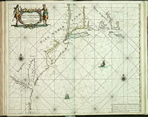
Background imageSpain Collection: Chart of New Holland, Virginia and New England, 1660 (engraving)

Chart of New Holland, Virginia and New England, 1660 (engraving)
7340064 Chart of New Holland, Virginia and New England, 1660 (engraving) by Doncker, Hendrick (c.1626-99); 46.5x57 cm; National Maritime Museum, London


All Professionally Made to Order for Quick Shipping


-

Spain Collection

Spain is a country located in southwestern Europe, bordered by Portugal to the west and France to the northeast and has a population of approximately 47 million people and its capital city is Madrid. Spain's geography includes mountain ranges such as the Pyrenees and Sierra Nevada, as well as coastal regions along both the Mediterranean Sea and Atlantic Ocean. The country has a diverse economy with industries including tourism, agriculture, manufacturing, and services. Spain is known for its rich history and culture, including famous landmarks like La Sagrada Familia in Barcelona and flamenco dancing in Andalusia.
+

Our beautiful Wall Art and Photo Gifts include Framed Prints, Photo Prints, Poster Prints, Canvas Prints, Jigsaw Puzzles, Metal Prints and so much more

The Spain collection from Media Storehouse is a stunning assortment of wall art and framed prints that showcase the beauty, history, and culture of Spain. Our collection features an array of maps and charts that depict different regions, cities, landmarks, and historical events in Spain. These pieces are perfect for those who love to travel or have a passion for geography. From vintage-style maps to contemporary designs, the Spain collection offers something for everyone's taste. Each piece is printed on high-quality paper using archival inks to ensure long-lasting color vibrancy. The frames are made with premium materials such as wood or metal to provide durability while complementing the artwork. Whether you're looking for a unique gift or want to add some character to your home decor, our collection has plenty of options. With its rich history and diverse landscapes, Spain is truly a country worth exploring - let these beautiful maps and charts take you there.
+

What are Spain (Maps and Charts) art prints?

Spain art prints are a collection of high-quality, visually stunning prints that showcase the beauty and intricacies of Spain's geography. These prints feature detailed maps and charts that highlight the country's diverse regions, cities, landmarks, and topography. They are perfect for anyone who loves to explore new places or has an interest in history, geography or travel. These art prints are created using state-of-the-art printing technology on premium quality paper to ensure their longevity and durability. They come in various sizes to suit different preferences and can be framed or mounted according to individual taste. Whether you're looking for a unique piece of wall decor for your home or office space or want to gift someone with a special memento from Spain, these art prints offer something for everyone. With their intricate details and vibrant colors, they capture the essence of this beautiful country like no other medium can.
+

What Spain (Maps and Charts) art prints can I buy from Media Storehouse?

We offer a wide variety of Spain art prints for purchase. These prints range from vintage maps of Spain to modern charts depicting the country's geography, landmarks, and attractions. Some popular options include antique city plans of Madrid or Barcelona, detailed topographical maps highlighting the Pyrenees Mountains or Andalusian coastlines, and colorful illustrations showcasing Spanish culture such as flamenco dancing or bullfighting. In addition to traditional paper prints, Media Storehouse also offers canvas and framed options for many of their Spain pieces. You can choose from a range of sizes to fit their space needs, whether they are looking for a small accent piece or a large statement print. We provide an extensive selection of high-quality Spain art prints that cater to various tastes and preferences.
+

How do I buy Spain (Maps and Charts) art prints?

To buy Spain art prints from Media Storehouse, you can browse our extensive collection of artwork online. Simply search for "Spain Maps and Charts" in the search bar on our website to find a range of options available. Once you have found the print that you like, select the size and format that suits your needs. We offer a variety of printing options including canvas, framed prints, posters, and photographic prints. You can choose between different sizes as well as finishes such as gloss or matte. Once you have made your selection, add it to your cart and proceed to checkout where you will be prompted to enter your payment details. After completing the purchase process, your order will be processed by our team who will ensure that it is printed according to your specifications before being shipped out for delivery. Buying Spain art prints from Media Storehouse is an easy process with plenty of options available for customization so that you can get exactly what you want.
+

How much do Spain (Maps and Charts) art prints cost?

We offer a wide range of Spain art prints at varying prices. Our collection includes vintage maps, antique charts, and contemporary designs that capture the beauty and history of this fascinating country. The cost of our Spain art prints depends on various factors such as size, framing options, and printing materials. We use high-quality paper stock to ensure that our prints are long-lasting and vibrant in color. Our you can choose from different sizes ranging from small to large formats depending on their preferences. We also offer custom framing services for those who want to display their artwork in style. Our Spain art prints are perfect for home or office decor, gifts for friends or family members who love travel or history buffs interested in exploring the rich cultural heritage of Spain. With our extensive collection of Spain art prints available at affordable prices, you're sure to find something that suits your taste.
+

How will my Spain (Maps and Charts) art prints be delivered to me?

Your Spain art prints will be delivered to you in a secure and protective packaging. We take great care in ensuring that your artwork arrives at your doorstep in perfect condition. We use high-quality materials for our packaging to prevent any damage during transit. The delivery method may vary depending on your location and the size of the print(s). For smaller prints, we usually ship them via standard mail or courier service. Larger prints may require special handling and will be shipped using a different carrier. Once your order is dispatched, you will receive an email notification with tracking information so that you can monitor its progress until it reaches you. If there are any issues with delivery, please do not hesitate to contact us as we are always happy to assist our customers. Rest assured that your Spain art prints will be delivered safely and securely to your chosen address.