Fraud Blocker Skip to main content

Home > Maps and Charts > Ireland

Ireland Collection (page 7)

Ireland is an island nation located in the northwestern part of Europe

1,432 items

Background imageIreland Collection: Isles of Scilly, 1680 (manuscript on vellum)

Isles of Scilly, 1680 (manuscript on vellum)
7340775 Isles of Scilly, 1680 (manuscript on vellum) by Thornton, John (1641-1708); National Maritime Museum, London, UK; (add.info.: Creator: Bayly, Simon; Thornton, John Single sheet)

Background imageIreland Collection: Chart of Scilly Isles, c.1693 (print)

Chart of Scilly Isles, c.1693 (print)
7340689 Chart of Scilly Isles, c.1693 (print) by Collins, Greenvile (1643-94); National Maritime Museum, London, UK; (add.info.: Creator: Greenvile Collins 'The Islands of Scilly')

Background imageIreland Collection: A general chart for the purpose of pricking off ship's track from England southward

A general chart for the purpose of pricking off ship's track from England southward and round the world (detail)
7340631 A general chart for the purpose of pricking off ship's track from England southward and round the world (detail), 1860 (print) by British School

Background imageIreland Collection: Chart of River Thames from London to the Buoy of the Noure, 1686 (print)

Chart of River Thames from London to the Buoy of the Noure, 1686 (print)
7340613 Chart of River Thames from London to the Buoy of the Noure, 1686 (print) by Unknown Artist, (17th century); National Maritime Museum, London

Background imageIreland Collection: Map of Willesden and Hampstead, 1746 (coloured engraving)

Map of Willesden and Hampstead, 1746 (coloured engraving)
7340515 Map of Willesden and Hampstead, 1746 (coloured engraving) by Rocque, John (c.1704-d.1762); 51x67 cm; National Maritime Museum, London

Background imageIreland Collection: Map of Acton, Paddington, Hyde Park and Kensington, 1746 (coloured engraving)

Map of Acton, Paddington, Hyde Park and Kensington, 1746 (coloured engraving)
7340514 Map of Acton, Paddington, Hyde Park and Kensington, 1746 (coloured engraving) by Rocque, John (c.1704-d.1762); 51x67 cm; National Maritime Museum, London

Background imageIreland Collection: Map of Hackney, Waltham and Wanstead, 1746 (coloured engraving)

Map of Hackney, Waltham and Wanstead, 1746 (coloured engraving)
7340505 Map of Hackney, Waltham and Wanstead, 1746 (coloured engraving) by Rocque, John (c.1704-d.1762); 51x67 cm; National Maritime Museum, London

Background imageIreland Collection: Map of Mottingham, Bromley and Chislehurst, 1746 (coloured engraving)

Map of Mottingham, Bromley and Chislehurst, 1746 (coloured engraving)
7340504 Map of Mottingham, Bromley and Chislehurst, 1746 (coloured engraving) by Rocque, John (c.1704-d.1762); 51x67 cm; National Maritime Museum, London

Background imageIreland Collection: England-East Coast. Outer Gabbard to Outer Dowsing, 1961 (engraving)

England-East Coast. Outer Gabbard to Outer Dowsing, 1961 (engraving)
7340582 England-East Coast. Outer Gabbard to Outer Dowsing, 1961 (engraving) by British School, (20th century) ; 99.5x66 cm; National Maritime Museum, London

Background imageIreland Collection: England East Coast, 1955 (engraving)

England East Coast, 1955 (engraving)
7340578 England East Coast, 1955 (engraving) by British School, (20th century) ; National Maritime Museum, London, UK; (add.info.: Creator)

Background imageIreland Collection: England East Coast, 1941 (engraving)

England East Coast, 1941 (engraving)
7340577 England East Coast, 1941 (engraving) by British School, (20th century) ; National Maritime Museum, London, UK; (add.info.: Creator)

Background imageIreland Collection: The battle off the Isle of Wight on 4 August, 1588, c.1590 (coloured engraving)

The battle off the Isle of Wight on 4 August, 1588, c.1590 (coloured engraving)
7340028 The battle off the Isle of Wight on 4 August, 1588, c.1590 (coloured engraving) by Adams, Robert (1540-95) (after); 38x50 cm; National Maritime Museum, London

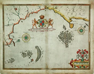
Background imageIreland Collection: The English engage the Spanish fleet near Plymouth on 31 July, 1588, c.1590 (coloured engraving)

The English engage the Spanish fleet near Plymouth on 31 July, 1588, c.1590 (coloured engraving)
7340026 The English engage the Spanish fleet near Plymouth on 31 July, 1588, c.1590 (coloured engraving) by Adams, Robert (1540-95) (after); 37x50 cm; National Maritime Museum, London

Background imageIreland Collection: England East Coast: Southwolds to Cromer, 1846 (print)

England East Coast: Southwolds to Cromer, 1846 (print)
7340601 England East Coast: Southwolds to Cromer, 1846 (print) by Walker, J. & C. (19th century); 63x47.5 cm; National Maritime Museum, London, UK; (add.info.: Creator: British Admiralty; Captn)

Background imageIreland Collection: England East Coast: Orford Ness to Crome, 1874-87 (engraving)

England East Coast: Orford Ness to Crome, 1874-87 (engraving)
7340594 England East Coast: Orford Ness to Crome, 1874-87 (engraving) by British School, (19th century); 92.5x64 cm; National Maritime Museum, London

Background imageIreland Collection: England East Coast: Outer Gabbard to Outer Dowsing, 1919 (engraving)

England East Coast: Outer Gabbard to Outer Dowsing, 1919 (engraving)
7340592 England East Coast: Outer Gabbard to Outer Dowsing, 1919 (engraving) by British School, (20th century) ; 63.1x96 cm; National Maritime Museum, London

Background imageIreland Collection: England East Coast from Thames Estuary to the Wash, 1698 (engraving)

England East Coast from Thames Estuary to the Wash, 1698 (engraving)
7340590 England East Coast from Thames Estuary to the Wash, 1698 (engraving) by Collins, Greenvile (1643-94); 92x57.5 cm; National Maritime Museum, London

Background imageIreland Collection: Portulan chart constructed by William Borough showing the sea area of the North Sea and Baltic

Portulan chart constructed by William Borough showing the sea area of the North Sea and Baltic
7340468 Portulan chart constructed by William Borough showing the sea area of the North Sea and Baltic, from the east coast of England to the head of the Gulf of Sweden, c.1580 (vellum) by Borough

Background imageIreland Collection: Hampshire or the county of Southampton including the Isle of Wight, 1791 (engraving)

Hampshire or the county of Southampton including the Isle of Wight, 1791 (engraving)
7340465 Hampshire or the county of Southampton including the Isle of Wight, 1791 (engraving) by Milne, Thomas (18th century); 50x70.5 cm; National Maritime Museum, London

Background imageIreland Collection: Chart of Cork harbour, Ireland, 1780 (ink, watercolour)

Chart of Cork harbour, Ireland, 1780 (ink, watercolour)
7340463 Chart of Cork harbour, Ireland, 1780 (ink, watercolour) by Unknown artist, (18th century); 38.5x72 cm; National Maritime Museum, London

Background imageIreland Collection: A chart of the seacoasts from the Landsend of England to Cape Bona Esperanca, 1675 (engraving)

A chart of the seacoasts from the Landsend of England to Cape Bona Esperanca, 1675 (engraving)
7340048 A chart of the seacoasts from the Landsend of England to Cape Bona Esperanca, 1675 (engraving) by Seller, John (1632-97); 45x55.5 cm; National Maritime Museum, London

Background imageIreland Collection: Map of 'The pursuit to Calais, 4 - 6 August 1588', 1590 (technical drawing)

Map of 'The pursuit to Calais, 4 - 6 August 1588', 1590 (technical drawing)
7340033 Map of 'The pursuit to Calais, 4 - 6 August 1588', 1590 (technical drawing) by Adams, Robert (1540-95) (after); 43x53.5 cm; National Maritime Museum, London

Background imageIreland Collection: A chart tracking the voyage of the ship, Edwin Fox from Portsmouth, 1865 (print)

A chart tracking the voyage of the ship, Edwin Fox from Portsmouth, 1865 (print)
7342552 A chart tracking the voyage of the ship, Edwin Fox from Portsmouth, 1865 (print) by Unknown Artist, (19th century); National Maritime Museum, London, UK; (add.info.: Unknown Artist)

Background imageIreland Collection: The English pilot the first book: describing the northern navigation, c.1671 (paper)

The English pilot the first book: describing the northern navigation, c.1671 (paper)
7342405 The English pilot the first book: describing the northern navigation, c.1671 (paper) by Seller, John (1632-97); National Maritime Museum, London, UK; (add.info.: Creator: John Seller Map 6)

Background imageIreland Collection: Map of Kingsale Harbour (coloured etching)

Map of Kingsale Harbour (coloured etching)
7342242 Map of Kingsale Harbour (coloured etching) by Unknown artist, (18th century); 51x61.7 cm; National Maritime Museum, London, UK; (add.info.: Creator: F)

Background imageIreland Collection: Map showing telegraph lines between England and Australia, 1863. (print)

Map showing telegraph lines between England and Australia, 1863. (print)
7419988 Map showing telegraph lines between England and Australia, 1863. (print); (add.info.: Map showing telegraph lines between England and Australia in 1863)

Background imageIreland Collection: Map of Smerwick, Ireland, showing the English earthwork with two guns for attacking the Spanish fort

Map of Smerwick, Ireland, showing the English earthwork with two guns for attacking the Spanish fort
7339829 Map of Smerwick, Ireland, showing the English earthwork with two guns for attacking the Spanish fort and English soldiers marching out of Castell More, 1580 (paper, linen) by Unknown Artist

Background imageIreland Collection: The description of Muskery, c.1590 (paper, linen)

The description of Muskery, c.1590 (paper, linen)
7339827 The description of Muskery, c.1590 (paper, linen) by Unknown Artist, (16th century); 26.5x43 cm; National Maritime Museum, London, UK; (add.info.: Creator: unknown From volume eight)

Background imageIreland Collection: Chart of Kinsale, 1601 (paper, linen)

Chart of Kinsale, 1601 (paper, linen)
7339824 Chart of Kinsale, 1601 (paper, linen) by Unknown Artist, (17th century); 28x43.5 cm; National Maritime Museum, London, UK; (add.info.: Creator: unknown From volume eight, Maps of Ireland)

Background imageIreland Collection: Chart of the English coast, Isle of Wight and Portsmouth harbour, 1693 (coloured engraving)

Chart of the English coast, Isle of Wight and Portsmouth harbour, 1693 (coloured engraving)
7339372 Chart of the English coast, Isle of Wight and Portsmouth harbour, 1693 (coloured engraving) by Jaillot, Alexis-Hubert (1632-1712); 64x97 cm; National Maritime Museum, London

Background imageIreland Collection: Ireland Kingstown Harbour surveyed by Commander G.A.Frazer M.R.I.A. 1838

Ireland Kingstown Harbour surveyed by Commander G.A.Frazer M.R.I.A. 1838. Additions by Captain Frazer to 1857
7339460 Ireland Kingstown Harbour surveyed by Commander G.A.Frazer M.R.I.A. 1838. Additions by Captain Frazer to 1857., 1857 (engraving) by Frazer, G.A

Background imageIreland Collection: A chart of the Channel between England and France, 1702 (coloured engraving)

A chart of the Channel between England and France, 1702 (coloured engraving)
7339452 A chart of the Channel between England and France, 1702 (coloured engraving) by British School, (18th Century); 46x58 cm; National Maritime Museum, London

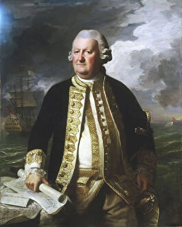
Background imageIreland Collection: Admiral Clark Gayton (1720-1787), 1779 (oil on canvas)

Admiral Clark Gayton (1720-1787), 1779 (oil on canvas)
7337908 Admiral Clark Gayton (1720-1787), 1779 (oil on canvas) by Copley, John Singleton (1738-1815); 127x101.8 cm; National Maritime Museum, London

Background imageIreland Collection: Gillingham and Cookham Bloods, River Medway, c.1680 (coloured manuscript)

Gillingham and Cookham Bloods, River Medway, c.1680 (coloured manuscript)
7337539 Gillingham and Cookham Bloods, River Medway, c.1680 (coloured manuscript) by Gomme, Bernard de (1620-85); 36.2x53.2 cm; National Maritime Museum, London

Background imageIreland Collection: Ice chart of the southern hemisphere compiled from the voyages of Cook 1772-5

Ice chart of the southern hemisphere compiled from the voyages of Cook 1772-5, Bellingshausen 1819-21
7295406 Ice chart of the southern hemisphere compiled from the voyages of Cook 1772-5, Bellingshausen 1819-21... and Shackleton 1908-9, 1874-1910 (lithograph) by British School

Background imageIreland Collection: Map of England, Ireland, and Scotland based on Ptolemy's geography showing the island of Brazil

Map of England, Ireland, and Scotland based on Ptolemy's geography showing the island of Brazil just west of
MMM5473033 Map of England, Ireland, and Scotland based on Ptolemy's geography showing the island of Brazil just west of Ireland

Background imageIreland Collection: Map of Roman Britain c. 410. From Historical Atlas, published 1923 (print)

Map of Roman Britain c. 410. From Historical Atlas, published 1923 (print)
2603520 Map of Roman Britain c. 410. From Historical Atlas, published 1923 (print)

Background imageIreland Collection: Map of Scotland, England, Ireland in 900 (Map of british islands, England)

Map of Scotland, England, Ireland in 900 (Map of british islands, England)
ELD4930071 Map of Scotland, England, Ireland in 900 (Map of british islands, England, Scotland and Ireland in 900) Plate from Houze's Universal Atlas

Background imageIreland Collection: Map of England, Ireland, Scotland and Isle of Man, 1100-1280 (Map of England, Ireland)

Map of England, Ireland, Scotland and Isle of Man, 1100-1280 (Map of England, Ireland, Scotland and island of Man)
ELD4928123 Map of England, Ireland, Scotland and Isle of Man, 1100-1280 (Map of England, Ireland, Scotland and island of Man, 1100 - 1280) Engraving from " Atlas Universel" by Houze

Background imageIreland Collection: Map of the United States in 1819 showing the territory under occupation of the Spanish

Map of the United States in 1819 showing the territory under occupation of the Spanish
NWI4846207 Map of the United States in 1819 showing the territory under occupation of the Spanish and English colonial populations

Background imageIreland Collection: Mutinerie du Bounty: logbook or ship's log of William Bligh, commander of the Bounty

Mutinerie du Bounty: logbook or ship's log of William Bligh, commander of the Bounty
ELD4881307 Mutinerie du Bounty: logbook or ship's log of William Bligh, commander of the Bounty, written after the mutiny during the travel on the boat adrift

Background imageIreland Collection: Geographic map of England and France when King Henry II came to power (1133-1189) in 1154

Geographic map of England and France when King Henry II came to power (1133-1189) in 1154
NWI4874482 Geographic map of England and France when King Henry II came to power (1133-1189) in 1154. Lithograph of the 19th century.; (add.info)

Background imageIreland Collection: Map showing the area in the North Sea mined by the British during WWI

Map showing the area in the North Sea mined by the British during WWI, from The War Illustrated Album Deluxe, pub.1915
3502686 Map showing the area in the North Sea mined by the British during WWI, from The War Illustrated Album Deluxe, pub.1915; (add.info)

Background imageIreland Collection: Dress during the Protectorate, 1653-1659. She wears five ribbons in her hair, a tall lace collar

Dress during the Protectorate, 1653-1659. She wears five ribbons in her hair, a tall lace collar
FLO4594692 Dress during the Protectorate, 1653-1659. She wears five ribbons in her hair, a tall lace collar, a black dress with green sleeves and scarlet shoulders over embroidered petticoats

Background imageIreland Collection: The death of Captain James Cook, 1850

The death of Captain James Cook, 1850
3480624 The death of Captain James Cook, 1850; (add.info.: 19th century illustration showing the death of Captain James Cook (1728 - 14 February 1779)

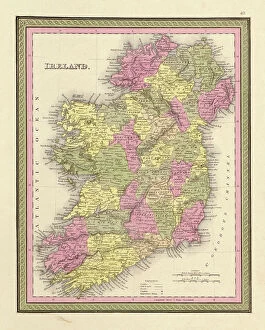
Background imageIreland Collection: Ireland, 1849

Ireland, 1849
2902838 Ireland, 1849; (add.info.: Ireland, 1849.); Buyenlarge Archive/UIG

Background imageIreland Collection: New Brighton

New Brighton
2903133 New Brighton; (add.info.: New Brighton, Pennsylvania, 1883.); Buyenlarge Archive/UIG

Background imageIreland Collection: Ulster, Ireland, 1885

Ulster, Ireland, 1885
2902829 Ulster, Ireland, 1885; (add.info.: Ulster, Ireland, 1885.); Buyenlarge Archive/UIG


All Professionally Made to Order for Quick Shipping


-

Ireland Collection

Ireland is an island nation located in the northwestern part of Europe. It covers an area of 70,273 square kilometers and has a population of approximately 4.9 million people. The country is divided into four provinces: Leinster, Munster, Connacht, and Ulster. Ireland's capital city is Dublin which is also its largest city. The official languages are Irish and English with Catholicism being the predominant religion. Ireland's economy relies heavily on exports particularly in pharmaceuticals, software development, and financial services sectors. Its natural beauty attracts millions of tourists annually to explore its rugged coastline, rolling hillsides dotted with sheep farms as well as ancient castles and ruins dating back centuries ago.
+

Our beautiful pictures are available as Framed Prints, Photos, Wall Art and Photo Gifts

The Ireland collection from Media Storehouse is a stunning compilation of vintage maps and charts that depict the beautiful landscapes, cities, towns, and coastlines of Ireland. Our collection features an extensive range of prints that showcase different regions in Ireland, including Dublin City Centre, Cork Harbour, Galway Bay, Connemara National Park, Ring of Kerry and many more. These maps are carefully curated to provide a unique perspective on the history and geography of Ireland. They offer a glimpse into the past with their intricate details such as old road networks or historical landmarks. Our collection includes both black-and-white and color prints which can be customized to suit any decor style. Whether you're looking for wall art for your home or office space or searching for unique gifts for loved ones who have an affinity towards Irish culture or heritage - our collection has something special to offer everyone. These high-quality framed prints make perfect additions to any room's decor while also being educational pieces that spark conversations about Irish history and geography.
+

What are Ireland (Maps and Charts) art prints?

Ireland art prints are high-quality reproductions of antique maps and charts depicting the geography, topography, and history of Ireland. These prints showcase the intricate details of Ireland's landscape, including its mountains, rivers, lakes, cities, towns, and historical landmarks. We offer a fascinating glimpse into Ireland's past as well as its present-day layout. These art prints are perfect for anyone with an interest in Irish history or geography. They make great gifts for those who have a connection to Ireland or simply appreciate beautiful artwork. The prints come in a variety of sizes to suit any space or decor style. We offer a wide selection of these stunning art prints that can be easily ordered online from their website. Each print is made using high-quality materials to ensure longevity and durability over time. Whether you're looking for something to hang on your wall at home or in your office space, these Ireland art prints will add character and charm to any room they're displayed in.
+

What Ireland (Maps and Charts) art prints can I buy from Media Storehouse?

We offer a wide range of Ireland art prints that are perfect for adding a touch of Irish charm to your home or office. These prints feature detailed maps and charts of various regions in Ireland, showcasing the country's rich history and culture. Some popular options include vintage maps of Dublin, Cork, Galway, and Belfast, as well as antique charts depicting the coastlines and waterways around Ireland. You can also find contemporary designs featuring colorful illustrations of iconic landmarks like the Cliffs of Moher or the Giant's Causeway. Whether you're looking for a unique gift for an Irish friend or simply want to decorate your own space with some beautiful artwork inspired by this stunning country, we have plenty of options to choose from. With high-quality printing on premium paper stock, these art prints are sure to impress anyone who sees them.
+

How do I buy Ireland (Maps and Charts) art prints?

To purchase Ireland art prints from Media Storehouse, you can browse our extensive collection of prints online. Simply search for the specific print you are interested in or browse through their categories to find a print that catches your eye. Once you have found the perfect print, select the size and format that suits your needs. We offer a range of formats including framed prints, canvas prints, and photographic prints. You can also choose to customize your order by selecting different framing options or adding a mount. Once you have made your selection, simply add it to your cart and proceed to checkout. At this point, you will be prompted to enter your shipping information and payment details. Buying Ireland art prints from Media Storehouse is an easy process that allows you to bring beautiful artwork into your home or office with just a few clicks of a button.
+

How much do Ireland (Maps and Charts) art prints cost?

We offer a wide range of Ireland art prints that are available at varying prices. Our collection includes high-quality prints featuring detailed maps and charts of different regions in Ireland, showcasing the country's rich history and culture. Our pricing is competitive and affordable, ensuring that everyone can find something they love within their budget. We have options for every taste and preference, from vintage-style prints to modern designs. Each print is produced using premium materials to ensure longevity and durability. They are printed on high-quality paper with vibrant colors that will not fade over time. Whether you're looking for a unique piece of art to decorate your home or office or searching for the perfect gift for an Irish enthusiast, our Ireland art prints are an excellent choice. With our extensive selection of designs at various price points, you're sure to find the perfect print to suit your needs.
+

How will my Ireland (Maps and Charts) art prints be delivered to me?

We take great care in delivering your Ireland art prints to you. We use high-quality packaging materials to ensure that your print arrives in perfect condition. Depending on the size of the print, it will either be delivered flat or rolled up in a sturdy tube. We work with trusted courier partners who provide reliable and secure delivery services. Once your order has been dispatched, you will receive an email notification with tracking information so that you can keep track of its progress. We understand how important it is for our customers to receive their orders promptly and safely. That's why we strive to deliver all orders as quickly as possible while ensuring they are well-protected during transit. Whether you're ordering for yourself or as a gift for someone else, rest assured that your Ireland art prints will be delivered to you with the utmost care and attention from Media Storehouse.