Fraud Blocker Skip to main content

Home > Maps and Charts > Ireland

Ireland Collection (page 6)

Ireland is an island nation located in the northwestern part of Europe

1,432 items

Background imageIreland Collection: First World War: France, Humorous map showing the two Austrian

First World War: France, Humorous map showing the two Austrian and German emperors in pig on a dance imposed by
LUX4736554 First World War: France, Humorous map showing the two Austrian and German emperors in pig on a dance imposed by the allies and nicknamed "the last tango"

Background imageIreland Collection: First World War: France, Patriotic Map showing the plane of the distruding triple agreement

First World War: France, Patriotic Map showing the plane of the distruding triple agreement and German Zeppelin, 1914
LUX4740514 First World War: France, Patriotic Map showing the plane of the distruding triple agreement and German Zeppelin

Background imageIreland Collection: Map of Scotland showing Telford's and military roads, 1850

Map of Scotland showing Telford's and military roads, 1850
3359154 Map of Scotland showing Telford's and military roads, 1850; (add.info.: Map of Scotland showing Telford's roads (dotted lines) and military roads (solid lines)

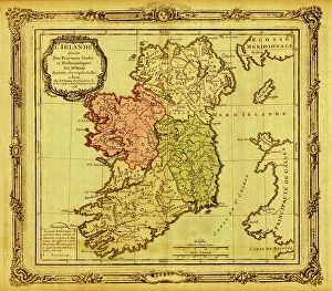
Background imageIreland Collection: Ireland pictured in Ecclesiastical Divisions, 1766

Ireland pictured in Ecclesiastical Divisions, 1766
2902828 Ireland pictured in Ecclesiastical Divisions, 1766; (add.info.: Ireland pictured in Ecclesiastical Divisions, 1766.); Buyenlarge Archive/UIG

Background imageIreland Collection: Memoir Map of Ireland, 1797

Memoir Map of Ireland, 1797
2902826 Memoir Map of Ireland, 1797; (add.info.: Memoir Map of Ireland, 1797.); Buyenlarge Archive/UIG

Background imageIreland Collection: Tudor nobleman (detail), from a map of England and wales by John Speed, c.1612 (engraving)

Tudor nobleman (detail), from a map of England and wales by John Speed, c.1612 (engraving)
2911212 Tudor nobleman (detail), from a map of England and wales by John Speed, c.1612 (engraving); Universal History Archive/UIG

Background imageIreland Collection: Tudor nobleman (detail), from a map of England and wales by John Speed, c.1612 (engraving)

Tudor nobleman (detail), from a map of England and wales by John Speed, c.1612 (engraving)
2911211 Tudor nobleman (detail), from a map of England and wales by John Speed, c.1612 (engraving); Universal History Archive/UIG

Background imageIreland Collection: English Claims to North America, 1755

English Claims to North America, 1755
2902802 English Claims to North America, 1755; (add.info.: The English empire in North America; Representing their rightful claim as confirmed by charters)

Background imageIreland Collection: London: The City Churches (litho)

London: The City Churches (litho)
8629747 London: The City Churches (litho) by English Photographer, (20th century); Private Collection; (add.info.: The City Churches)

Background imageIreland Collection: London: The Palace of Westminster (litho)

London: The Palace of Westminster (litho)
8629745 London: The Palace of Westminster (litho) by English Photographer, (20th century); Private Collection; (add.info.: The Palace of Westminster)

Background imageIreland Collection: The Grand National course, Aintree (litho)

The Grand National course, Aintree (litho)
8664071 The Grand National course, Aintree (litho) by English School, (20th century); Private Collection; (add.info.: The Grand National course, Aintree, Merseyside)

Background imageIreland Collection: Ancient Roman walls of Chester (litho)

Ancient Roman walls of Chester (litho)
8672213 Ancient Roman walls of Chester (litho) by English School, (20th century); Private Collection; (add.info.: The ancient Roman walls of the city of Chester, Cheshire)

Background imageIreland Collection: Plan of St Andrews (b/w photo)

Plan of St Andrews (b/w photo)
8648812 Plan of St Andrews (b/w photo) by English Photographer, (20th century); Private Collection; (add.info.: Plan of St Andrews)

Background imageIreland Collection: Map of Fenland (b/w photo)

Map of Fenland (b/w photo)
8648808 Map of Fenland (b/w photo) by English Photographer, (20th century); Private Collection; (add.info.: Map of Fenland)

Background imageIreland Collection: Map of the Channel Islands (b/w photo)

Map of the Channel Islands (b/w photo)
8648805 Map of the Channel Islands (b/w photo) by English Photographer, (20th century); Private Collection; (add.info.: Map of the Channel Islands)

Background imageIreland Collection: Map of the Upper Severn (b/w photo)

Map of the Upper Severn (b/w photo)
8648796 Map of the Upper Severn (b/w photo) by English Photographer, (20th century); Private Collection; (add.info.: Map of the Upper Severn)

Background imageIreland Collection: Map of the Tunbridge Wells Country (b/w photo)

Map of the Tunbridge Wells Country (b/w photo)
8648790 Map of the Tunbridge Wells Country (b/w photo) by English Photographer, (20th century); Private Collection; (add.info.: Map of the Tunbridge Wells Country)

Background imageIreland Collection: Map of the Severn below Shrewsbury (b/w photo)

Map of the Severn below Shrewsbury (b/w photo)
8648787 Map of the Severn below Shrewsbury (b/w photo) by English Photographer, (20th century); Private Collection; (add.info.: Map of the Severn below Shrewsbury)

Background imageIreland Collection: Map of the Thames, from the Source to London (b/w photo)

Map of the Thames, from the Source to London (b/w photo)
8648777 Map of the Thames, from the Source to London (b/w photo) by English Photographer, (20th century); Private Collection; (add.info.: Map of the Thames, from the Source to London)

Background imageIreland Collection: Plan of Aberdeen (b/w photo)

Plan of Aberdeen (b/w photo)
8648771 Plan of Aberdeen (b/w photo) by English Photographer, (20th century); Private Collection; (add.info.: Plan of Aberdeen)

Background imageIreland Collection: Map of Sutherland and Caithness (b/w photo)

Map of Sutherland and Caithness (b/w photo)
8648683 Map of Sutherland and Caithness (b/w photo) by English Photographer, (20th century); Private Collection; (add.info.: Map of Sutherland and Caithness)

Background imageIreland Collection: The City Boundaries (b/w photo)

The City Boundaries (b/w photo)
8648673 The City Boundaries (b/w photo) by English Photographer, (20th century); Private Collection; (add.info.: The City Boundaries)

Background imageIreland Collection: The world as known after the circumnavigation by Sir Francis Drake

The world as known after the circumnavigation by Sir Francis Drake
1578478 The world as known after the circumnavigation by Sir Francis Drake; (add.info.: The world as known after the circumnavigation by Sir Francis Drake in the years 1577-1580)

Background imageIreland Collection: Cambridge: Physiographical Map showing Iron Age, Roman and Saxon Remains in and near Cambridge

Cambridge: Physiographical Map showing Iron Age, Roman and Saxon Remains in and near Cambridge (colour litho)
8621722 Cambridge: Physiographical Map showing Iron Age, Roman and Saxon Remains in and near Cambridge (colour litho) by English School

Background imageIreland Collection: Manchester and District (colour litho)

Manchester and District (colour litho)
8658795 Manchester and District (colour litho) by English School, (20th century); Private Collection; (add.info.: Manchester and District)

Background imageIreland Collection: Grims Dyke, Map shewing position in relation to the existing roads (litho)

Grims Dyke, Map shewing position in relation to the existing roads (litho)
8661960 Grims Dyke, Map shewing position in relation to the existing roads (litho) by English School, (20th century); Private Collection; (add.info.: Grims Dyke)

Background imageIreland Collection: Places mentioned in Dickens' Works (litho)

Places mentioned in Dickens' Works (litho)
8652517 Places mentioned in Dickens' Works (litho) by Bartholomew, John George (1860-1920) ; Private Collection; (add.info.: Places mentioned in Dickens' Works)

Background imageIreland Collection: Plan of Southwell (b/w photo)

Plan of Southwell (b/w photo)
8651733 Plan of Southwell (b/w photo) by English Photographer, (20th century); Private Collection; (add.info.: Plan of Southwell)

Background imageIreland Collection: Plan of Glasgow (b/w photo)

Plan of Glasgow (b/w photo)
8651359 Plan of Glasgow (b/w photo) by English Photographer, (20th century); Private Collection; (add.info.: Plan of Glasgow)

Background imageIreland Collection: Map of Cornwall and the Scilly Isles (b/w photo)

Map of Cornwall and the Scilly Isles (b/w photo)
8651358 Map of Cornwall and the Scilly Isles (b/w photo) by English Photographer, (20th century); Private Collection; (add.info.: Map of Cornwall and the Scilly Isles)

Background imageIreland Collection: Part of Speed's map of Wiltshire (engraving)

Part of Speed's map of Wiltshire (engraving)
8641418 Part of Speed's map of Wiltshire (engraving) by English School, (19th century); Private Collection; (add.info.: Part of Speed's map of Wiltshire)

Background imageIreland Collection: OS map, 1922: Dorset (colour litho)

OS map, 1922: Dorset (colour litho)
8645570 OS map, 1922: Dorset (colour litho) by English School, (20th century); Private Collection; (add.info.: Dorset. Illustration for the Ordnance Survey Map of England and Wales)

Background imageIreland Collection: OS map, 1922: Worcestershire, Warwickshire, Hertfordshire (colour litho)

OS map, 1922: Worcestershire, Warwickshire, Hertfordshire (colour litho)
8645560 OS map, 1922: Worcestershire, Warwickshire, Hertfordshire (colour litho) by English School, (20th century); Private Collection; (add.info.: Worcestershire, Warwickshire, Hertfordshire)

Background imageIreland Collection: OS map, 1922: Parts of Kesteven, Parts of Holland, Norfolk (colour litho)

OS map, 1922: Parts of Kesteven, Parts of Holland, Norfolk (colour litho)
8645558 OS map, 1922: Parts of Kesteven, Parts of Holland, Norfolk (colour litho) by English School, (20th century); Private Collection; (add.info.: Parts of Kesteven, Parts of Holland, Norfolk)

Background imageIreland Collection: OS map, 1922: Anglesey, Carnarvonshire, Denbigh (colour litho)

OS map, 1922: Anglesey, Carnarvonshire, Denbigh (colour litho)
8645554 OS map, 1922: Anglesey, Carnarvonshire, Denbigh (colour litho) by English School, (20th century); Private Collection; (add.info.: Anglesey, Carnarvonshire, Denbigh)

Background imageIreland Collection: OS map, 1922: Irish Sea, Lancashire (colour litho)

OS map, 1922: Irish Sea, Lancashire (colour litho)
8645552 OS map, 1922: Irish Sea, Lancashire (colour litho) by English School, (20th century); Private Collection; (add.info.: Irish Sea, Lancashire)

Background imageIreland Collection: Peninsular War (engraving)

Peninsular War (engraving)
8636199 Peninsular War (engraving) by English School, (19th century); Private Collection; (add.info.: Peninsular War. Illustration for Philips' Picturesque History of England edited by J Francon)

Background imageIreland Collection: Picture telegraphy: map of Europe (litho)

Picture telegraphy: map of Europe (litho)
8635920 Picture telegraphy: map of Europe (litho) by English School, (20th century); Private Collection; (add.info.: Picture telegraphy: map of Europe)

Background imageIreland Collection: Famous rivers: The Thames (litho)

Famous rivers: The Thames (litho)
8634757 Famous rivers: The Thames (litho) by English School, (20th century); Private Collection; (add.info.: The Thames. Illustration for Chatterbox, 1913.); © Look and Learn

Background imageIreland Collection: Och! My blessin' go wid ye (colour litho)

Och! My blessin' go wid ye (colour litho)
8656037 Och! My blessin' go wid ye (colour litho) by English School, (20th century); Private Collection; (add.info.: Och! My blessin' go wid ye, every inch of the way that ye go)

Background imageIreland Collection: Ireland (colour litho)

Ireland (colour litho)
8653595 Ireland (colour litho) by English School, (19th century); Private Collection; (add.info.: Ireland. Illustration for "The Times" Atlas (Office of "The Times")

Background imageIreland Collection: Roman Britain (litho)

Roman Britain (litho)
8661402 Roman Britain (litho) by English School, (20th century); Private Collection; (add.info.: Roman Britain. Following the raids of Julius Caesar in 55 and 54 BC the southern British tribes)

Background imageIreland Collection: Sketch Map of the English Lake District (colour litho)

Sketch Map of the English Lake District (colour litho)
8646675 Sketch Map of the English Lake District (colour litho) by English School, (20th century); Private Collection; (add.info.: Sketch Map of the English Lake District)

Background imageIreland Collection: Comic Song, Bradshaw's Guide, 1876 (lithograph on paper)

Comic Song, Bradshaw's Guide, 1876 (lithograph on paper)
8836223 Comic Song, Bradshaw's Guide, 1876 (lithograph on paper) by Packer, Thomas (1824-1896); 35 x 25 cm; Ironbridge Gorge Museum Trust, Telford, Shropshire

Background imageIreland Collection: Primary cities of Europe, their population and degree of trade of individual states (print)

Primary cities of Europe, their population and degree of trade of individual states (print)
6202957 Primary cities of Europe, their population and degree of trade of individual states (print; (add.info.: CARTOGRAPHY "Primary cities of Europe)

Background imageIreland Collection: Detailed plan of the ship 'Revenge' (1805), describing the ballast and the lower level of the boat

Detailed plan of the ship 'Revenge' (1805), describing the ballast and the lower level of the boat
MMM5477551 Detailed plan of the ship 'Revenge' (1805), describing the ballast and the lower level of the boat, a third class of 74 guns; National Maritime Museum, London

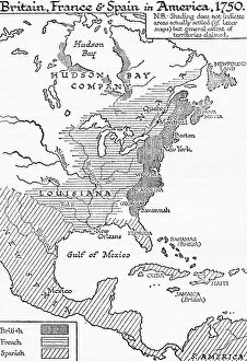
Background imageIreland Collection: Map showing Britain, France and Spain in America, 1750, 1936

Map showing Britain, France and Spain in America, 1750, 1936
7125156 Map showing Britain, France and Spain in America, 1750, 1936; (add.info.: Map showing Britain, France and Spain in America, 1750)

Background imageIreland Collection: Map of the British Colonies south of Canada up to 1783. From British History in Periods

Map of the British Colonies south of Canada up to 1783. From British History in Periods, published 1904 (b/w engraving)
6867187 Map of the British Colonies south of Canada up to 1783. From British History in Periods, published 1904 (b/w engraving); (add.info.: Map of the British Colonies south of Canada up to 1783)


All Professionally Made to Order for Quick Shipping


-

Ireland Collection

Ireland is an island nation located in the northwestern part of Europe. It covers an area of 70,273 square kilometers and has a population of approximately 4.9 million people. The country is divided into four provinces: Leinster, Munster, Connacht, and Ulster. Ireland's capital city is Dublin which is also its largest city. The official languages are Irish and English with Catholicism being the predominant religion. Ireland's economy relies heavily on exports particularly in pharmaceuticals, software development, and financial services sectors. Its natural beauty attracts millions of tourists annually to explore its rugged coastline, rolling hillsides dotted with sheep farms as well as ancient castles and ruins dating back centuries ago.
+

Our beautiful pictures are available as Framed Prints, Photos, Wall Art and Photo Gifts

The Ireland collection from Media Storehouse is a stunning compilation of vintage maps and charts that depict the beautiful landscapes, cities, towns, and coastlines of Ireland. Our collection features an extensive range of prints that showcase different regions in Ireland, including Dublin City Centre, Cork Harbour, Galway Bay, Connemara National Park, Ring of Kerry and many more. These maps are carefully curated to provide a unique perspective on the history and geography of Ireland. They offer a glimpse into the past with their intricate details such as old road networks or historical landmarks. Our collection includes both black-and-white and color prints which can be customized to suit any decor style. Whether you're looking for wall art for your home or office space or searching for unique gifts for loved ones who have an affinity towards Irish culture or heritage - our collection has something special to offer everyone. These high-quality framed prints make perfect additions to any room's decor while also being educational pieces that spark conversations about Irish history and geography.
+

What are Ireland (Maps and Charts) art prints?

Ireland art prints are high-quality reproductions of antique maps and charts depicting the geography, topography, and history of Ireland. These prints showcase the intricate details of Ireland's landscape, including its mountains, rivers, lakes, cities, towns, and historical landmarks. We offer a fascinating glimpse into Ireland's past as well as its present-day layout. These art prints are perfect for anyone with an interest in Irish history or geography. They make great gifts for those who have a connection to Ireland or simply appreciate beautiful artwork. The prints come in a variety of sizes to suit any space or decor style. We offer a wide selection of these stunning art prints that can be easily ordered online from their website. Each print is made using high-quality materials to ensure longevity and durability over time. Whether you're looking for something to hang on your wall at home or in your office space, these Ireland art prints will add character and charm to any room they're displayed in.
+

What Ireland (Maps and Charts) art prints can I buy from Media Storehouse?

We offer a wide range of Ireland art prints that are perfect for adding a touch of Irish charm to your home or office. These prints feature detailed maps and charts of various regions in Ireland, showcasing the country's rich history and culture. Some popular options include vintage maps of Dublin, Cork, Galway, and Belfast, as well as antique charts depicting the coastlines and waterways around Ireland. You can also find contemporary designs featuring colorful illustrations of iconic landmarks like the Cliffs of Moher or the Giant's Causeway. Whether you're looking for a unique gift for an Irish friend or simply want to decorate your own space with some beautiful artwork inspired by this stunning country, we have plenty of options to choose from. With high-quality printing on premium paper stock, these art prints are sure to impress anyone who sees them.
+

How do I buy Ireland (Maps and Charts) art prints?

To purchase Ireland art prints from Media Storehouse, you can browse our extensive collection of prints online. Simply search for the specific print you are interested in or browse through their categories to find a print that catches your eye. Once you have found the perfect print, select the size and format that suits your needs. We offer a range of formats including framed prints, canvas prints, and photographic prints. You can also choose to customize your order by selecting different framing options or adding a mount. Once you have made your selection, simply add it to your cart and proceed to checkout. At this point, you will be prompted to enter your shipping information and payment details. Buying Ireland art prints from Media Storehouse is an easy process that allows you to bring beautiful artwork into your home or office with just a few clicks of a button.
+

How much do Ireland (Maps and Charts) art prints cost?

We offer a wide range of Ireland art prints that are available at varying prices. Our collection includes high-quality prints featuring detailed maps and charts of different regions in Ireland, showcasing the country's rich history and culture. Our pricing is competitive and affordable, ensuring that everyone can find something they love within their budget. We have options for every taste and preference, from vintage-style prints to modern designs. Each print is produced using premium materials to ensure longevity and durability. They are printed on high-quality paper with vibrant colors that will not fade over time. Whether you're looking for a unique piece of art to decorate your home or office or searching for the perfect gift for an Irish enthusiast, our Ireland art prints are an excellent choice. With our extensive selection of designs at various price points, you're sure to find the perfect print to suit your needs.
+

How will my Ireland (Maps and Charts) art prints be delivered to me?

We take great care in delivering your Ireland art prints to you. We use high-quality packaging materials to ensure that your print arrives in perfect condition. Depending on the size of the print, it will either be delivered flat or rolled up in a sturdy tube. We work with trusted courier partners who provide reliable and secure delivery services. Once your order has been dispatched, you will receive an email notification with tracking information so that you can keep track of its progress. We understand how important it is for our customers to receive their orders promptly and safely. That's why we strive to deliver all orders as quickly as possible while ensuring they are well-protected during transit. Whether you're ordering for yourself or as a gift for someone else, rest assured that your Ireland art prints will be delivered to you with the utmost care and attention from Media Storehouse.