Fraud Blocker Skip to main content

Home > Maps and Charts > Early Maps

Early Maps Collection (page 104)

Early maps, also known as maps and charts, were created by ancient civilizations to navigate their surroundings

26,886 items

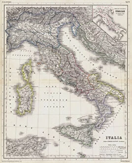
Background imageEarly Maps Collection: Map of Italy in the time before the Romans (coloured engraving)

Map of Italy in the time before the Romans (coloured engraving)
7148251 Map of Italy in the time before the Romans (coloured engraving) by Kiepert, Heinrich (1818-99); Private Collection; (add.info.: Map of Italy in the time before the Romans)

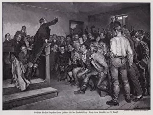
Background imageEarly Maps Collection: German philosopher Professor Henrik Steffens inspiring his audience to join the war to liberate

German philosopher Professor Henrik Steffens inspiring his audience to join the war to liberate Prussian from the rule
7148150 German philosopher Professor Henrik Steffens inspiring his audience to join the war to liberate Prussian from the rule of Napoleon, Breslau, 1813 (engraving) by Kampf

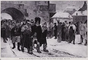
Background imageEarly Maps Collection: Soldiers of Napoleons defeated Grande Armee returning from Russia, 1812 (engraving)

Soldiers of Napoleons defeated Grande Armee returning from Russia, 1812 (engraving)
7148147 Soldiers of Napoleons defeated Grande Armee returning from Russia, 1812 (engraving) by Kampf, Arthur (1864-1950); Private Collection; (add.info)

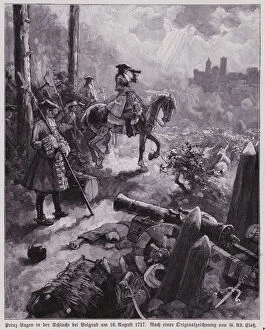
Background imageEarly Maps Collection: Prince Eugene of Savoy at the Battle of Belgrade, 1717 (engraving)

Prince Eugene of Savoy at the Battle of Belgrade, 1717 (engraving)
7148104 Prince Eugene of Savoy at the Battle of Belgrade, 1717 (engraving) by Closs, Gustav Adolf (1864-1938); Private Collection; (add.info.: Prince Eugene of Savoy at the Battle of Belgrade, 1717)

Background imageEarly Maps Collection: Countess Maria Franziska, wife of Margrave Leopold Wilhelm of Baden-Baden

Countess Maria Franziska, wife of Margrave Leopold Wilhelm of Baden-Baden
7148100 Countess Maria Franziska, wife of Margrave Leopold Wilhelm of Baden-Baden, leaving her castle after it was burned by the French, Nine Years War, 1689 (engraving) by Zick

Background imageEarly Maps Collection: Destruction of the Abbey of Hirsau, Germany, by the French army under Ezechiel du Mas

Destruction of the Abbey of Hirsau, Germany, by the French army under Ezechiel du Mas, Comte de Melac, Nine Years War
7148099 Destruction of the Abbey of Hirsau, Germany, by the French army under Ezechiel du Mas, Comte de Melac, Nine Years War, 1692 (engraving) by Closs

Background imageEarly Maps Collection: The Holy Roman Emperor Charles V fleeing across the Alps from the rebellion of Maurice

The Holy Roman Emperor Charles V fleeing across the Alps from the rebellion of Maurice, Elector of Saxony, Austria
7148089 The Holy Roman Emperor Charles V fleeing across the Alps from the rebellion of Maurice, Elector of Saxony, Austria, 1552 (engraving) by Closs

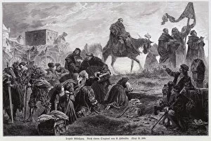
Background imageEarly Maps Collection: Monks led by German Dominican friar Johann Tetzel selling indulgences to the people of Saxony to

Monks led by German Dominican friar Johann Tetzel selling indulgences to the people of Saxony to release them
7148067 Monks led by German Dominican friar Johann Tetzel selling indulgences to the people of Saxony to release them from punishment for their sins, early 16th Century (engraving) by Haberlin

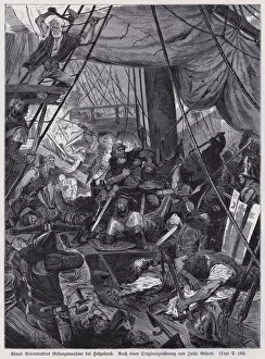
Background imageEarly Maps Collection: Capture of German privateer Klaus von Stortebeker, leader of the Victual Brothers

Capture of German privateer Klaus von Stortebeker, leader of the Victual Brothers
7148034 Capture of German privateer Klaus von Stortebeker, leader of the Victual Brothers, by the Hamburg fleet commanded by Simon of Utrecht, Heligoland, 1401 (engraving) by Gehrts

Background imageEarly Maps Collection: Kriemhild surrounded by her maidens (engraving)

Kriemhild surrounded by her maidens (engraving)
7147997 Kriemhild surrounded by her maidens (engraving) by Klimsch, Eugen (1839-96); Private Collection; (add.info.: Kriemhild surrounded by her maidens)

Background imageEarly Maps Collection: Isolde (engraving)

Isolde (engraving)
7147996 Isolde (engraving) by Schraudolph, Claudius (1843-1902); Private Collection; (add.info.: Isolde. Illustration for Bildersaal Deutscher Geschichte (Union Deutsche Verlagsgesellschaft)

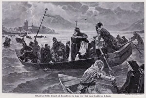
Background imageEarly Maps Collection: Arrival of the Abbess Irmgard, daughter of King Louis the German

Arrival of the Abbess Irmgard, daughter of King Louis the German, at the convent on the island of Frauenchiemsee
7147961 Arrival of the Abbess Irmgard, daughter of King Louis the German, at the convent on the island of Frauenchiemsee, Bavaria, 9th Century (engraving) by Raupp

Background imageEarly Maps Collection: Pagan Yule celebrations of the ancient Germans (engraving)

Pagan Yule celebrations of the ancient Germans (engraving)
7147956 Pagan Yule celebrations of the ancient Germans (engraving) by Zick, Alexander (1845-1907); Private Collection; (add.info.: Pagan Yule celebrations of the ancient Germans)

Background imageEarly Maps Collection: King Rudolf I of Germany over the body of King Ottokar II of Bohemia after defeating him at

King Rudolf I of Germany over the body of King Ottokar II of Bohemia after defeating him at the Battle
7147903 King Rudolf I of Germany over the body of King Ottokar II of Bohemia after defeating him at the Battle on the Marchfeld, Austria, 1278 (engraving) by Zick

Background imageEarly Maps Collection: The Holy Roman Emperor Frederick II greeting his bride to be, Isabella of England

The Holy Roman Emperor Frederick II greeting his bride to be, Isabella of England, daughter of King John
7147896 The Holy Roman Emperor Frederick II greeting his bride to be, Isabella of England, daughter of King John, at Stolzenfels on the banks of the Rhine, 1235 (engraving) by Zick

Background imageEarly Maps Collection: Pope Gregory VII (engraving)

Pope Gregory VII (engraving)
7147865 Pope Gregory VII (engraving) by Knille, Otto (1832-98); Private Collection; (add.info.: Pope Gregory VII (c1015-1085)

Background imageEarly Maps Collection: The Holy Roman Emperor Henry III challenging King Henry I of France to a duel, 1056 (engraving)

The Holy Roman Emperor Henry III challenging King Henry I of France to a duel, 1056 (engraving)
7147864 The Holy Roman Emperor Henry III challenging King Henry I of France to a duel, 1056 (engraving) by Roeber, Fritz (1851-1924); Private Collection; (add.info)

Background imageEarly Maps Collection: Otto I, King of East Francia, reconciled with his brother, Henry

Otto I, King of East Francia, reconciled with his brother, Henry, who had plotted to have him assassinated in 941
7147857 Otto I, King of East Francia, reconciled with his brother, Henry, who had plotted to have him assassinated in 941 (engraving) by Zick

Background imageEarly Maps Collection: Milan Cathedral. Bronze door designed by Italian sculptor Ludovico Pogliaghi

Milan Cathedral. Bronze door designed by Italian sculptor Ludovico Pogliaghi. Major scenes from the bible. Italy
7136756 Milan Cathedral. Bronze door designed by Italian sculptor Ludovico Pogliaghi. Major scenes from the bible. Italy. by Pogliaghi, Ludovico (1857-1950); Milan Cathedral, Milan
Background imageEarly Maps Collection: Saint Joseph des Fins church. Noahs Ark. Stained glass window. Annecy. France

Saint Joseph des Fins church. Noahs Ark. Stained glass window. Annecy. France
7136549 Saint Joseph des Fins church. Noahs Ark. Stained glass window. Annecy. France. by Bellot, Dom Paul (1876-1944); © Pascal Deloche/Godong

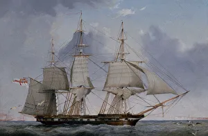
Background imageEarly Maps Collection: A Fifth-Rate 36-Gun Frigate Hove-To on a Starboard Tack (oil on panel)

A Fifth-Rate 36-Gun Frigate Hove-To on a Starboard Tack (oil on panel)
7088882 A Fifth-Rate 36-Gun Frigate Hove-To on a Starboard Tack (oil on panel) by Ward of Hull, John (1798-1849); 15x23 cm; Private Collection

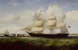
Background imageEarly Maps Collection: Ship Shepherdess passing Perch Rock Fort and Lighthouse as she arrives in the Mersey (oil on canvas)

Ship Shepherdess passing Perch Rock Fort and Lighthouse as she arrives in the Mersey (oil on canvas)
7088841 Ship Shepherdess passing Perch Rock Fort and Lighthouse as she arrives in the Mersey (oil on canvas) by McMinn, Williams Kimmins (1818-98); Private Collection

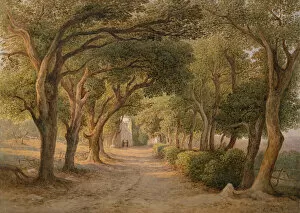
Background imageEarly Maps Collection: Castel Gandolfo (w / c on paper)

Castel Gandolfo (w / c on paper)
7085141 Castel Gandolfo (w/c on paper) by Muller, Rudolf (1802-85); 42x59.7 cm; Private Collection

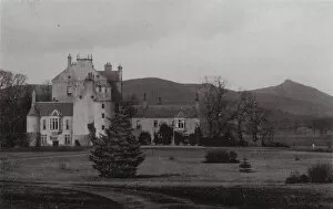
Background imageEarly Maps Collection: Gordon Castle (b / w photo)

Gordon Castle (b / w photo)
7198813 Gordon Castle (b/w photo) by Porter, James (1874-1937); Private Collection; (add.info.: Gordon Castle. Illustration for Views of Elgin and Vicinity (np, c 1905).); © Look and Learn

Background imageEarly Maps Collection: In the Bodleian (litho)

In the Bodleian (litho)
7193820 In the Bodleian (litho) by Stamp, Ernest (1869-1942); Private Collection; (add.info.: In the Bodleian. Illustration for Oxford by Andrew Lang (Seeley, 1906).); © Look and Learn

Background imageEarly Maps Collection: Berwick St Leonard, Wiltshire (colour litho)

Berwick St Leonard, Wiltshire (colour litho)
7193542 Berwick St Leonard, Wiltshire (colour litho) by Twopeny, William (1797-1873); Private Collection; (add.info.: Berwick St Leonard, Wiltshire)

Background imageEarly Maps Collection: Pounds Bridge, near Penshurst, Kent (colour litho)

Pounds Bridge, near Penshurst, Kent (colour litho)
7193539 Pounds Bridge, near Penshurst, Kent (colour litho) by Twopeny, William (1797-1873); Private Collection; (add.info.: Pounds Bridge, near Penshurst, Kent)

Background imageEarly Maps Collection: The 'Feathers'Inn, Ludlow, Shropshire (colour litho)

The "Feathers"Inn, Ludlow, Shropshire (colour litho)
7193538 The " Feathers" Inn, Ludlow, Shropshire (colour litho) by Twopeny, William (1797-1873); Private Collection; (add.info.: The " Feathers" Inn, Ludlow, Shropshire)

Background imageEarly Maps Collection: A Morning Party (engraving)

A Morning Party (engraving)
7192018 A Morning Party (engraving) by Doyle, Richard (1824-83) (after); Private Collection; (add.info.: A Morning Party. Shewing the Nobility and Gentry playing the Fashionable Game of the Period)

Background imageEarly Maps Collection: A Popular Entertainment (engraving)

A Popular Entertainment (engraving)
7192012 A Popular Entertainment (engraving) by Doyle, Richard (1824-83) (after); Private Collection; (add.info.: A Popular Entertainment)

Background imageEarly Maps Collection: Rigi Kaltbad und Vierwaldstattersee (b / w photo)

Rigi Kaltbad und Vierwaldstattersee (b / w photo)
7191938 Rigi Kaltbad und Vierwaldstattersee (b/w photo) by Gaberell, Jean (1887-1949); Private Collection; (add.info.: Rigi Kaltbad und Vierwaldstattersee)

Background imageEarly Maps Collection: Rigi Kaltbad, Fruhling (b / w photo)

Rigi Kaltbad, Fruhling (b / w photo)
7191931 Rigi Kaltbad, Fruhling (b/w photo) by Gaberell, Jean (1887-1949); Private Collection; (add.info.: Rigi Kaltbad, Fruhling)

Background imageEarly Maps Collection: Abendstimmung (b / w photo)

Abendstimmung (b / w photo)
7191917 Abendstimmung (b/w photo) by Gaberell, Jean (1887-1949); Private Collection; (add.info.: Abendstimmung. Illustration for booklet of views of Rigi (np, c 1920).); © Look and Learn

Background imageEarly Maps Collection: Rigi Kulm, Blick auf Zugersee (b / w photo)

Rigi Kulm, Blick auf Zugersee (b / w photo)
7191915 Rigi Kulm, Blick auf Zugersee (b/w photo) by Gaberell, Jean (1887-1949); Private Collection; (add.info.: Rigi Kulm, Blick auf Zugersee)

Background imageEarly Maps Collection: Castle Street (b / w photo)

Castle Street (b / w photo)
7191265 Castle Street (b/w photo) by Porter, James (1874-1937); Private Collection; (add.info.: Castle Street. Illustration for Porters Views of Aberdeen and District (James Porter, Aberdeen)

Background imageEarly Maps Collection: Schoolhill and Upperkirkgate (b / w photo)

Schoolhill and Upperkirkgate (b / w photo)
7191250 Schoolhill and Upperkirkgate (b/w photo) by Porter, James (1874-1937); Private Collection; (add.info.: Schoolhill and Upperkirkgate)

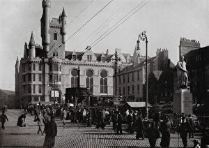
Background imageEarly Maps Collection: Wallace Statue (b / w photo)

Wallace Statue (b / w photo)
7191249 Wallace Statue (b/w photo) by Porter, James (1874-1937); Private Collection; (add.info.: Wallace Statue. Illustration for Porters Views of Aberdeen and District (James Porter, Aberdeen)

Background imageEarly Maps Collection: Bathing Station and Beach (b / w photo)

Bathing Station and Beach (b / w photo)
7191247 Bathing Station and Beach (b/w photo) by Porter, James (1874-1937); Private Collection; (add.info.: Bathing Station and Beach)

Background imageEarly Maps Collection: Westburn Park (b / w photo)

Westburn Park (b / w photo)
7191235 Westburn Park (b/w photo) by Porter, James (1874-1937); Private Collection; (add.info.: Westburn Park. Illustration for Porters Views of Aberdeen and District (James Porter, Aberdeen)
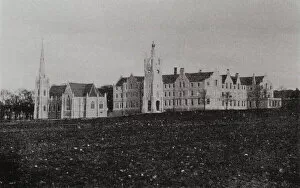
Background imageEarly Maps Collection: Blairs College (b / w photo)

Blairs College (b / w photo)
7191231 Blairs College (b/w photo) by Porter, James (1874-1937); Private Collection; (add.info.: Blairs College. Illustration for Porters Views of Aberdeen and District (James Porter, Aberdeen)

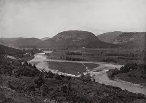
Background imageEarly Maps Collection: Banchory (b / w photo)

Banchory (b / w photo)
7191221 Banchory (b/w photo) by Porter, James (1874-1937); Private Collection; (add.info.: Banchory. Illustration for Porters Views of Aberdeen and District (James Porter, Aberdeen, c 1905)

Background imageEarly Maps Collection: The Green, Aboyne (b / w photo)

The Green, Aboyne (b / w photo)
7191215 The Green, Aboyne (b/w photo) by Porter, James (1874-1937); Private Collection; (add.info.: The Green, Aboyne. Illustration for Porters Views of Aberdeen and District (James Porter, Aberdeen)

Background imageEarly Maps Collection: Ballater (b / w photo)

Ballater (b / w photo)
7191213 Ballater (b/w photo) by Porter, James (1874-1937); Private Collection; (add.info.: Ballater. Illustration for Porters Views of Aberdeen and District (James Porter, Aberdeen, c 1905)

Background imageEarly Maps Collection: Craigendarroch, the Hill of Oaks (b / w photo)

Craigendarroch, the Hill of Oaks (b / w photo)
7191210 Craigendarroch, the Hill of Oaks (b/w photo) by Porter, James (1874-1937); Private Collection; (add.info.: Craigendarroch, the Hill of Oaks)

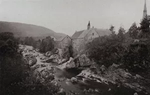
Background imageEarly Maps Collection: Mill on the Clunie (b / w photo)

Mill on the Clunie (b / w photo)
7191200 Mill on the Clunie (b/w photo) by Porter, James (1874-1937); Private Collection; (add.info.: Mill on the Clunie. Illustration for Porters Views of Aberdeen and District (James Porter)

Background imageEarly Maps Collection: Stonehaven (b / w photo)

Stonehaven (b / w photo)
7191192 Stonehaven (b/w photo) by Porter, James (1874-1937); Private Collection; (add.info.: Stonehaven. Illustration for Porters Views of Aberdeen and District (James Porter, Aberdeen, c 1905)

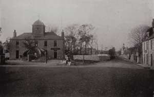
Background imageEarly Maps Collection: Kintore Town Hall (b / w photo)

Kintore Town Hall (b / w photo)
7191182 Kintore Town Hall (b/w photo) by Porter, James (1874-1937); Private Collection; (add.info.: Kintore Town Hall. Illustration for Porters Views of Aberdeen and District (James Porter, Aberdeen)

Background imageEarly Maps Collection: Monymusk House (b / w photo)

Monymusk House (b / w photo)
7191177 Monymusk House (b/w photo) by Porter, James (1874-1937); Private Collection; (add.info.: Monymusk House. Illustration for Porters Views of Aberdeen and District (James Porter, Aberdeen)


All Professionally Made to Order for Quick Shipping


-

Early Maps Collection

Early maps, also known as maps and charts, were created by ancient civilizations to navigate their surroundings. These early cartographers used various techniques such as observation, measurement, and estimation to create accurate depictions of the world around them. The earliest known map dates back to 6th century BCE in Babylonia. As time progressed, more advanced mapping techniques were developed including the use of longitude and latitude lines for navigation purposes. Maps have played a significant role in history by aiding explorers in discovering new lands and helping nations establish boundaries. Today, they can valuable artifacts that provide insight into the past and serve as a reminder of how far cartography has come over time.
+

Our beautiful pictures are available as Framed Prints, Photos, Wall Art and Photo Gifts

The Early Maps collection from Media Storehouse is a fascinating assortment of historical maps and charts that offer an insight into the evolution of cartography. Our collection features antique maps dating back to the 16th century, including world maps, regional maps, city plans, and nautical charts. These meticulously crafted pieces are not only visually stunning but also provide valuable information about the geography, topography, and political boundaries of different regions throughout history. The Early Maps collection offers a unique opportunity for art enthusiasts, historians or anyone interested in exploring the past through visual representation. The prints are available in various sizes and formats such as canvas prints or framed wall art making them suitable for any home or office decor. Whether you're looking to add a touch of vintage charm to your living space or seeking inspiration for research projects on historical geography or navigation techniques - our collection has something for everyone.
+

What are Early Maps (Maps and Charts) art prints?

Early Maps art prints are reproductions of historical maps and charts that were created centuries ago. These maps were originally made by cartographers who used various techniques to accurately depict the geography, topography, and other features of different regions around the world. Early Maps art prints offer a glimpse into how people perceived the world in earlier times, as well as providing valuable information about past civilizations, cultures, and trade routes. These art prints are ideal for history buffs, collectors or anyone who appreciates vintage artwork. They can be displayed in homes or offices to add a touch of elegance and sophistication to any space. We offer a wide variety of Early Maps art prints from different eras such as medieval Europe, ancient Rome or China during the Ming dynasty. These beautiful reproductions provide an opportunity for individuals to own a piece of history while also enjoying stunning works of art that showcase incredible craftsmanship from long ago.
+

What Early Maps (Maps and Charts) art prints can I buy from Media Storehouse?

We offer a wide range of early maps and charts art prints for purchase. These include antique world maps, vintage city plans, historical nautical charts, and topographical surveys from various periods in history. Some of the most popular collections available on Media Storehouse are the 16th-century world maps by Gerardus Mercator and Abraham Ortelius, as well as the 18th-century British county maps by John Speed. In addition to these classic pieces, Media Storehouse also has an extensive collection of rare and unique maps that showcase different regions around the globe. Whether you're looking for a map of ancient Rome or a detailed chart of the Caribbean islands from the 17th century, there is something for everyone at Media Storehouse. All art prints are produced using high-quality materials to ensure they look great on any wall. They come in a variety of sizes and finishes to suit your needs. With so many options available, finding the perfect early map or chart print has never been easier.
+

How do I buy Early Maps (Maps and Charts) art prints?

To buy Early Maps art prints from Media Storehouse, you can browse our online collection of maps and charts. Once you have found the print that you like, simply add it to your cart and proceed to checkout. You will be prompted to enter your shipping information and payment details. After completing your purchase, your print will be printed on high-quality paper using archival inks. We offer a wide range of sizes for their prints so that you can choose the perfect size for your space. We also offer framing options if you prefer to receive a framed print rather than an unframed one. Whether you are looking for antique maps or modern interpretations of historical cartography, we have a vast selection of Early Maps art prints available for purchase. Our easy-to-use website makes it simple to find the perfect piece of artwork for any room in your home or office.
+

How much do Early Maps (Maps and Charts) art prints cost?

We offer a wide range of Early Maps art prints that vary in price depending on the size and type of print you choose. Our prices are competitive and affordable, making it easy for anyone to own a piece of history through our collection of vintage maps and charts. Our Early Maps art prints come in various sizes ranging from small to large, so you can find the perfect fit for your home or office space. We also offer different types of paper finishes such as matte or glossy to suit your preference. Whether you're looking for a unique gift or want to add some character to your living space, our Early Maps art prints are an excellent choice. With their intricate details and historical significance, they make for fascinating conversation starters while adding charm to any room.
+

How will my Early Maps (Maps and Charts) art prints be delivered to me?

We take great care in delivering your Early Maps art prints to you. We use high-quality packaging materials to ensure that your prints are protected during transit. Depending on the size of your order, we may use either a sturdy cardboard tube or a flat package with reinforced corners. We work closely with our trusted delivery partners to ensure that your order arrives safely and on time. Our standard delivery service is reliable and efficient, but if you need your order urgently, we also offer express shipping options for an additional fee. Once your order has been dispatched, you will receive a tracking number so that you can monitor its progress online. If there are any issues with the delivery of your print(s), please do not hesitate to contact us - our friendly customer service team will be happy to assist you in resolving any problems as quickly as possible.