Fraud Blocker Skip to main content

Home > Maps and Charts > British Empire Maps

British Empire Maps Collection (page 2)

British Empire Maps were a collection of maps and charts that depicted the vast territories under British rule during the height of its empire

728 items

Background imageBritish Empire Maps Collection: The Countie and Citie of Lyncolne, engraved by Jodocus Hondius (1563-1612) from John

The Countie and Citie of Lyncolne, engraved by Jodocus Hondius (1563-1612) from John
XCF113458 The Countie and Citie of Lyncolne, engraved by Jodocus Hondius (1563-1612) from John Speeds Theatre of the Empire of Great Britain, pub

Background imageBritish Empire Maps Collection: Rutlandshire with Oukham and Stanford, engraved by Jodocus Hondius (1563-1612)

Rutlandshire with Oukham and Stanford, engraved by Jodocus Hondius (1563-1612)
XCF113456 Rutlandshire with Oukham and Stanford, engraved by Jodocus Hondius (1563-1612) from John Speeds Theatre of the Empire of Great Britain, pub

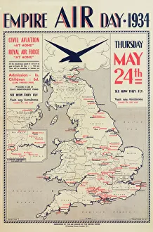
Background imageBritish Empire Maps Collection: Empire Air Day Poster

Empire Air Day Poster
Poster, Empire Air Day 1934, organised by the Air League of the British Empire. A civil aviation and RAF " at home". With a map of UK showing where the events are taking place. May 1934
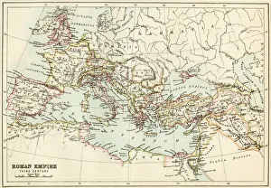
Background imageBritish Empire Maps Collection: Roman Empire, circa 200 AD

Roman Empire, circa 200 AD
Map of the Roman Empire in the third century. Printed color lithograph of a 19th-century illustration

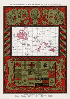
Background imageBritish Empire Maps Collection: British Empire Map 1902

British Empire Map 1902
Map showing the extent of the British Empire in 1902 - the Empire on which the sun never sets

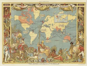
Background imageBritish Empire Maps Collection: Imperial Federation (colour litho)

Imperial Federation (colour litho)
726786 Imperial Federation (colour litho) by Crane, Walter (1845-1915) (after); Private Collection; (add.info.: Imperial Federation - map of the world showing the extent of the British Empire in)

Background imageBritish Empire Maps Collection: Leicester, engraved by Jodocus Hondius (1563-1612) from John Speeds Theatre

Leicester, engraved by Jodocus Hondius (1563-1612) from John Speeds Theatre
XJF113467 Leicester, engraved by Jodocus Hondius (1563-1612) from John Speeds Theatre of the Empire of Great Britain, pub

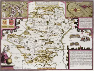
Background imageBritish Empire Maps Collection: Hartfordshire and the situation of Hartford, engraved by Jodocus Hondius (1563-1612)

Hartfordshire and the situation of Hartford, engraved by Jodocus Hondius (1563-1612)
XCF113460 Hartfordshire and the situation of Hartford, engraved by Jodocus Hondius (1563-1612) from John Speeds Theatre of the Empire of Great Britain, pub

Background imageBritish Empire Maps Collection: Empire map of the world

Empire map of the world

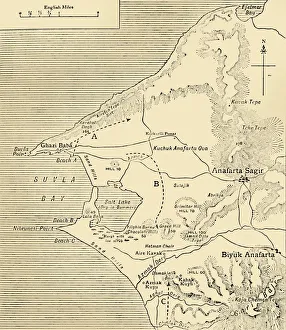
Background imageBritish Empire Maps Collection: Map of Suvla Bay, Gallipoli peninsula, First World War, 1915, (c1920). Creator: Unknown

Map of Suvla Bay, Gallipoli peninsula, First World War, 1915, (c1920). Creator: Unknown
Map of Suvla Bay, Gallipoli peninsula, First World War, 1915, (c1920). After the Suvla Bay Landing: Approximate Positions of General Stopfords Divisions on the night of August 7, 1915

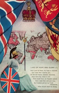
Background imageBritish Empire Maps Collection: Land of Hope and Glory (colour litho)

Land of Hope and Glory (colour litho)
5996702 Land of Hope and Glory (colour litho) by English School, (20th century); Private Collection; (add.info.: Land of Hope and Glory. Postcard, early 20th century.); © Look and Learn

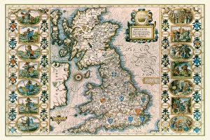
Background imageBritish Empire Maps Collection: Old Map of Anglo Saxon Britain by John Speed

Old Map of Anglo Saxon Britain by John Speed
A facimile of John Speeds historical map of the Saxon Heptarchy originally published for the " Theatre of the Empire of Great Britain"

Background imageBritish Empire Maps Collection: Old Map of The Province of Connacht, Ireland 1611 by John Speed

Old Map of The Province of Connacht, Ireland 1611 by John Speed
A facimile of John Speeds historical map of the Province of Connacht originally published for the " Theatre of the Empire of Great Britain"

Background imageBritish Empire Maps Collection: Map of Bengal, the North West and Central Provinces, and Assam, 1902. Creator: Unknown

Map of Bengal, the North West and Central Provinces, and Assam, 1902. Creator: Unknown
Map of Bengal, the North West and Central Provinces, and Assam, 1902. From The Century Atlas of the World. [John Walker & Co, Ltd. London, 1902]

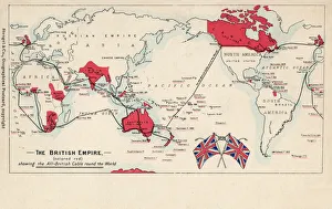
Background imageBritish Empire Maps Collection: Map of British Empire showing international cable

Map of British Empire showing international cable
Map of the British Empire (coloured red), showing the All-British international cable going round the world, enabling telegraphic communication. Date: circa 1902

Background imageBritish Empire Maps Collection: Old County Map of Yorkshire West Riding 1611 by John Speed

Old County Map of Yorkshire West Riding 1611 by John Speed
A facimile of John Speeds historical map of Yorkshire West Riding originally published for the " Theatre of the Empire of Great Britain"

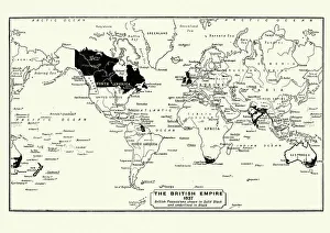
Background imageBritish Empire Maps Collection: Map of the British Empire in 1837

Map of the British Empire in 1837. At its height, the British Empire was the largest empire in history and, for over a century, was the foremost global power

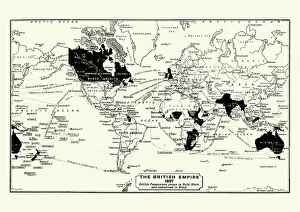
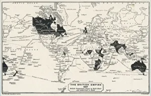
Background imageBritish Empire Maps Collection: Map of the British Empire in 1897

Map of the British Empire in 1897. At its height, the British Empire was the largest empire in history and, for over a century, was the foremost global power

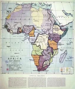
Background imageBritish Empire Maps Collection: Map of Africa showing Treaty Boundaries, 1891 (colour lithograph)

Map of Africa showing Treaty Boundaries, 1891 (colour lithograph)
XCF282018 Map of Africa showing Treaty Boundaries, 1891 (colour lithograph) by English School, (19th century); British Museum, London, UK; English, out of copyright

Background imageBritish Empire Maps Collection: WORLD MAP / 1897

WORLD MAP / 1897
Map of the world showing British Empire possessions

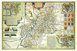
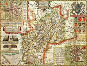
Background imageBritish Empire Maps Collection: Old County Map of Gloucestershire 1611 by John Speed

Old County Map of Gloucestershire 1611 by John Speed
A facimile of John Speeds historical map of Gloucestershire originally published for the " Theatre of the Empire of Great Britain"

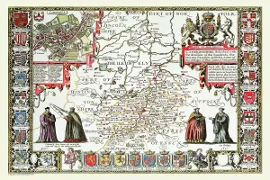
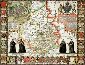
Background imageBritish Empire Maps Collection: Old County Map of Cambridgeshire 1611 by John Speed

Old County Map of Cambridgeshire 1611 by John Speed
A facimile of John Speeds historical map of Cambridgeshire originally published for the " Theatre of the Empire of Great Britain"

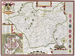
Background imageBritish Empire Maps Collection: Old County Map of Leicestershire 1611 by John Speed

Old County Map of Leicestershire 1611 by John Speed
A facimile of John Speeds historical map of Leicestershire originally published for the " Theatre of the Empire of Great Britain"

Background imageBritish Empire Maps Collection: Leicestershire Historical John Speed 1610 Map

Leicestershire Historical John Speed 1610 Map
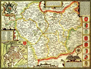
A reproduction of John Speeds historical map of the county of Leicestershire. Originally published as part of his atlas called The Theatre of the Empire of Great Britain in 1610

Background imageBritish Empire Maps Collection: Norfolk Historical John Speed 1610 Map

Norfolk Historical John Speed 1610 Map
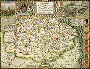
A reproduction of John Speeds historical map of the county of Norfolk. Originally published as part of his atlas called The Theatre of the Empire of Great Britain in 1610

Background imageBritish Empire Maps Collection: Suffolk Historical John Speed 1610 Map

Suffolk Historical John Speed 1610 Map
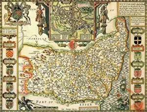
A reproduction of John Speeds historical map of the county of Suffolk. Originally published as part of his atlas called The Theatre of the Empire of Great Britain in 1610

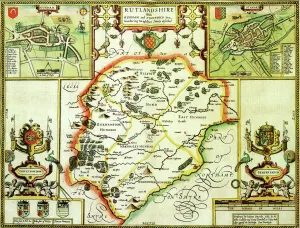
Background imageBritish Empire Maps Collection: Rutland Historical John Speed 1610 Map

Rutland Historical John Speed 1610 Map
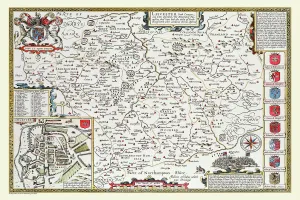
A reproduction of John Speeds historical map of the county of Rutland. Originally published as part of his atlas called The Theatre of the Empire of Great Britain in 1610

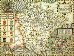
Background imageBritish Empire Maps Collection: Devon Historical John Speed 1610 Map

Devon Historical John Speed 1610 Map
A reproduction of John Speeds historical map of the county of Devon. Originally published as part of his atlas called The Theatre of the Empire of Great Britain in 1610

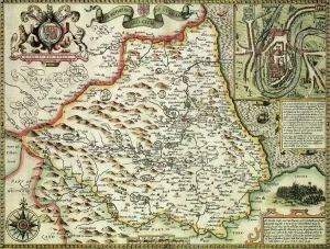
Background imageBritish Empire Maps Collection: Durham Historical John Speed 1610 Map

Durham Historical John Speed 1610 Map
A reproduction of John Speeds historical map of the county of Durham. Originally published as part of his atlas called The Theatre of the Empire of Great Britain in 1610

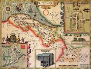
Background imageBritish Empire Maps Collection: Flintshire Historical John Speed 1610 Map

Flintshire Historical John Speed 1610 Map
A reproduction of John Speeds historical map of the county of Flintshire. Originally published as part of his atlas called The Theatre of the Empire of Great Britain in 1610

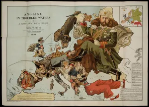
Background imageBritish Empire Maps Collection: Angling in Troubled Waters. A Serio-Comic Map of Europe. Artist: Fred W

Angling in Troubled Waters. A Serio-Comic Map of Europe. Artist: Fred W. Rose (active End of 19th cen. )
Angling in Troubled Waters. A Serio-Comic Map of Europe. Private Collection

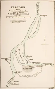
Background imageBritish Empire Maps Collection: Kartoum, Sudan, 1884, from The Journals of Major-General C. G. Gordon, C. B. at Kartoum

Kartoum, Sudan, 1884, from The Journals of Major-General C. G. Gordon, C. B. at Kartoum
KW259860 Kartoum, Sudan, 1884, from The Journals of Major-General C.G. Gordon, C.B. at Kartoum, published by Kegan Paul Trench & Co

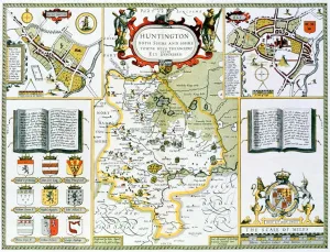
Background imageBritish Empire Maps Collection: Huntington, engraved by Jodocus Hondius (1563-1612) from John Speeds Theatre

Huntington, engraved by Jodocus Hondius (1563-1612) from John Speeds Theatre
XCF113473 Huntington, engraved by Jodocus Hondius (1563-1612) from John Speeds Theatre of the Empire of Great Britain, pub

Background imageBritish Empire Maps Collection: Hantshire, engraved by Jodocus Hondius (1563-1612) from John Speeds Theatre

Hantshire, engraved by Jodocus Hondius (1563-1612) from John Speeds Theatre
XCF113466 Hantshire, engraved by Jodocus Hondius (1563-1612) from John Speeds Theatre of the Empire of Great Britain, pub

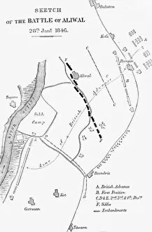
Background imageBritish Empire Maps Collection: Plan of the Battle of Aliwal, c1891. Creator: James Grant

Plan of the Battle of Aliwal, c1891. Creator: James Grant
Plan of the Battle of Aliwal, c1891. From " Cassells Illustrated History of India Vol. II.", by James Grant. [Cassell Petter & Galpin, London, Paris and New York]

Background imageBritish Empire Maps Collection: Map of the Roman provinces of Gaul, Britannia and Germania (coloured engraving)

Map of the Roman provinces of Gaul, Britannia and Germania (coloured engraving)
7148263 Map of the Roman provinces of Gaul, Britannia and Germania (coloured engraving) by Kiepert, Heinrich (1818-99); Private Collection; (add.info.: Map of the Roman provinces of Gaul)

Background imageBritish Empire Maps Collection: Cover of a catalogue of linoleum samples published by Barrys of Kirkcaldy, 1935-36 (colour litho)

Cover of a catalogue of linoleum samples published by Barrys of Kirkcaldy, 1935-36 (colour litho)
7193331 Cover of a catalogue of linoleum samples published by Barrys of Kirkcaldy, 1935-36 (colour litho) by English School

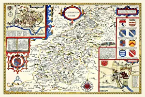
Background imageBritish Empire Maps Collection: Old County Map of Northamptonshire 1611 by John Speed

Old County Map of Northamptonshire 1611 by John Speed
A facimile of John Speeds historical map of Northamptonshire originally published for the " Theatre of the Empire of Great Britain"

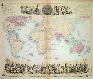
Background imageBritish Empire Maps Collection: Map Of The World Showing In Red The Extent Of The British Empire In 1901

Map Of The World Showing In Red The Extent Of The British Empire In 1901

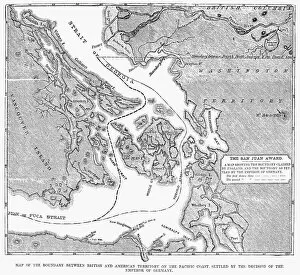
Background imageBritish Empire Maps Collection: CANADA: MAP, 1872. Map of the boundary between British and American territory on the Pacific coast

CANADA: MAP, 1872. Map of the boundary between British and American territory on the Pacific coast, settled by the decision of the Emperor of Germany by arbitration in 1872

Background imageBritish Empire Maps Collection: OldCounty Map of Wiltshire 1611 by John Speed

OldCounty Map of Wiltshire 1611 by John Speed
A facimile of John Speeds historical map of Wiltshire published for the " Theatre of the Empire of Great Britain", an atlas to accompany " a history of Great Britain"

Background imageBritish Empire Maps Collection: Cambridgeshire Historical John Speed 1610 Map

Cambridgeshire Historical John Speed 1610 Map
A reproduction of John Speeds historical map of the county of Cambridgeshire. Originally published as part of his atlas called The Theatre of the Empire of Great Britain in 1610

Background imageBritish Empire Maps Collection: Gloucestershire Historical John Speed 1610 Map

Gloucestershire Historical John Speed 1610 Map
A reproduction of John Speeds historical map of the county of Gloucestershire. Originally published as part of his atlas called The Theatre of the Empire of Great Britain in 1610

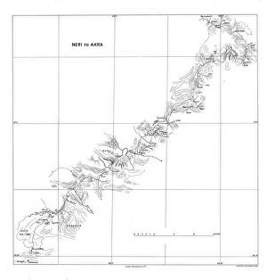
Background imageBritish Empire Maps Collection: Neri to Akra, c1915. Creator: Stanfords Geographical Establishment

Neri to Akra, c1915. Creator: Stanfords Geographical Establishment
Neri to Akra, c1915. Map showing the journey of British writer, soldier and diplomatic advisor Mark Sykes in Turkey, (at that time part of the Ottoman Empire)

Background imageBritish Empire Maps Collection: British Empire throughout the World (coloured engraving)

British Empire throughout the World (coloured engraving)
XCF275033 British Empire throughout the World (coloured engraving) by English School, (19th century); Private Collection; English, out of copyright

Background imageBritish Empire Maps Collection: The Russo-Turkish War, 1877-78, map of the seat of war in Europe

The Russo-Turkish War, 1877-78, map of the seat of war in Europe
3062101 The Russo-Turkish War, 1877-78, map of the seat of war in Europe.; Private Collection; (add.info.: From The Century Edition of Cassell's History of England, published c. 1900)

Background imageBritish Empire Maps Collection: Map showing the Roman roads in Britain. Illustrated Easy Stories from English History

Map showing the Roman roads in Britain. Illustrated Easy Stories from English History
1000964 Map showing the Roman roads in Britain. Illustrated Easy Stories from English History.; Private Collection

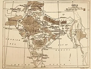
Background imageBritish Empire Maps Collection: Map showing the British Control over India

Map showing the British Control over India
3523302 Map showing the British Control over India; (add.info.: Map showing the British Control over India. Dated 19th Century); Universal History Archive/UIG


All Professionally Made to Order for Quick Shipping


-

British Empire Maps Collection

British Empire Maps were a collection of maps and charts that depicted the vast territories under British rule during the height of its empire. These maps were created by cartographers, explorers, and military personnel who documented their findings on land, sea, and air. They provided valuable information for navigation, trade routes, colonization efforts, and military strategy. The maps also reflected the political power dynamics of the time as they showed how Britain controlled large parts of Africa, Asia, North America, Australia and New Zealand. Today these maps are important historical artifacts that offer insights into colonialism's impact on indigenous peoples' lives and cultures around the world.
+

Our beautiful pictures are available as Framed Prints, Photos, Wall Art and Photo Gifts

The British Empire Maps collection is a fascinating assortment of maps and charts that depict the vastness and complexity of the British Empire during its peak. Our collection , available through our wall art and framed prints, offers a glimpse into the history of one of the most powerful empires in world history. From detailed maps showcasing trade routes to colorful illustrations depicting colonial territories, our collection provides an insight into how Britain once ruled over much of the world. The maps are beautifully crafted with intricate details that capture the essence of each region under British rule. Whether you're interested in exploring historical geography or simply looking for unique decor for your home or office space, our collection has something for everyone. With high-quality printing techniques used on premium paper stock, these prints are sure to make a statement wherever they are displayed. The British Empire Maps collection from Media Storehouse is an excellent resource for anyone seeking to learn about or celebrate Britain's imperial past.
+

What are British Empire Maps (Maps and Charts) art prints?

British Empire Maps art prints are a collection of historical maps and charts that depict the vast territories once controlled by the British Empire. These art prints showcase the intricate details of various regions, including coastlines, rivers, mountains, cities, and other landmarks. They also feature important trade routes and shipping lanes that were crucial to the expansion of the British Empire. These maps and charts were originally created for navigational purposes or as tools for military strategy during colonial times. Today they serve as fascinating pieces of artwork that offer a glimpse into our shared history. Each print is carefully reproduced using high-quality printing techniques to ensure that every detail is captured accurately. Whether you're a history buff or simply appreciate beautiful artwork, these British Empire Maps art prints are sure to impress. They make great additions to any home or office space and are perfect conversation starters for guests who admire them.
+

What British Empire Maps (Maps and Charts) art prints can I buy from Media Storehouse?

We offer a wide range of British Empire Maps art prints that you can purchase. These maps showcase the vastness and diversity of the British Empire during its peak, covering various regions such as Africa, Asia, Australia, Canada, India, New Zealand and more. You can choose from different styles of maps including antique or vintage designs that add a touch of nostalgia to your home decor. The collection includes detailed topographical maps as well as political maps showing the territories under British rule at different points in history. Whether you are interested in exploring historical geography or simply looking for unique wall art to decorate your space with an imperial theme, we have something for everyone. With high-quality printing techniques used on premium paper stock materials, these prints will make a lasting impression on any viewer.
+

How do I buy British Empire Maps (Maps and Charts) art prints?

To buy British Empire Maps art prints from Media Storehouse, you can browse our extensive collection of vintage maps and charts online. Once you have found the print that you want to purchase, simply add it to your cart and proceed to checkout. You will be prompted to enter your shipping information and payment details. We offer a variety of sizes for their art prints, so make sure to select the size that best fits your needs. We also offer framing options if you prefer a ready-to-hang piece of artwork. Our collection includes maps from various time periods in the history of the British Empire, including colonial America, India, Africa, Australia and New Zealand. These maps are not only beautiful pieces of art but also serve as historical documents that provide insight into past political boundaries and cultural landscapes. Buying British Empire Maps art prints from Media Storehouse is an easy process that allows you to bring a piece of history into your home or office space.
+

How much do British Empire Maps (Maps and Charts) art prints cost?

We offer a wide range of British Empire Maps art prints at varying prices. Our collection includes vintage maps from the 18th and 19th centuries as well as more modern reproductions. The cost of each print depends on factors such as size, framing options, and the specific map or chart chosen. We take pride in offering high-quality prints that are perfect for home decor or office spaces. Each print is carefully crafted using premium materials to ensure longevity and durability. Whether you're looking for a unique gift or a stunning addition to your own collection, our selection of British Empire Maps art prints has something for everyone. With so many options available, you're sure to find the perfect piece at an affordable price point that suits your budget.
+

How will my British Empire Maps (Maps and Charts) art prints be delivered to me?

We take pride in delivering your British Empire Maps art prints with utmost care. We use high-quality packaging materials to ensure that your print arrives in perfect condition. Your print will be carefully rolled and placed into a sturdy cardboard tube for protection during transit. We work with trusted delivery partners who offer reliable shipping services worldwide. Once your order has been dispatched, you will receive a tracking number so you can monitor the progress of your delivery. Our team is dedicated to ensuring that all orders are processed efficiently and delivered promptly. If you have any questions or concerns about the delivery of your British Empire Maps art prints, please do not hesitate to contact us. We are always happy to help.