Fraud Blocker Skip to main content

Home > Maps and Charts > Americas

Americas Collection (page 42)

"Americas " refers to a collection of maps and charts that depict the geography, topography, climate, demographics, and other aspects of North America

7,012 items

Background imageAmericas Collection: Map of the Ice Age in North America (colour litho)

Map of the Ice Age in North America (colour litho)
5995600 Map of the Ice Age in North America (colour litho) by English School, (20th century); Private Collection; (add.info.: Map of the Ice Age in North America)

Background imageAmericas Collection: North America (colour litho)

North America (colour litho)
5996937 North America (colour litho) by English School, (20th century); Private Collection; (add.info.: North America. Illustration from The Modern World Encyclopedia)

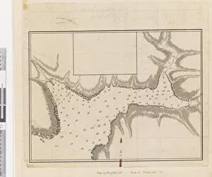
Background imageAmericas Collection: ib. A Plan of the Harbour of Croque in Newfoundland, 1763 (pen & ink and wash)

ib. A Plan of the Harbour of Croque in Newfoundland, 1763 (pen & ink and wash)
5670246 ib. A Plan of the Harbour of Croque in Newfoundland, 1763 (pen & ink and wash) by Cook, James (1728-79); Mitchell Library, State Library of New South Wales; (add.info.: Original Sketches)

Background imageAmericas Collection: Birds eye view of the city of Lansing, Michigan 1866 (colour litho)

Birds eye view of the city of Lansing, Michigan 1866 (colour litho)
6256737 Birds eye view of the city of Lansing, Michigan 1866 (colour litho) by American School, (19th century); 50x71 cm; Private Collection; American, out of copyright

Background imageAmericas Collection: Birds eye view of Boston, c. 1902 (colour litho)

Birds eye view of Boston, c. 1902 (colour litho)
6256305 Birds eye view of Boston, c.1902 (colour litho) by American School, (20th century); 42x63 cm; Private Collection; (add.info.: Boston, Geo. H. Walker & Co); American, out of copyright

Background imageAmericas Collection: City of New-York, Brooklyn, Jersey City & Quarantine Station on Staten Island, c

City of New-York, Brooklyn, Jersey City & Quarantine Station on Staten Island, c
5897737 City of New-York, Brooklyn, Jersey City & Quarantine Station on Staten Island, c.1850 (colour litho) by American School, (19th century); Private Collection; American, out of copyright

Background imageAmericas Collection: Thaddeus Kosciuszko, the friend of Washington, 1839 (litho)

Thaddeus Kosciuszko, the friend of Washington, 1839 (litho)
5853976 Thaddeus Kosciuszko, the friend of Washington, 1839 (litho) by Girard, A. (fl.1839); Private Collection; (add.info)

Background imageAmericas Collection: Map of Upper and Lower Bays of New York Harbor (b / w photo)

Map of Upper and Lower Bays of New York Harbor (b / w photo)
5215539 Map of Upper and Lower Bays of New York Harbor (b/w photo) by American Photographer, (19th century); Private Collection; (add.info.: Map of Upper and Lower Bays of New York Harbor)

Background imageAmericas Collection: Map of Greater New York (b / w photo)

Map of Greater New York (b / w photo)
5215538 Map of Greater New York (b/w photo) by American Photographer, (19th century); Private Collection; (add.info.: Map of Greater New York)

Background imageAmericas Collection: Roman Empire in its greatest extent (colour litho)

Roman Empire in its greatest extent (colour litho)
5207099 Roman Empire in its greatest extent (colour litho) by American School, (19th century); Private Collection; (add.info.: Roman Empire in its greatest extent)

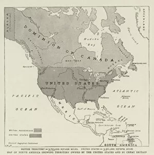
Background imageAmericas Collection: Map of North America showing Territory owned by the United States and by Great Britain (engraving)

Map of North America showing Territory owned by the United States and by Great Britain (engraving)
1056864 Map of North America showing Territory owned by the United States and by Great Britain (engraving) by English School

Background imageAmericas Collection: New York, 1889 (colour litho)

New York, 1889 (colour litho)
5914782 New York, 1889 (colour litho) by American School, (19th century); New York Public Library, USA; (add.info.: Series of advertising cards issued by Arbuckle Bros)

Background imageAmericas Collection: Plan of Chicago, Chicago, Illinois, Railroad Circuits Diagram

Plan of Chicago, Chicago, Illinois, Railroad Circuits Diagram
5862232 Plan of Chicago, Chicago, Illinois, Railroad Circuits Diagram, 1909 (colored ink and paint on a printed map) by Burnham, Daniel Hudson (1846-1912); 77x62 cm; The Art Institute of Chicago, IL

Background imageAmericas Collection: Map of Philadelphia, from an Atlas of the United States, 1824 (engraving)

Map of Philadelphia, from an Atlas of the United States, 1824 (engraving)
497565 Map of Philadelphia, from an Atlas of the United States, 1824 (engraving) by KlinckowstrAom, Axel Leonhard (1775-1837); 56x44 cm; Gilder Lehrman Collection, New York

Background imageAmericas Collection: Map of the United States, 1816 (engraving)

Map of the United States, 1816 (engraving)
497555 Map of the United States, 1816 (engraving) by Melish, John (1771-1822); Gilder Lehrman Collection, New York, USA; eGilder Lehrman Institute of American History; American, out of copyright

Background imageAmericas Collection: Confederate Civil War map of the Army of Mississippi camp at Corinth, Mississippi

Confederate Civil War map of the Army of Mississippi camp at Corinth, Mississippi
696118 Confederate Civil War map of the Army of Mississippi camp at Corinth, Mississippi, May 1862 (litho) by American School, (19th century); 58.5x50 cm; Gilder Lehrman Collection, New York

Background imageAmericas Collection: A sketch of the operations before Charlestown, the capital of South Carolina, c

A sketch of the operations before Charlestown, the capital of South Carolina, c
696019 A sketch of the operations before Charlestown, the capital of South Carolina, c.1780 (colour litho) by DesBarres, Joseph Frederick Wallet (1721-1824); 110x81 cm; Gilder Lehrman Collection

Background imageAmericas Collection: Plan of the Bay and City of Rio de Janeiro and the disposition of the French

Plan of the Bay and City of Rio de Janeiro and the disposition of the French
694860 Plan of the Bay and City of Rio de Janeiro and the disposition of the French and Portuguese naval forces during the French attack under Duguay-Trouin in 1711, c.1730 (engraving) by Coquart

Background imageAmericas Collection: To his excellency George Clinton, Esq... This plan of the City of New York

To his excellency George Clinton, Esq... This plan of the City of New York
1079225 To his excellency George Clinton, Esq... This plan of the City of New York and its environs... 1785 (black & colour ink, black pencil, and colour wash on paper backed with cloth) by Hills

Background imageAmericas Collection: Map of the City of New-York, 1854 (engraving, ink on paper)

Map of the City of New-York, 1854 (engraving, ink on paper)
1079219 Map of the City of New-York, 1854 (engraving, ink on paper) by Hayward, George (c.1800-72); Collection of the New-York Historical Society

Background imageAmericas Collection: Manhattan Island circa 1765-1770 from the Battery to above Turtle Bay

Manhattan Island circa 1765-1770 from the Battery to above Turtle Bay
1079257 Manhattan Island circa 1765-1770 from the Battery to above Turtle Bay, 1845 (Pen-and-ink (black and colour), watercolour, pencil on paper.) by American School

Background imageAmericas Collection: Map of the City of New York showing the Location of Small Pox

Map of the City of New York showing the Location of Small Pox
1079248 Map of the City of New York showing the Location of Small Pox, from May 1st 1874 to April 30th 1875. 1874-75 (black ink on paper) by American School

Background imageAmericas Collection: New York City Map, 1857, 1857 (black ink on paper, colour wash)

New York City Map, 1857, 1857 (black ink on paper, colour wash)
1079240 New York City Map, 1857, 1857 (black ink on paper, colour wash) by American School, (19th century); 38x66, on sheet 43x74 cm; Collection of the New-York Historical Society

Background imageAmericas Collection: Map of the city and county environs of New York with original characters

Map of the city and county environs of New York with original characters
1079238 Map of the city and county environs of New York with original characters and illusutrations, 1850, 1850 (black ink on paper, backed with cloth) by American School

Background imageAmericas Collection: Bernardino Rivadavia, Argentinian revolutionary and politician (chromolitho)

Bernardino Rivadavia, Argentinian revolutionary and politician (chromolitho)
1093553 Bernardino Rivadavia, Argentinian revolutionary and politician (chromolitho) by French School, (19th century); Private Collection; (add.info.: Bernardino Rivadavia (1780-1845)

Background imageAmericas Collection: Spanish-American War (engraving)

Spanish-American War (engraving)
1063480 Spanish-American War (engraving) by English School, (19th century); Private Collection; (add.info.: Spanish-American War)

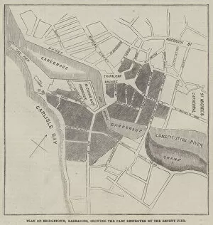
Background imageAmericas Collection: Plan of Bridgetown, Barbadoes, showing the Part destroyed by the Recent Fire (engraving)

Plan of Bridgetown, Barbadoes, showing the Part destroyed by the Recent Fire (engraving)
1098670 Plan of Bridgetown, Barbadoes, showing the Part destroyed by the Recent Fire (engraving) by English School, (19th century); Private Collection; (add.info.: Plan of Bridgetown, Barbadoes)

Background imageAmericas Collection: Map of North America, showing the Relative Positions of Texas and Oregon with the United States

Map of North America, showing the Relative Positions of Texas and Oregon with the United States (engraving)
1101471 Map of North America, showing the Relative Positions of Texas and Oregon with the United States (engraving) by English School

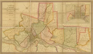
Background imageAmericas Collection: A Map of the County of Philadelphia, from Actual Survey, 1843 (colour litho)

A Map of the County of Philadelphia, from Actual Survey, 1843 (colour litho)
1121423 A Map of the County of Philadelphia, from Actual Survey, 1843 (colour litho) by American School, (19th century); Free Library of Philadelphia; (add.info)

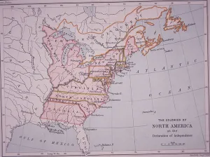
Background imageAmericas Collection: The Colonies of North America at the Declaration of Independence (colour litho)

The Colonies of North America at the Declaration of Independence (colour litho)
PNP468338 The Colonies of North America at the Declaration of Independence (colour litho) by Stanford, Edward (1827-1904); Private Collection; (add.info)

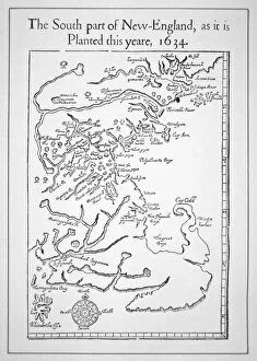
Background imageAmericas Collection: Map including Massachusetts Bay (litho)

Map including Massachusetts Bay (litho)
PNP367770 Map including Massachusetts Bay (litho) by American School; Private Collection; (add.info.: the south part of New-England as it is planted this yeare)

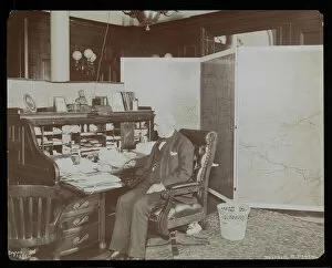
Background imageAmericas Collection: Chauncey Depew in his office, 1898 (silver gelatin print)

Chauncey Depew in his office, 1898 (silver gelatin print)
MNY381659 Chauncey Depew in his office, 1898 (silver gelatin print) by Byron Company (fl.1890-1942); 20.3x25.4 cm; Museum of the City of New York, USA; (add.info.: Chauncey Depew (1834-1928)

Background imageAmericas Collection: Amerigo Vespucci, in the Sala del Mappamondo (fresco)

Amerigo Vespucci, in the Sala del Mappamondo (fresco)
808745 Amerigo Vespucci, in the Sala del Mappamondo (fresco) by Italian School, (16th century); Villa Farnese, Caprarola, Voterbo, Lazio

Background imageAmericas Collection: Andrew Ellicot, from A New Nation... by John Benson Lossing (litho)

Andrew Ellicot, from A New Nation... by John Benson Lossing (litho)
752915 Andrew Ellicot, from A New Nation... by John Benson Lossing (litho) by American School, (19th century); New York Public Library, USA; (add.info.: Andrew Ellicott (January 24, 1754 - August 28)

Background imageAmericas Collection: Philadelphia in 1886 (colour litho)

Philadelphia in 1886 (colour litho)
483714 Philadelphia in 1886 (colour litho) by Burk, William, and McFetridge, John (fl.1886); 104x183 cm; Free Library of Philadelphia; eFree Library of Philadelphia; Map Collection

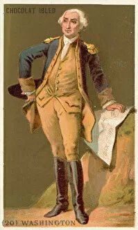
Background imageAmericas Collection: George Washington, first President of the United States (chromolitho)

George Washington, first President of the United States (chromolitho)
2815969 George Washington, first President of the United States (chromolitho) by French School, (19th century); Private Collection; (add.info.: George Washington (1732-1799)

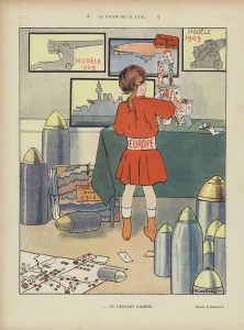
Background imageAmericas Collection: The palace of peace. Illustration for Le Rire (colour litho)

The palace of peace. Illustration for Le Rire (colour litho)
2786581 The palace of peace. Illustration for Le Rire (colour litho) by French School, (20th century); Private Collection; (add.info.: The palace of peace)

Background imageAmericas Collection: Tabor St. and Olney Road, Hexamer General Surveys, 1894 (colour litho)

Tabor St. and Olney Road, Hexamer General Surveys, 1894 (colour litho)
2630790 Tabor St. and Olney Road, Hexamer General Surveys, 1894 (colour litho) by Hexamer, Ernest (1827-1912); Free Library of Philadelphia; (add.info.: Hexamer General Surveys)

Background imageAmericas Collection: Antique Map of Lower Manhattan and Central Park, 1892 (colour litho)

Antique Map of Lower Manhattan and Central Park, 1892 (colour litho)
2630128 Antique Map of Lower Manhattan and Central Park, 1892 (colour litho) by American School, (19th century); Private Collection; (add.info.: Antique map of lower Manhattan and Central Park)

Background imageAmericas Collection: Global Communications, 1945 (screen print)

Global Communications, 1945 (screen print)
2630022 Global Communications, 1945 (screen print) by American School, (20th century); Private Collection; (add.info.: Telephone, telegraph, and television operators in front of a world map)

Background imageAmericas Collection: Two Hemispheres of the Earth Facing Each Other, 1959 (colour litho)

Two Hemispheres of the Earth Facing Each Other, 1959 (colour litho)
2630055 Two Hemispheres of the Earth Facing Each Other, 1959 (colour litho) by American School, (20th century); Private Collection; Photo eGraphicaArtis; American, out of copyright

Background imageAmericas Collection: Sketch of the skirmish at Petersburg: between the Royal Army under the command of Major

Sketch of the skirmish at Petersburg: between the Royal Army under the command of Major
2629684 Sketch of the skirmish at Petersburg: between the Royal Army under the command of Major Gel. Phillips and the American army commandd by Major Genl

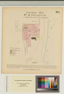
Background imageAmericas Collection: Providence Mill, Little Elk Creek, Maryland, Hexamer General Surveys (colour litho)

Providence Mill, Little Elk Creek, Maryland, Hexamer General Surveys (colour litho)
3077382 Providence Mill, Little Elk Creek, Maryland, Hexamer General Surveys (colour litho) by Hexamer, Ernest (1827-1912); Free Library of Philadelphia; (add.info.: Hexamer General Surveys)

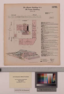
Background imageAmericas Collection: Hannis Distilling Co.s Mount Vernon Distillery, Maryland, Hexamer General Surveys

Hannis Distilling Co.s Mount Vernon Distillery, Maryland, Hexamer General Surveys
3077391 Hannis Distilling Co.s Mount Vernon Distillery, Maryland, Hexamer General Surveys, 1880 (colour litho) by Hexamer

Background imageAmericas Collection: Poster advertising Pan American World Airways

Poster advertising Pan American World Airways - Round the World, Round the Clock Date: 1955

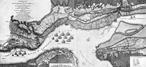
Background imageAmericas Collection: A Correct Plan of the environs of Quebec and of the battle fought on 13th September

A Correct Plan of the environs of Quebec and of the battle fought on 13th September
3058239 A Correct Plan of the environs of Quebec and of the battle fought on 13th September, 1759 (engraving) by Jefferys

Background imageAmericas Collection: An Imaginary Map of America, 1500 (colour litho)

An Imaginary Map of America, 1500 (colour litho)
3101935 An Imaginary Map of America, 1500 (colour litho) by Ford, Henry Justice (1860-1941); Private Collection; (add.info.: An Imaginary Map of America, 1500)

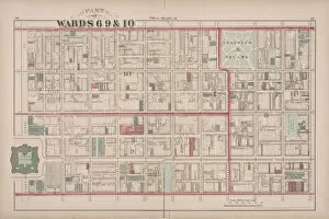
Background imageAmericas Collection: 2nd to 20th and 29th and 31st Wards, 1875: Volume 6, Atlas of the City of Philadelphia

2nd to 20th and 29th and 31st Wards, 1875: Volume 6, Atlas of the City of Philadelphia
3090933 2nd to 20th and 29th and 31st Wards, 1875: Volume 6, Atlas of the City of Philadelphia, 1875 (colour litho) by American School


All Professionally Made to Order for Quick Shipping


-

Americas Collection

"Americas " refers to a collection of maps and charts that depict the geography, topography, climate, demographics, and other aspects of North America, Central America, South America, and the Caribbean. These maps and charts are used for educational purposes in schools and universities as well as by researchers studying various topics related to the Americas. They provide valuable information about landforms such as mountains, rivers, lakes; political boundaries between countries; population density; natural resources distribution; transportation networks; weather patterns among others. The use of these maps has helped people understand the complex nature of this vast region better.
+

Our beautiful pictures are available as Framed Prints, Photos, Wall Art and Photo Gifts

The Americas collection from Media Storehouse is a stunning assortment of wall art and framed prints that showcase the beauty and diversity of North, Central, and South America. Our collection features an extensive range of maps and charts that depict various regions, cities, countries, oceans, mountains, rivers, lakes as well as historical events such as explorations and discoveries. The artwork is available in different sizes to suit any space or decor style. Our collection offers a unique opportunity to explore the rich cultural heritage of the Americas through visually striking images. Whether you are looking for vintage maps or contemporary designs with bold colors or intricate details - our collection has something for everyone. These high-quality prints are perfect for home decoration or office spaces. The Americas collection from Media Storehouse provides an excellent way to appreciate the natural beauty and history of this vast continent while adding a touch of sophistication to your living space.
+

What are Americas (Maps and Charts) art prints?

America's Maps and Charts art prints are a collection of stunningly detailed, high-quality reproductions of historical maps and charts from the United States. These prints showcase the rich history and geography of America, featuring intricate details such as coastlines, rivers, mountains, cities, and landmarks. From antique maps dating back to the 18th century to modern-day topographical charts, this collection offers a wide range of styles and subjects for any decor or interest. Whether you're looking for a vintage map of your hometown or an artistic rendering of the Grand Canyon, there is something for everyone in this extensive collection. Each print is carefully crafted using state-of-the-art printing technology to ensure that every detail is captured with precision and accuracy. They are printed on high-quality paper stock that will last for years to come. America's Maps and Charts art prints make excellent gifts for history buffs or anyone who appreciates fine art. They can be framed or displayed as-is to add a touch of sophistication to any room in your home or office.
+

What Americas (Maps and Charts) art prints can I buy from Media Storehouse?

We offer a wide range of America's maps and charts art prints that you can buy. These include vintage maps, antique charts, historical diagrams, and contemporary cartography designs. You can choose from various sizes and formats such as framed or unframed prints, canvas wraps, or photographic prints. Some of the popular America's maps and charts art prints available at Media Storehouse are the Vintage Map of United States by John Melish (1816), Antique Chart of New York Harbor (1855), Historical Diagram Showing the Growth of American Railroads (1860-1890), Contemporary Map Artwork of Manhattan Island in New York City by Michael Tompsett, among others. Whether you're looking for a unique wall decor for your home or office space or searching for a special gift for someone who loves geography or history, we have plenty to offer when it comes to America's maps and charts art prints.
+

How do I buy Americas (Maps and Charts) art prints?

To buy America's maps and charts art prints from Media Storehouse, you can browse our extensive collection of high-quality images online. Once you have found the artwork that you want to purchase, simply select the size and format that suits your needs. You can choose from a range of options including canvas prints, framed prints, or unframed prints. When making your purchase, be sure to provide accurate shipping information so that your order is delivered promptly and securely. We offer a variety of payment options for your convenience. Whether you are looking for historical maps or contemporary chart art, we have something to suit every taste and budget. Their vast selection of fine art prints ensures that there is always something new to discover in their collection. So if you're looking to add some beautiful map or chart artwork to your home or office decor, look no further than Media Storehouse.
+

How much do Americas (Maps and Charts) art prints cost?

We offer a wide range of America-themed art prints including maps and charts. The cost of our art prints varies depending on the size, material, and framing options chosen by the customer. We provide high-quality paper or canvas options for our customers to choose from. Our America-themed art prints are perfect for those who love history, geography or simply want to add some unique decor to their homes or offices. Our collection includes vintage maps and charts that showcase different regions in America such as New York City, California, Florida among others. We take pride in offering affordable prices without compromising on quality. Our team ensures that every print is produced with precision and care so that you can enjoy it for years to come. If you're looking for beautiful America-themed art prints at reasonable prices then look no further than Media Storehouse.
+

How will my Americas (Maps and Charts) art prints be delivered to me?

We take pride in delivering your Americas art prints with utmost care. We use high-quality packaging materials to ensure that your print arrives in perfect condition. Depending on the size of the print you have ordered, it will be either rolled or flat-packed for delivery. For smaller prints, we use a sturdy cardboard envelope to protect them during transit. Larger prints are carefully wrapped in acid-free tissue paper before being placed inside a strong postal tube. This ensures that they remain safe and secure throughout their journey. We work with trusted courier partners who offer reliable delivery services across the world. Once your order has been dispatched, you will receive an email notification containing tracking information so that you can keep track of its progress. At Media Storehouse, our priority is to deliver your Americas art prints safely and efficiently so that they arrive at your doorstep ready to be enjoyed for years to come.