Fraud Blocker Skip to main content

Home > Maps and Charts > Africa

Africa Collection (page 3)

Africa is the world's second-largest continent

2,235 items

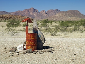
Background imageAfrica Collection: Rooi Drom features on most Namibian maps and a visitor

Rooi Drom features on most Namibian maps and a visitor could be excused if he or she expected it to be an important centre

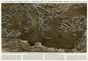
Background imageAfrica Collection: Panoramic map of Mediterranean by G. H. Davis

Panoramic map of Mediterranean by G. H. Davis
A new centre of world alarm during the Second World War: a panoramic map of the Mediterranean, showing the principal bases

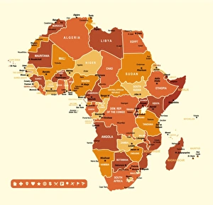
Background imageAfrica Collection: Africa Infographic map

Africa Infographic map
Africa Infographic High detailed map with navigation icons

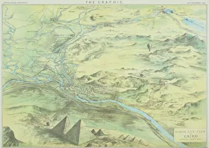
Background imageAfrica Collection: Antique engraving depicting birds eye view of Cairo

Antique engraving depicting birds eye view of Cairo

Background imageAfrica Collection: Antique map of Nile River

Antique map of Nile River

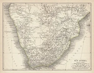
Background imageAfrica Collection: Ancient map of South Africa, lithograph, published in 1876

Ancient map of South Africa, lithograph, published in 1876
Ancient map of South Africa. Lithograph, published in 1876

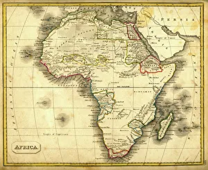
Background imageAfrica Collection: Antquie Map of Africa

Antquie Map of Africa
Vintage map of Africa from 1837

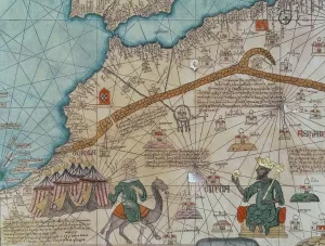
Background imageAfrica Collection: Detail from the Catalan Atlas, 1375 (vellum) (detail of 151844)

Detail from the Catalan Atlas, 1375 (vellum) (detail of 151844)
XZL387496 Detail from the Catalan Atlas, 1375 (vellum) (detail of 151844) by Cresques, Abraham (1325-87); Bibliotheque Nationale, Paris

Background imageAfrica Collection: Sketch map of Africa, from The Life of Captain Sir Richard Burton, Volume II

Sketch map of Africa, from The Life of Captain Sir Richard Burton, Volume II
KW265425 Sketch map of Africa, from The Life of Captain Sir Richard Burton, Volume II by Isabel Burton (1831-96) published in 1893 (litho) by Burton

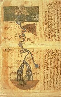
Background imageAfrica Collection: Course of river Nile, map by Arab geographer and astronomer Muhammad ibn Musa al-Khwarizmi (780-850)

Course of river Nile, map by Arab geographer and astronomer Muhammad ibn Musa al-Khwarizmi (780-850)
Cartography, Africa, 9th century. The course of the river Nile. Map by Arab geographer and astronomer Muhammad ibn Musa al-Khwarizmi (780-850)

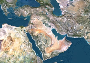
Background imageAfrica Collection: Middle East, satellite image

Middle East, satellite image
Middle East. North is at top. Satellite image of the Middle East, showing the borders (white lines) of the countries. The Middle East is a Eurocentric term used to describe a region that roughly

Background imageAfrica Collection: Mississippi river steamboat

Mississippi river steamboat. Steamboats on river with scenes of African-Americans on raft, picking cotton, and dancing and playing instruments. Map of southern states in upper left corner. Date c1895

Background imageAfrica Collection: VOYAGE OF THE ARGONAUTS. Voyage of the Argonauts according to Greek mythology

VOYAGE OF THE ARGONAUTS. Voyage of the Argonauts according to Greek mythology

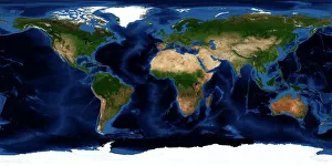
Background imageAfrica Collection: Earth, topographic and bathymetric map

Earth, topographic and bathymetric map
Earth. Blue Marble: Next Generation cloud-free topographic and bathymetric map of the Earth in July 2004. Highlands and lowlands of the continents are shown as ridges and flat areas

Background imageAfrica Collection: MAP / AFRICA 1842

MAP / AFRICA 1842
Map of Africa

Background imageAfrica Collection: World Map / Pomponius Mela

World Map / Pomponius Mela
A world map according to Pomponius Mela, showing Europe, Africa, Asia, and the rest in the lower half

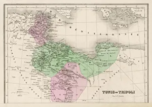
Background imageAfrica Collection: Map / North Africa 19C

Map / North Africa 19C
Tunisia and Tripoli (now largely Libya)

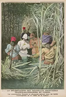
Background imageAfrica Collection: Africa / Exploration / Congo

Africa / Exploration / Congo
CONGO - French and German officials, determined to correctly map the boundary between their territories, make their way through the marshy Lobaye valley

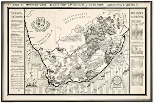
Background imageAfrica Collection: A Map of the Union of South Africa, 1931 (colour litho)

A Map of the Union of South Africa, 1931 (colour litho)
1198400 A Map of the Union of South Africa, 1931 (colour litho) by Gill, Leslie MacDonald (Max) (1884-1947); 102x153 cm; Private Collection; (add.info.: Gill)

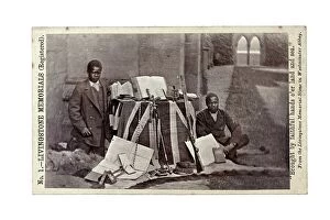
Background imageAfrica Collection: James Chuma and Abdullah Susi with David Livingstone artefacts, Newstead Abbey, England

James Chuma and Abdullah Susi with David Livingstone artefacts, Newstead Abbey, England
622820 James Chuma and Abdullah Susi with David Livingstone artefacts, Newstead Abbey, England, June 1874 (albumen print) by Allen, R

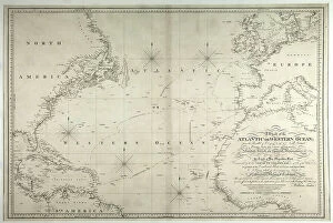
Background imageAfrica Collection: A Chart of the Atlantic or Western Ocean, showing the track of Nelsons fleet

A Chart of the Atlantic or Western Ocean, showing the track of Nelsons fleet
3244750 A Chart of the Atlantic or Western Ocean, showing the track of Nelsons fleet, 12th May-15th August 1805, 1807 (engraving) by Faden, William (1750-1836); National Museum of the Royal Navy

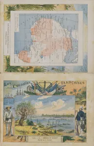
Background imageAfrica Collection: Map of French possessions and spheres of influence in Africa

Map of French possessions and spheres of influence in Africa
CHT206391 Map of French possessions and spheres of influence in Africa and a view of the river Senegal, cover of a school exercise book, late 19th century (colour engraving) by Dascher, G

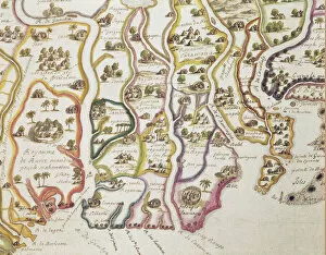
Background imageAfrica Collection: Map of the Coast of Africa and the River Gambia, 1622 (coloured engraving)

Map of the Coast of Africa and the River Gambia, 1622 (coloured engraving)
884601 Map of the Coast of Africa and the River Gambia, 1622 (coloured engraving) by French School, (17th century); Bibliotheque Nationale, Paris

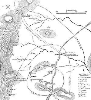
Background imageAfrica Collection: Plan of the Battle of Isandhlwana, (Jan. 22, 1879), c1880

Plan of the Battle of Isandhlwana, (Jan. 22, 1879), c1880. From British Battles on Land and Sea, Vol. IV, by James Grant. [Cassell Petter & Galpin, London, Paris & Melbourne, c1880]

Background imageAfrica Collection: Wylds Military Sketch of Zululand, 1879 (colour engraving)

Wylds Military Sketch of Zululand, 1879 (colour engraving)
XCF282014 Wylds Military Sketch of Zululand, 1879 (colour engraving) by Wyld, James the Elder (1790-1836); British Museum, London, UK; (add.info.: the Transvaal and adjoining territories; ); British

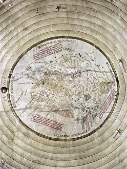
Background imageAfrica Collection: WORLD MAP, c1490. Map of the world incorporating the discoveries of Bartholomeu Diaz in 1488

WORLD MAP, c1490. Map of the world incorporating the discoveries of Bartholomeu Diaz in 1488, but not those of Christopher Columbus

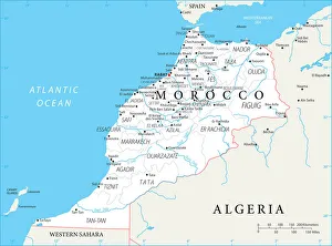
Background imageAfrica Collection: Reference Map of Morocco

Reference Map of Morocco
Morocco is a country in the western Maghreb region of North Africa. Morocco is bordered by the Atlantic Ocean in west, by the Mediterranean Sea in north

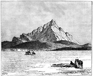
Background imageAfrica Collection: The Jebel Zaghwan, c1890. Artist: Meunier

The Jebel Zaghwan, c1890. Artist: Meunier
The Jebel Zaghwan, c1890. Jebel Zaghouan, a mountain in Tunisia. Illustration from The Universal Geography with Illustrations and Maps, Division XXI, (Virtue & Co Limited, London, c1890)

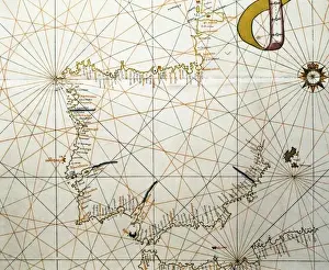
Background imageAfrica Collection: Portolan Atlas, 1587. Map of the Iberian Peninsula

Portolan Atlas, 1587. Map of the Iberian Peninsula, the north coastline of Africa and the Vasque Countrys region in France. Made in Messina. Facsimile. Miniature Painting. SPAIN. Madrid

Background imageAfrica Collection: MAP / AFRICA 1763

MAP / AFRICA 1763
Map of Africa

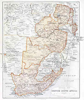
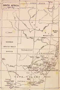
Background imageAfrica Collection: General Map Of British South Africa. From The Book South Africa And The Transvaal War

General Map Of British South Africa. From The Book South Africa And The Transvaal War, Volume 1 By Louis Creswicke, Published 1900

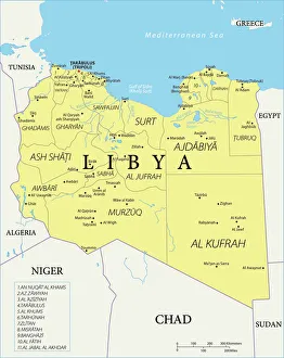
Background imageAfrica Collection: Reference Map of Libya

Reference Map of Libya
Libya is an African nation situated in North Africa, along the Mediterranean Sea. Libya shares borders with Egypt, Sudan, Chad, Niger, Algeria, and Tunisia

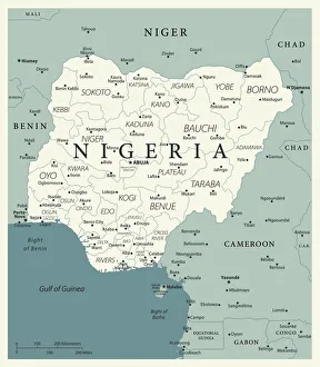
Background imageAfrica Collection: Reference Map of Nigeria

Reference Map of Nigeria
Nigeria is located in western Africa. Nigeria is bordered by the Gulf of Guinea, Benin to the west, Niger to the north, and Chad and Cameroon to the east

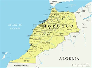
Background imageAfrica Collection: Map of Morocco

Map of Morocco
Morocco is a country in the western Maghreb region of North Africa. Morocco is bordered by the Atlantic Ocean in west, by the Mediterranean Sea in north

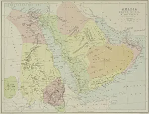
Background imageAfrica Collection: Antique map of Arabia with Egypt, Nubia, and Abyssinia

Antique map of Arabia with Egypt, Nubia, and Abyssinia

Background imageAfrica Collection: Map of the Horn of Africa, oil painting by Stefano Buonsignori 1575-1584

Map of the Horn of Africa, oil painting by Stefano Buonsignori 1575-1584
Italy - Tuscany region - Florence. Palazzo Vecchio, Hall of the Geographical Maps. Map of the Horn of Africa, oil painting by Stefano Buonsignori 1575-1584

Background imageAfrica Collection: Map of the journey of the Israelites, since their exit from Egypt, 1739 (engraving)

Map of the journey of the Israelites, since their exit from Egypt, 1739 (engraving)
8822197 Map of the journey of the Israelites, since their exit from Egypt, 1739 (engraving); Private Collection; (add.info)

Background imageAfrica Collection: Map of Africa, 1564 - 1 of 8 sheets, 1564 (technical drawing)

Map of Africa, 1564 - 1 of 8 sheets, 1564 (technical drawing)
7340675 Map of Africa, 1564 - 1 of 8 sheets, 1564 (technical drawing) by Gastaldi, Giacomo (c.1500-66); National Maritime Museum, London

Background imageAfrica Collection: Map of Africa, 1564 - 1 of 8 sheets, 1564 (technical drawing)

Map of Africa, 1564 - 1 of 8 sheets, 1564 (technical drawing)
7340670 Map of Africa, 1564 - 1 of 8 sheets, 1564 (technical drawing) by Gastaldi, Giacomo (c.1500-66); National Maritime Museum, London

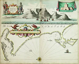
Background imageAfrica Collection: A chart of Guinea describing the sea coast from Cape de Verde to Cape Bona Esperanca

A chart of Guinea describing the sea coast from Cape de Verde to Cape Bona Esperanca, 1677 (coloured engraving)
7340049 A chart of Guinea describing the sea coast from Cape de Verde to Cape Bona Esperanca, 1677 (coloured engraving) by Seller, John (1632-97); 43x54 cm; National Maritime Museum, London

Background imageAfrica Collection: A new map or chart of the western or Atlantic ocean with part of Europe, Africa and America

A new map or chart of the western or Atlantic ocean with part of Europe, Africa and America
7295401 A new map or chart of the western or Atlantic ocean with part of Europe, Africa and America: showing the course of the galleons to and from the West Indies, 1740 (engraving) by Bowen

Background imageAfrica Collection: Map of the Roman Dominions in the 2nd century BC

Map of the Roman Dominions in the 2nd century BC
7177142 Map of the Roman Dominions in the 2nd century BC; Private Collection; (add.info.: Map of the Roman Dominions in the 2nd century BC, with the dates of the chief aquisitions)

Background imageAfrica Collection: Ethnological And Philological Map Of Africa As It Was In The 19Th Century

Ethnological And Philological Map Of Africa As It Was In The 19Th Century
UIG5420423 Ethnological And Philological Map Of Africa As It Was In The 19Th Century. From Africa By Keith Johnston, Published 1884 ©UIG/Leemage

Background imageAfrica Collection: Map of South Africa during the 19th Century

Map of South Africa during the 19th Century
3523214 Map of South Africa during the 19th Century; (add.info.: Map of South Africa during the 19th Century); Universal History Archive/UIG

Background imageAfrica Collection: First map of Cape Bonne Esperance (South Africa), mapped at its correct latitude in 1508 by Johann

First map of Cape Bonne Esperance (South Africa), mapped at its correct latitude in 1508 by Johann (or Johannes)
NWI4852318 First map of Cape Bonne Esperance (South Africa), mapped at its correct latitude in 1508 by Johann (or Johannes) Ruysch (d. 1533)

Background imageAfrica Collection: A chart of the southern hemisphere; shewing the tracks of some of the most distinguished navigators

A chart of the southern hemisphere; shewing the tracks of some of the most distinguished navigators
7342328 A chart of the southern hemisphere; shewing the tracks of some of the most distinguished navigators, by Captain James Cook, of His Majesty's Navy, 1777 (print) by Cook

Background imageAfrica Collection: Sphere and stand, c.1890 (plaster, printed lithography, varnish, papier mache, brass, wood, paper)

Sphere and stand, c.1890 (plaster, printed lithography, varnish, papier mache, brass, wood, paper, ink)
7339588 Sphere and stand, c.1890 (plaster, printed lithography, varnish, papier mache, brass, wood, paper, ink) by Johnston, Alexander Keith (1804-71); 24.4x23.5 cm; National Maritime Museum, London

Background imageAfrica Collection: Chart of the western Mediterrean showing the north African and Spanish coasts

Chart of the western Mediterrean showing the north African and Spanish coasts, 17th century (ink on vellum)
7339121 Chart of the western Mediterrean showing the north African and Spanish coasts, 17th century (ink on vellum) by Unknown Artist, (17th century); 151.8x274.3 cm; National Maritime Museum


All Professionally Made to Order for Quick Shipping


-

Africa Collection

Africa is the world's second-largest continent, covering approximately 30 million square kilometers and has a population of over one billion people and is home to some of the most diverse cultures and languages on earth, and is known for its vast natural resources, including oil, gold, diamonds, and other minerals. However, despite its wealth in resources, many African countries struggle with poverty and political instability. Maps and charts can help us understand the geography as well as economic trends such as trade flows or GDP growth rates and can also highlight issues like climate change or disease outbreaks that affect different regions differently.
+

Our beautiful pictures are available as Framed Prints, Photos, Wall Art and Photo Gifts

Media Storehouse offers a vast collection of Africa maps and charts that showcase the beauty and diversity of the continent. Our collection includes vintage maps, political maps, topographical maps, geological charts, and more. These prints are perfect for anyone who loves geography or wants to add an African touch to their home decor. The Africa Maps and Charts collection features high-quality prints that are available in various sizes and formats such as canvas prints, art prints, framed prints, or posters. Customers can choose from different styles ranging from colorful abstract designs to detailed black-and-white illustrations. These stunning pieces of wall art capture the essence of Africa's rich history and culture while providing educational value for those interested in learning about its geography. Whether you're looking to decorate your living room or office space with unique artwork or want to gift someone with a meaningful present related to their interests - our Africa Maps and Charts collection is definitely worth exploring.
+

What are Africa (Maps and Charts) art prints?

Africa art prints are a collection of high-quality, visually stunning artworks that showcase the diverse geography and topography of the African continent. These prints feature detailed maps and charts that highlight various regions, countries, cities, landmarks, and natural wonders across Africa. These art prints are perfect for anyone who has an interest in African history, culture or geography. They can be used to decorate homes or offices with a unique touch of elegance while also serving as educational resources for students studying African geography or history. The Africa art print collection is available in a variety of sizes to suit different needs. The prints are produced using state-of-the-art printing technology on premium quality paper to ensure they last for years without fading or losing their vibrancy. These art prints offer an excellent way to appreciate the beauty and diversity of Africa's landscapes while also learning more about its rich cultural heritage.
+

What Africa (Maps and Charts) art prints can I buy from Media Storehouse?

We offer a wide range of Africa maps and charts art prints that are perfect for anyone looking to add some African flair to their home or office decor. These prints feature detailed maps and charts of various regions in Africa, showcasing the diverse geography, topography, and cultural heritage of this vast continent. Some popular options include vintage-style maps that highlight colonial-era borders and territories, as well as more contemporary designs that showcase modern political boundaries and natural landmarks. You can also find charts depicting wildlife populations, climate patterns, and other fascinating data about different parts of Africa. Whether you're a history buff, nature lover, or simply appreciate beautiful artwork with an African theme, we have something for everyone. With high-quality printing techniques and a variety of sizes available to choose from, these art prints are sure to make a stunning addition to any space.
+

How do I buy Africa (Maps and Charts) art prints?

To buy Africa art prints from Media Storehouse, you can browse our extensive collection of high-quality prints online. Simply search for the specific artwork or artist that you are interested in, or explore their curated collections to discover new pieces. Once you have found a print that you would like to purchase, simply add it to your cart and proceed to checkout. You will be prompted to enter your shipping and payment information, after which your order will be processed. We offer a range of sizes and framing options for their prints, so be sure to choose the one that best suits your needs. Whether you are looking for a small print to display on your desk or a large statement piece for your living room wall, they have something for everyone. Buying Africa art prints from Media Storehouse is an easy and convenient way to bring beautiful artwork into your home or office.
+

How much do Africa (Maps and Charts) art prints cost?

We offer a wide range of Africa maps and charts art prints that are available at varying prices. Our collection features different styles and designs to suit your preferences. The cost of our Africa maps and charts art prints is dependent on several factors such as the size, quality, and type of print you choose. We provide affordable options for those looking for budget-friendly pieces while also offering high-end prints for those who want something more luxurious. Our pricing structure ensures that everyone can find an artwork that fits their budget without compromising on quality. Our Africa maps and charts art prints are perfect for adding a touch of culture to any space in your home or office. They make great gifts too. We take pride in providing our customers with exceptional products at reasonable prices so they can enjoy beautiful artwork without breaking the bank.
+

How will my Africa (Maps and Charts) art prints be delivered to me?

We take great care in ensuring that your Africa art prints are delivered to you in the best possible condition. We use high-quality packaging materials to protect your artwork during transit, including sturdy cardboard tubes for rolled prints and flat cardboard envelopes for smaller sizes. Once your order is processed, our team carefully packs your artwork and sends it out for delivery via a trusted courier service. You will receive a tracking number so that you can follow the progress of your package until it arrives at your doorstep. We understand how important it is to receive your artwork promptly and securely, which is why we work hard to ensure that all orders are dispatched as quickly as possible. Whether you're ordering from within the UK or overseas, we strive to provide a reliable and efficient delivery service every time.