Home > Maps and Charts > Turkey
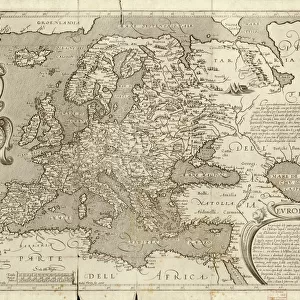
Canvas Print : Map / Europe / Balkans 1792


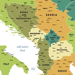
![]()
Canvas Prints from Mary Evans Picture Library
Map / Europe / Balkans 1792
A map showing Turkey in Europe and its neighbouring European states of the Balkans
Mary Evans Picture Library makes available wonderful images created for people to enjoy over the centuries
Media ID 620825
© Mary Evans Picture Library 2015 - https://copyrighthub.org/s0/hub1/creation/maryevans/MaryEvansPictureID/10074527
1792 Balkans Maps Neighbouring
20"x16" (51x41cm) Canvas Print
Discover the rich history of Europe's Balkan region with our stunning Canvas Prints from Media Storehouse, featuring the captivating "Map / Europe / Balkans 1792" from Mary Evans Prints Online. This beautiful map transports you back in time, showcasing Turkey's European territories and its neighboring European states. Each print is meticulously reproduced on premium canvas, ensuring vibrant colors and exceptional detail. Bring history into your home or office with this unique and intriguing conversation starter. Order yours today and let the story of the Balkans unfold before your eyes.
Delivered stretched and ready to hang our premium quality canvas prints are made from a polyester/cotton blend canvas and stretched over a 1.25" (32mm) kiln dried knot free wood stretcher bar. Packaged in a plastic bag and secured to a cardboard insert for safe transit.
Canvas Prints add colour, depth and texture to any space. Professionally Stretched Canvas over a hidden Wooden Box Frame and Ready to Hang
Estimated Product Size is 50.8cm x 40.6cm (20" x 16")
These are individually made so all sizes are approximate
Artwork printed orientated as per the preview above, with landscape (horizontal) orientation to match the source image.
FEATURES IN THESE COLLECTIONS
> Asia
> Turkey
> Related Images
> Maps and Charts
> Early Maps
EDITORS COMMENTS
This historical map print from 1792 showcases the intricate borders and political landscape of Europe, specifically focusing on the Balkans region and Turkey in Europe. The detailed cartography highlights the neighboring European states surrounding Turkey, providing a glimpse into the complex history and territorial divisions of the time.
The map offers a fascinating insight into the geopolitical dynamics of Europe during this period, with each country clearly delineated and labeled for easy reference. From Hungary to Greece, Serbia to Bulgaria, every nation is represented on this meticulously crafted piece of historical artwork.
As we study this map, we are transported back in time to an era when empires clashed and alliances shifted constantly. The intricate details and fine craftsmanship of the map serve as a testament to the skill and dedication of cartographers from centuries past.
Whether you are a history buff or simply appreciate fine artistry, this vintage map print is sure to captivate your imagination and spark curiosity about the rich tapestry of European history. Display it proudly in your home or office as a conversation piece that will inspire discussion about our shared past and how it has shaped our present-day world.
MADE IN THE USA
Safe Shipping with 30 Day Money Back Guarantee
FREE PERSONALISATION*
We are proud to offer a range of customisation features including Personalised Captions, Color Filters and Picture Zoom Tools
SECURE PAYMENTS
We happily accept a wide range of payment options so you can pay for the things you need in the way that is most convenient for you
* Options may vary by product and licensing agreement. Zoomed Pictures can be adjusted in the Cart.