Home > Maps and Charts > Early Maps
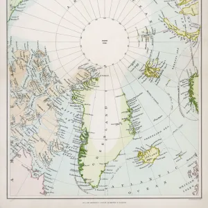
Framed Print : Map / Arctic Circle 1895


Framed Photos from Mary Evans Picture Library
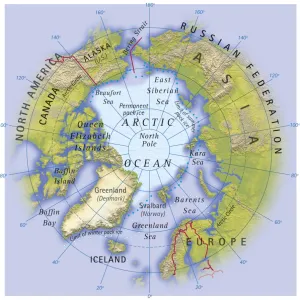
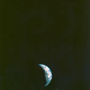
Map / Arctic Circle 1895
Map of the Arctic Circle and surrounding areas
Mary Evans Picture Library makes available wonderful images created for people to enjoy over the centuries
Media ID 608851
© Mary Evans Picture Library 2015 - https://copyrighthub.org/s0/hub1/creation/maryevans/MaryEvansPictureID/10114181
Arctic Circle Maps Surrounding 1895
16"x13" Modern Frame
Discover the captivating allure of the Arctic Circle with our exquisite Framed Prints from Media Storehouse, featuring the stunning "Map / Arctic Circle 1895" by Mary Evans Picture Library from Mary Evans Prints Online. This intricately detailed map transports you back in time to the late 19th century, offering a glimpse into the unexplored, icy expanse of the Arctic Circle and its surrounding areas. With the map's rich, antique hues and intricate cartography, this Framed Print adds an air of adventure and history to any space, making it a perfect addition to your home or office. Embrace the beauty and mystery of the Arctic with this beautiful, vintage map.
14x11 Print in an MDF Wooden Frame with 180 gsm Satin Finish Paper. Glazed using shatter proof thin plexi glass. Frame thickness is 1 inch and depth 0.75 inch. Fluted cardboard backing held with clips. Supplied ready to hang with sawtooth hanger and rubber bumpers. Spot clean with a damp cloth. Packaged foam wrapped in a card.
Contemporary Framed and Mounted Prints - Professionally Made and Ready to Hang
Estimated Image Size (if not cropped) is 35.5cm x 33cm (14" x 13")
Estimated Product Size is 40.6cm x 33cm (16" x 13")
These are individually made so all sizes are approximate
Artwork printed orientated as per the preview above, with landscape (horizontal) orientation to match the source image.
FEATURES IN THESE COLLECTIONS
> Maps and Charts
> Early Maps
> Popular Themes
> Maps and Charts
EDITORS COMMENTS
This stunning print captures a piece of history with the Map of the Arctic Circle from 1895. The intricate details and design of this map provide a fascinating glimpse into the past, showcasing the geographical layout of the Arctic Circle and its surrounding areas during that time period.
The historical significance of this map is undeniable, as it offers valuable insights into how explorers navigated through these icy waters over a century ago. From the rugged terrain to the icy waters, every element on this map tells a story of adventure and discovery in one of Earth's most remote regions.
As we study this map closely, we can't help but marvel at the dedication and bravery of those who ventured into these uncharted territories in search of new lands and resources. The precision and accuracy with which this map was created are truly remarkable, highlighting both scientific knowledge and artistic skill.
Whether you're a history buff or simply appreciate beautiful cartography, this Map of the Arctic Circle from 1895 is sure to captivate your imagination. It serves as a reminder of our planet's vastness and diversity, urging us to explore beyond our comfort zones and embrace new horizons just waiting to be discovered.
MADE IN THE USA
Safe Shipping with 30 Day Money Back Guarantee
FREE PERSONALISATION*
We are proud to offer a range of customisation features including Personalised Captions, Color Filters and Picture Zoom Tools
SECURE PAYMENTS
We happily accept a wide range of payment options so you can pay for the things you need in the way that is most convenient for you
* Options may vary by product and licensing agreement. Zoomed Pictures can be adjusted in the Cart.