Home > Asia > Bangladesh > Maps
Framed Print : Map of India Etc / Mallet


![]()
Framed Photos from Mary Evans Picture Library
Map of India Etc / Mallet
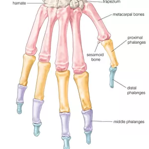
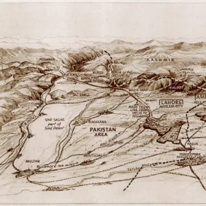
Crude map of northern India, previous to any extensive colonisation, including parts of Pakistan & Bangladesh & the sources of two great rivers the Ganges & Indus. A map with ornate title cartouche and floral surrounds
Mary Evans Picture Library makes available wonderful images created for people to enjoy over the centuries
Media ID 589248
© Mary Evans Picture Library 2015 - https://copyrighthub.org/s0/hub1/creation/maryevans/MaryEvansPictureID/10173756
1683 Bangladesh Cartouche Cashmere Ganges Himalayas Indus Kashmir Mallet Maps Mogul Pakistan Parts Rivers Sources Surrounds Title
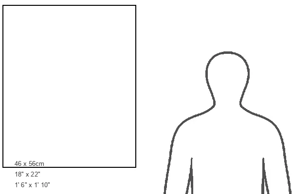
22"x18" Modern Frame
Discover the rich history and geography of India with our exquisite Framed Prints from Media Storehouse, featuring the captivating "Map of India Etc / Mallet" by Mary Evans Picture Library. This vintage map offers a glimpse into the past, showcasing a crude yet intriguing representation of northern India prior to extensive colonization. Explore the regions that are now part of Pakistan and Bangladesh, and trace the origins of two mighty rivers, the Ganges and Indus. Add an element of historical charm to your home or office décor with this unique and informative piece.
20x16 Print in an MDF Wooden Frame with 180 gsm Satin Finish Paper. Glazed using shatter proof thin plexiglass. Frame thickness is 1 inch and depth 0.75 inch. Fluted cardboard backing held with clips. Supplied ready to hang with sawtooth hanger and rubber bumpers. Spot clean with a damp cloth. Packaged foam wrapped in a card.
Contemporary Framed and Mounted Prints - Professionally Made and Ready to Hang
Estimated Image Size (if not cropped) is 45.7cm x 50.8cm (18" x 20")
Estimated Product Size is 45.7cm x 55.9cm (18" x 22")
These are individually made so all sizes are approximate
Artwork printed orientated as per the preview above, with portrait (vertical) orientation to match the source image.
FEATURES IN THESE COLLECTIONS
> Asia
> Bangladesh
> Maps
> Asia
> Bangladesh
> Related Images
> Asia
> India
> Related Images
> Asia
> Pakistan
> Related Images
> Maps and Charts
> Early Maps
> Maps and Charts
> India
EDITORS COMMENTS
This stunning print of a "Map of India Etc" by Mallet offers a fascinating glimpse into the historical geography of northern India prior to extensive colonization. The map includes parts of present-day Pakistan and Bangladesh, showcasing the intricate details of the region's topography and waterways.
Highlighted on the map are two great rivers, the Ganges and Indus, which served as vital lifelines for civilizations in this area. The ornate title cartouche and floral surrounds add an elegant touch to this depiction of a bygone era.
Dating back to 1683, this map provides valuable insights into the political landscape of India during the Mogul Empire. From Kashmir in the north to central regions near the Himalayas, each area is meticulously illustrated with precision and care.
As you study this piece closely, you can almost feel yourself transported back in time to when these lands were ruled by emperors and dynasties. It serves as a reminder of India's rich history and cultural heritage that continues to captivate us today.
This print from Mary Evans Picture Library is not just a visual representation but also a gateway to exploring the complexities of Asia's past through cartography.
MADE IN THE USA
Safe Shipping with 30 Day Money Back Guarantee
FREE PERSONALISATION*
We are proud to offer a range of customisation features including Personalised Captions, Color Filters and Picture Zoom Tools
SECURE PAYMENTS
We happily accept a wide range of payment options so you can pay for the things you need in the way that is most convenient for you
* Options may vary by product and licensing agreement. Zoomed Pictures can be adjusted in the Cart.