Home > Europe > United Kingdom > England > London > Boroughs > Harrow
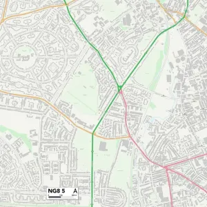
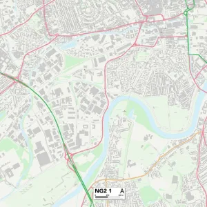
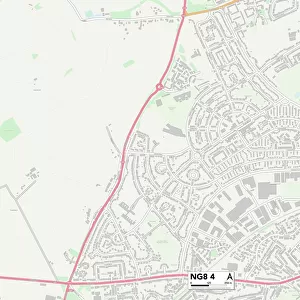
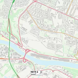
Nottingham NG8 1 Map

![]()
Wall Art and Photo Gifts from Map Marketing
Nottingham NG8 1 Map
Postcode Sector Map of Nottingham NG8 1
Media ID 19976024
Abbots Way Brendon Road Cambridge Road Canterbury Road Coombe Close Dorset Street Harris Close Harrow Road Kennington Road Kingswood Road Lambourne Drive Lanark Close Lime Tree Avenue Marchwood Close Newland Close Nottingham Old Coach Road Reynolds Drive Russell Crescent St Pauls Street Sydney Road Woodhall Road
FEATURES IN THESE COLLECTIONS
> Arts
> Portraits
> Pop art gallery
> Street art portraits
> Europe
> United Kingdom
> England
> Derbyshire
> Elvaston
> Europe
> United Kingdom
> England
> Derbyshire
> Middleton
> Europe
> United Kingdom
> England
> Derbyshire
> Related Images
> Europe
> United Kingdom
> England
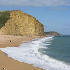
> Dorset
> Bridport
> Europe
> United Kingdom
> England
> Dorset
> Grove
> Europe
> United Kingdom
> England
> Dorset
> Related Images
> Europe
> United Kingdom
> England
> London
> Boroughs
> Harrow
> Europe
> United Kingdom
> Scotland
> Strathclyde
> Lanark
> Europe
> United Kingdom
> Wales
> Flintshire
> Broughton
> Map Marketing
> Postcode Sector Maps
> NG - Nottingham
MADE IN THE USA
Safe Shipping with 30 Day Money Back Guarantee
FREE PERSONALISATION*
We are proud to offer a range of customisation features including Personalised Captions, Color Filters and Picture Zoom Tools
SECURE PAYMENTS
We happily accept a wide range of payment options so you can pay for the things you need in the way that is most convenient for you
* Options may vary by product and licensing agreement. Zoomed Pictures can be adjusted in the Cart.