Home > Europe > United Kingdom > England > London > Towns > Upminster
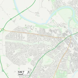
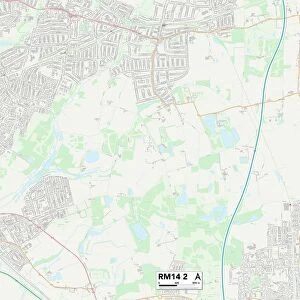
Havering RM14 2 Map

![]()
Wall Art and Photo Gifts from Map Marketing
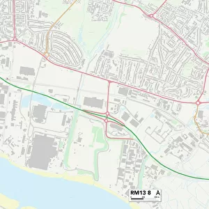
Havering RM14 2 Map
Postcode Sector Map of Havering RM14 2
Media ID 19979020
Acacia Drive Alder Avenue Aspen Grove Beech Avenue Belmont Avenue Boundary Road Bramble Lane Bridge Avenue Brookdale Avenue Brookdale Close Carlton Close Cedar Avenue Chelmsford Drive Church View Clarence Avenue Clayton Avenue Convent Close Derby Avenue Elm Avenue Havering Hill Rise Hornbeam Avenue Howard Road Lime Avenue Lingfield Avenue Longwood Close Maple Avenue Norfolk Road Oak Avenue Park Drive Park Farm Road Parkland Avenue Pine Court St Lawrence Road St Marys Lane Station Approach Station Road Stewart Avenue Sycamore Avenue The Approach The Grove Windmill Close Upminster Warwick Lane
FEATURES IN THESE COLLECTIONS
> Animals
> Birds
> Passerines
> Finches
> Brambling
> Europe
> United Kingdom
> England
> London
> Boroughs
> Havering
> Europe
> United Kingdom
> England
> London
> Towns
> Belmont
> Europe
> United Kingdom
> England
> London
> Towns
> Elm Park
> Europe
> United Kingdom
> England
> London
> Towns
> Grove Park
> Europe
> United Kingdom
> England
> London
> Towns
> Newbury Park
> Europe
> United Kingdom
> England
> London
> Towns
> Upminster
> Europe
> United Kingdom
> England
> Norfolk
> Aldborough
> Europe
> United Kingdom
> England
> Norfolk
> Little London
> Europe
> United Kingdom
> England
> Norfolk
> Related Images
> Map Marketing
> Postcode Sector Maps
> RM - Romford
MADE IN THE USA
Safe Shipping with 30 Day Money Back Guarantee
FREE PERSONALISATION*
We are proud to offer a range of customisation features including Personalised Captions, Color Filters and Picture Zoom Tools
SECURE PAYMENTS
We happily accept a wide range of payment options so you can pay for the things you need in the way that is most convenient for you
* Options may vary by product and licensing agreement. Zoomed Pictures can be adjusted in the Cart.