Home > Europe > Italy > Piedmont > Novara
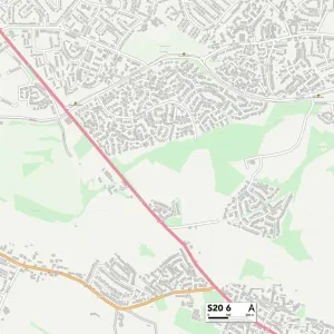
Barnsley S70 3 Map

![]()
Wall Art and Photo Gifts from Map Marketing
Barnsley S70 3 Map
Postcode Sector Map of Barnsley S70 3
Media ID 19980340
A635 Ash Grove Barnsley Birch Road Bracken Court Brookside Drive Broom Close Calder Crescent Cedar Crescent Chestnut Crescent Conway Street Croft Road Cypress Road Doncaster Road Edward Close Farm Road Field Lane Foster Street Gerald Road Kenwood Close Lambert Road Larch Place Laurel Avenue Lavender Court Leslie Road Lulworth Close Maple Close Masons Way Neville Avenue Neville Close Nursery Gardens Philip Road Pine Close Poplars Road Raymond Road Reginald Road Rosebery Street Rosedene Close School Street Shaftesbury Street Stanley Road The Firs Thornton Road Victoria Street Wheatley Road Worsley Close
FEATURES IN THESE COLLECTIONS
> Animals
> Mammals
> Muridae
> House Mouse
> Arts
> Portraits
> Pop art gallery
> Street art portraits
> Europe
> Italy
> Calabria
> Related Images
> Europe
> Italy
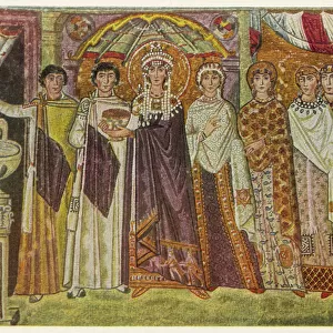
> Emilia-Romagna
> Ravenna
> Europe
> Italy
> Piedmont
> Novara
> Europe
> Italy
> Tuscany
> Related Images
> Map Marketing
> Postcode Sector Maps
> S - Sheffield
> Maps and Charts
> Related Images
MADE IN THE USA
Safe Shipping with 30 Day Money Back Guarantee
FREE PERSONALISATION*
We are proud to offer a range of customisation features including Personalised Captions, Color Filters and Picture Zoom Tools
SECURE PAYMENTS
We happily accept a wide range of payment options so you can pay for the things you need in the way that is most convenient for you
* Options may vary by product and licensing agreement. Zoomed Pictures can be adjusted in the Cart.