Home > Europe > United Kingdom > England > Norfolk > Norwich
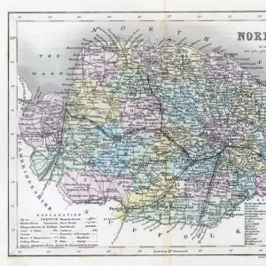
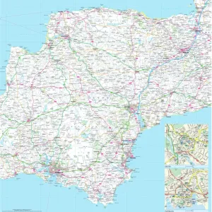
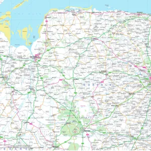
Norfolk County Road Map

![]()
Wall Art and Photo Gifts from Map Marketing
Norfolk County Road Map
A detailed map of the glorious county of Norfolk in England. Derived from high quality Collins Bartholomew map data showing larger villages, towns and cities along with a detailed road network combined with rivers, lakes and county boundaries. The Norfolk Broads National Park boundary is also marked
Media ID 19950623
© Map Marketing Ltd 2020, Map derived from Collins Bartholomew Digital Data Collins Bartholomew Ltd 2019
FEATURES IN THESE COLLECTIONS
> Arts
> Landscape paintings
> Waterfall and river artworks
> River artworks
> Arts
> Photorealistic artworks
> Detailed art pieces
> Masterful detailing in art
> Arts
> Street art graffiti
> Digital art
> Digital paintings
> Europe
> United Kingdom
> England
> Lakes
> Europe
> United Kingdom
> England
> Maps
> Europe
> United Kingdom
> England
> Norfolk
> Norwich
> Europe
> United Kingdom
> England
> Norfolk
> Related Images
> Europe
> United Kingdom
> England
> Norwich
> Europe
> United Kingdom
> England
> Posters
> Europe
> United Kingdom
> England
> Related Images
MADE IN THE USA
Safe Shipping with 30 Day Money Back Guarantee
FREE PERSONALISATION*
We are proud to offer a range of customisation features including Personalised Captions, Color Filters and Picture Zoom Tools
SECURE PAYMENTS
We happily accept a wide range of payment options so you can pay for the things you need in the way that is most convenient for you
* Options may vary by product and licensing agreement. Zoomed Pictures can be adjusted in the Cart.