Home > Europe > United Kingdom > Wales > Flintshire > Broughton
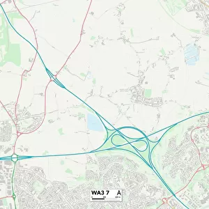
Warrington WA4 3 Map

![]()
Wall Art and Photo Gifts from Map Marketing
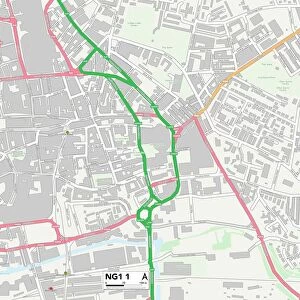
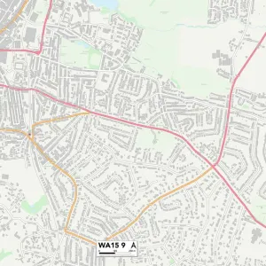
Warrington WA4 3 Map
Postcode Sector Map of Warrington WA4 3
Media ID 19982980
Ash Lane Bernard Avenue Beverley Avenue Bridge Lane Broad Lane Broughton Close Chichester Close Church Lane Cinder Lane Cliff Lane Clydesdale Road Croft Gardens Dale Lane Dashwood Close Dingle Lane Farm Lane Farnham Close Greenfields Avenue Greenway Guernsey Close Hall Lane Lichfield Avenue Melrose Avenue New Lane Warrington Waterside Waverley Avenue Wolfe Close Wood Lane Cobbs
FEATURES IN THESE COLLECTIONS
> Europe
> United Kingdom
> Scotland
> Scottish Borders
> Melrose
> Europe
> United Kingdom
> Wales
> Flintshire
> Broughton
> Map Marketing
> Postcode Sector Maps
> WA - Warrington
> Maps and Charts
> Related Images
> Oceania
> Australia
> Related Images
MADE IN THE USA
Safe Shipping with 30 Day Money Back Guarantee
FREE PERSONALISATION*
We are proud to offer a range of customisation features including Personalised Captions, Color Filters and Picture Zoom Tools
SECURE PAYMENTS
We happily accept a wide range of payment options so you can pay for the things you need in the way that is most convenient for you
* Options may vary by product and licensing agreement. Zoomed Pictures can be adjusted in the Cart.